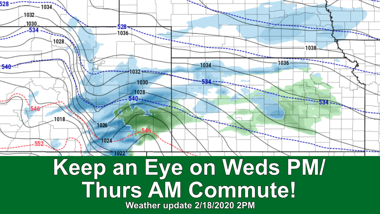
Before we even get a chance to catch our breath, another storm system is on the way! You’ll notice there’s going to be a lot of similarities in this storm and what we saw on Monday night. Similar areas favored for heavier snowfall, similar impacts to roads under the heavier bands of snowfall and simlar speed. The storm won’t linger around for very long which means overall accumulation looks light for most of us. The wildcard as always is that the jet stream is still overhead so some very spotty areas could over-perform.
Here’s the latest, need-to-knows on our next storm system:
Storm Discussion (Impacts/Timing/Hazards/Trends)
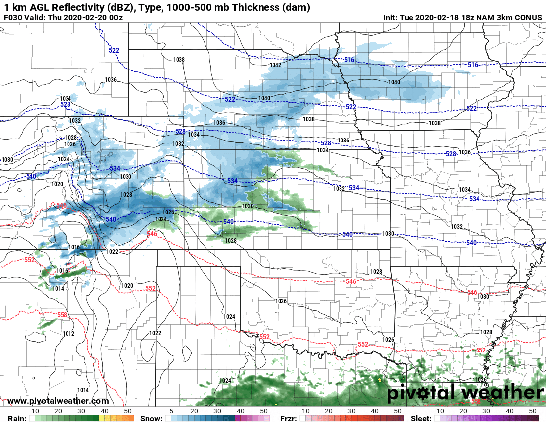
NAM3K’s thinking of storm situation around 5 PM on Wednesday
Timing
- Tuesday evening/overnight
- Spotty snow showers will be possible but don’t look to add up to much more than a trace or an inch in areas. Chance of seeing snow on Tuesday night is around 20% along the Palmer Divide
- Wednesday morning/afternoon
- Spotty snow showers possible in the morning, chances are still low 20-30% with areas on the Eastern plains and Northeastern Colorado favored for any spotty showers
- Models currently have snow picking up in the afternoon hours… many show sometime between 2-4PM as the start for more widespread snow
- Wednesday evening
- If current model trends verify, snow would be falling during the Wednesday evening commute
- During this point in the evening, models still favor the front range foothills and Palmer Divide for moderate/heavy snow with some banding possible
- Be prepared for challenging driving conditions during the commute and through the evening on Wednesday if everything verifies
- Thursday morning
- Lingering snow showers possible, especially South and West of Denver over the higher elevations
- Most areas should see snow end by sunrise
- Roads in areas with the higher/heavier snow accumulation may still have slick spots
- Be prepared for possibility of tricky driving conditions for Thursday morning commute
*Forecast is fluid, keep an eye on our forecasts and we will be sure to pass along any changes if things change!
Impacts (similar to last storm)As quic
- Wet/slushy and icy roads are all impacts possible with this storm
- I’d expect these impacts to favor higher terrain areas South and West of Denver
- Banded snowfall means these impacts could occur anywhere heavier snowfall bands set up so be prepared!
Expected Snowfall
Palmer Divide
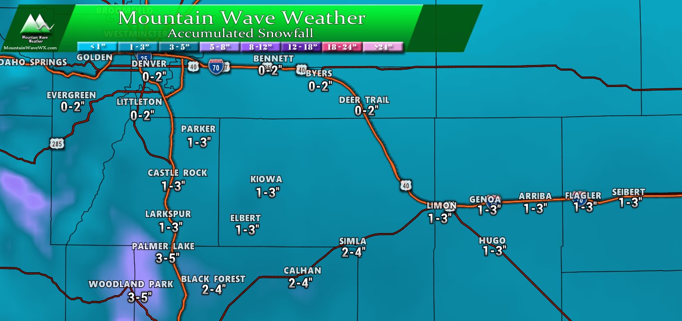
Snowfall amounts through Thursday PM for Palmer Divide/ South Denver (note, where snow bands form take the higher end of the range, for overperforming areas range may be too low)
Colorado
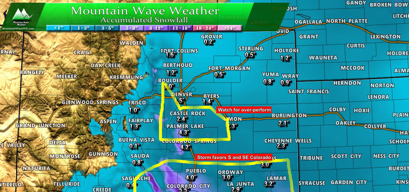
Snowfall amounts through Thursday PM (add +/- 1 or 2 inches to get a range)
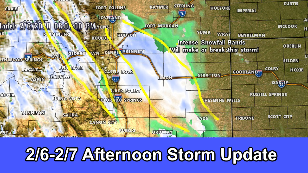
Pay close attention to that spot between Colorado Springs, Pueblo, Colorado City and out to the East. Southeastern Colorado could see bouts of heavy snowfall… while accumulations don’t look astronomical, the snow will be coming down hard while the storm passes through. Your highest chances of travel impacts are the Southern Central and Southeastern part of Colorado during the afternoon/evening/overnight hours on Wednesday.
Summary
Another similar type of storm to this past Monday. A quick hitter with a shallow upslope component and some jet stream induced lift overhead. The storm has some energy and moisture to work with but will move through the area relatively quickly so snow totals won’t be anything to write home about. It could possibly make your drive a bit miserable on Wednesday evening or Thursday morning so keep that in mind!
We have another storm system possible next week that we will keep a close eye on. It has potential to give someone a ton of snow… the question remains as to whether that will be us, Wyoming or New Mexico. Models are really not handling it well and are jumping all over the place, so until we get better clarity we will just mention it as a “keep an eye on the forecast throughout the rest of the week and into the weekend” type of thing.
Have a great Tuesday, will post forecast updates as needed!

Why? This is more like Canada! I’ve live here for nearly 20 years. This is not normal temps or snowfalls