As of this post it's Friday... about 48 hours ahead of our expected storm arrival on Sunday and sadly the forecast isn't getting any easier. Surprisingly, the models agree quite well across the board on the track of this storm with only slight variations, but none of them can agree on how strong the storm is or where it begins to rapidly intensify (we call this cyclogenesis.) These are all crucial details as storm track, storm timing, intensity and where it strengthens will mean the difference between seeing absolutely nothing out of this storm or seeing a significant event.
Both options are still on the table for the Palmer Divide at this point. Here's a look at what we are seeing with this afternoon's data:
Storm Track (High Agreement)
I'll post the GFS and Euro as they're a reflection of what we are seeing overall with the models...
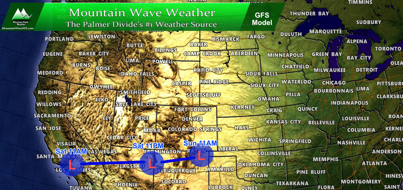
GFS anticipated storm track as of this article
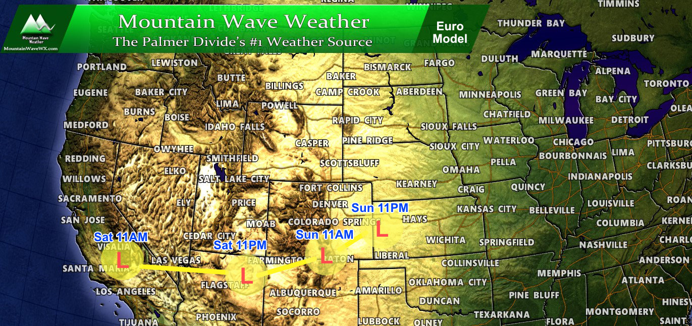
Euro anticipated storm track as of this article
The NAM and Canadian all show similar tracks to above with only slight differences in timing. So for once, the models actually agree on something but this is not the only ingredient we need to consider.
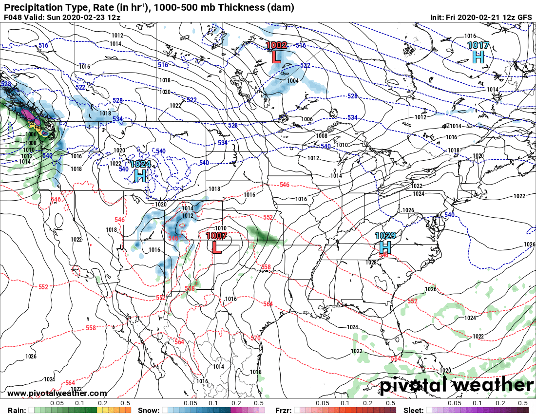
Storm Intensity (Low Agreement)
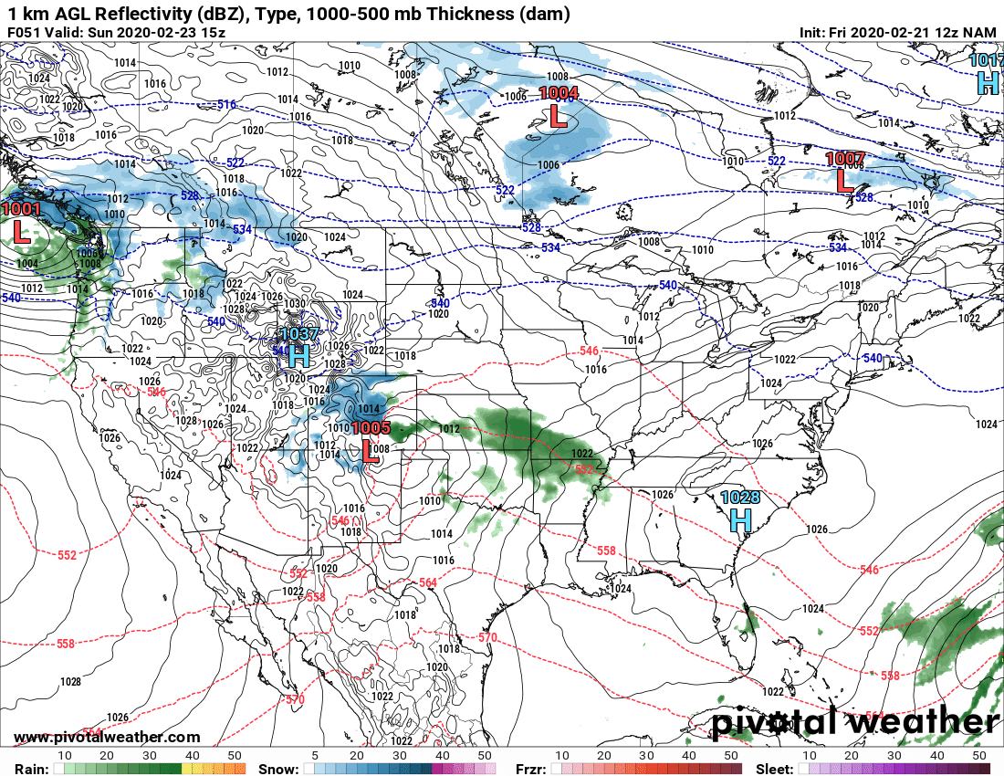
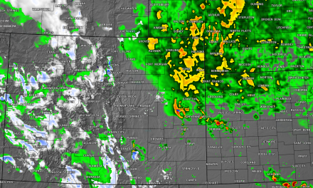
The kicker here is that the models agree this will be a strong storm at some point, but they disagree what it looks like in Colorado after it crosses the mountains. The image below is the GFS and good representation of the Euro; these are the 2 models that haven't been very excited about this storm. These two models keep the low loosely organized across the mountains and still somewhat organized as it moves onto the Eastern plains of Colorado. You can see the weak moisture return on the plains translating to not a lot of energy for upslope and not a lot of moisture for snow. A storm like this would struggle to produce much snow for the Colorado front range.
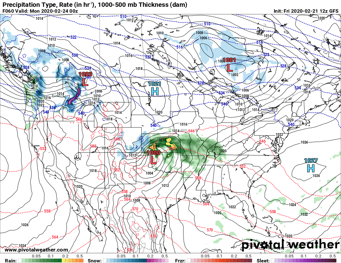
This next image is the NAM and is a good representation of what the NAM and Canadian model believe will happen... these 2 models have been quite a bit more excited about this storm. In this case you can see much stronger moisture associated and a bit more well organized storm center (1005MB instead of 1007... lower is better/stronger) More energy means a better tap on moisture and a stronger upslope component will be possible.
Strengthening Location (Cyclogenesis - Low Agreement)
All models generally agree on this storm system going through a pretty decent intensification process once it leaves the mountains but again the devil is in the details. For a big snow producer you would want it to rapidly intensify over the Southeastern Colorado plains and stall for a bit.
The GFS doesn't hold much hope for that:
GFS: has storm intensifying more into Kansas than Colorado. This means periods of snow for the front range but not enough intensity to make for a big storm until it moves away from Colorado

The NAM has the storm intensifying earlier and further West on Sunday afternoon. This would mean a lot of moisture and upslope for whatever area the storm track favored (remember that's not set in stone yet either)
Summary
We are still in the "wait and see" period of this storm. Unfortunately, due to all the moving pieces and low agreement on the models we can't call this thing for sure one way or another. I don't think we will begin to see decent details until Saturday morning or afternoon, which doesn't give everyone much time to prepare if this thing does end up being a bigger storm.
Right now, most likely snowfall range for the Palmer divide is somewhere in the 4-8" range, with Denver in probably the 3-6" range. Expect those totals to move drastically by the next update so take them as just a reference point with the data we are seeing this afternoon.
What to Do?
50%/50% change for a big storm vs. nothing at all. My advice:
- Don't change or cancel plans yet unless you absolutely have to. Understand that cancelling plans at this point means there's a decent risk you could cancel for no reason
- Have grocery shopping to do? I imagine with the media hype folks will hit the stores hard tomorrow. If you can get it done tonight, all the better. If not, be prepared to have lots of company joining you.
- For those in rural areas, get some of your stuff together in case you need to store water/ lose heat or power.
- Watch the forecast very closely over the next 24-48 hours, we will keep you up to date.
Nothing really nudging us towards calling this a big storm yet, we just don't have any data to support that. The main message here is the chance is there so best to prepare ahead of time and not need it vs. not being prepared at all.
Stay tuned, more updates to follow!
