High Wind Watch Issued
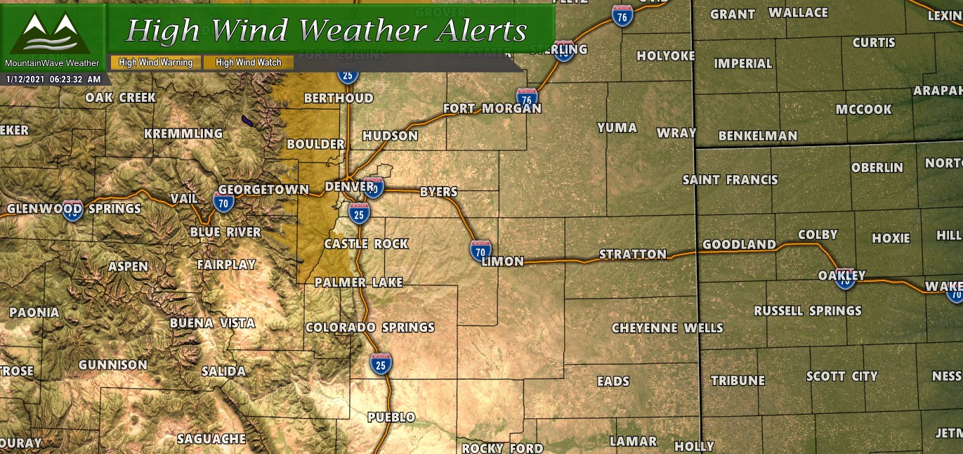
…HIGH WIND WATCH IN EFFECT FROM LATE TUESDAY NIGHT THROUGH LATE
WEDNESDAY NIGHT…* WHAT…West winds 20 to 40 mph with gusts up to 75 mph
possible.
* WHERE…The Northern Front Range Foothills, The Southern Front
Range Foothills, Larimer County below 6000 feet and Northwest
Weld County and Boulder and the western suburbs of Denver.
* WHEN…From late Tuesday night through late Wednesday night.
* IMPACTS…Strong winds will blow unsecured objects around.
Tree limbs could be blown down and a few power outages may
result. Travel will be difficult for high profile vehicles.
As a strong disturbance moves through to our North through later Tuesday and into Wednesday a bora style wind event sets up across the mountains and front range foothills. This means areas in the mountains and along the front range foothills will see very high winds with gusts up to 75mph. If you live in the area of the high wind watch, make sure things are secured and won’t blow around before Tuesday afternoon is closes out.
Outside of the watch, windy conditions will still exist but won’t be high enough or long enough to meet High Wind Warning criteria. According the latest model guidance we do see stronger winds along the Palmer Divide starting later in the night Tuesday and through the day Wednesday. We will keep an eye out in case that High Wind Watch or Warning is expanded to cover more of our area.
Bora Wind Events
Bora wind events are very similar to the strong and damaging “chinook” wind events we get along the front range of Colorado. The main difference is that the Bora is often associated with strong winds and colder temperatures, they can often accompany a front or like a chinook they can form due to strong pressure gradients in and around Colorado.
NWS: A strong, cold high pressure system moving from the west across the Rockies can generate a damaging wind down the leeward slopes of the mountains, known as a Bora. These episodes feature widespread high winds from the west or northwest into the adjacent plains at speeds which can exceed 100 mph.
The term bora is found in the name of the Greek mythological figure of Boreas (Βορέας), the North Wind
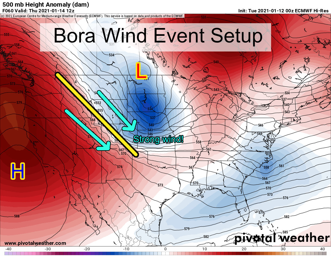
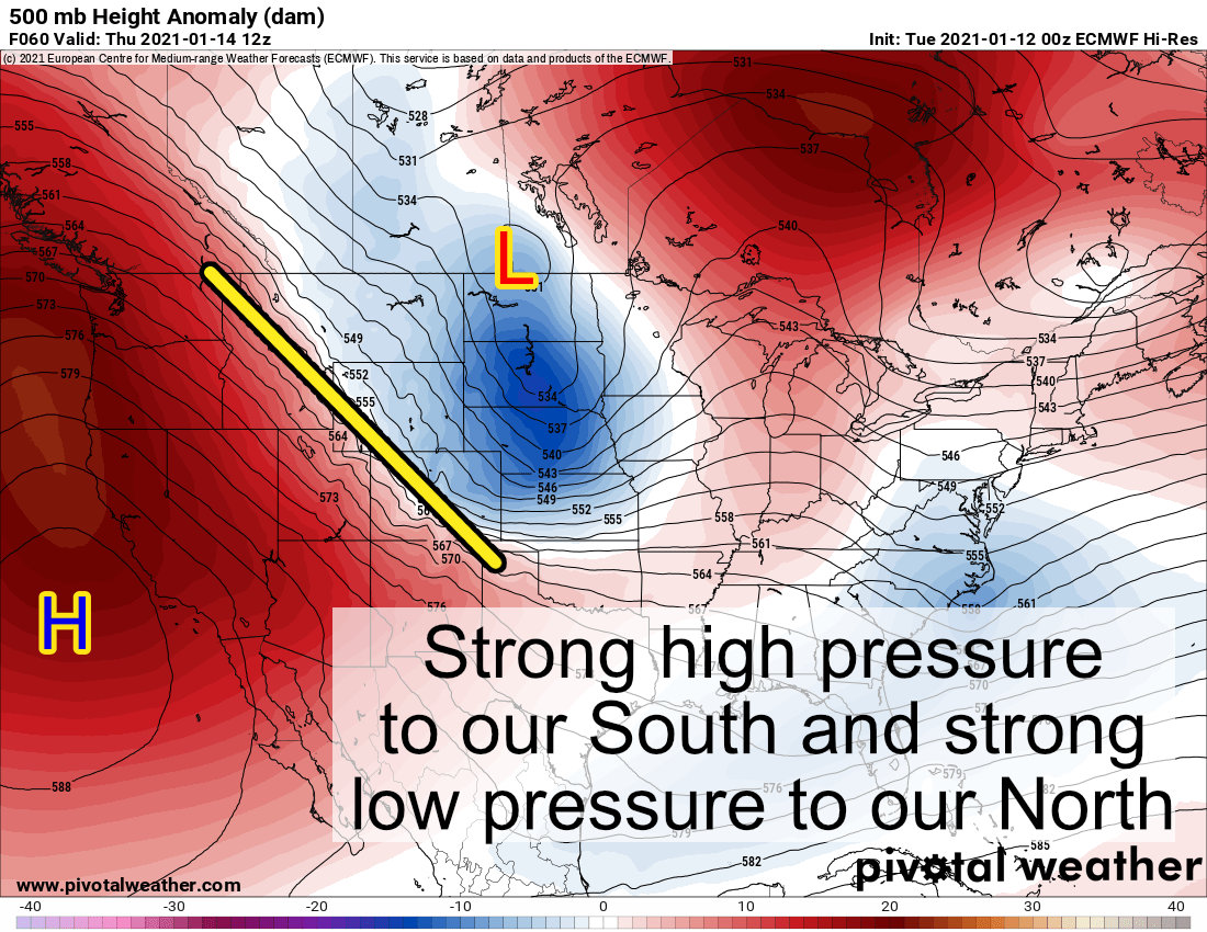
The image above is from the Euro and shows 500mb heights for Thursday morning, this is the setup that will be responsible for our strong winds on Tuesday Night, through the day Wednesday and into Thursday. Strong high pressure to the South and strong low pressure to the North means a tight pressure gradient will form over Colorado, Wyoming and Idaho. Many of those areas along with the Northern Great Plains (Dakotas) will see strong winds from this system
Timing
Folks across the mountains should be prepared for high winds as early as Tuesday afternoon.
For the front range and Palmer Divide, expect winds to pick up through the day Tuesday with the strongest gusts starting late Tuesday night into Wednesday morning. Strong winds will continue on and off through the day Wednesday, into Wednesday night and into Thursday morning.
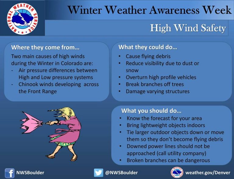
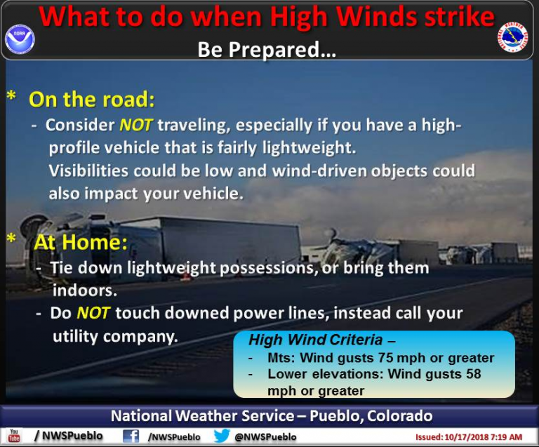
Be Prepared for High Wind!
Here are a couple of infographics from the National Weather Service on how to best be prepared for High Wind events. We are no stranger to these during the winter months across Colorado, be ready for this week’s event!

