Where We Are
As you know, we’ve seen mainly sunny dry days with quick bursts of very small snow storms moving through the Eastern half of the state. This is not entirely unexpected as during La Nina years we often start out slow for snow (especially in the mountains) while the Eastern plains tend to trend warmer and drier early on.
Colorado’s Statewide Snowpack shows that we are slightly below average for this time of year.
Drought is still a very concerning issue across much of the state. Despite the snow we have gotten early on; the wind, above average temperatures and relatively low moisture content of the snow we have seen is helping perpetuate worsening drought conditions across Colorado. The latest U.S. Drought Monitor Conditions are shown below for the state of Colorado and surrounding areas. Notice that Utah and Wyoming are also in particularly bad shape in terms of drought conditions.

Colorado Drought Conditions as of December 3, 2020 per the U.S. Drought Monitor
Notice the exceptional drought creeping into Douglas County while most of Elbert County remains in Severe Drought. Exceptional drought is the worst of the worst in terms of drought and is usually associated with dust storms and poor topsoil conditions as well as agricultural and economic loss. We are seeing large amounts of stress on the vegetation across the Palmer Divide region as we start December.
Update from the U.S. Drought Monitor:
Exceptional drought shrank slightly in central Colorado. According to USDA reports, half to two-thirds of the topsoil moisture was short to very short in all of the High Plains states except Colorado, where 83% of the topsoil moisture was short to very short. USDA statistics show that 38% of the winter wheat was in poor to very poor condition in Colorado.
The failure of the summer monsoon resulted in record dryness to the Southwest states, and record heat over warm season increased evapotranspiration, resulting in record SPEI values over the last 3 to 6 to 9 months. The SPEI values were not only record, they exceeded previous records by huge margins. The expansion of exceptional drought reflected this prolonged dryness.
In short the Standardised Precipitation-Evapotranspiration Index (SPEI values they speak of above) is a tool different scientific disciplines to detect, monitor and analyze droughts. The SPEI can measure drought severity according to its intensity and duration, and can identify the onset and end of drought episodes. I can speak more about this if folks are interested, but the basic theme here is the higher the number the worse the drought is.
Where We Are Going (This Week)
Here’s a few of the CPC outlooks from 11/30/2020 which highlights this weekend, early next week and mid next week.
CPC 6-10 Day Precipitation Outlook from 11/30/2020 (highlights this upcoming weekend and early/mid next week)
CPC 6-10 Day Temperature Outlook from 11/30/2020 (highlights this upcoming weekend and early/mid next week)
The CPC Outlooks are not a forecast, they are simply one puzzle piece that goes into the entire puzzle that is a forecast. They are handy for graphically displaying probabilities and uncertainties around temperature and preciptation for any given region, but they must be used in conjunction with other data to put a good forecast together.
That’s where we turn to models!
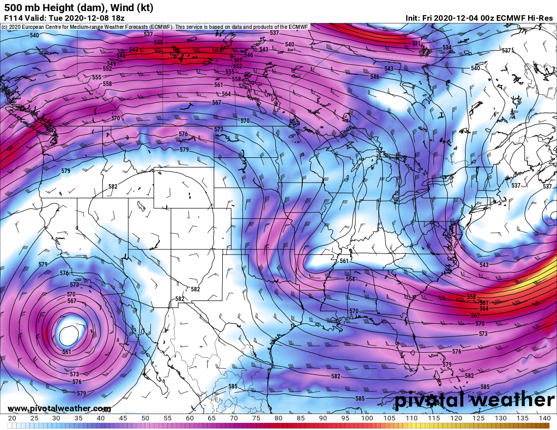
Euro 500mb setup next week 12/8/2020

GFS 500mb setup next week 12/9/2020
Notice there is decent agreement on both longer range models (euro and gfs) that ridging will build over the weekend and into early next week. This means Colorado can expect mild and dry weather through at least the middle of next week. A little closed low forms over California and tries to move East but ends up falling apart before it gets too far.
Verdict: This weekend and through mid/late next week look very warm and dry for a large portion of Colorado
Where We Are Going (6-10 Days)

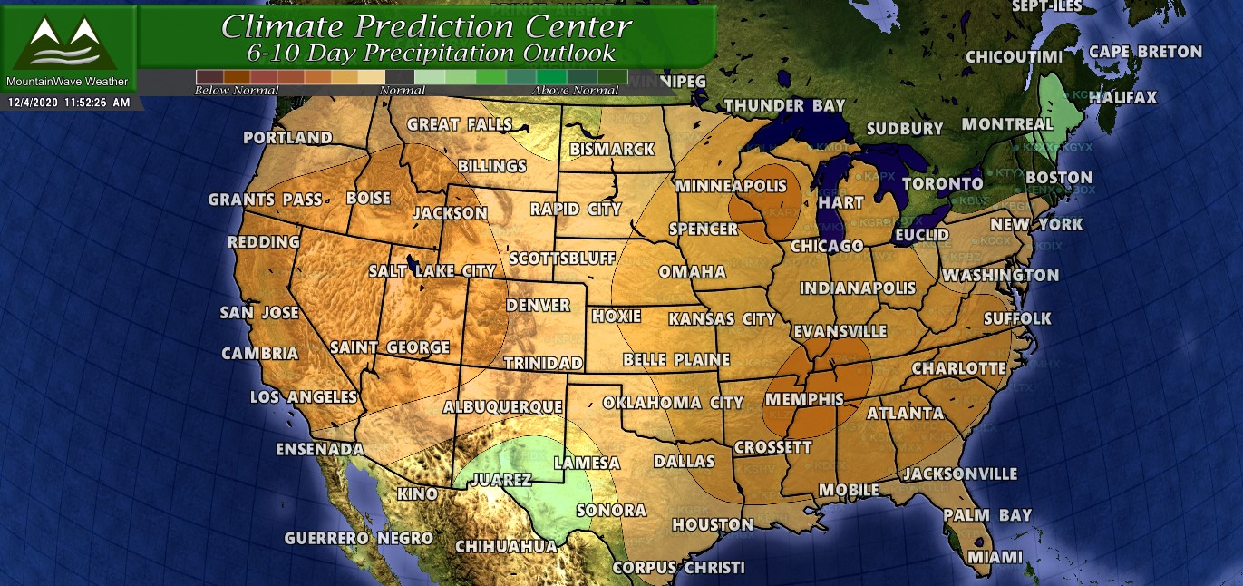
CPC 6-10 Day Precipitation Outlook from 12/03/2020 (highlights late next week into next weekend)
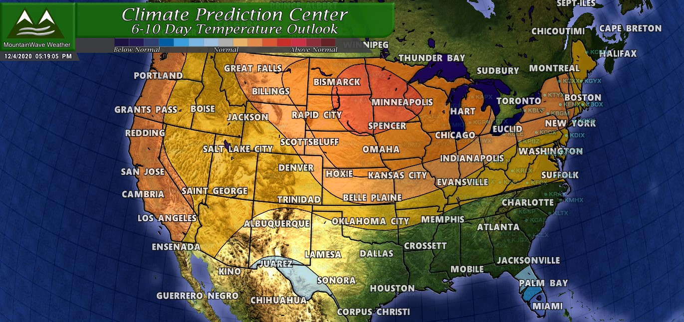
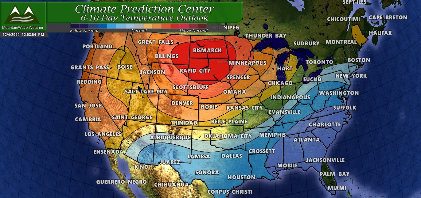
CPC 6-10 Day Temperature Outlook from 12/03/2020 (highlights late next week into next weekend)
Could this scenario unfold? It’s possible with what models are saying and the general pattern shift we expect right around the middle of the month. It’s coming, we can see it… but there’s still a ton of uncertainty in how these storm systems set up, where they set up, how strong they become and what their ultimate effect will be in Colorado.
Verdict: By late next week, unsettled weather is likely with cooler temperatures. Precipitation is still a big maybe, even though the CPC outlooks have a higher chance of wetter weather… the models don’t necessarily agree we will see meaningful moisture East of the Continental Divide. We will have to watch this to see how it plays out.
Where We Are Going (Next 8-14 Days)
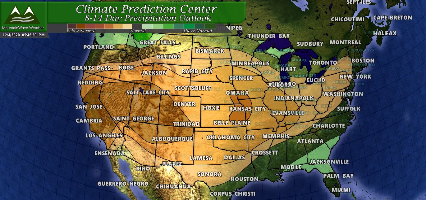
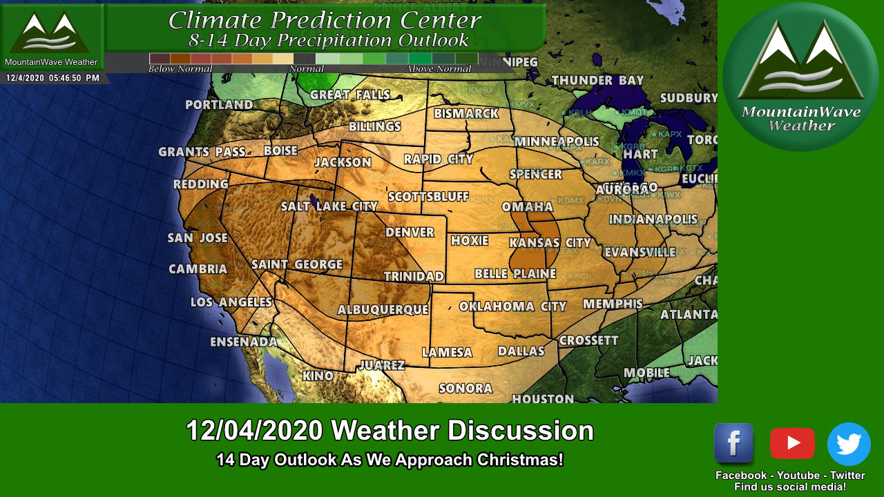
CPC 8-14 Day Precipitation Outlook from 12/03/2020 (highlights the time period starting 12/12 and next several days)

CPC 8-14 Day Temperature Outlook from 12/03/2020 (highlights the time period starting 12/12 and next several days)
Verdict: The fact that the 8-14 day outlook contradicts the 6-10 day outlook in precipitation means there is still a lot of uncertainty around if any of these storms product a whole lot of moisture. That’s why, despite the face that the weather may get more active in the next 2 weeks or so, there’s no gaurantee we see any meaningful moisture. As stated above the timeframe is simply too far down the road – it means we will just have to keep an eye on these storms as we get closer to those dates.
Pattern Change Likely Beginning Mid-December!
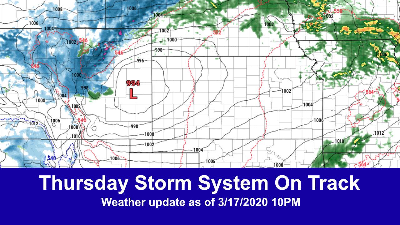
Look how many separate storm systems the GFS brings through our area starting around the middle of the month…
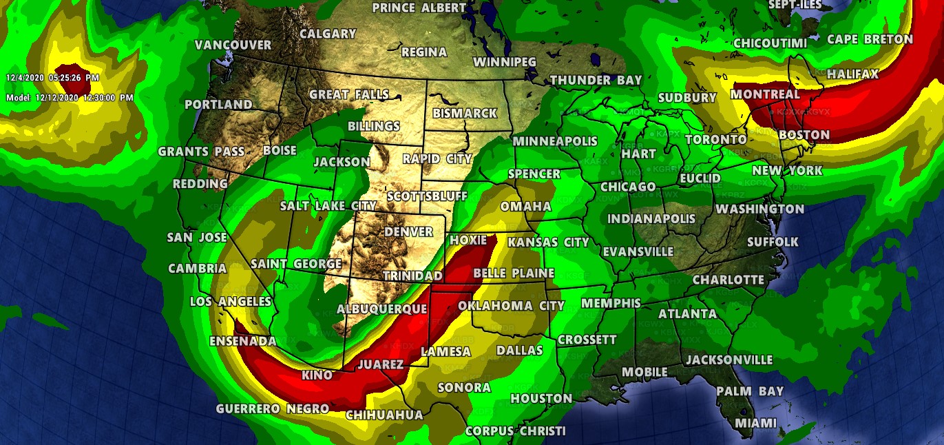
Trough #1 should move through late next week or towards next weekend.
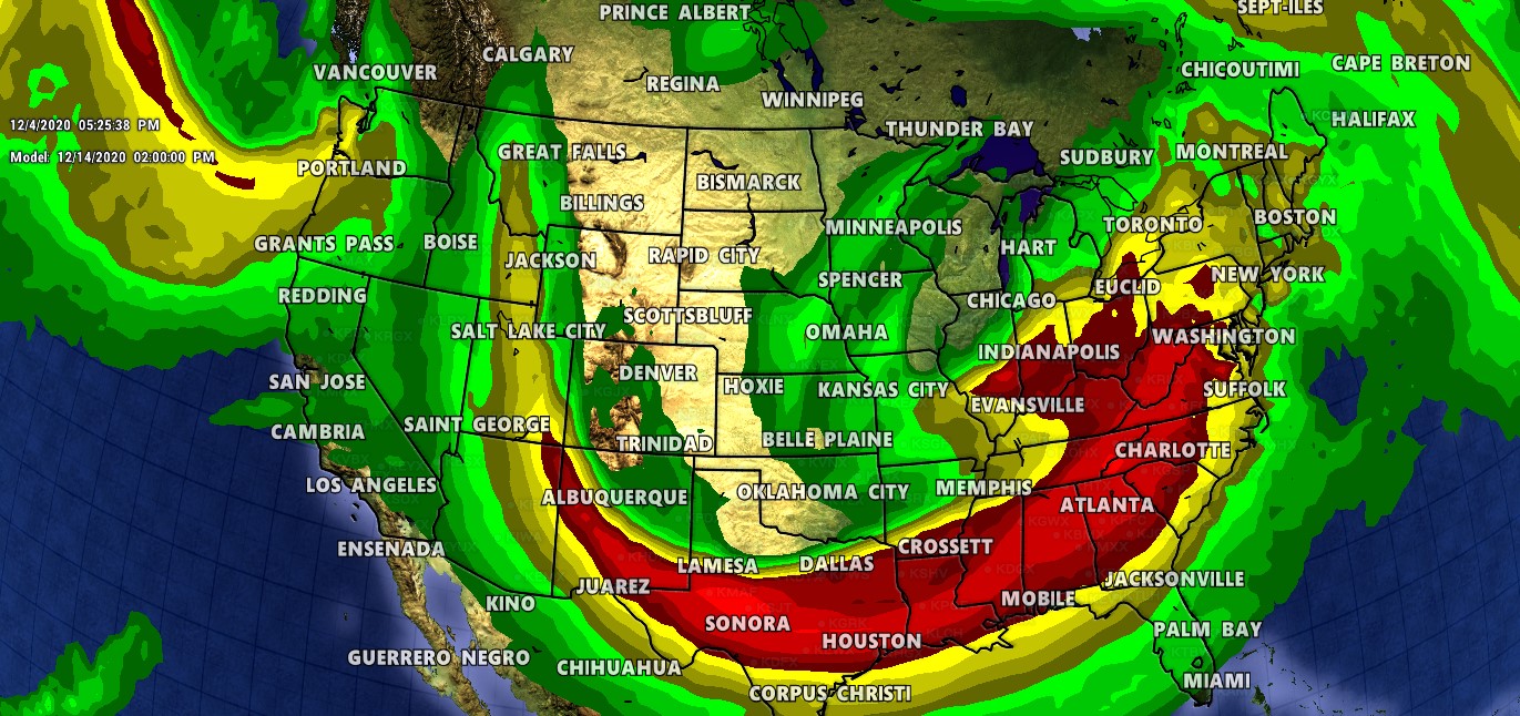
Trough #2 should swing through early the following week (12/14-ish) keeping the chance of unsettled weather around
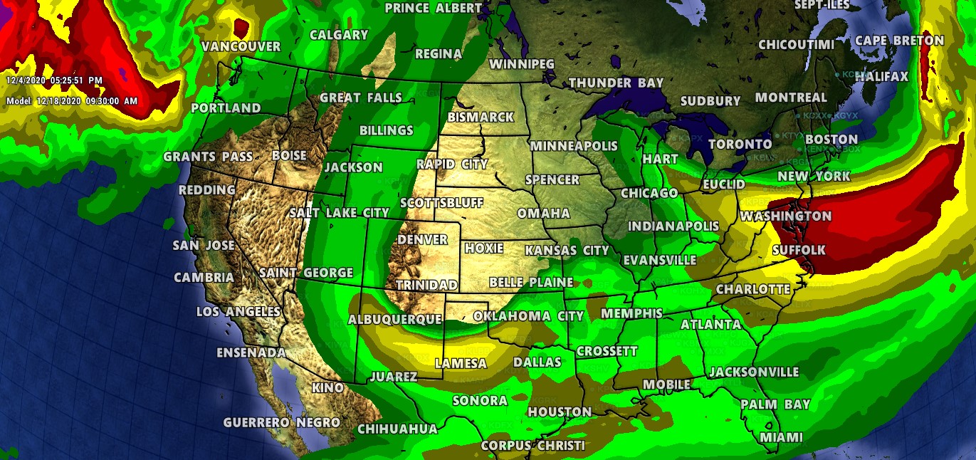
Trough #3 should swing through late the following week (12/18-ish) keeping the chance of unsettled weather around
What Does This Tell Us?
- There is a higher chance of unsettled weather beginning around the middle of the month (12/12-12/15ish)
- Troughs like this have the chance to bring much colder air and precipitation **depending on how and where they set up!**
- We need to keep a closer eye on the weather starting around 12/12
What This Doesn’t Tell Us
- How much precipitation (if any) we will receive
- How warm or cold temperatures may be
- Finer details on each storm system such as impacts and timing (beyond within a few days)
We are simply too far out to know the finer details, all we can see at this point is the days we should be keeping an eye on!
A Quick Word About the CPC Outlook Products
Now some of you may ask, why am I showing the CPC Outlooks? It is true that the CPC Outlooks are only one piece of the puzzle when it comes to forecasting. My general philosophy is when they match up to my forecast (models, probabilities, outlooks, meteorology, etc…) I like to show them because they are a decent graphic representation of what is possible. Since they are probability based they also communicate uncertainty quite well, which as you all know I like!
Summary
So in the short term we look to remain mild and dry but there is some potential coming down the road. The problem is we just don’t have enough details to determine if we see any moisture out of it… the good news is that if the pattern is active we have a higher chance of seeing precipitation. So we can take that!
I will keep an eye out and will be sure to update on these storms as they line up and potentially move through Colorado starting late next week.
