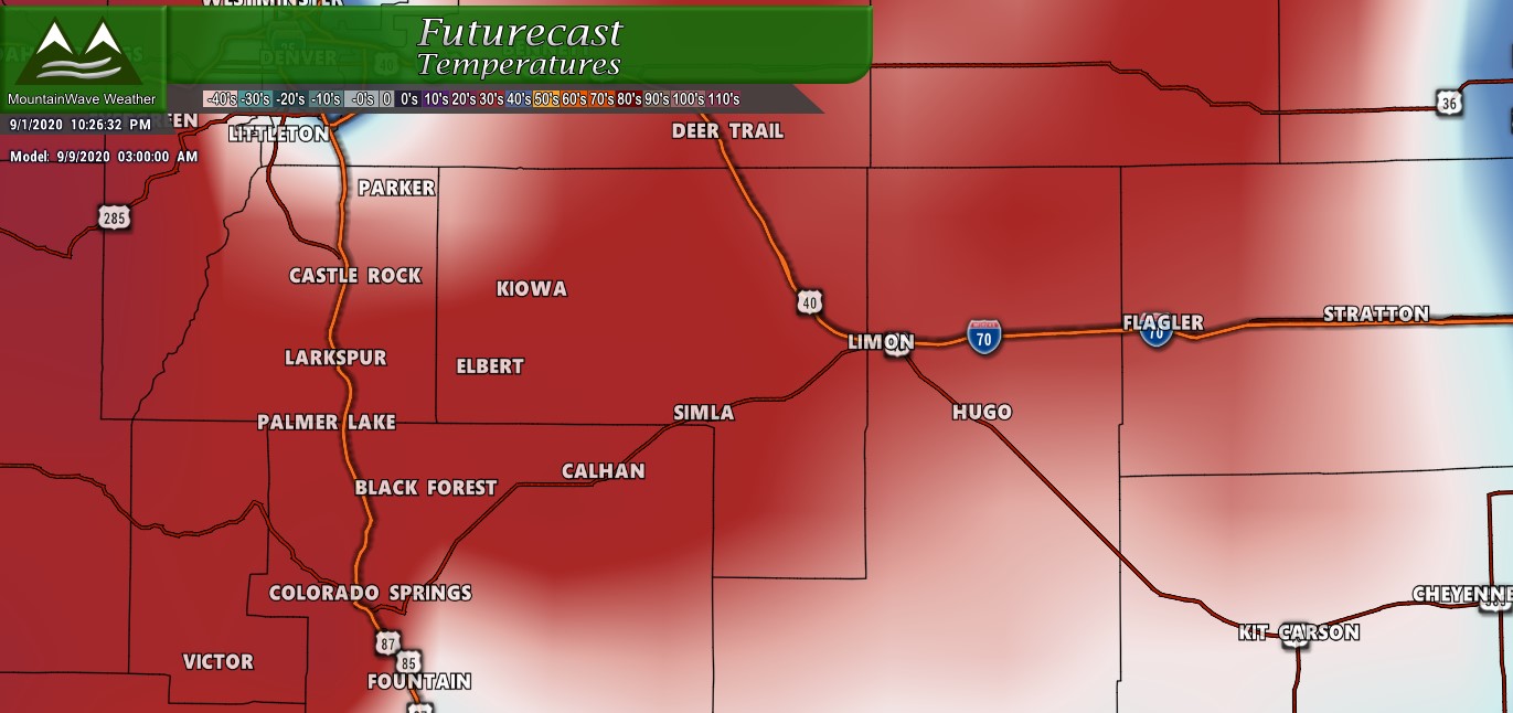
To Start: More of the Status Quo
The first few days of September are going to start off similar to how most of August went... we are expecting a steady climb back into very warm temperatures with some record setting highs possible by the weekend.
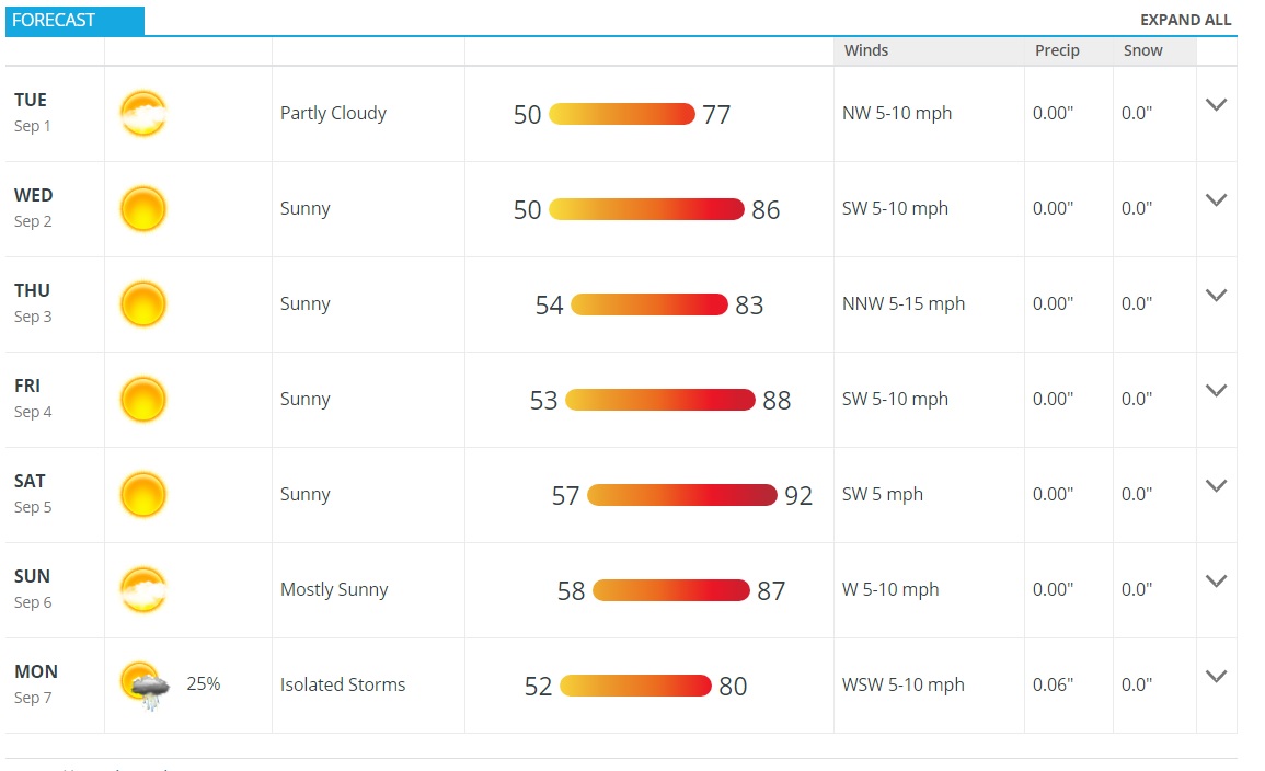
Castle Rock forecast for next 7 or so days...
These hot temperatures will linger into next week before we see a chance at a big change. The reason I use the term "shocking" with our next storm system is that it could be a shock to a lot of people to come from the hot temperatures we've seen the past several weeks to what we could wake up to on Tuesday morning!
Next Week: A Storm System to Keep An Eye On
Understand that this is still nearly 7 days out so the finer details are just not possible to discern just yet. I'm going to break it down by what we know and what we don't which is often the best way to look at weather systems when looking at them on models this far in advance;
- What We Know
- A strong, powerful cold front will travel down from Canada sometime late Monday or Early Tuesday
- There does seem to be some moisture with this storm system
- Most models agree on cooler temperatures but differ on how cold/ how far South the front travels/ etc...
- What We Don't Know
- How cold does it get (if at all?)
- How far South does the front travel out of Canada?
- How much moisture makes it into Colorado?
- Will it actually be cold enough to snow... and if so what elevations are most likely to see it accumulate?
- Timing is still up in the air a bit!
I'm going to show a few models, but I re-iterate... it is very early yet and none of these should be taken as final solutions, forecasts or outlooks. I'm showing them to discuss and provide context only.
I'm going to show you exactly why no one should be getting too excited about actually seeing snow along the front range just yet...
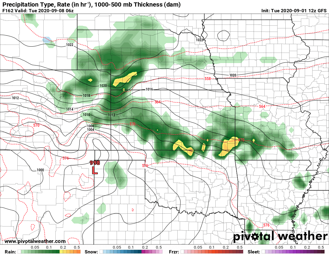
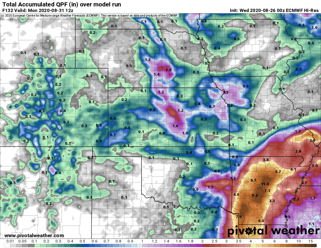
The GFS moves the entire system through with precipitation staying as rain, but agrees on colder temperatures. It doesn't believe temperatures will be as cold as other models do. If this were to verify, snow would be unlikely.
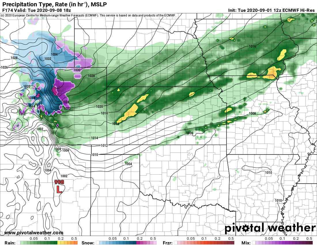
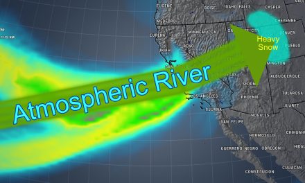
The Euro brings more moisture through and much colder temperatures. If this were to verify we could see a rain/snow mix along many areas of the front range and snow at higher elevations (foothills, Palmer Divide, etc...)
What About Snow Accumulation Amounts?
I'm not going to show those... and anyone that does this far out is nuts. There are still too many variables and you have to understand that models don't handle snow accumulation amounts well this early as the lower atmosphere and ground remain very warm. This means that even if you're seeing high amounts of snowfall accumulation for the front range it is very unlikely we see those amounts... we just can't confirm them until we get a bit closer.
So What Now?
I imagine you're going to hear a lot about this storm system on the local tv stations over the next few days... it is something to increase viewers and they love to latch onto things like this. This storm looks promising at this point for cooler temperatures and some moisture, but it's simply too early to get too excited about it. If we see this trend continue in the models through the weekend that will be another story.
Remember, we will keep you updated and will let you know if this is something to get excited about. For right now our best advice is to keep an eye on it and stay tuned to the forecasts through the weekend to see how this thing evolves.
Our policy here is...

