Another disturbance will slide across Colorado on Thanksgiving Day and will bring along with it our next shot at snow along the Palmer Divide and Front range.
Weather Alerts
As of the writing of this post, there are no current weather alerts/advisories/watches scheduled for the day tomorrow. This includes the mountains, so that should give you a decent idea on the severity of this storm.
Snowfall Forecast
Models are not particularly excited about the moisture associated with this storm and you will see the product of that on our snowfall graphics below. The storm system will bring a bit of cooler air to the region but really only the mountains have a decent show at accumulating snowfall - and even then we are talking about 1-2 inches tops for the areas that do get snow.
You will see on the graphic below that many areas along the Palmer Divide and Front range (even though they may see a few snow flurries here and there) are not likely to see snow accumulation from this storm amounting to much.

Looking at some of the models, they verify pretty closely with the snowfall forecast above, here's the Nam3K's thinking on what areas will actually see snow accumulation:
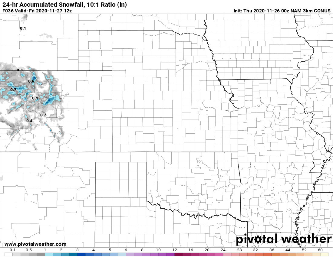
Nam3k estimated snow accumulation through 6AM Friday
Again, you can see how it keeps snow accumulation mainly to the higher elevations in the mountains... all in all this storm system is pretty moisture starved so don't expect a whole lot of snow with it.
Timing/Impacts
Timing
The best chance to see snow along the Palmer Divide will be from around 8PM through midnight Thursday/Friday. Don't expect to see a whole lot coming down from the sky and most areas won't see snow. If you live South of Denver, put your chance of seeing snow fall at around 20-30% and chance of snow actually accumulating at less than 10%.
By after midnight things will clear out and we don't expect lingering snow into the morning hours Friday morning
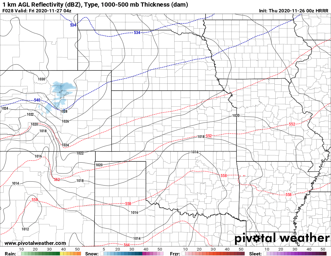
HRRR model late Thursday night - that tiny blue blob is about as good as it will get for snow. Don't expect much out of this storm!
Impacts
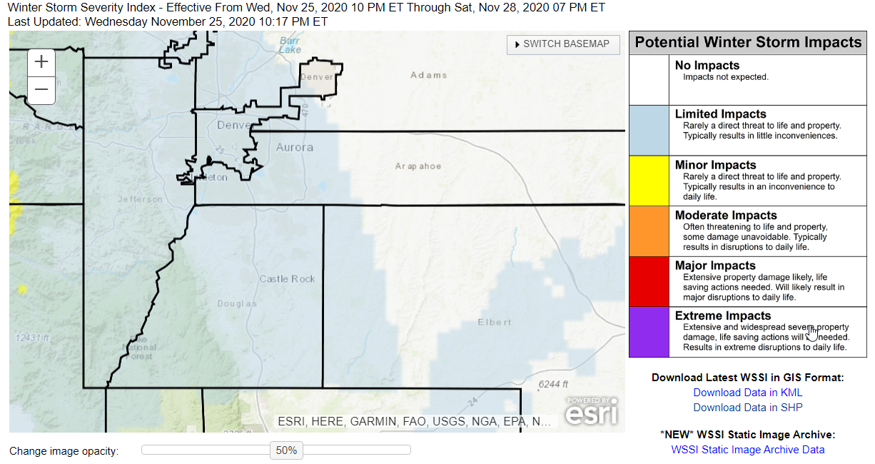
Impacts will be fairly light with this storm system. The Winter Storm Severity Index graphic below has a few limited impact areas; these areas may see minor inconveniences due to the weather (think a random slick spot here or there) but we don't anticipate system wide travel impacts with the amount of snow this storm will put down.
The main impact will be the cooler air during the day Thursday and the colder temperatures Thursday night and Friday morning. Beyond that, this storm won't be super exciting.
As always, we will keep an eye on it in case anything changes but this storm doesn't look super impressive from any angle.
For now, enjoy the Holiday tomorrow and stay warm and safe out there!
