We’ve been harping about how cold it is going to get along the front range for awhile now. For some of us that cold arrived already this week but for others in higher elevations or in areas aided by downsloping off of the mountains or foothills – we haven’t seen anything yet.
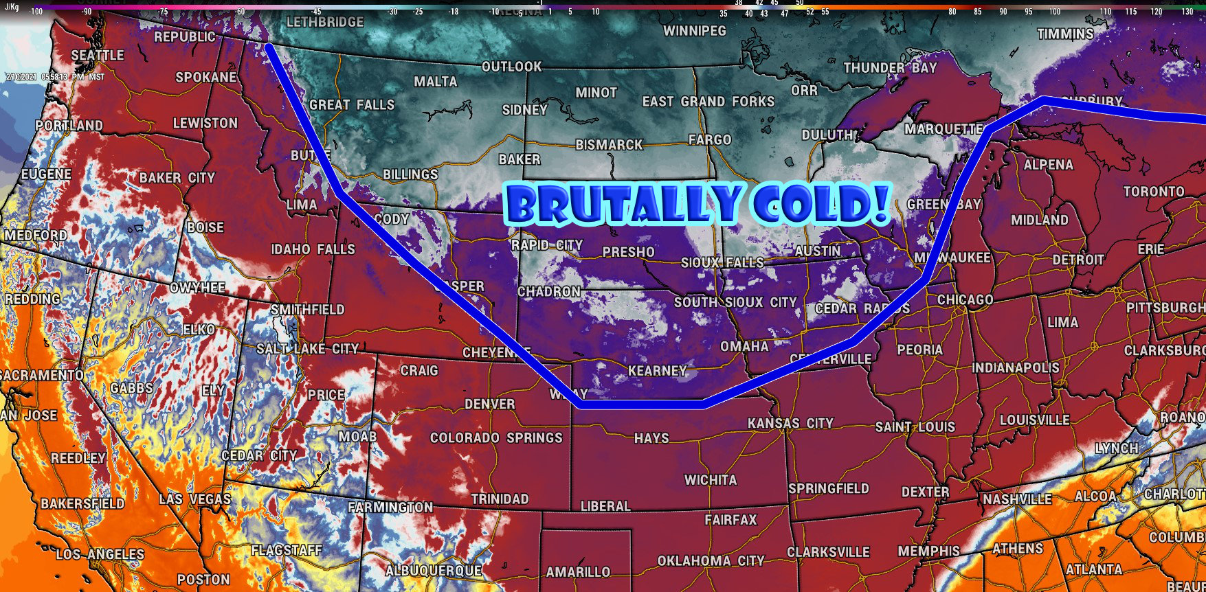
An extremely cold airmass has slid South from Canada into the Central part of the United States where some areas like the Dakotas are already seeing brutally cold arctic air.
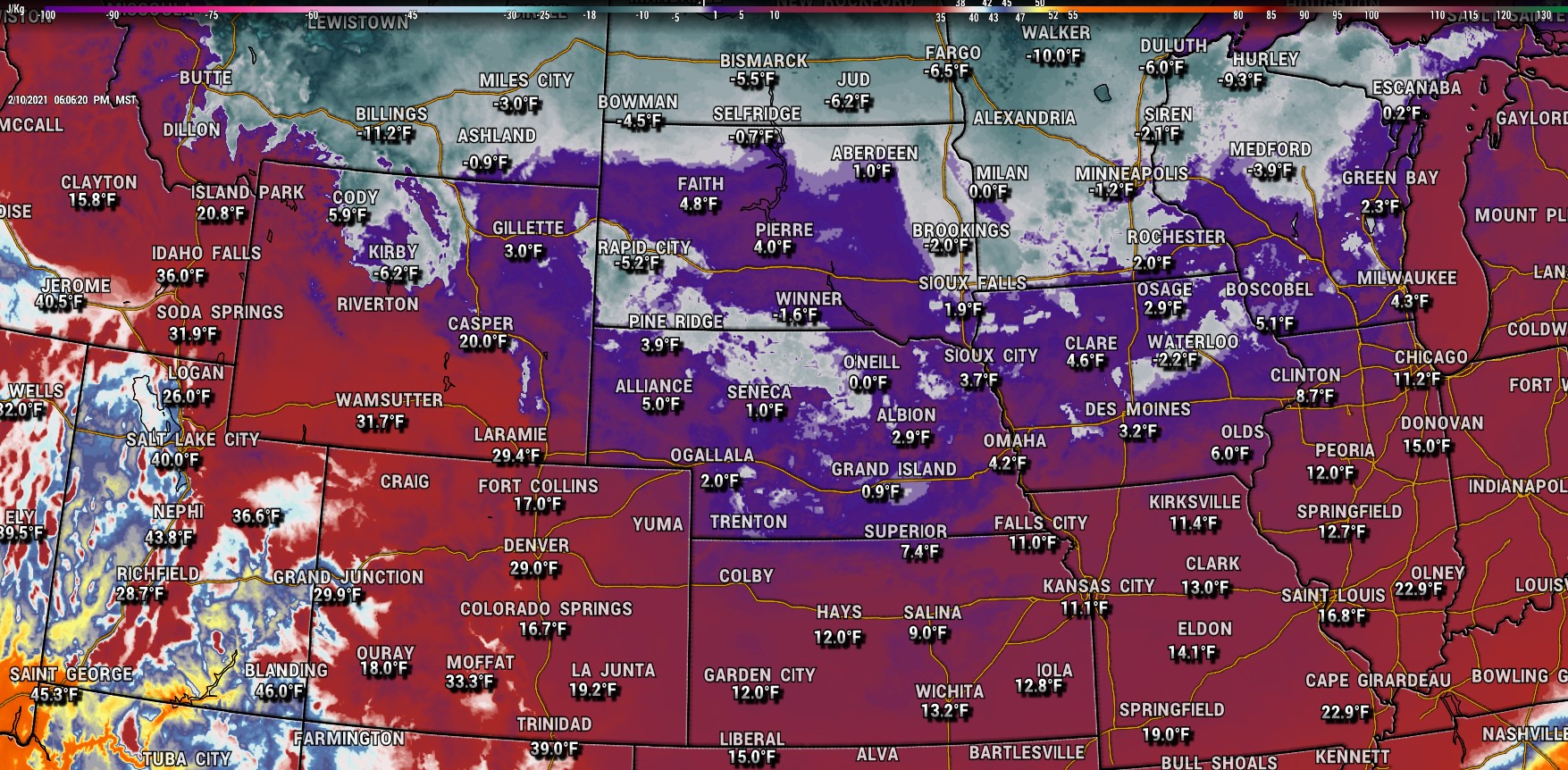
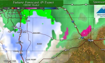
Surface temperatures as of 6PM on 2/10/2021
This air will continue to slide South for the next couple of days before turning Westward and sliding back towards the Rockies. That’s when the fun should start around here!
We are not talking about coldest temperatures of the season for the time period, we are talking about coldest temperatures in years for many places East of the Continental Divide.
Just How Cold?
As you can see from the surface temps above, it is getting chilly but it will get a whole lot chillier!
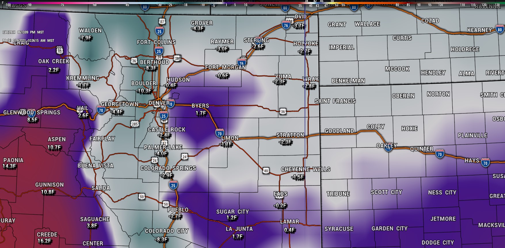
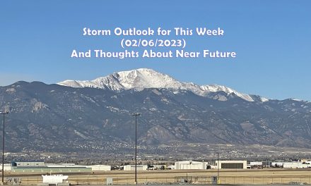
GFS forecast: surface temperatures at 10AM Sunday morning (2/14/2021)
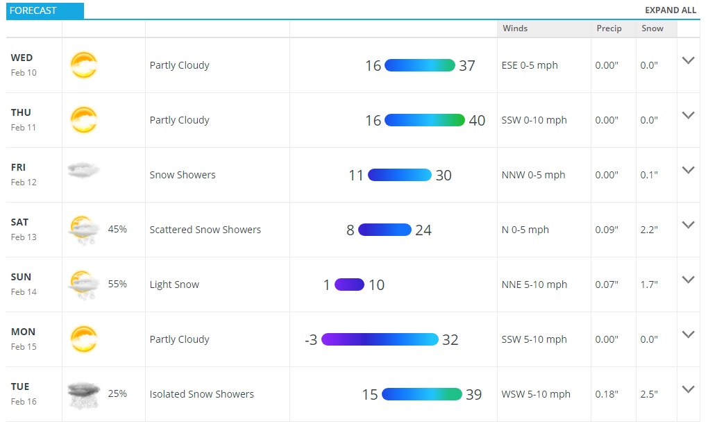
Saturday will see falling temperatures through the day as the colder air moves through. Expect Saturday night to get very cold with low temperatures on Sunday morning below zero for many areas. Highs on Saturday top out in the mid to lower 20’s for most Palmer Divide locations, but by Sunday morning (around 10AM as seen above) many areas will be well below zero. This will definitely be a bit of a deep freeze! For Sunday, you will be very lucky to see any high temperatures above 10 degrees along the Palmer Divide.
Moving into Sunday night and Monday morning, expect it to get even colder.
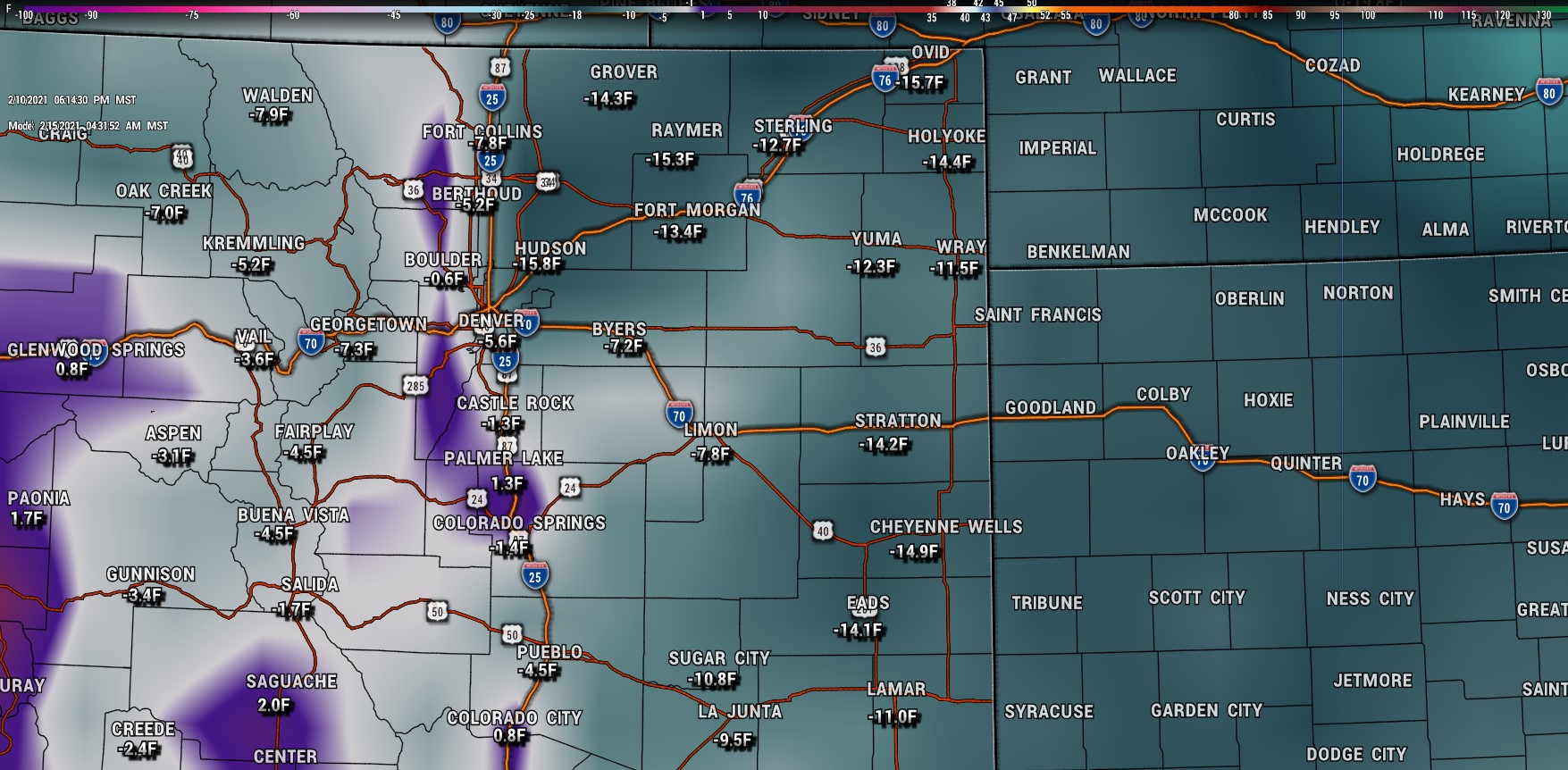
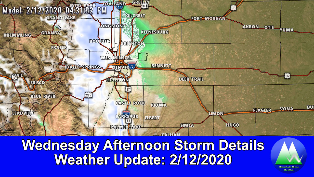
GFS forecast: surface temperatures around 4:30AM Monday morning
Monday morning will see most areas bottom out in the -3 to -10 range along the Palmer Divide with similar temperatures in Denver. For what it’s worth, I think it’s possible that temperatures could be lower than this! Best to be prepared for that cold air Monday morning.
Chance of Snow!
While all of this is going on we can’t rule out the chance for snow as this storm system pivots through the state. As you can see the mountains will most likely do very well with snowfall over the next 5-7 days with the front range seeing lesser amounts. The Euro below shows a chance for a couple of inches, but there’s a catch here… more about that in a minute.
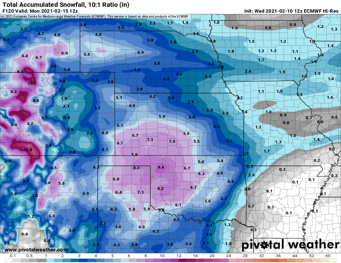
Euro total snowfall through 5AM Monday morning
As you look at both the Euro and GFS’ thoughts on snowfall you’ll see an ok amount of agreement on which areas see snow and what amounts. Since this article is writeen on a Wednesday and these models are for Sunday/Monday do expect the amounts to change… the forecast is not final. We are simply showing these to let you know there is a chance for snow this weekend and it doesn’t look all that impressive.
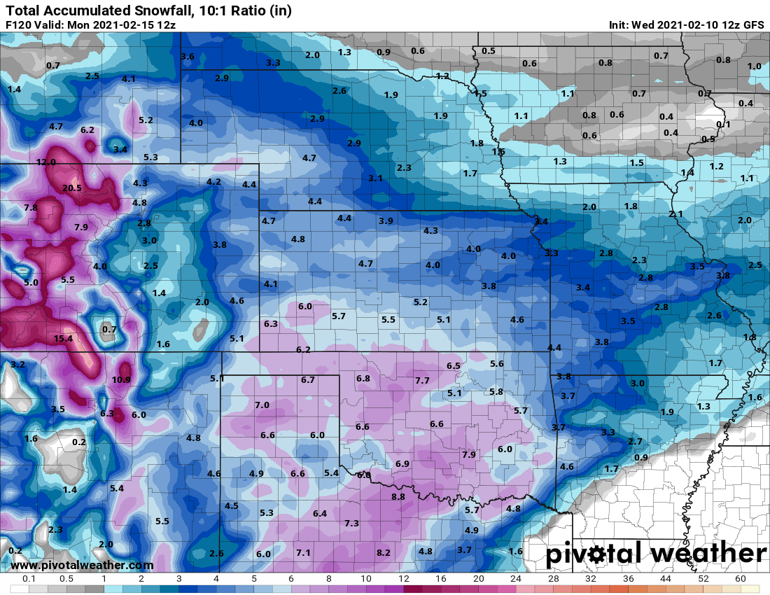
GFS total snowfall through 5AM Monday morning
A Note About Models and Snowfall During Abnormally Cold Storm Systems
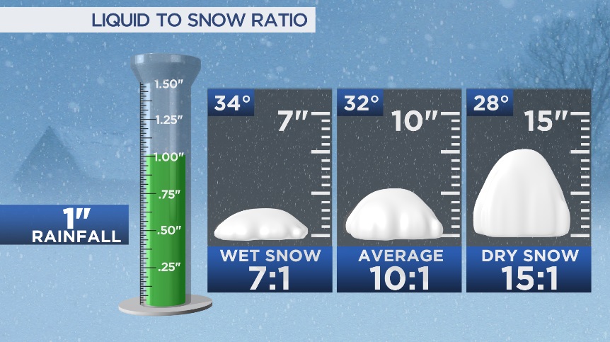
During very cold storms the snow often has less moisture content, is lighter and more “fluffy.” This means that if it does snow as predicted we could see some areas “overperform” in terms of snowfall totals. This will be something we have to watch closely as models do forecast this but can sometimes have trouble with it. A 1-3″ snow storm can easily turn into a 3-6″ storm if there’s enough moisture and lift to work with.
Timing of Cold and Snow
Bitter Cold
- Be prepared for the coldest temperatures from Saturday night through Monday afternoon
Snowfall
- Should the models verify expect the best chance for snow late Saturday night and during the day Sunday.
- Timing still may shift a bit for snowfall so stay tuned to the forecast
Impacts
- Extremely cold temperatures will be dangerous for animals and people outside unprepared for extreme cold
- Travel impacts may be possible due to snow late Saturday or Sunday. Stay tuned for further updates.
Wrap Up
Probably not a whole lot to worry about in the snow department, the major story with this storm will be the cold. If you plan on being out and about make sure you are prepared for extreme cold. For those travelling to the mountains, expect impacts due to snow and wind throughout the weekend.
As always, we will have more updates as the data warrants. Stay tuned!
