Weather Setup this Week
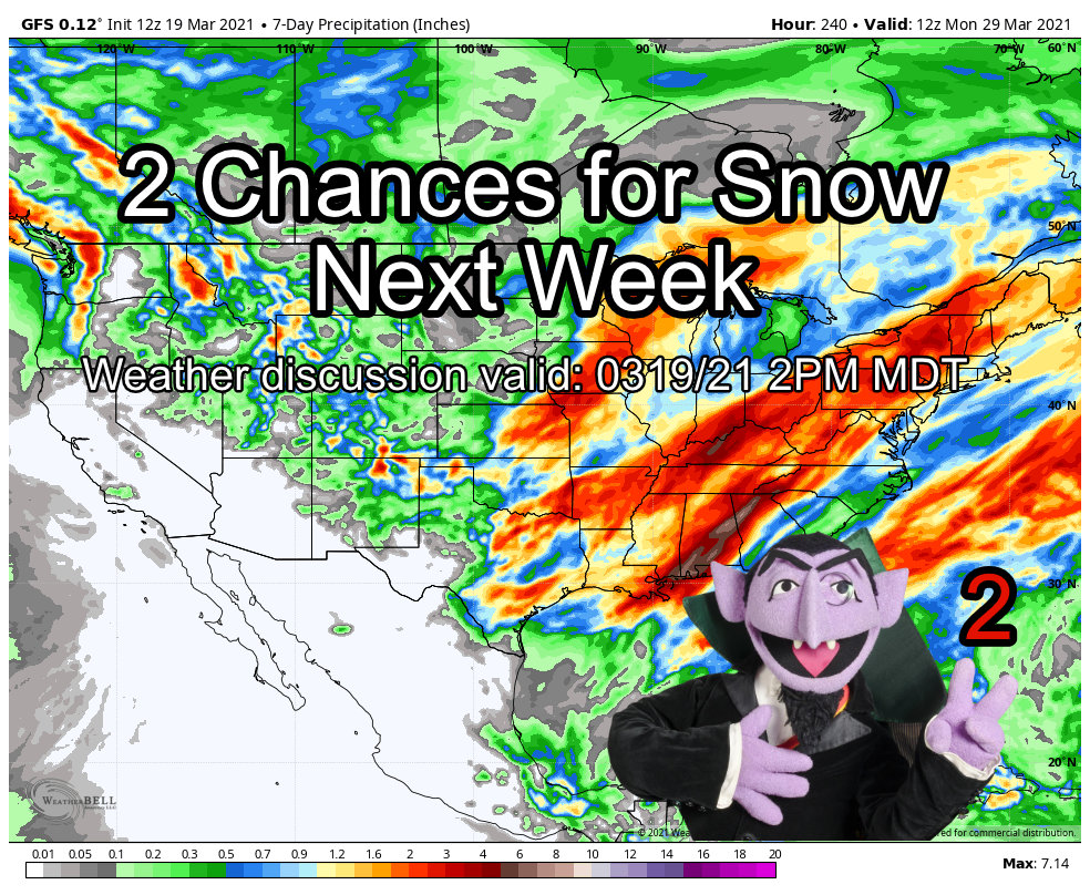
This week we will see a familiar pattern as flow aloft switches mainly to Northwesterly once again. This has been a hallmark for most of our season and while it means the front range will have a couple of shots at snow, neither is looking super impressive due to the pattern in place.
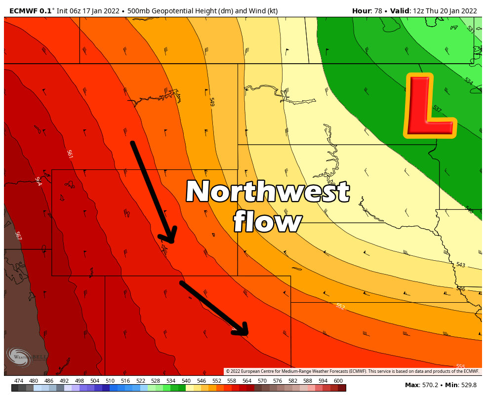
As the low stays well Northeast of Colorado, flow behind the center will remain Northwesterly across Colorado.
The kicker here is that there is no “atmospheric river” transporting moisture in from the Pacific so the mountains will not see heavy dumps of snow like they did the past few weeks. Snow showers in the hills will remain spotty with our first storm during the middle of the week with a bit better chance for snow for the storm ending the week.
That’s right, 2 storm systems possible this week!
Without the moisture however, we’re not getting too excited about much accumulating snow this week in most of Colorado.
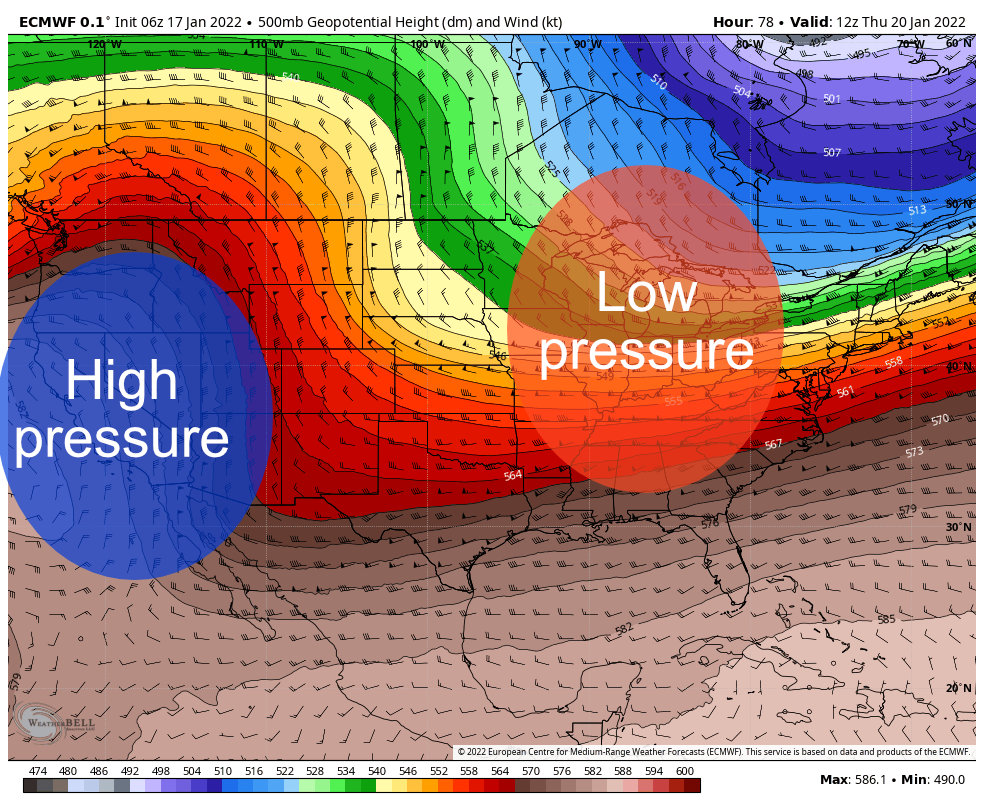
The overall pattern across the U.S. looks similar to above, high pressure to the West and low pressure to the East. This will favor unsettled, cold and potentially wintry weather for much of the Eastern U.S. for awhile. The details on precipitation are still a bit up in the air but temperatures will definitely be colder out East than they have been for a good portion of the winter.
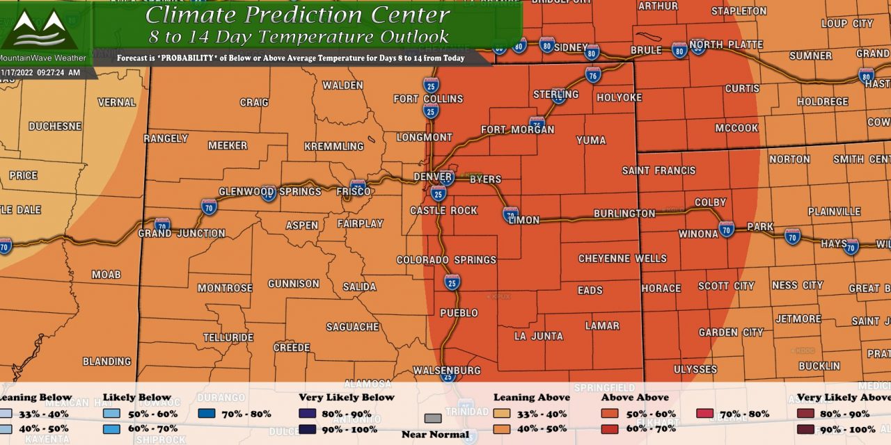
Here’s the CPC 6-10 day temperature outlook:
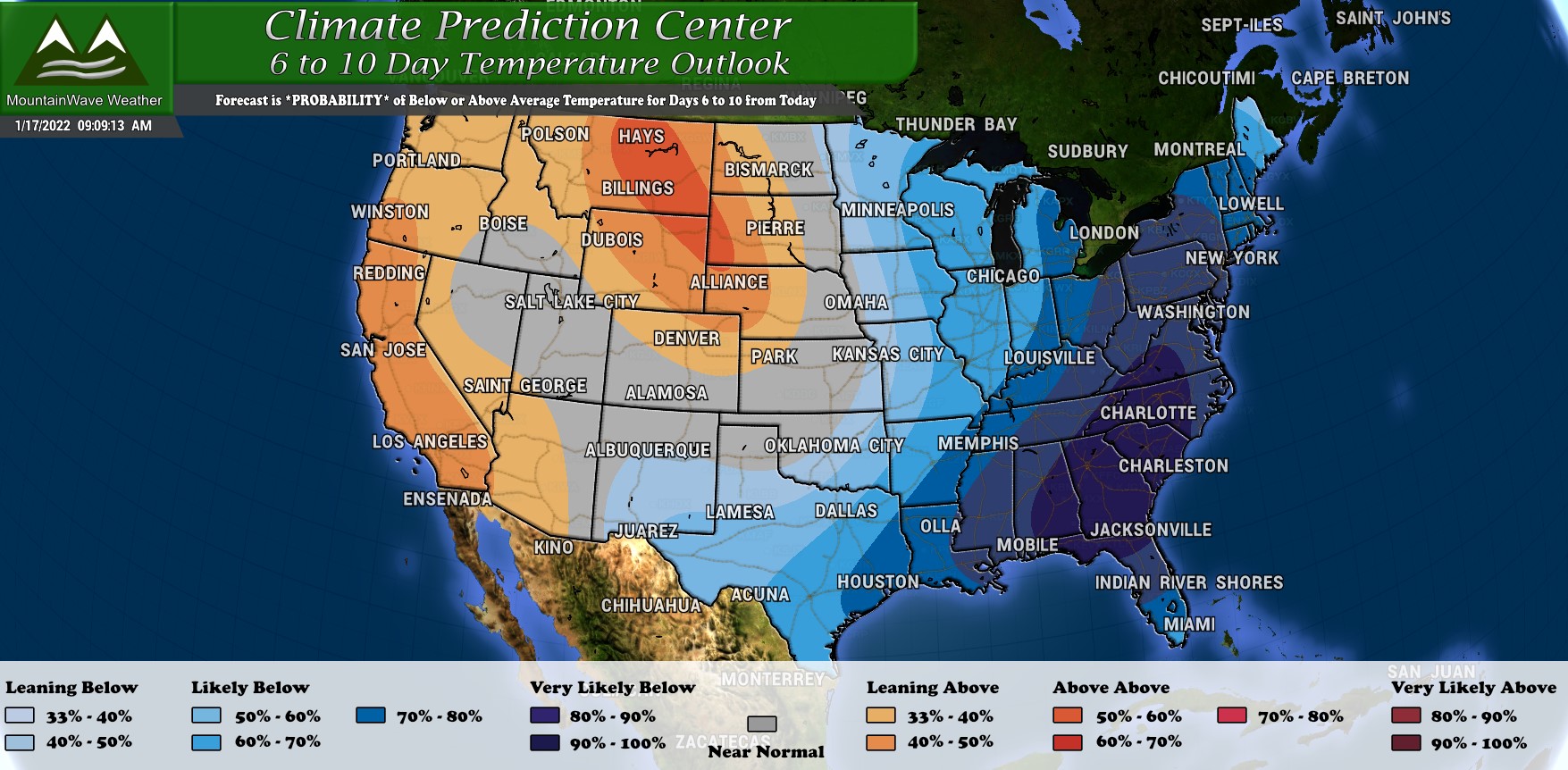
You can see the higher than average probabilities of colder than normal temperatures across the Northeast, Eastern and Southeastern United States. Further West, high pressure will keep temperatures near to above average with quieter weather conditions.
Castle Rock, CO – Palmer Divide Forecast
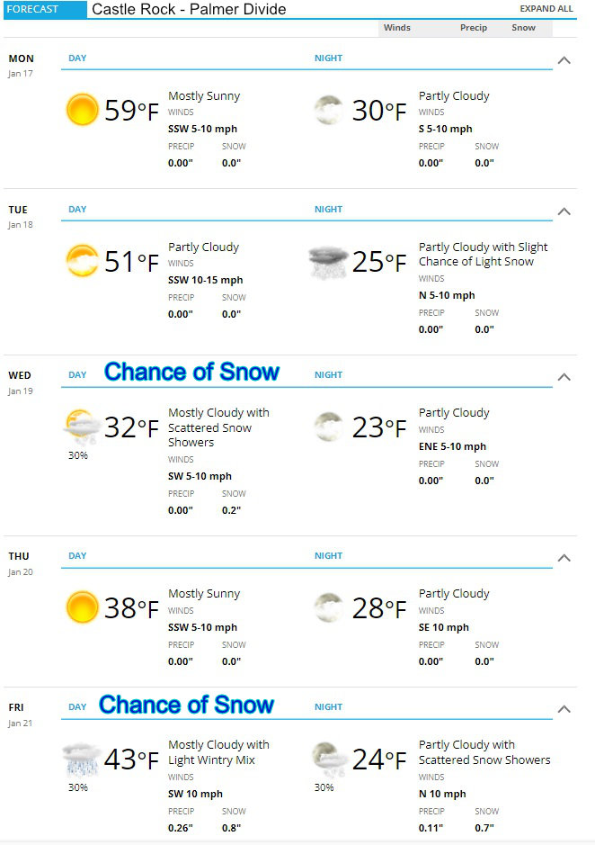
The forecast for the region consists of a warm first half of the week with daytime high temperatures generally in the 50’s across the Palmer Divide – Denver may flirt with 60 degrees especially on Monday. By Tuesday, temperatures cool a bit during the day with a drop off overnight, this is when the first front will move through and perhaps bring a few areas some snow into Wednesday morning. Wednesday sees a chance of spotty snow showers with clearing by later in the day.
Thursday looks quite seasonable before our next storm system moves in on Friday. Details are still a bit fuzzy with that one and as you can see temperatures during the day will be marginal for snowfall. Any snow accumulation with that storm will depend on timing and storm track but as of right now models seem to like that one a bit better than the one on Wednesday.
We will see if/how that changes throughout the week!
Preliminary Snowfall Forecast
Preliminary means: early forecast, keep an eye out for changes!
Palmer Divide / Urban Corridor / Eastern CO
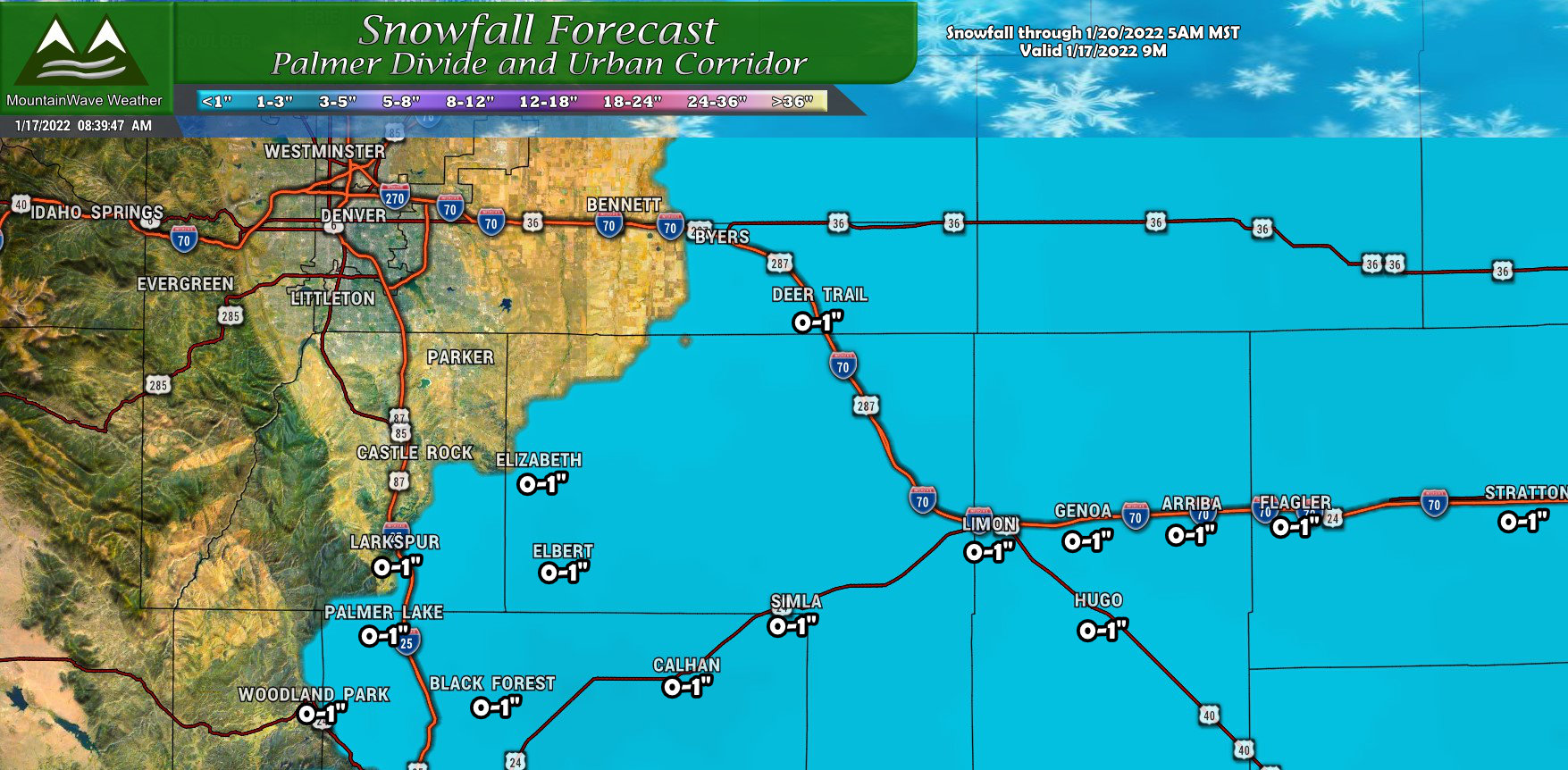
Preliminary snowfall forecast doesn’t show much exciting with this storm system. Most areas will see totals within the 0-1″ range. Two things to watch as we get more model data in over the coming days; does the snow push further West and get more of Castle Rock/ Lone Tree/ Parker and surrounding areas into the game or not?
The other area to watch is into Northern El Paso and South Central Elbert County – models are a bit more excited about a little heavier snow out in those areas, but at this stage in the game I will wait to see if the shorter range models also pick up on that to see if it’s worth adding to the forecast.
For now, everyone is pretty well on the low side of snow accumulation.
Northern Colorado
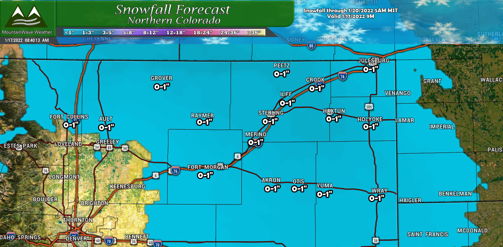
I’ve included Northern Colorado as they may see a bit of snow out of this as well, but it’s looking pretty scant in this region as well. A broad brush of 0-1″ is painted across most of the Northeastern part of the state…
Summary
Nothing too exciting on tap for the first half of the week, we will watch to see how these storms evolve throughout the week but the pattern is still just not consistent for heavy snow storms.
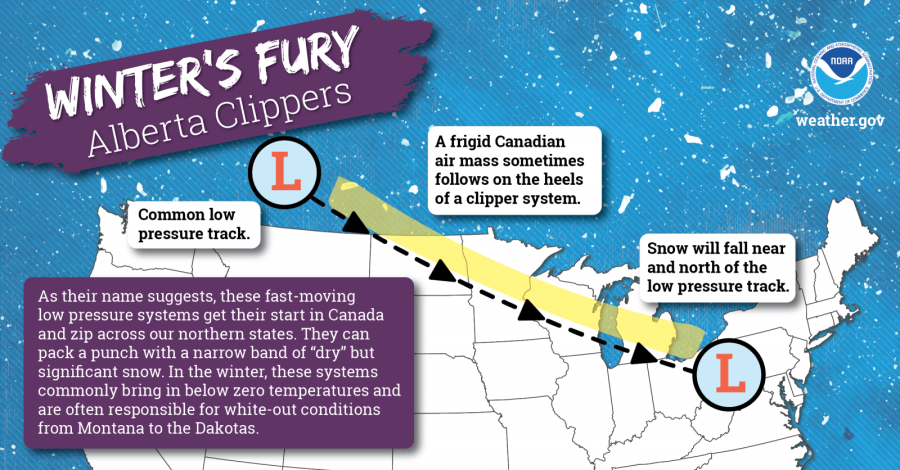
If you’re curious, the East will see a lot of “clipper” type storms over the next week or two, here’s some information about those:
