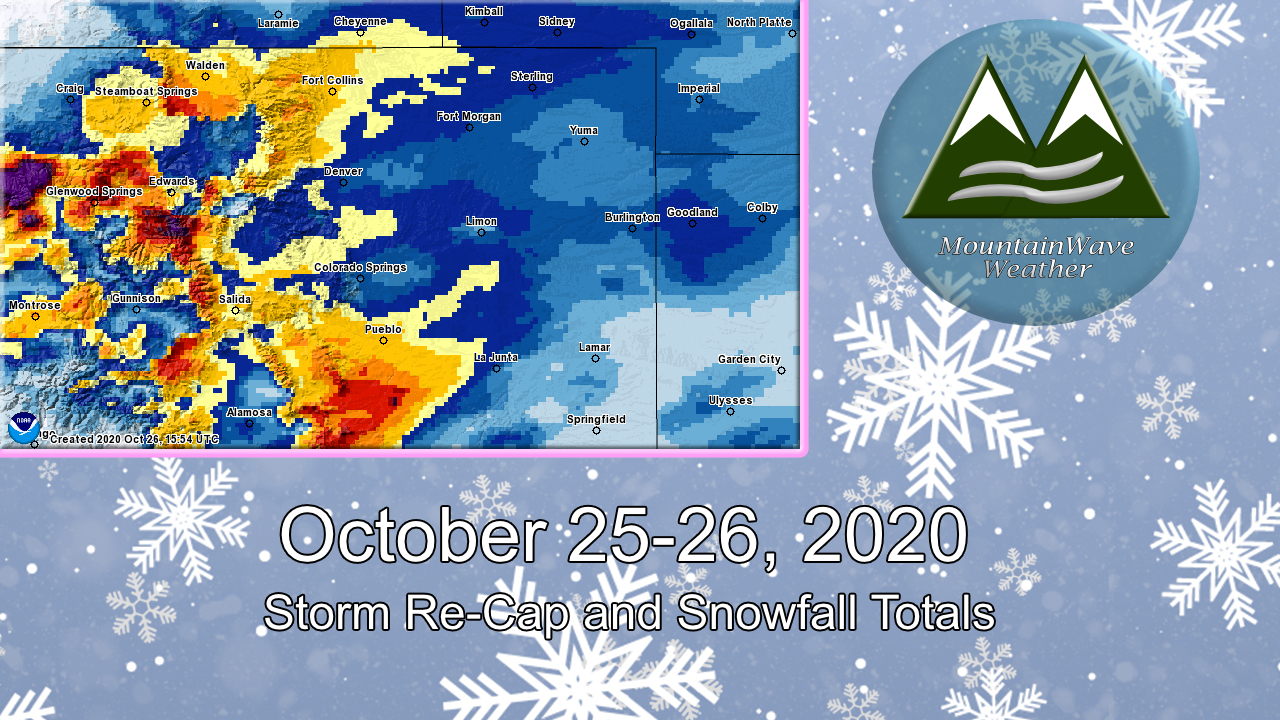
Our first decent sized storm to impact the state is in the books and it behaved as expected for the most part. The exception was a heavy snow band that set up and stalled over Northern Colorado most of the day on Sunday and dumped tons of snow in those areas. Despite upping snowfall forecasts for that area – in many cases our snowfall forecast was too low for a lot of Northern Colorado locations.
Many areas North of Denver ended up well over the forecast snowfall amount. This is mainly to a jet induced snowfall band that sat over the area for most of the day
Closer to Home
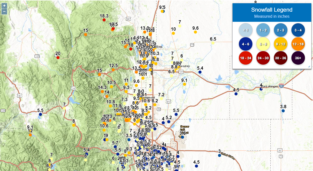
How’d we do? Our map for forecast snow totals vs official measurements is shown below. Not bad!

MountainWave Weather official snowfall forecast versus official verified snow totals – Palmer Divide Region/ Eastern Colorado
Overall the snowfall forecast for the Palmer Divide and Eastern Colorado verified pretty well. The timing was pretty sound (snow predicted to start morning on Sunday – it did) and the impacts (bitterly cold temperatures with icy/snow packed roads) verified as well.
How to Properly Measure Snowfall
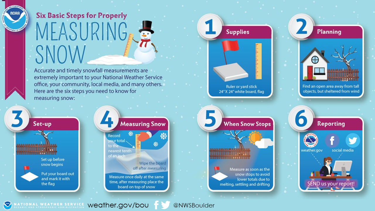
The graphic above shows the official NWS approved way to measure snowfall. I understand that not everyone has a board set up with an official measuring station though so there are a few other ways to get a more accurate measurement. If no board is available or if you have a lot of drifting it is advisable to pick 3-5 different spots, measure and then take the average of all of those measurements. For example, I took 3 measurements this morning and got an average of 5.3 inches of snow; that’s the number I sent in as an official measurement.
I also will usually look at reports around my area to make sure mine don’t seem outlandishly high or low… in today’s case my number was very close to those surrounding my area.
Summary/Quick Facts
Overall I was very happy how this forecast turned out. Despite the difficult with the jet-induced snow band sitting over Northern Colorado the forecast for snowfall, timing and impacts was pretty sound across much of the front range.
-
Monday October 19, 2020
- First alert of arctic cold air, recommended winterizing sprinkler systems
- Nearly 6 days of lead time!
-
Wednesday October 21, 2020
- First mention of accumulating snow likely with the weekend storm – reiterated winterizing sprinkler systems, advised of potential difficult travel conditions on late Saturday, Sunday and early Monday time-frame
- Nearly 4 days of lead time!
-
Saturday October 24, 2020
-
Official snowfall forecasts issued – weather warnings and impacts communicated
-
All but 2 locations along the Palmer Divide and Eastern Colorado fell within forecast snowfall ranges
-
Snow, travel impacts and cold preparedness all verified with this forecast. A good day for sure, I don’t get them all right but I do have a pretty good track record!
Happy Monday, stay warm out there!
