Before I even get started on the Weather Outlook this morning I wanted to share something that doesn’t happen too often in terms of weather in and around Colorado:
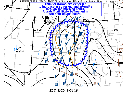 A mesoscale discussion is something the Storm Prediction Center uses to highlight areas of possible severe weather. One has been issued this morning for Western Colorado and Eastern Utah – basically saying that there is a very good chance (80%) that this area will see a severe thunderstorm watch shortly. Severe weather watches are very rare for any part of Colorado in the morning, but one issued in Western Colorado is just as rare!
This is all courtesy of a powerful storm system lining up to our West and while most of that low pressure trough will miss Colorado to the North, we will see some effects as it moves by.
Let’s get back on track!
Saturday/Sunday Weather Alerts
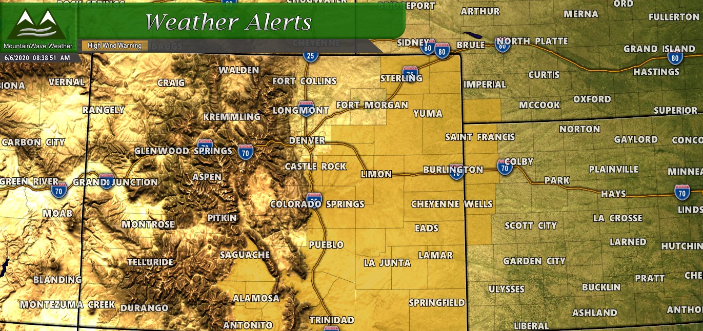
- A High Wind Warning is in effect on Saturday
- Timing: 12PM to 9PM
- Severity: SEVERE
- Impacts: Strong winds could result in property damage. Power outages will be possible and drivers of lightweight or high profile vehicles could experience difficult driving conditions due to strong crosswinds
More details on this warning are available on our alerts page: https://mountainwaveweather.com/castle-rock-weather/watches-warnings/
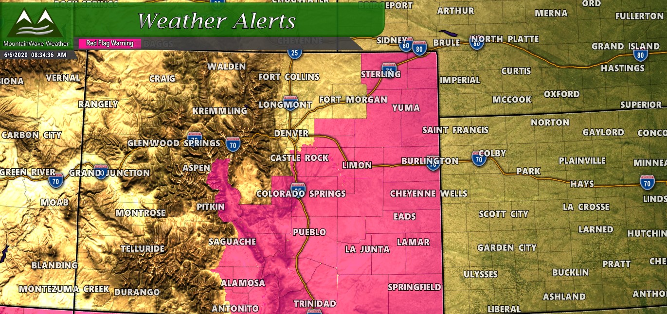
- A Red Flag Warning is in effect on Saturday and Sunday
- Timing: 11AM Saturday to 9PM Sunday
- Severity: SEVERE
- Impacts: Very low humidity coupled with warm temperatures and strong winds means fire conditions will be extreme to critical. Any fires that start will likely grow out of control quickly – call 911 if you see smoke.
If the above alerts didn’t give it away – the main theme of this weekend is going to be wind. Wind strong enough that it will approach or exceed severe levels, meaning property damage, trucks blowing over and power outages are some of the impacts you’ll likely see.
If that’s not enough fun for you; the SPC has a severe weather outlook slight risk level for most of Colorado today!
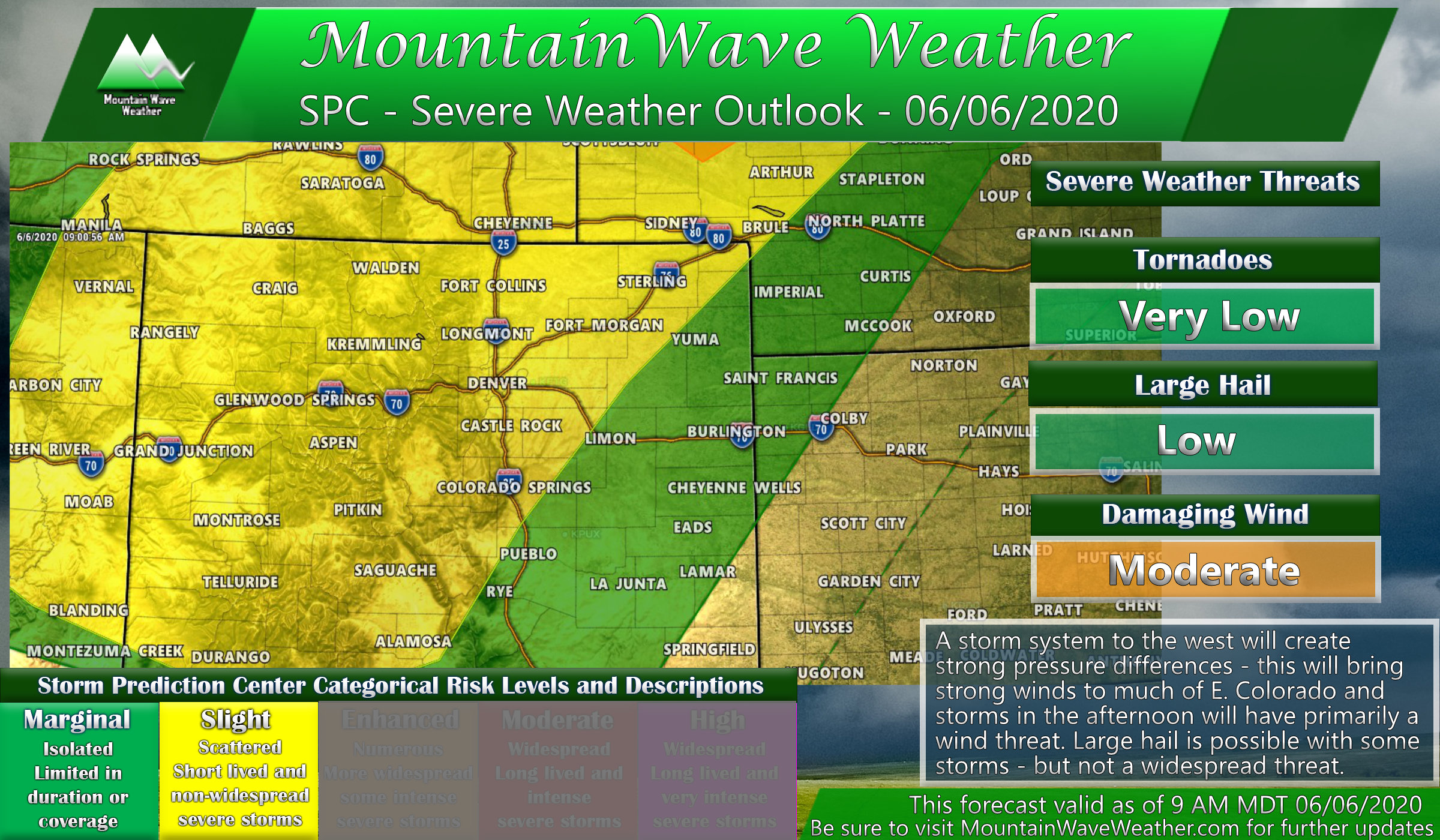
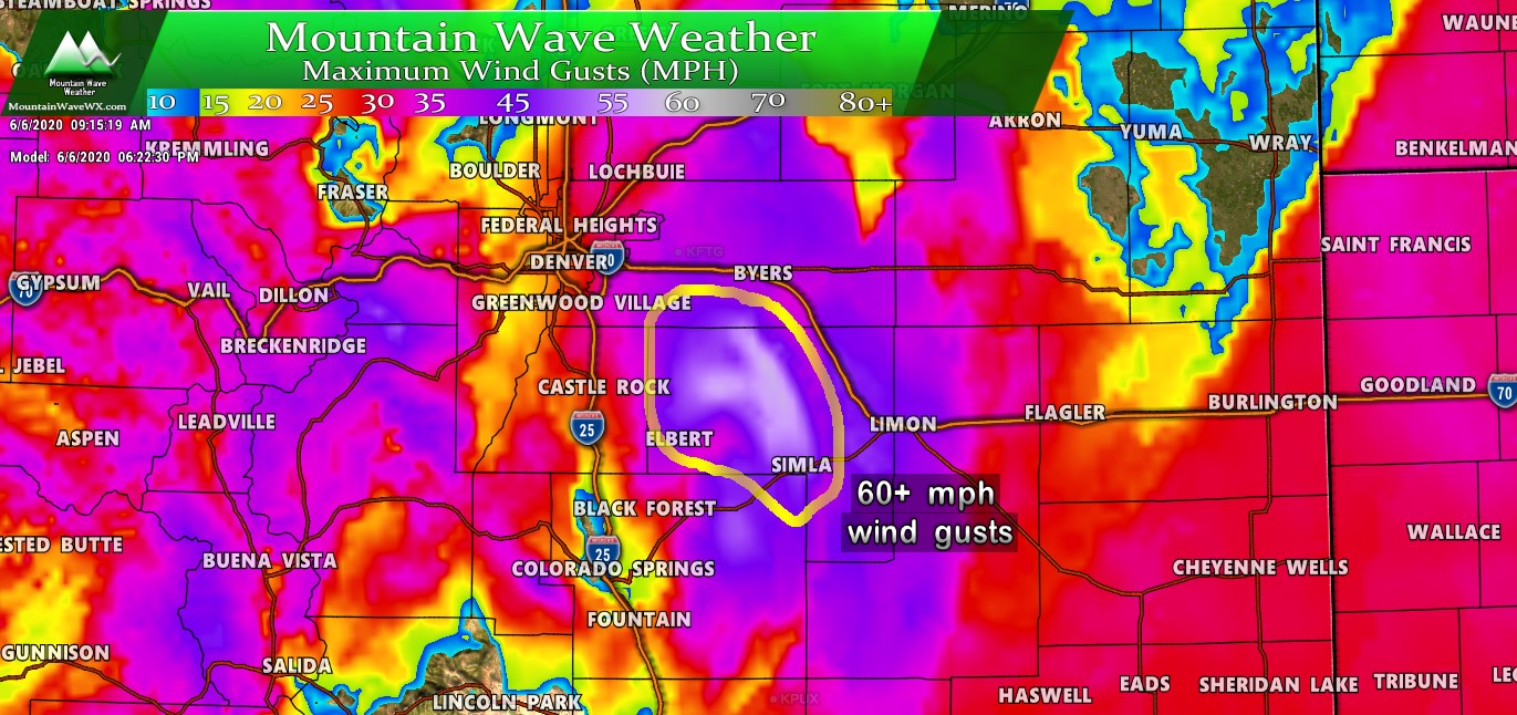
Primary threat as with the storms yesterday will be strong winds. Since lower levels of the atmosphere are dry, thunderstorms will be high based and cause strong winds and microbursts as they collapse. Interestingly, there is also a small threat for large hail out of a few storms – we don’t anticipate a ton of areas will see hail though.
Summary
In a nutshell here’s what today will look like
- Saturday morning
- breezy
- some clouds/rain showers especially over the foothills and mountains
- Saturday afternoon
- Thunderstorms possible
- Strong/damaging winds will become more likely after 12PM
- Saturday evening
- Strong winds likely through 9PM before relaxing into the overnight hours
On Sunday we will see winds pick up again along with warmer temperatures.
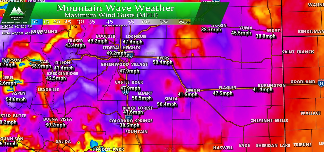
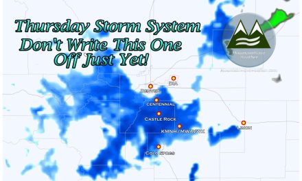
Wind gusts at around 3PM (Nam3k Model)
So for today, buckle up and make sure to secure anything that could come lose and fly around!
