An interesting weather pattern we are beginning to transition into this weekend… it will seem more like summer than spring with the setup. We will begin to see temperatures crank up and while chances for storms will still be with us… they will be hit and miss at best.
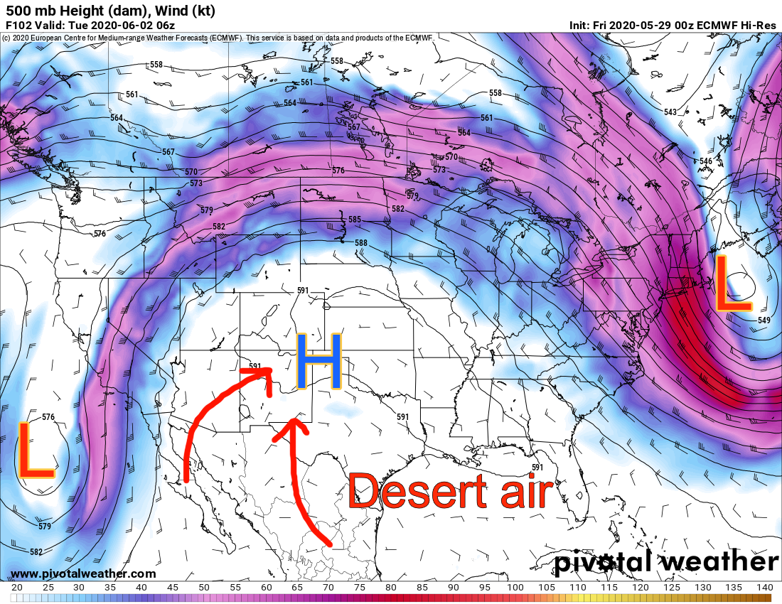
Euro 500mb heights/winds
A low pressure system sets up to the Southwest while another low pressure system lingers over the East coast. This will allow a ridge of high pressure to build across the central United States. It will draw hot, dry air from the deserts up across the mid-section of the country – many areas will see their hottest temperatures of the year (so far… it’s early yet!)
If this pattern looks familiar to you… it should! This is a textbook “omega block” pattern and we’ve seen it a couple of times already this year (mainly in the snowy season.) This is often called a persistent pattern because it may linger in the same area for several days or even a week or two. It means that if you’re stuck under the low pressures you often see stormy conditions for an extended period of time while those under the high pressure can often see warmer and quieter weather for an extended period of time.
Return of the Omega Block!
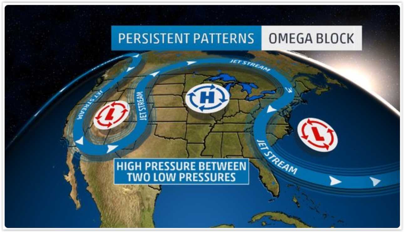
A typical “Omega Block: weather setup across the U.S.
Here’s a quick explainer from Meteorologist Cory Reppenhagen from 9News and what it means for our weather around here
As the video above said, we will still see pop-up thunderstorms in the afternoon due to heating and instability, but a large scale or organized severe weather event is highly unlikely during this type of pattern. We just don’t have the wind shear and moisture to sustain large severe thunderstorms.
The other thing you’ll notice this weekend is the heat!
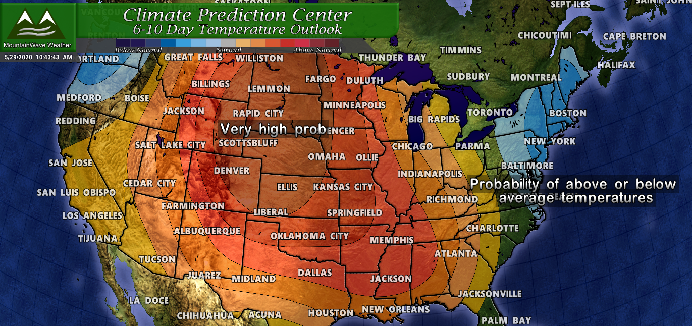
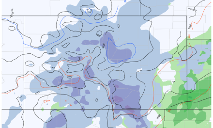
Climate Prediction Center 6-10 day temperature outlook
The climate prediction center product above shows the probability of higher or lower than average temperatures. You can see the area directly under that high pressure ridge will have a very high chance of well above normal temperatures over the next 6-10 days! The darker red over Colorado, Kansas, Nebraska, Wyoming and the Dakotas is a 80% probability of above average temperatures… those are pretty good odds so plan on a bit of a scorcher this weekend across Colorado.
How Hot?
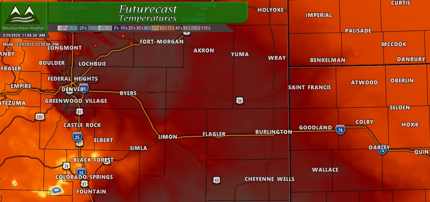
Expected high temps on Friday
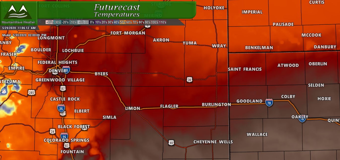
Expected high temps Saturday
I’ve attached the Nam3K temperature forecast above for Friday and Saturday. Let’s face it, upper 80’s and low 90’s isn’t the hottest temperatures we will see all year. I’d hesitate to even call them “scorching,” but the main thing to remember here is we are still in May. Anything hitting the 90’s in May is way above average for us in terms of temperatures. Here’s a bit of a closer breakdown for the next few days:
Friday (very warm!)
- Denver/Suburbs : temperatures will reach to near 90
- Palmer Divide below 6,500 feet: Lower to mid 80’s
- Palmer Divide above 6,500 feet: Upper 70’s
Saturday (slightly cooler)
- Denver/Suburbs : temperatures will mid to upper 80’s
- Palmer Divide below 6,500 feet: Lower 80’s
- Palmer Divide above 6,500 feet: Upper 70’s
Sunday (crank up the thermostat!)
- Denver/Suburbs : low 90’s
- Palmer Divide below 6,500 feet: upper 80’s
- Palmer Divide above 6,500 feet: low to mid 80’s
Monday (crank up the thermostat!)
- Denver/Suburbs : low 90’s, some areas could see mid 90’s!
- Palmer Divide below 6,500 feet: upper 80’s some spotty low 90’s
- Palmer Divide above 6,500 feet: mid 80’s, spotty areas reach upper 80’s
Definitely a warm period ahead for us, keep that in mind if you’re outdoors this weekend. Sunscreen is highly recommended!
Pulse Thunderstorms?
Yes, you will have to keep an eye out for pop-up thunderstorms each afternoon. This is something we typically see in later summer, but basically there will be enough heating and instability for storms to form. Due to their elevated nature and lack of moisture, most storms will present a wind/small hail threat but it is very difficult for severe storms to form in this environment.
If you’re outdoors in the afternoon, keep an eye to the sky and be prepared to move inside as soon as you hear thunder!
One More Thing…
As is often the case with these type of weather patterns we can see inversions and stagnant air which allows pollution and particulates to congregate in the lower levels of the atmosphere. Due to that, NWS has an air quality alert for Friday for high ozone and pollution concentrations across the front range. You may notice this if you have breathing problems or are sensitive to that type of thing.

That’s it for today, as always I’ll be keeping an eye on things but otherwise have a great weekend!
