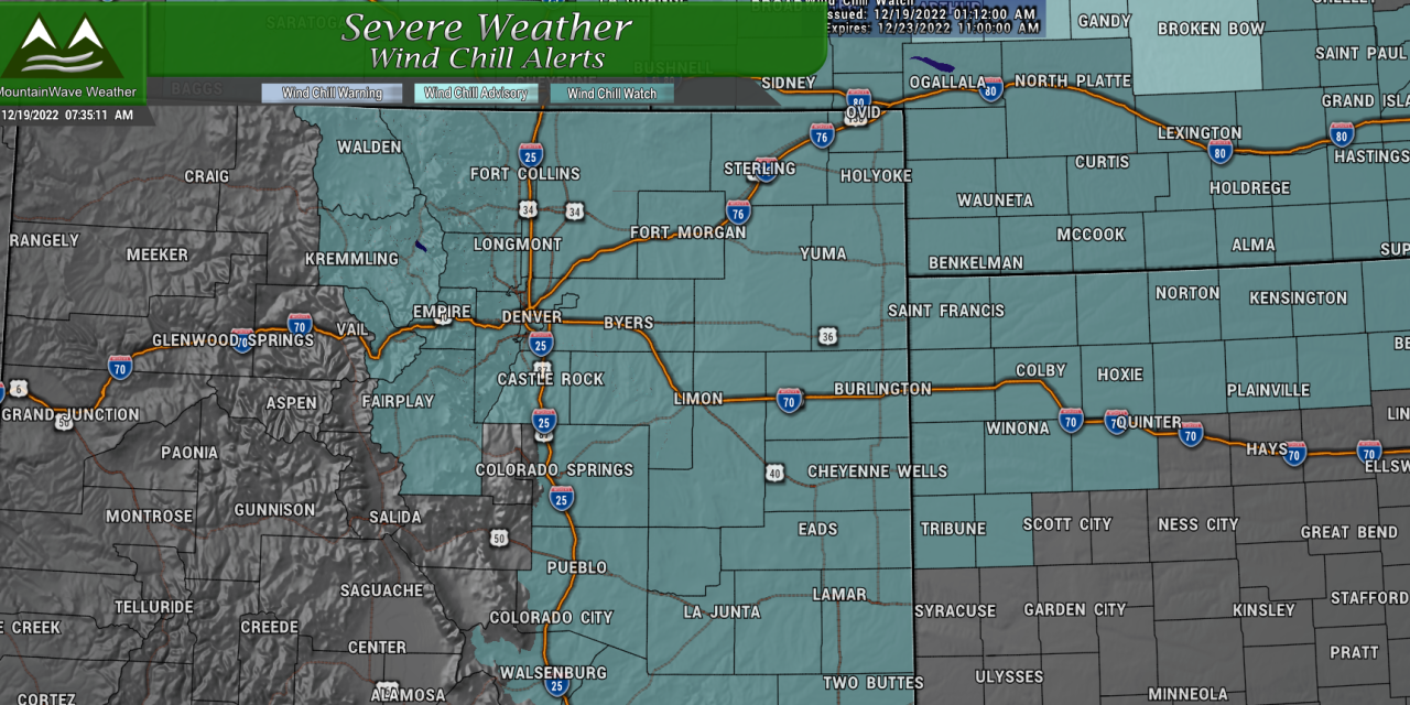
Severe/Cold Weather Alerts
The entirety of Eastern Colorado and the Northern and Central Colorado mountains are under a Wind Chill Watch, details below:
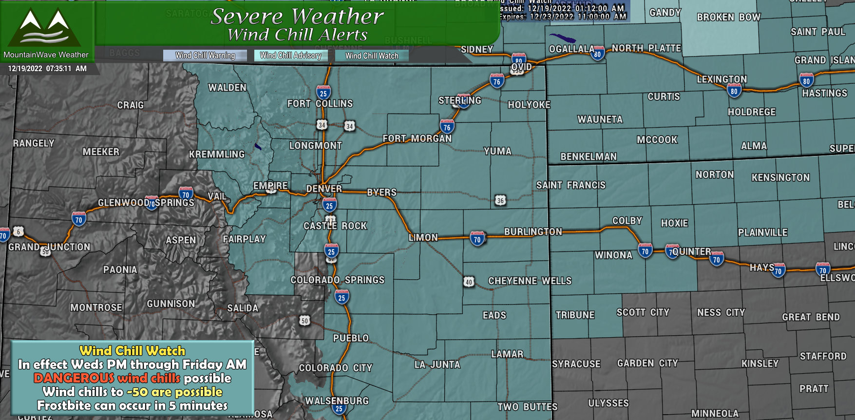
…WIND CHILL WATCH IN EFFECT FROM WEDNESDAY EVENING THROUGH FRIDAY MORNING…
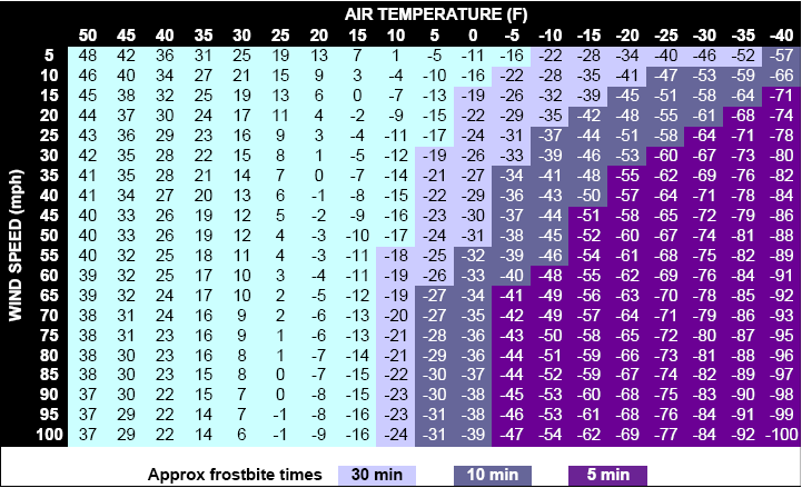
* WHAT…Dangerously cold wind chills possible. Wind chills as low as 50 below zero.
* WHERE…Portions of central, east central, north central, and northeast Colorado.
* WHEN…From Wednesday evening through Friday morning.
* IMPACTS…The dangerously cold wind chills could cause frostbite on exposed skin in as little as 5 minutes.
PRECAUTIONARY/PREPAREDNESS ACTIONS… The combination of wind and cold temperatures will create dangerously low wind chill values. Avoid outside activities if possible. When outside, make sure you wear appropriate clothing, a hat, and gloves.
More details about this Watch are updated live on our website: https://mountainwaveweather.com/castle-rock-weather/watches-warnings/
Arctic Cold Front Crashes Through Colorado on Wednesday Night
Latest model guidance has the cold front moving through late Wednesday night… these fronts often tend to come through earlier than predicted and models don’t handle that well. Models show the front moving through sometime between 10PM Wednesday night and 3AM Thursday morning… I would wager that it comes through earlier Wednesday… sometime between 6PM to 12AM.
The air temperatures are going to be very cold indeed, but my model snapshots below are all apparent temperatures (temperature with wind chill or “feels like” temperature) as that is the truly dangerous part of this storm.
This model shows the front moving through around 9PM Wednesday night, notice the extremely cold air working down from the North. Snow will follow shortly after the front’s arrival.
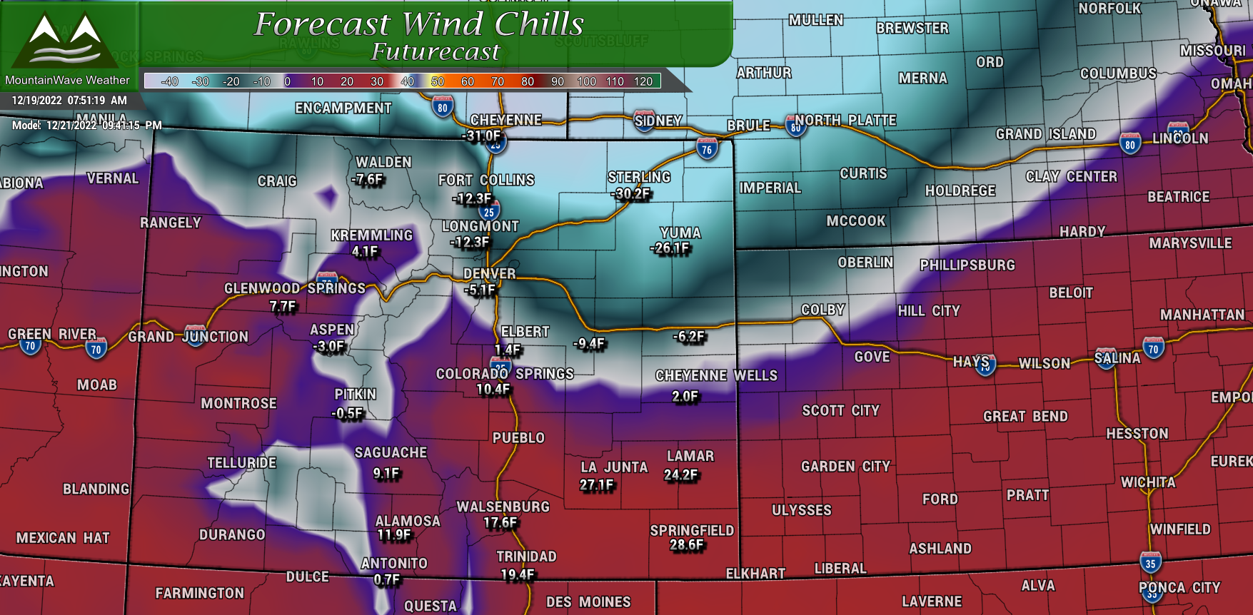
Wednesday 9PM Apparent Temperatures – cold front moving through
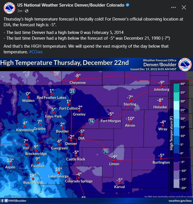
Thursday will be extremely cold with many areas not reaching 0 degrees for the high during that day. Most areas will see high temperatures max out in the -10 to 0 degree range in Eastern Colorado.
Thursday night is where things get downright dangerous! Wind chills could be as low as -50 across the plains and parts of the Central and Eastern Palmer Divide. Slightly warmer (if you want to call it that) towards the I-25 corridor, wind chills will be in the -25 to -35 range. Extremely cold and dangerous temperatures no matter how you slice it!
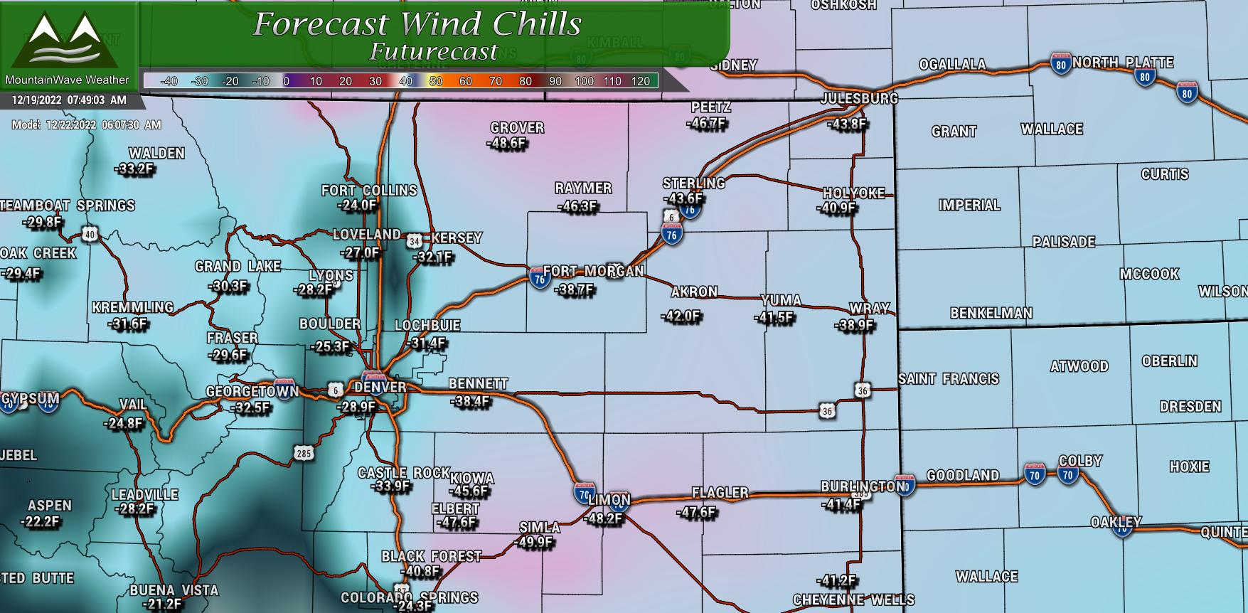
Thursday Morning Apparent Temperatures – Dangerous wind chills
Preparedness Actions
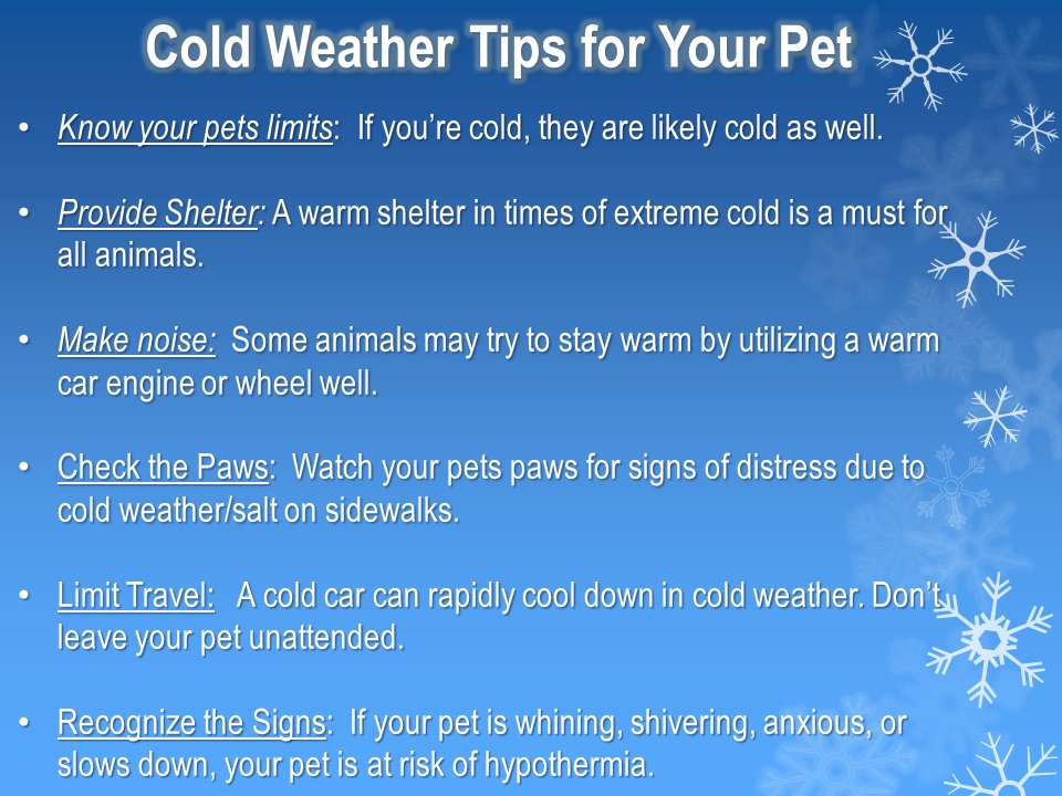
For Pets:
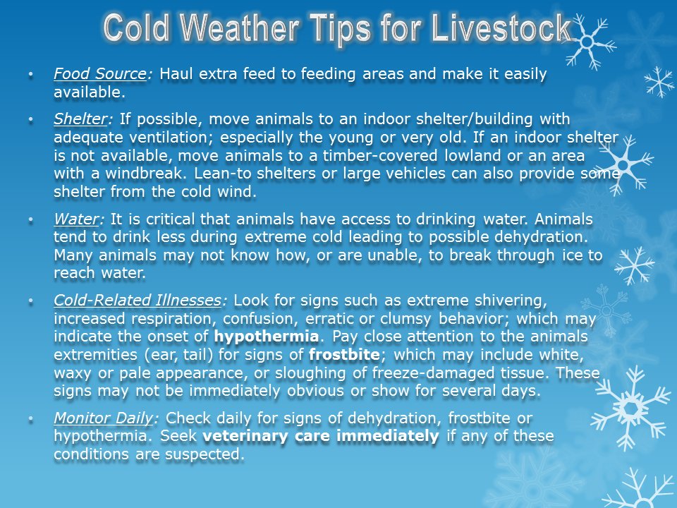
For Livestock:
Snowfall Forecast
While the snow won’t be the major story with this storm – there will be at least a little bit of snow on the ground Thursday morning making for headaches. Here’s a quick snapshot of that information:
Palmer Divide/ Urban Corridor
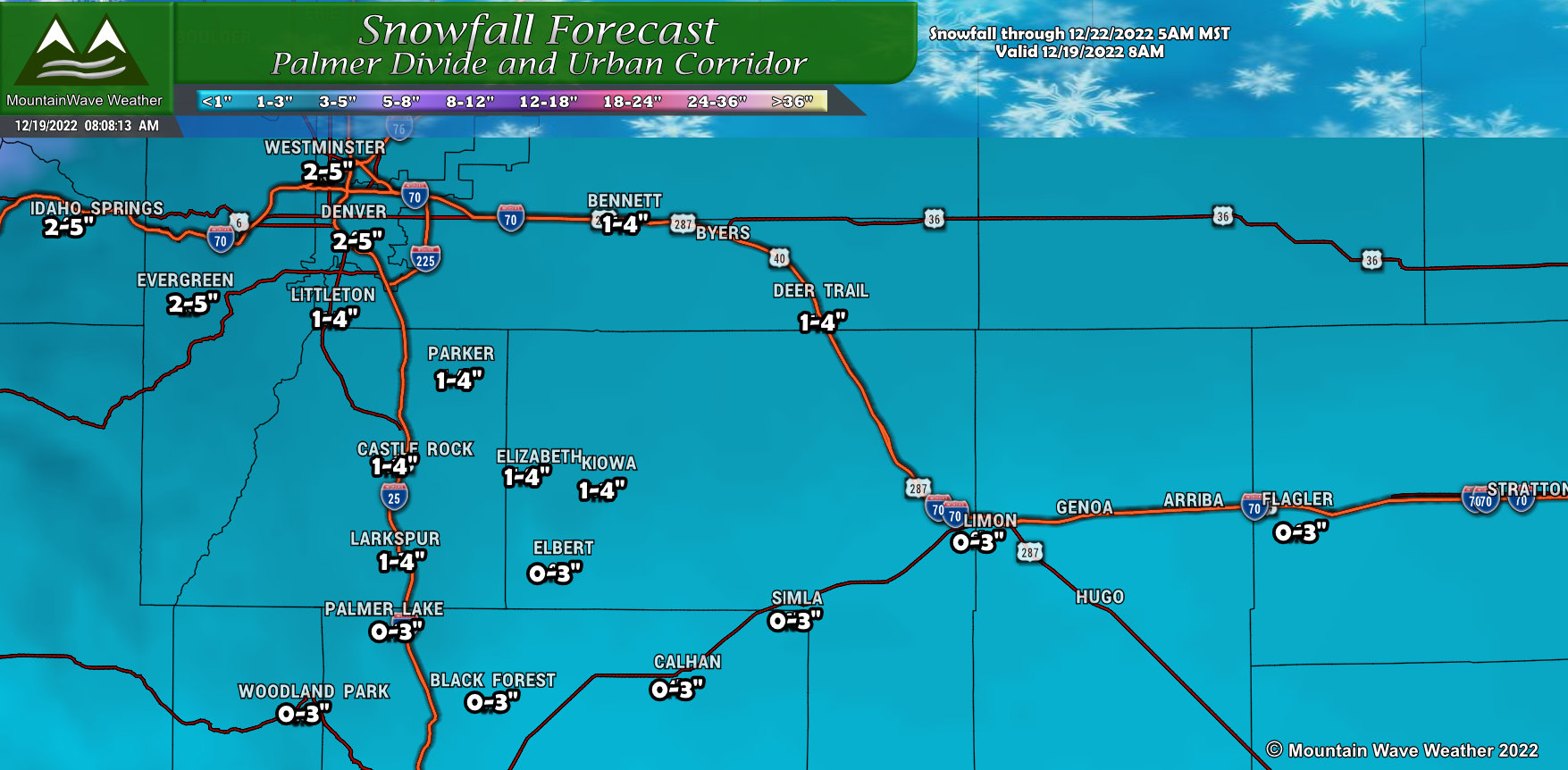 Not a ton of snow along the Palmer Divide and urban corridor, the wide spread is more due to the fact that models are not handling the extreme cold temperatures very well. What we do know is when the atmosphere is this cold, it doesn’t hold a lot of moisture so I’ve kept lower ranges for that, but included the higher ranges in case the models are picking up on something I am not. Looks like a couple at most, it is cold enough that this will all stick pretty quickly and may make for road/travel impacts
Northern Colorado
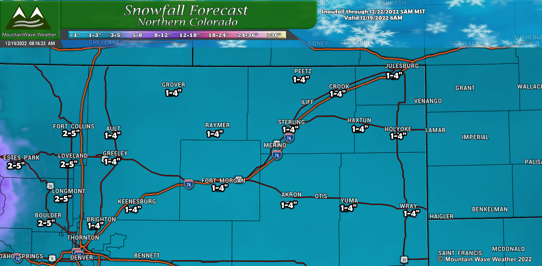 Northern Colorado will see similarly low snowfall amounts. Again the wide range is due to the coldness of the atmosphere and uncertainty amongst the models. Some models do want to bring higher snowfall accumulations to some of these areas – will keep an eye on it and see if adjustments are needed.
Northern/Central Mountains/ NW Colorado
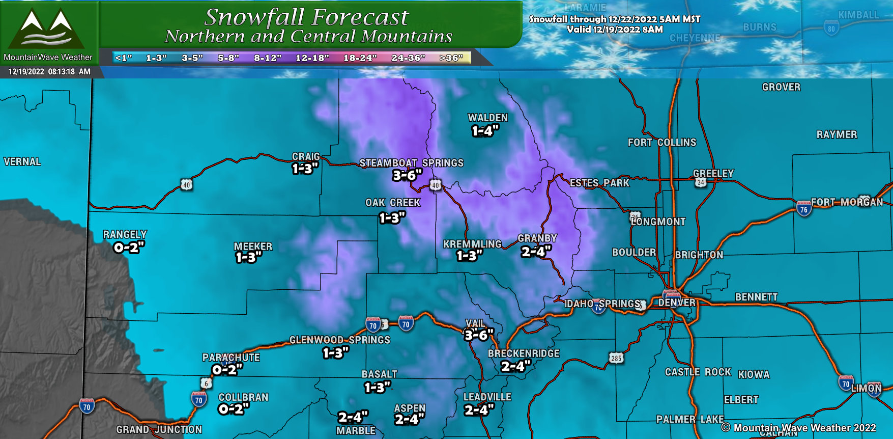 Not a big snowmaker for the mountains, but a few favored peaks/mountain ranges should see a few inches of snow out of this one.
Southern/Southwestern Colorado
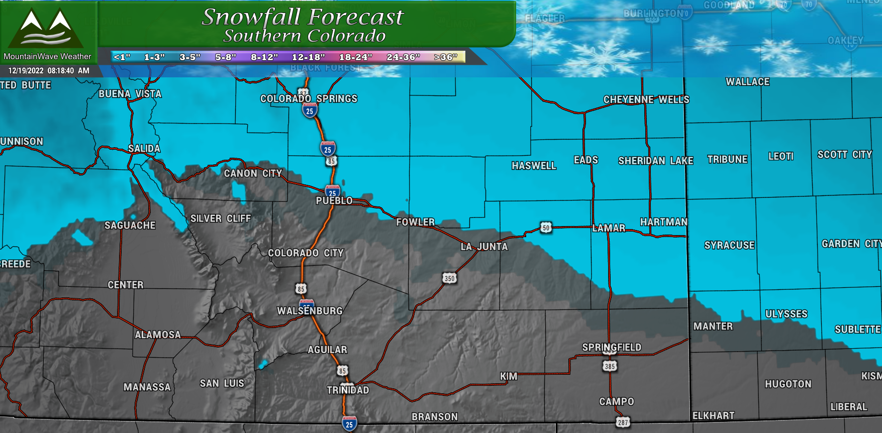
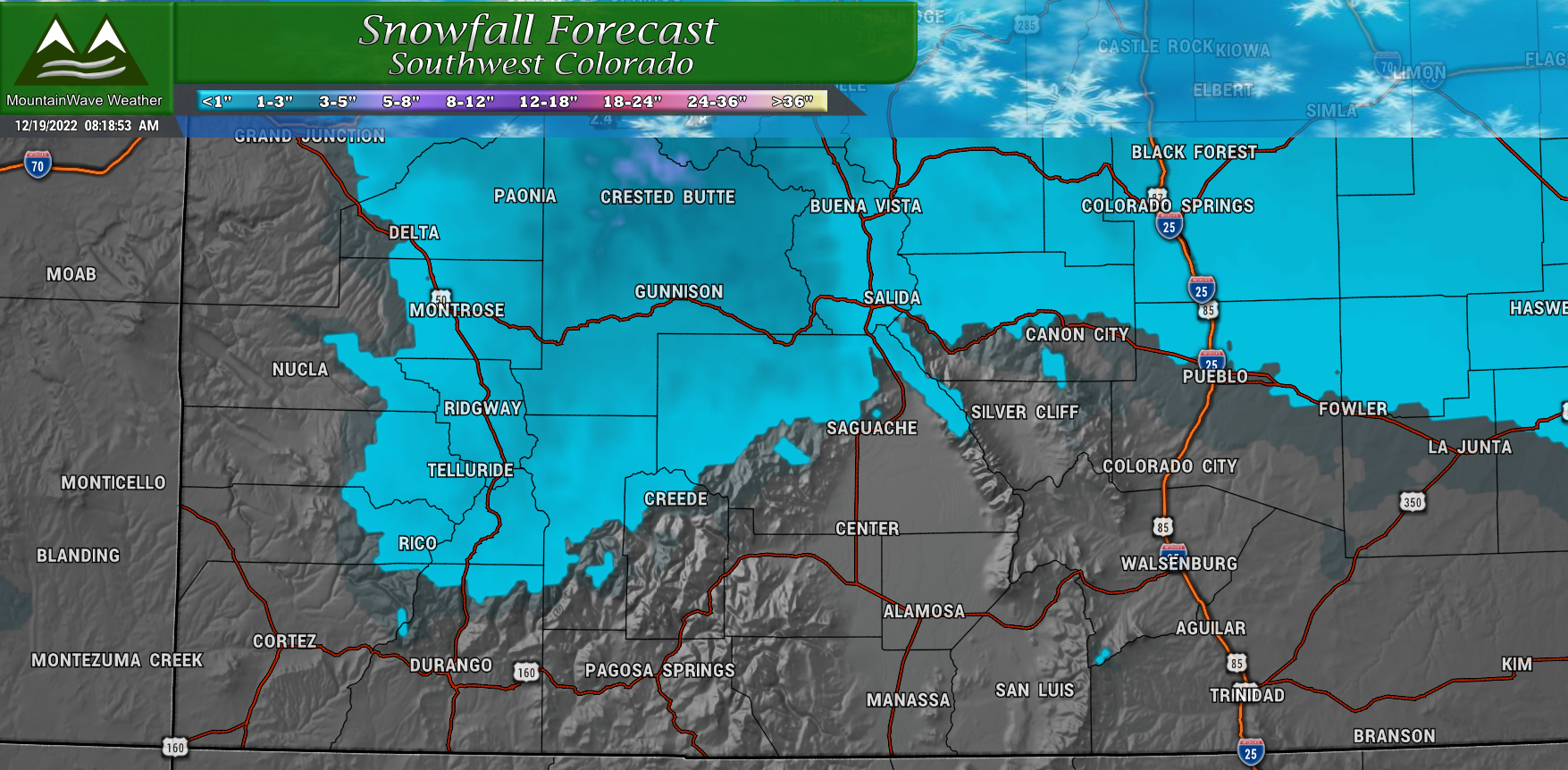 Southern Colorado will see little to no snowfall out of this storm, the main impact again will be out East with the extreme cold. The Southwestern corner of the state may be the one part of Colorado that escapes the extreme cold.
Summary
Be prepared for this storm, with the wind chills as they are late Wednesday night and Thursday night, frostbite is possible in as little as 5-10 minutes. I would postpone any outdoor activities you have planned, especially if you have small children or older folks tagging along.
It has been a couple of decades since we have seen temperatures this cold, take it seriously! I’ll pass along several updates with forecast changes and tips you can use to prepare for a storm like this. Stay tuned!
