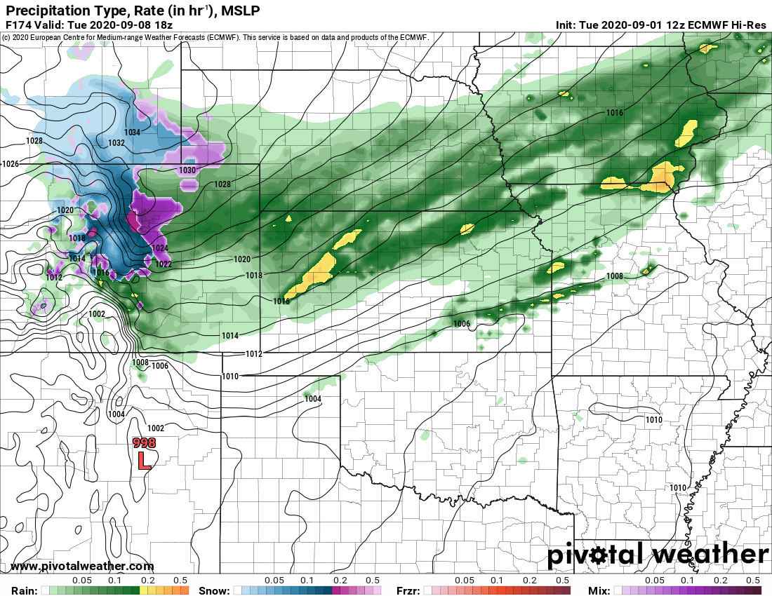
Here’s a quick recap with snowfall totals and the forecast discussion from last night’s storm…
Snowfall Forecast
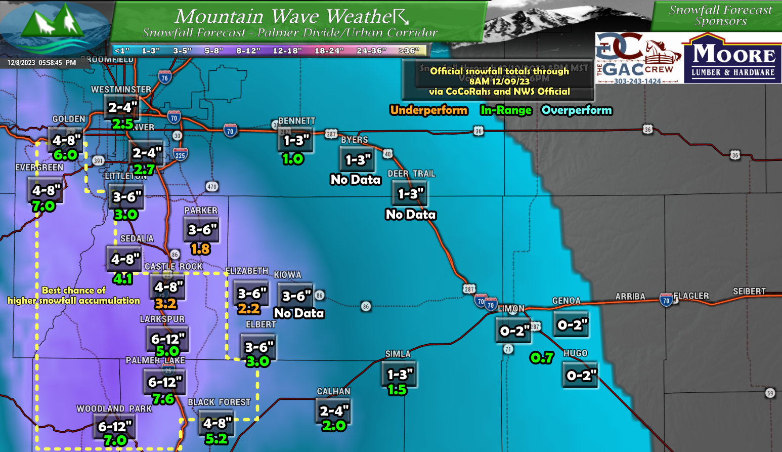
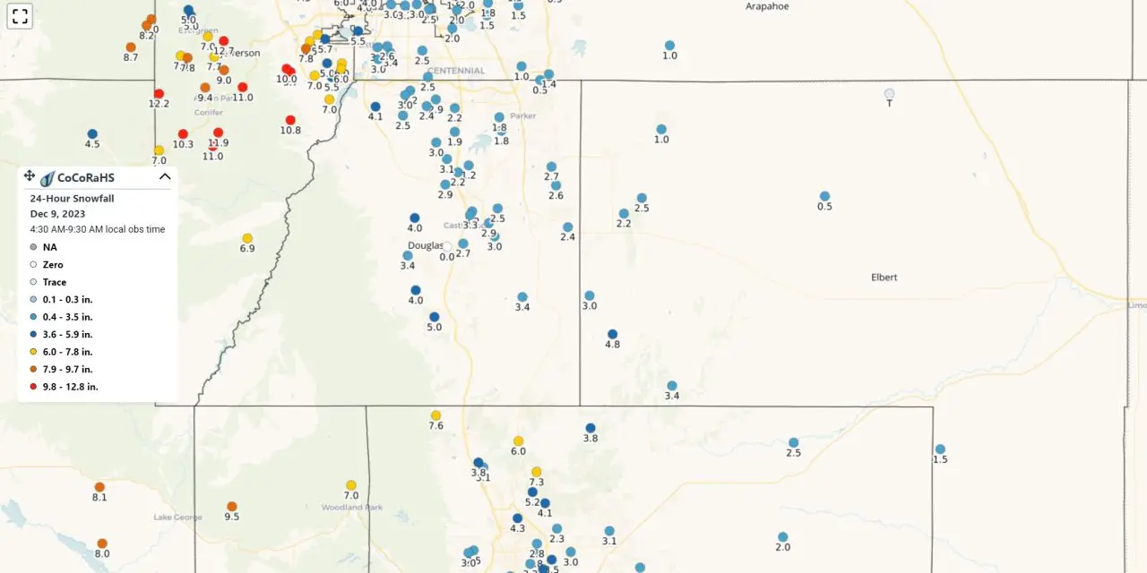
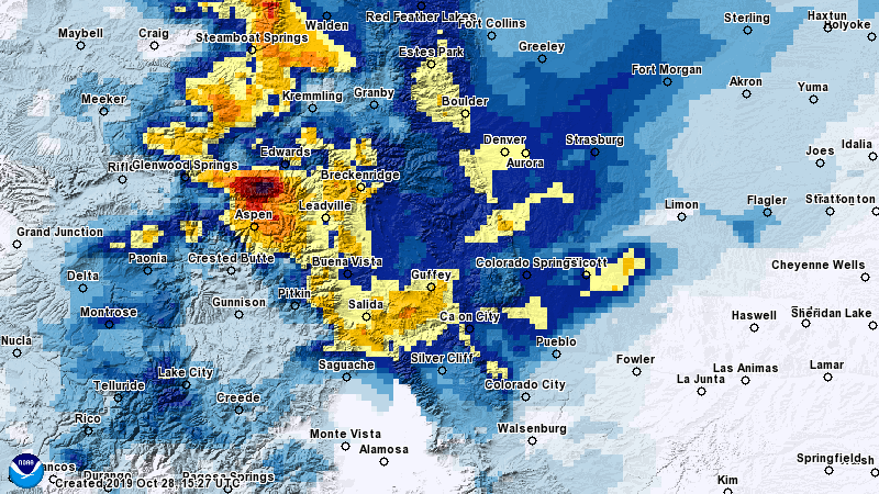
Here’s the official measurements from CoCoRahs and the NWS compared to my snowfall forecast. For the most part, snowfall estimates ended up in our forecast ranges. Some notable underperformers were Castle Rock, Elizabeth, Parker and potentially Kiowa (no measurements usually come out of Kiowa but that’s my guess.)
Given how squirrely the models were with this storm, I’m fairly happy with this part of the forecast. But snowfall isn’t everything, in fact I think snowfall total as part of the forecast often get viewed as the most important, but in actuality its the impacts the storm will bring.
How did that go?
Timing/Impacts
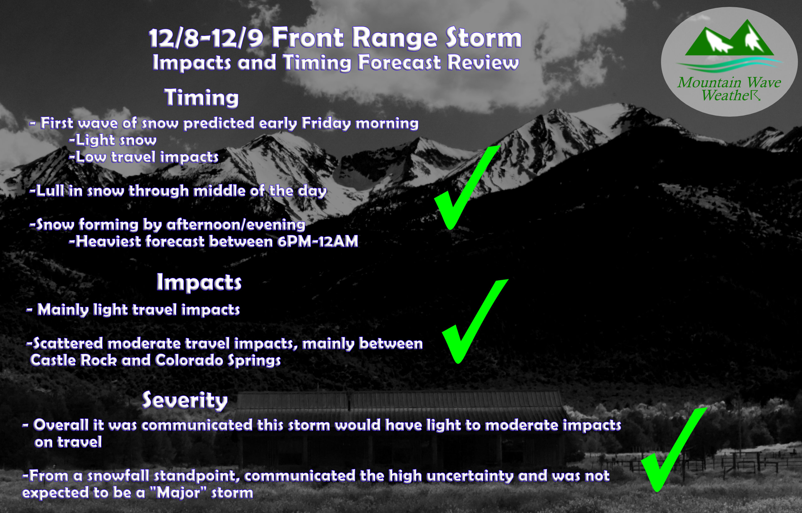
In terms of timing, impacts and storm severity – the forecast verified on all points.
We had a first shot of snow Friday morning, this was short lived and caused very little travel problems.
We had the lull throughout the day.
We had the heavier snow pick up in the later afternoon hours with heavier snow between 6PM and midnight as predicted.
Light to scattered moderate travel impacts were found across the area.
Overall – I’m happy with how the forecast turned out from all angles, despite very little help from the models and a tricky forecast setup in general.
Summary
Hopefully you all were well prepared for this one – not a major storm by any means but I think that you had a good idea it was coming and what it entailed!
