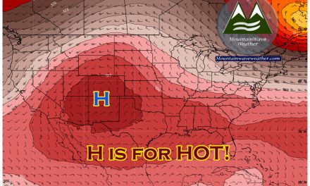
Another week full of weather on tap and in typical spring fashion, we’ll have dose of fire and a dose of ice sprinkled with continued windy conditions. Here’s a few weather headlines we’ll be watching for the week…
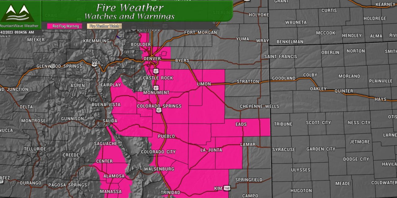
High Fire Danger/Wind Continues for Palmer Divide and Front Range
Red Flag Warning is in effect for Sunday 4/2/2023 for continued elevated and critical fire conditions
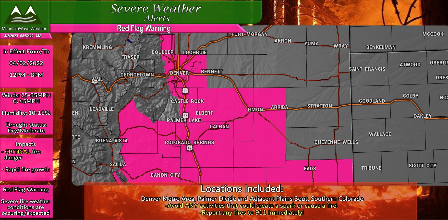
Due to the dry conditions and wind with warm temperatures, I expect high fire danger will linger through the middle of the week before we see a chance at a bit of moisture.
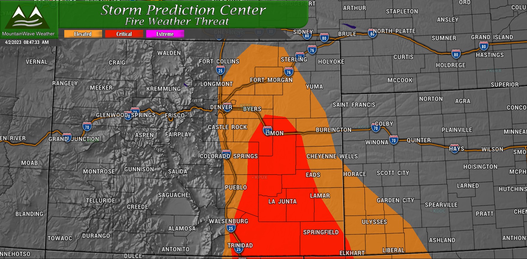
SPC Fire Weather Threat shows elevated and critical fire conditions for Southeastern Colorado and the Palmer Divide for Sunday 4/2/2023
Weather Change by Midweek?
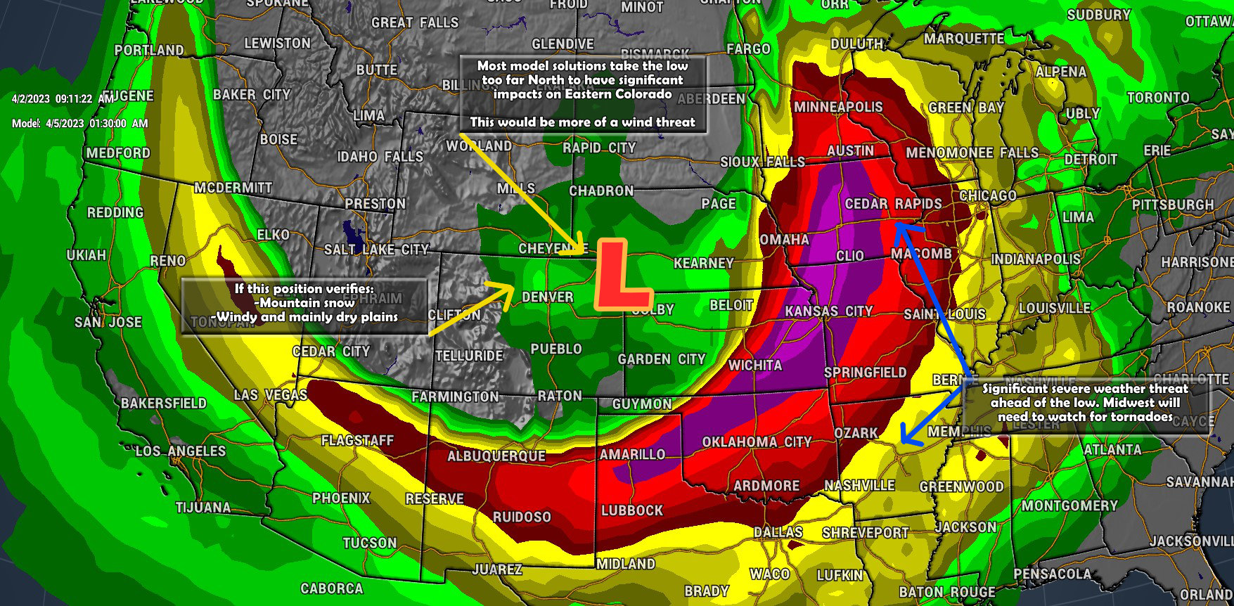
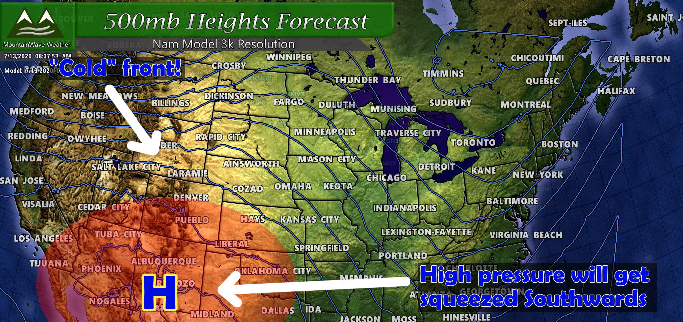
A very powerful storm system will swing through and rapidly intensify as it moves East of Colorado this week around Tuesday/Wednesday. Unfortunately, unless the track of this storm changes – it doesn’t look like a major moisture maker for Eastern Colorado. The mountains should see more snow however, so that is good news!
There is a small chance this thing organizes further West, or we see wrap around moisture, or the track shifts – so while odds are slim of seeing a significant storm out of this one – we can’t completely write it off just yet.
Here’s an initial snowfall forecast map from Sunday through Wednesday morning 5AM… take this with a HUGE GRAIN OF SALT as IT WILL CHANGE… but it gives you an idea of the snowfall amounts we would be looking at if this storm verified as-is by models today.
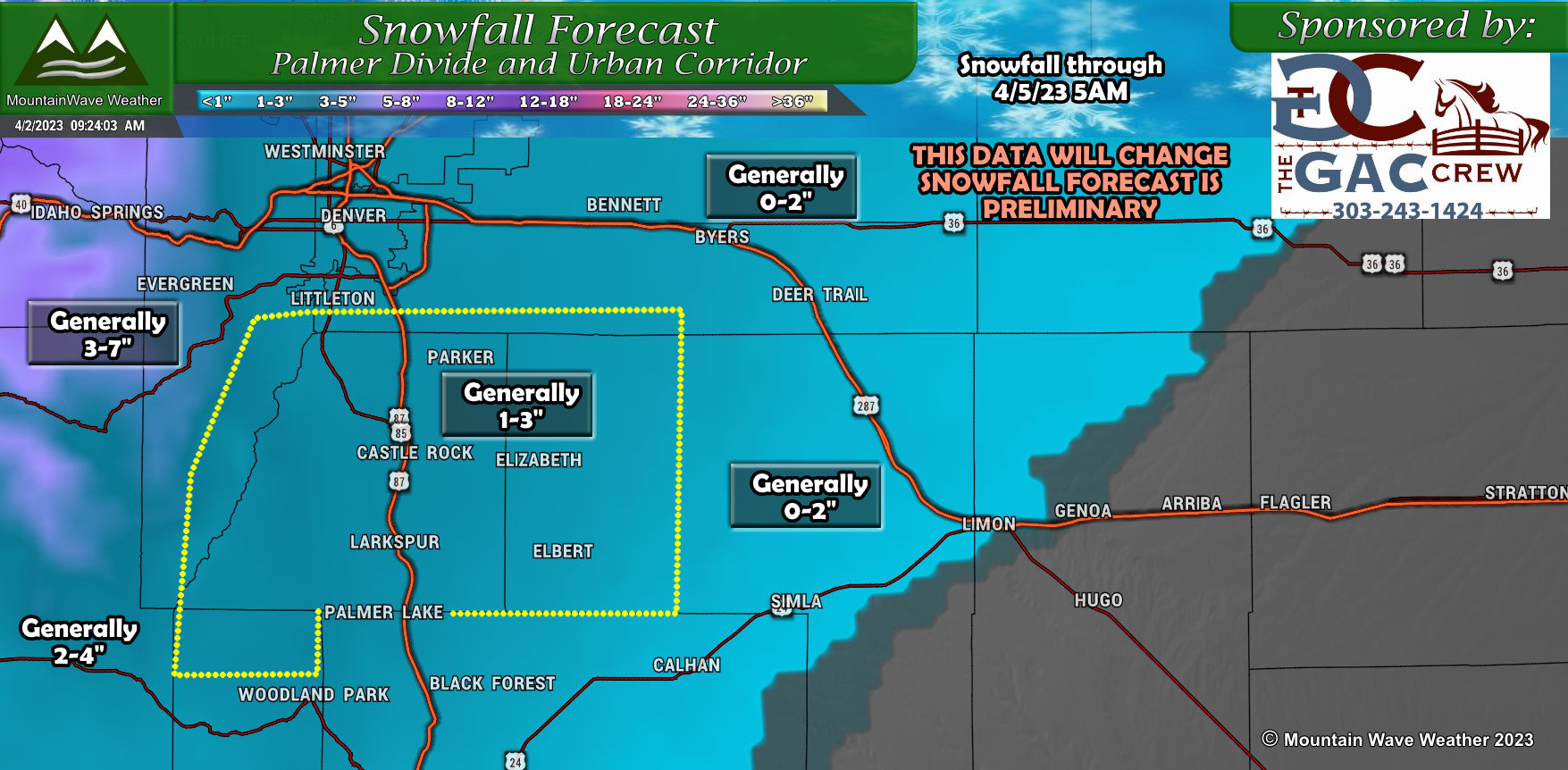
I wan to re-iterate, there’s still a lot of moving parts here so do expect things to change. Keep an eye out here and we’ll updated you as/if needed depending on the new data coming in.
More Severe Weather Outbreaks Expected
It’s severe weather season and the atmopshere is waking up. While we won’t see weather like this in Colorado for about another month or so, many other parts of the country are already dealing with damaging winds, large hail and even tornadoes. Here’s a quick look at the problem areas for this week:
Sunday 4/2/2023
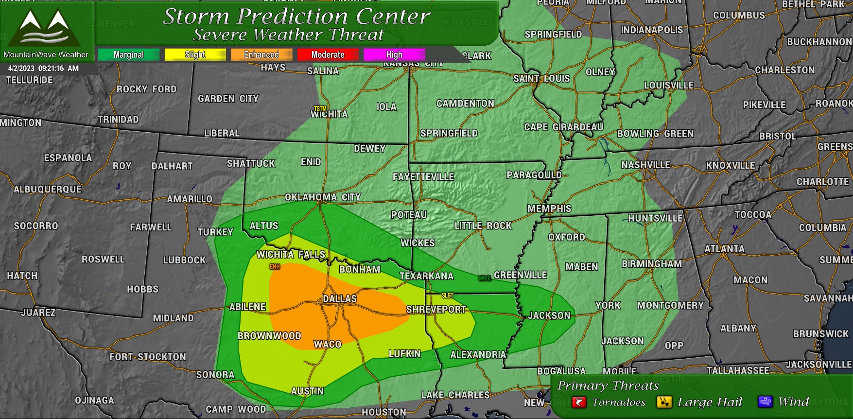
Texas looks under the gun for severe weather on Sunday 4/2. Primary threats are large hail and damaging wind, but a decent enough tornado threat exists as well. Be sure to keep an eye out for weather watches and have a a good/reliable way to receive weather warnings if you are in these areas.
Tuesday 4/4/2023
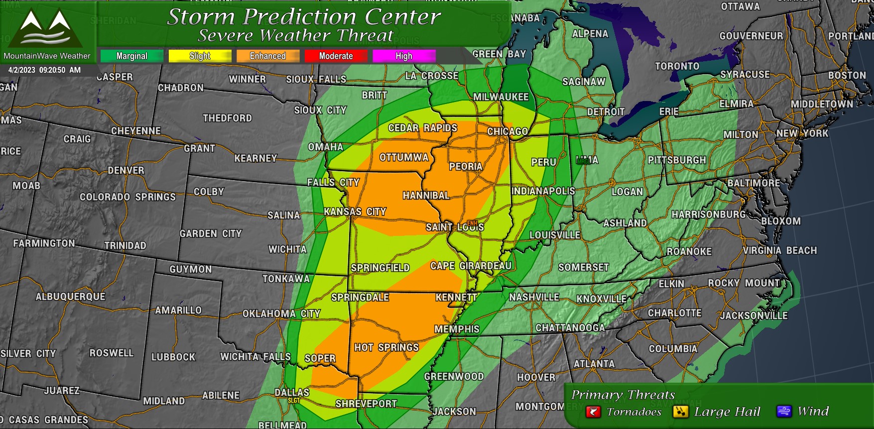
As our storm system swings East of Colorado and re-organizes, it will stir up pretty significant risks of severe weather in similar areas to saw it last week. Those traveling or living in Iowa, Missouri, Illinois, Arkansas and Texas should be on high alert for potentially dangerous weather through the day Tuesday and into Tuesday night.
Large hail and strong winds are threats, but there will likely be a significant threat of long-lived and violent tornadoes. Folks in these areas will need to stay weather-aware on Tuesday!
That’s it for today, I will have more details on the midweek storm if needed through the day Monday and Tuesday. Stay tuned for updates on that along with any other weather highlights you’ll need to be aware of this week.
Have a happy Sunday!

