Another one of those fall “fire and ice” kind of weeks… but we won’t see a whole lot of moisture out of any storm system we see this week sadly. Here’s the latest!
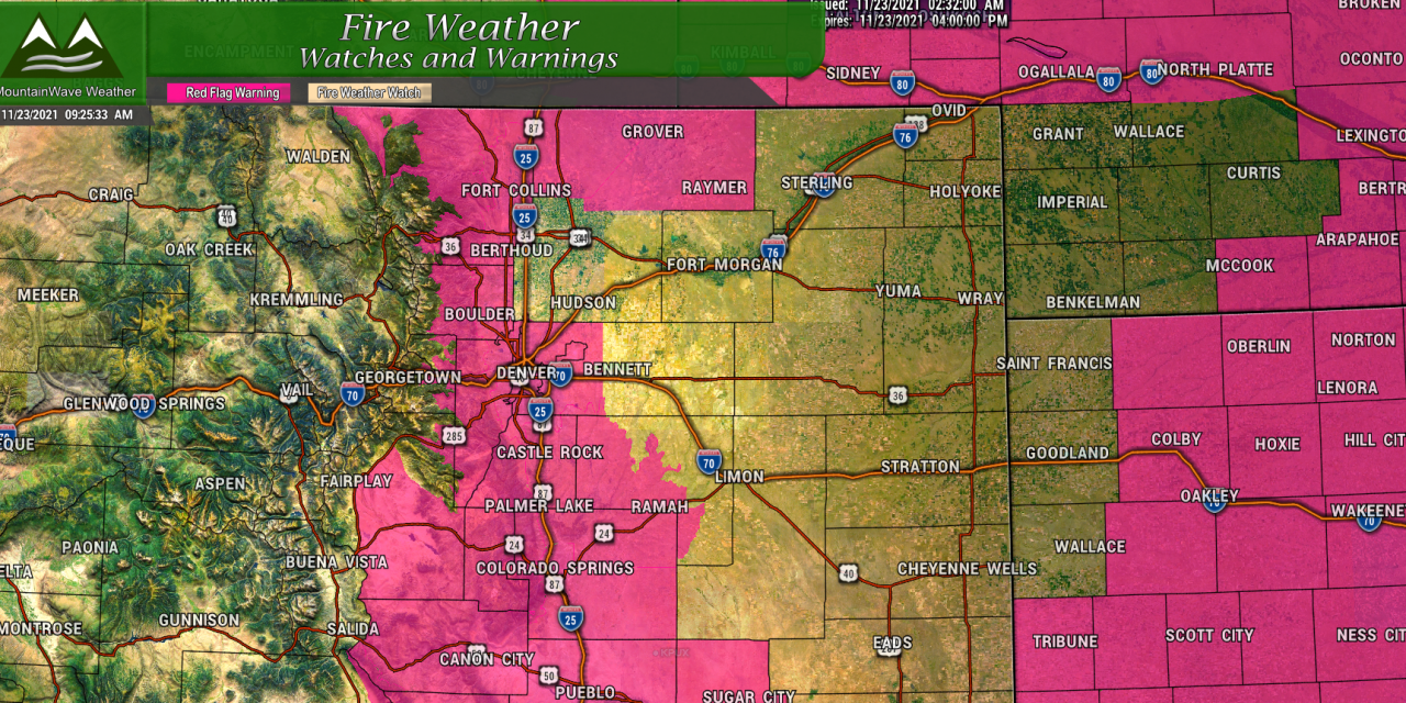
Current Colorado Weather Alerts (11/23/2021)
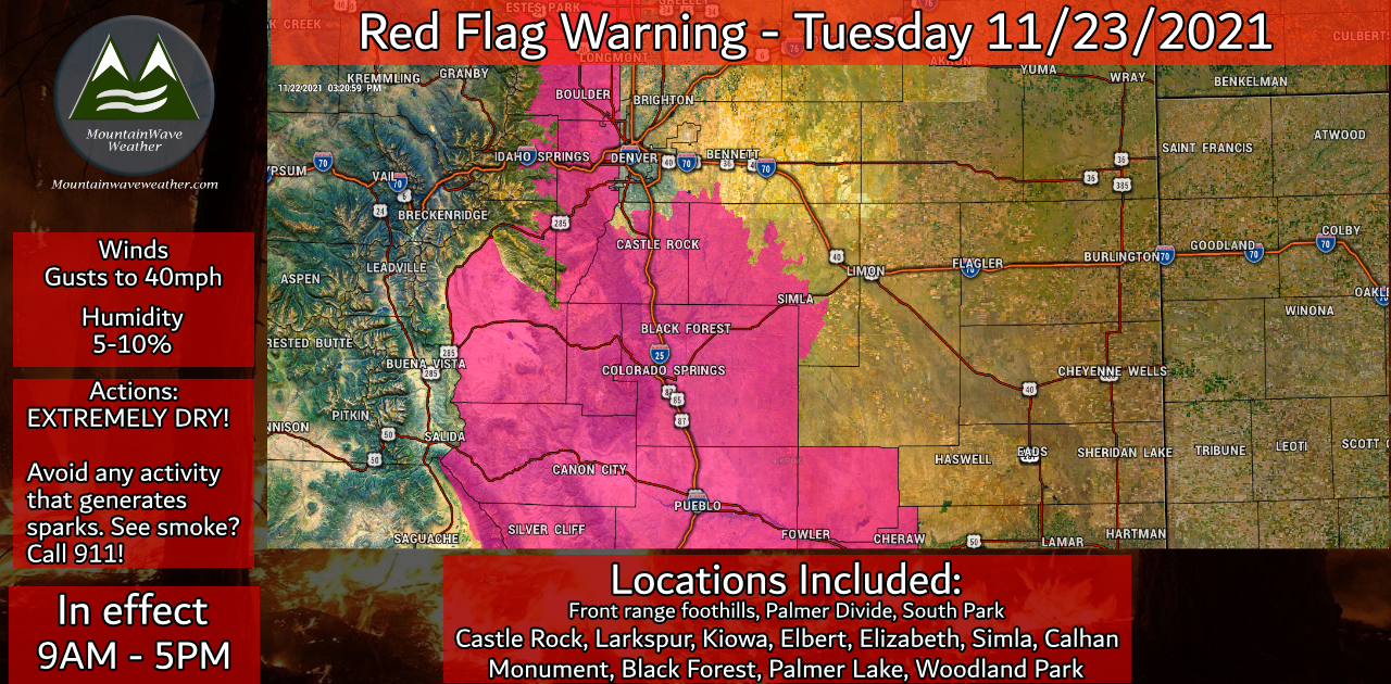
A Red Flag Warning is in effect for extreme fire danger on Tuesday. The combination of gusty winds, low humidity and bone dry conditions will make for critical fire weather conditions. Until we see a large scale change in our weather pattern, expect to see more fire weather warnings as conditions are very crispy and dry.
Snow Forecast – Next 48 Hours
As discussed in my video I posted earlier this week… I’m not too excited about our prospects of snow. Now, 24 hours before this storm system’s arrival, it is looking more and more likely that many areas won’t see any meaningful snowfall out of this storm. This shouldn’t be a surprise, our weather pattern has been and continues to be brutally dry and I see no change in that at the moment.
Here’s a look at our latest snowfall forecast for the Palmer Divide area through 5AM Thursday:
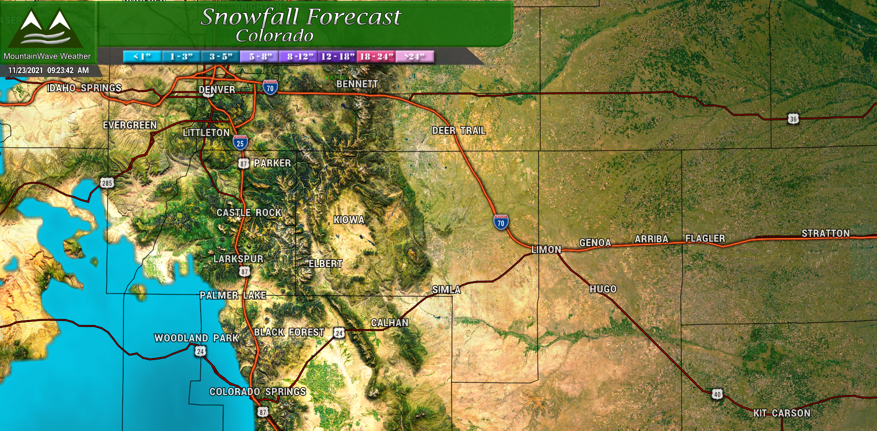
Palmer Divide Region – expected snowfall through 5AM Thursday
And a quick look at Southern Colorado through 5AM Thursday:
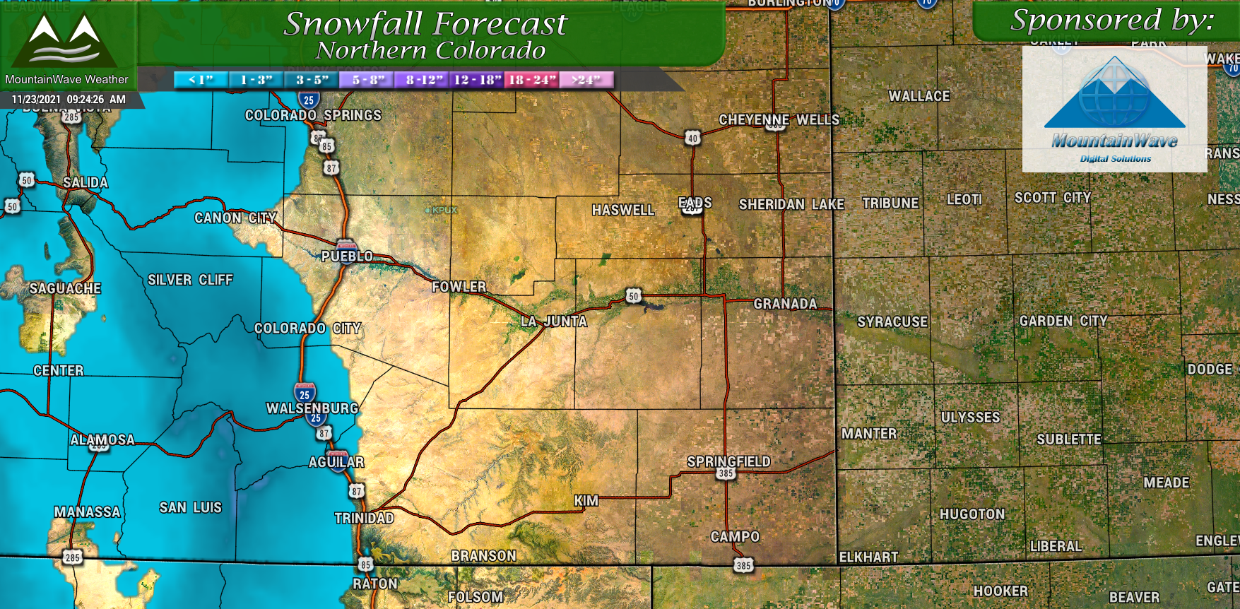
Southern Colorado – expected snowfall through 5AM Thursday
What Do the Models Think?
You’ll see that models are in pretty good agreement about this event, our forecast follows them fairly closely.
We use all the higher resolution models below as they’re all in range at this point and I agree with them more than the Euro and GFS. For what it’s worth, the Euro still shows up to an inch of snow along the Palmer Divide so it will be interesting to see how that works out. I wouldn’t be surprised to see no snow on the Palmer Divide through Thursday morning, but I also wouldn’t be surprised if a few of the higher elevations woke up to a dusting or a half inch either.
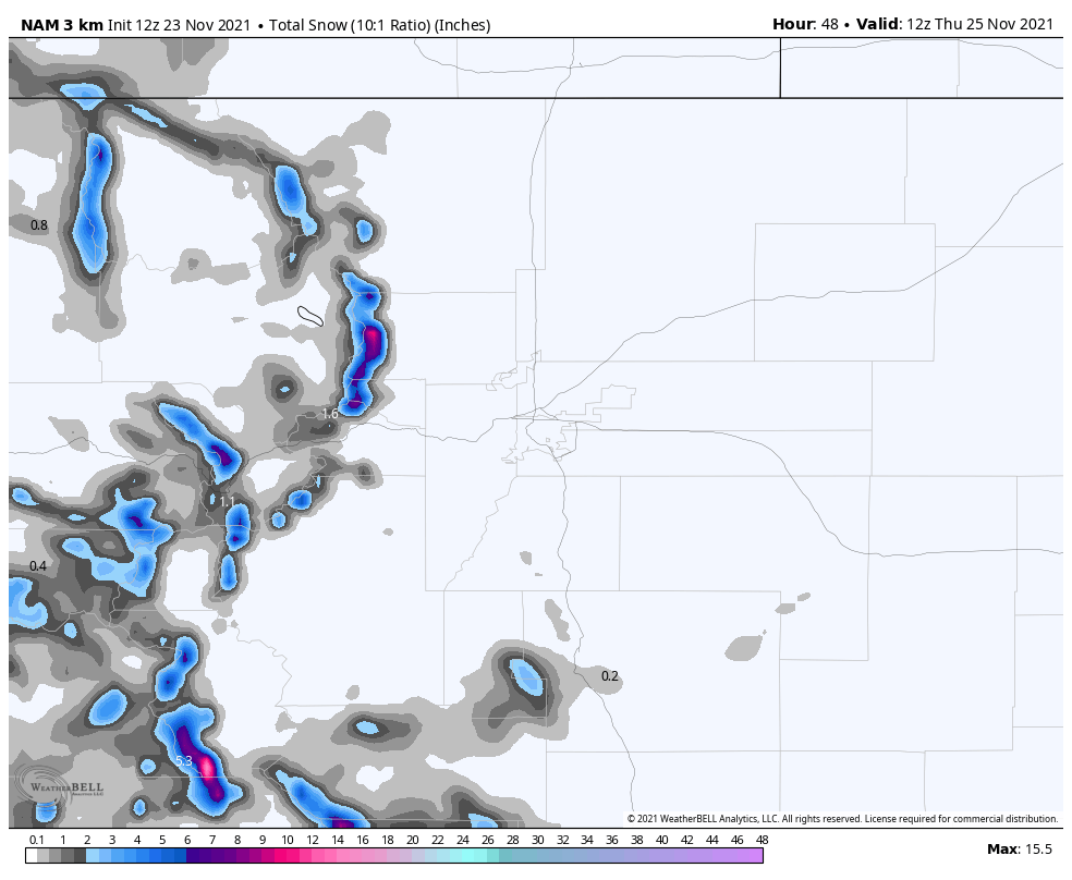
Nam3k Snowfall through Thursday 5AM
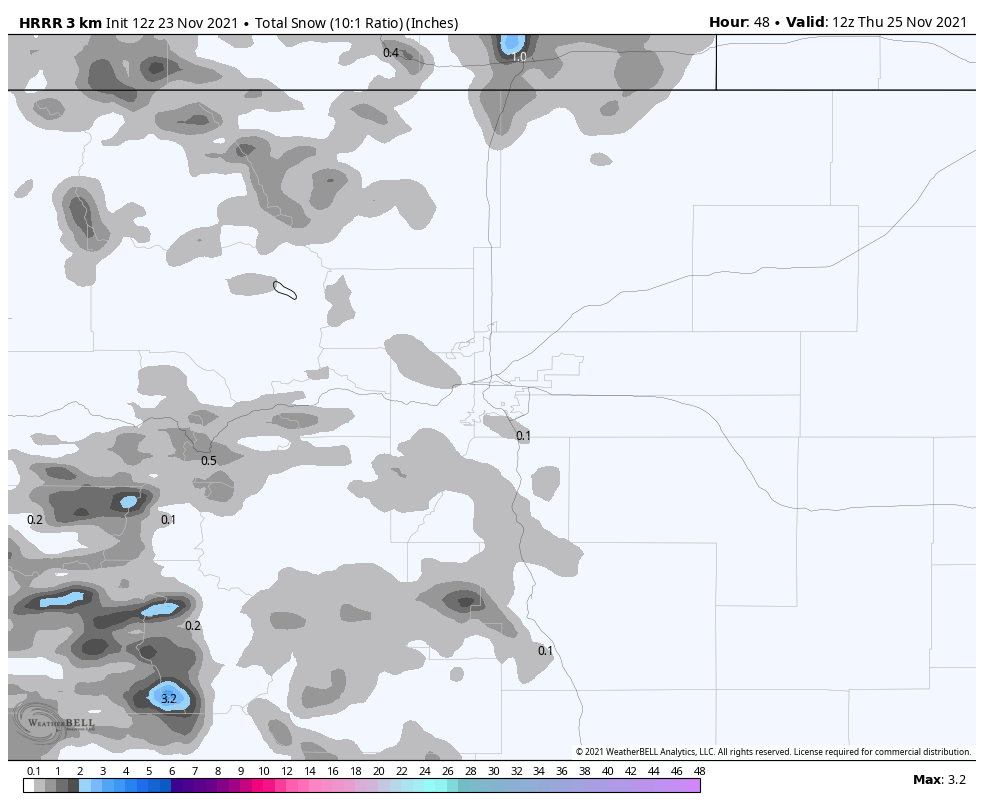
HRRR Snowfall through Thursday 5AM
For what it’s worth… here’s the Euro:

Euro Snowfall through Thursday 5AM
Summary
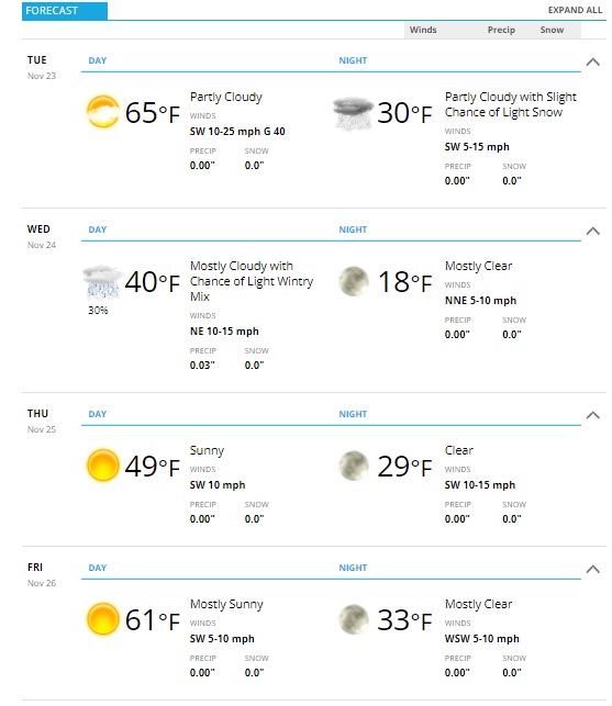
The weather is going to be pretty nice for the holiday after this quick hitting cold front on Wednesday. By the weekend we dry out and warm up once again!
I’m still not super excited about snow accumulation tomorrow for much of the Palmer Divide – just know that it will be cooler with a chance of scattered rain showers during the day with a chance of scattered snow showers thrown in there as well.
Here’s a look at the forecast for the next few days for planning purposes:
