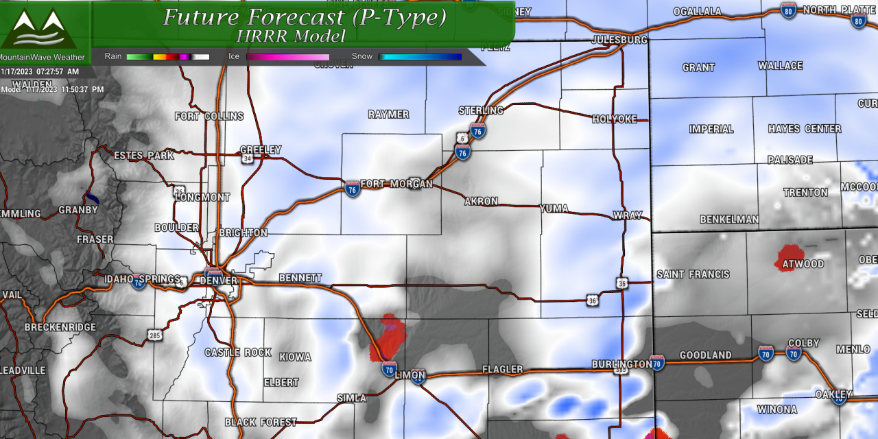
Everything looks on track this morning in terms of our forecast, finish preparations for a significant winter storm by early this afternoon. Here’s the latest forecast details around this storm from the data in as of this morning!
Winter Weather Highlights
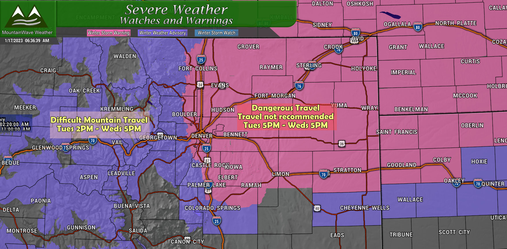
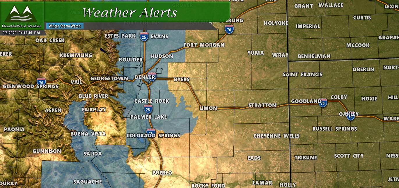
Numerous winter weather warning are in effect from this evening through Wednesday evening. Pay close attention to these alerts and consider delaying travel across the Northeastern plains during this storm.
Details below:
Winter Storm Warning
…WINTER STORM MOVES IN THIS EVENING AND CONTINUES THROUGH MOST OF
WEDNESDAY…
A storm system will enter Colorado late this afternoon. The storm
will intensify overnight and Wednesday morning as it moves across
eastern Colorado. Snow forms in the mountains this afternoon and
then spreads east across the I-25 Corridor and plains this evening.
The snow will be heavy at times tonight and Wednesday morning,
before gradually diminishing Wednesday afternoon. Travel will become
difficult overnight and continue through Wednesday morning.
…WINTER STORM WARNING REMAINS IN EFFECT FROM 5 PM THIS AFTERNOON
TO 5 PM MST WEDNESDAY…
* WHAT…Heavy snow expected. Total snow accumulations between 6 and
12 inches, with the potential for as much as 12 to 15 inches of
snow east of I-25. Winds gusting as high as 35 mph east of I-25
with some blowing and drifting snow.
* WHERE…Portions of east central, north central, and northeast
Colorado.
* WHEN…From 5 PM this afternoon to 5 PM MST Wednesday.
* IMPACTS…Snow covered roads will make travel very difficult due
to heavy snowfall on roadways. The hazardous conditions could
impact the tail end of the Tuesday evening commute and will
greatly impact the Wednesday morning commute.
Winter Weather Advisory
…WINTER STORM MOVES IN THIS EVENING AND CONTINUES THROUGH MOST OF
WEDNESDAY…
.A storm system will enter Colorado late this afternoon. The storm
will intensify overnight and Wednesday morning as it moves across
eastern Colorado. Snow forms in the mountains this afternoon and
then spreads east across the I-25 Corridor and plains this evening.
The snow will be heavy at times tonight and Wednesday morning,
before gradually diminishing Wednesday afternoon. Travel will become
difficult overnight and continue through Wednesday morning.
…WINTER WEATHER ADVISORY REMAINS IN EFFECT FROM 2 PM THIS
AFTERNOON TO 5 PM MST WEDNESDAY…
* WHAT…Snow expected. Total snow accumulations between 5 and 10
inches, with up to 12 inches possible in the mountains of Summit
County. Winds gusting as high as 35 mph.
* WHERE…Rabbit Ears Pass, Rocky Mountain National Park and the
Medicine Bow Range, The Mountains of Summit County, the Mosquito
Range, and the Indian Peaks, The Northern Front Range Foothills,
and The Southern Front Range Foothills.
* WHEN…From 2 PM this afternoon to 5 PM MST Wednesday.
* IMPACTS…Snow covered roads will make travel hazardous. The
hazardous conditions will impact the Tuesday evening and Wednesday
morning commutes.
Updated Snowfall Forecast and Discussion
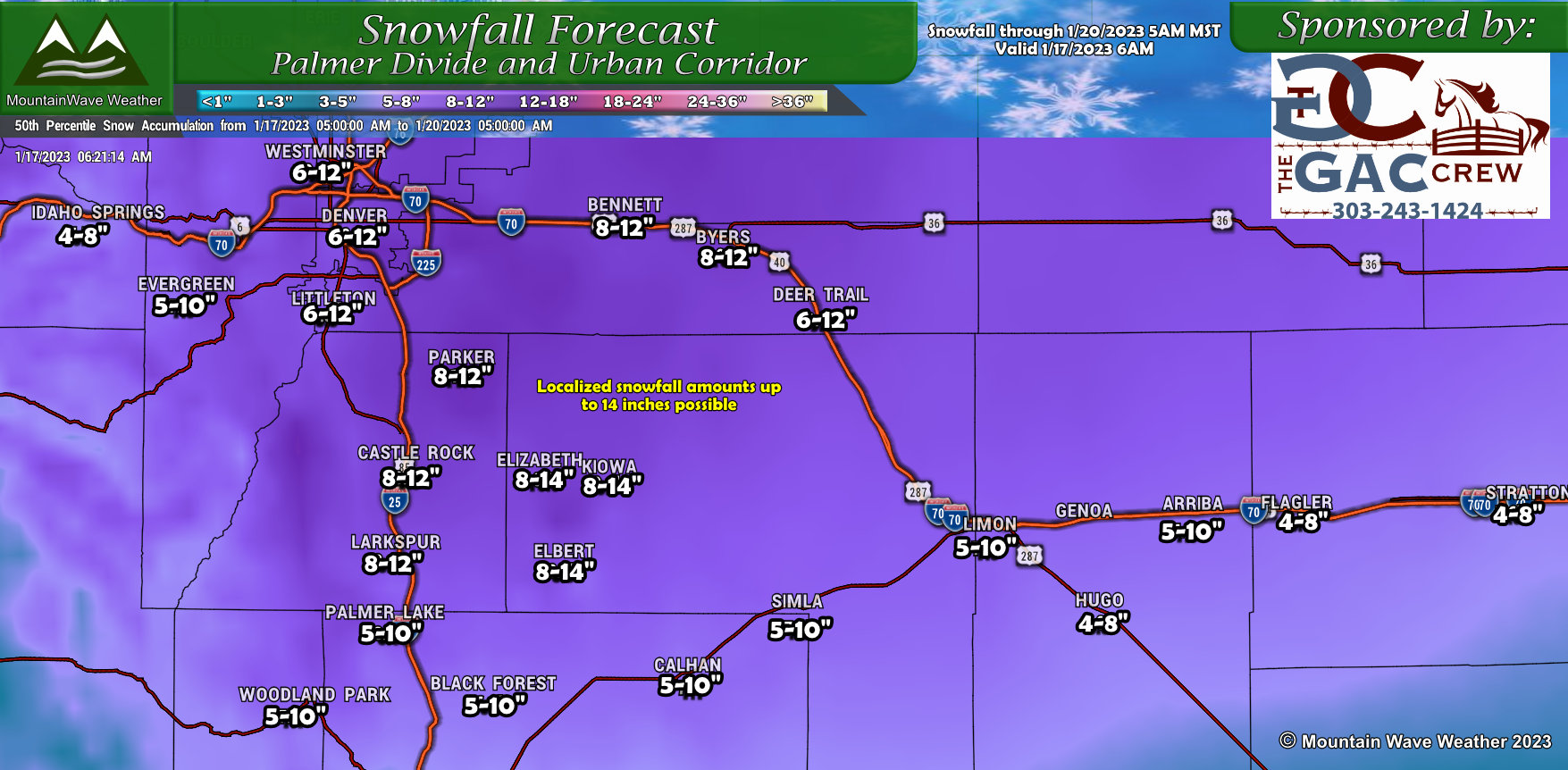
Palmer Divide/ Denver Metro Area
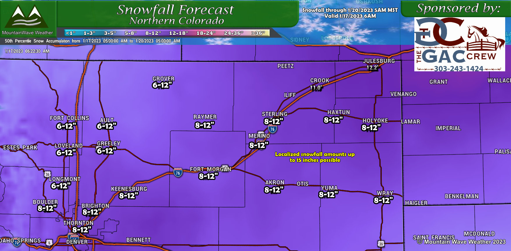
Northern Colorado
Overall forecast remains on track this morning, models have not backed off on snowfall – at all really. Even some of the high-res stragglers have come into line. The only changes we’ve made and it appears the NWS has made in their messaging as well, is to extend some of the heavier snowfall accumulations back towards the West. As such, you’ll see areas like Castle Rock, Western and Southwestern Denver all have been bumped up a bit. For the Palmer Divide, amounts region-wide were bumped up a bit to come in line with modeling and probabilistic forecasts… at this point I feel pretty good about the ranges. For example, Castle Rock has 71% chance of seeing over 8 inches snow and even a 35% chance of seeing more than 12. Long story short, a few of these favored areas may overperform the forecast slightly, so I’ve made note of that on the forecast map in yellow.
Either way, still on track for a pretty good sized storm!
Southern Colorado

Timing and Impacts
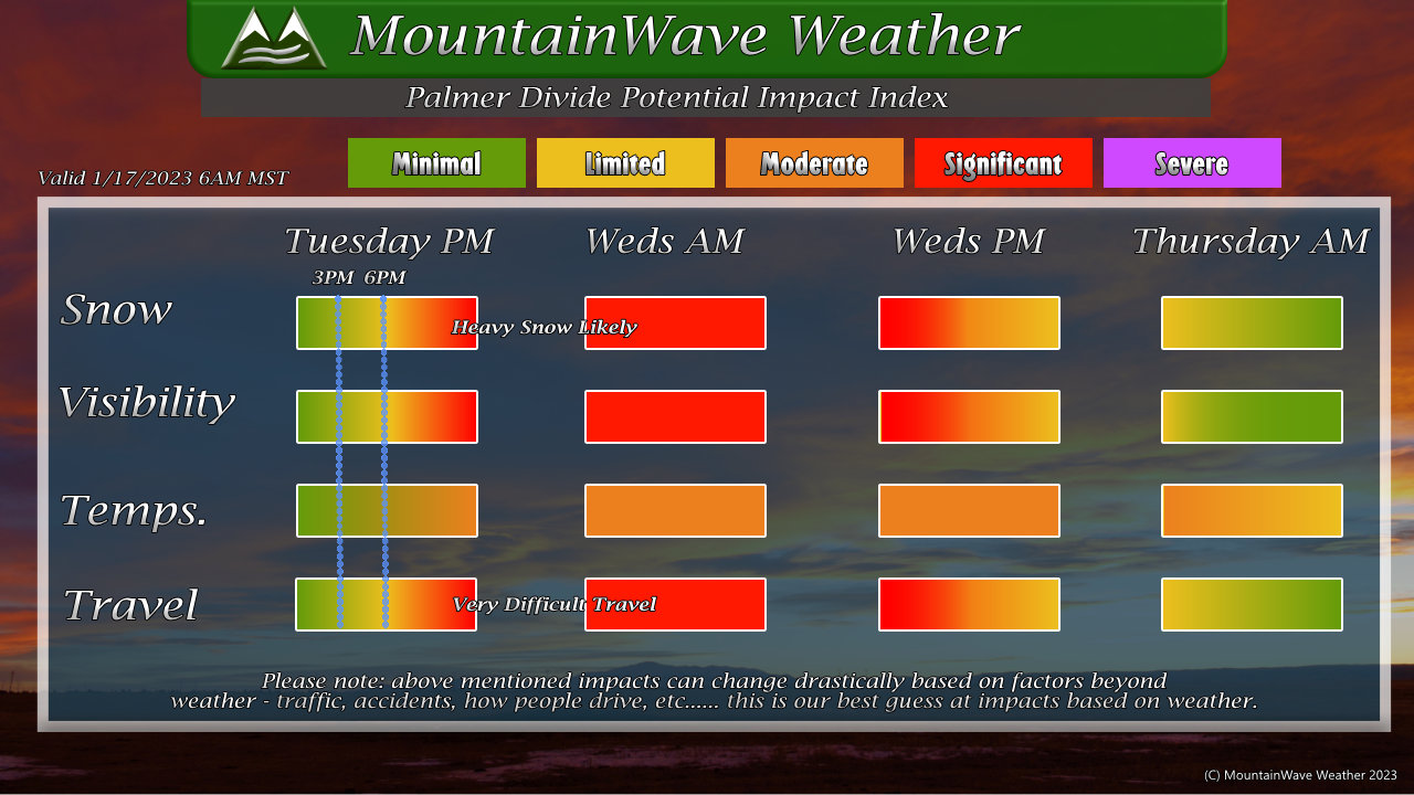
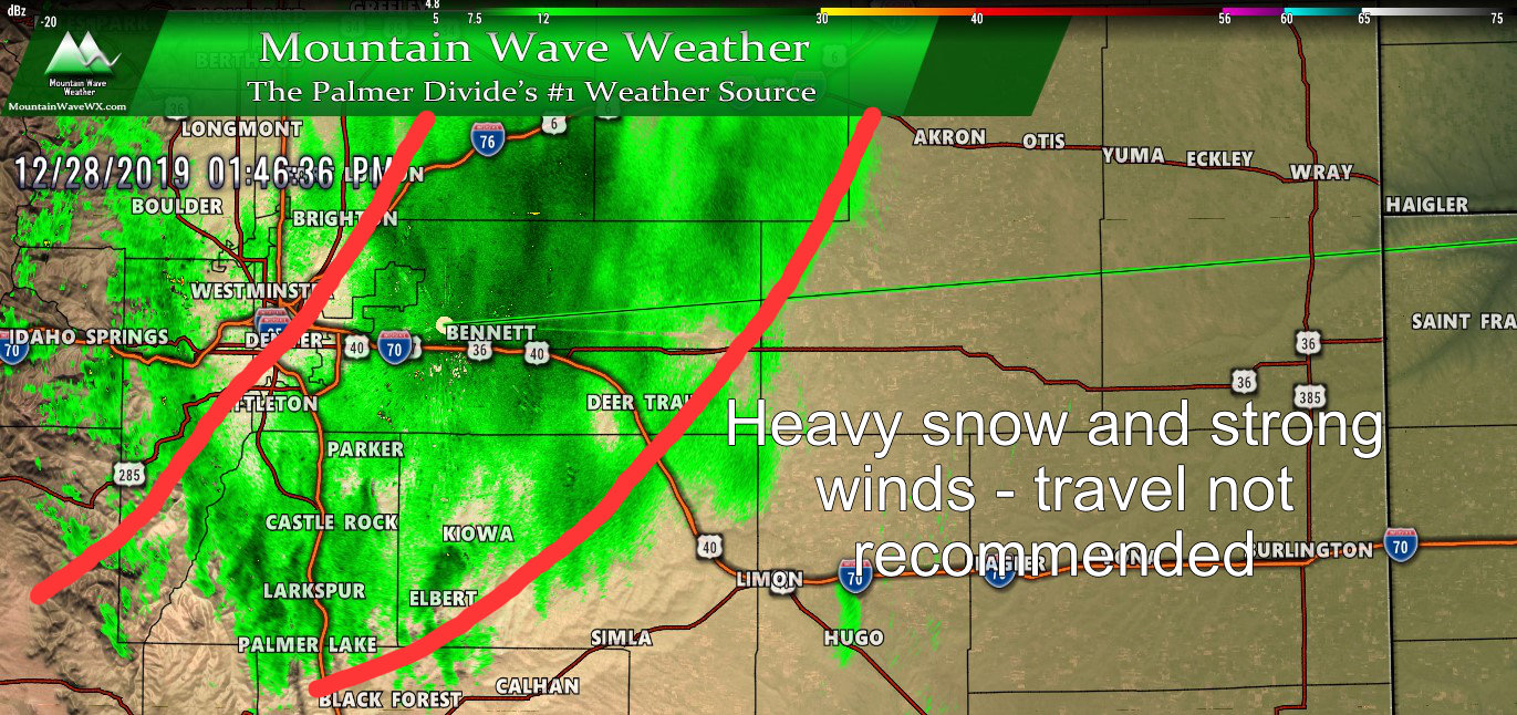
Significant impacts to travel across the Palmer Divide and Eastern plains are likely late Tuesday night through Wednesday morning, with additional moderate/significant impacts likely through the day on Wednesday. The storm looks to move out later on Wednesday, but roads will take time to recover and drifting and blowing snow means road closures are likely – especially across rural areas.
Plan on not driving unless its an emergency from later Tuesday evening through Wednesday afternoon.
Timing
- Snow starts between 3-6PM
- Winter Storm Warning starts at 5PM
- Plan on being off the roads by no later than 6PM
- Storm will move out later Wednesday late afternoon/evening, snow and wind will continue through most of the day until then
Impacts
- Heavy snow accumulation
- Strong winds up to 40-45mph making for blizzard conditions, especially East of I-25
- Road closures are likely, especially East of I-25
- Expect significant impacts to travel across the front range and Northeastern plains
FAQ’s
- Will school be cancelled?
- Not sure, you’ll probably get notice by late Tuesday or early Wednesday. The school district will be your best source of information for that.
- Will my flight be cancelled, should I reschedule?
- Check with your airline, many will let you rebook for free during extreme weather events.
- In my opinion, there will probably be impacts to air travel late Tuesday and through most of the day Wednesday
- I’m driving from or to Denver on Wednesday. Should I wait or postpone travel?
- If you are planning on driving to Denver during the Winter Storm Warning (Tuesday 5PM through Wednesday 5PM) travel is not recommended.
- Yes you should postpone travel during this time
- I have doctors/dentist/etc… appointments on Wednesday, should I reschedule?
- Winter Storm Warning means do not travel unless its an emergency… I highly recommend you reschedule…
Summary
There you have it, this storm should surprise no one at this point!
I will be keeping an eye on the data throughout the day for any last minute changes/curveballs but overall forecast confidence is fairly high at the moment.
Stay tuned for any further information!

