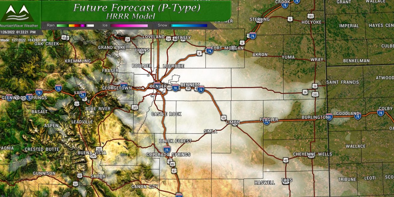
Storm Setup
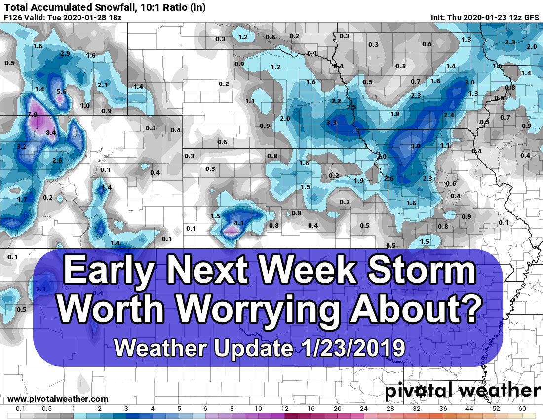
Our next storm system is slated to impact mainly the front range of Colorado again as early as Thursday morning. There’s quite a few similarities with this storm and the last one we saw on Tuesday. An shortwave trough will move across Colorado on the Southern end of the jet stream, this is very close to what we saw happen Tuesday with a couple of slight differences.
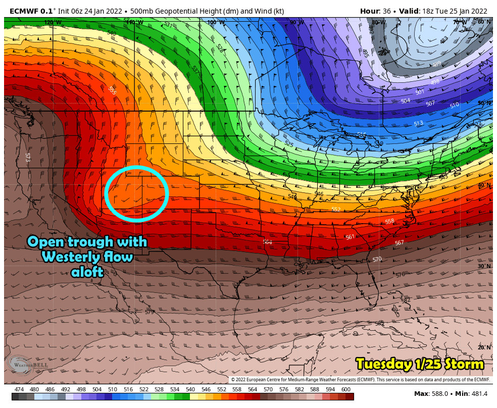 Here’s a snapshot of how modeling portrayed Tuesday’s storm and for the most part this verified. A shortwave moves across the desert Southwest and into Colorado. These storms have more “zonal” (west to east) flow aloft so are not often big snow producers unless they hook up with some other feature in the jet stream. That being said, some areas in Eastern Colorado saw 2 plus feet of snow as a moderate/heavy snow band formed along a front that stalled in the area. The jet overhead most likely enhanced lift and produced high snowfall rates over a short period of time and over a small geographic area.
You can bet that a feature like this could be in play again for Thursday’s storm, but the question will be if – when -where…
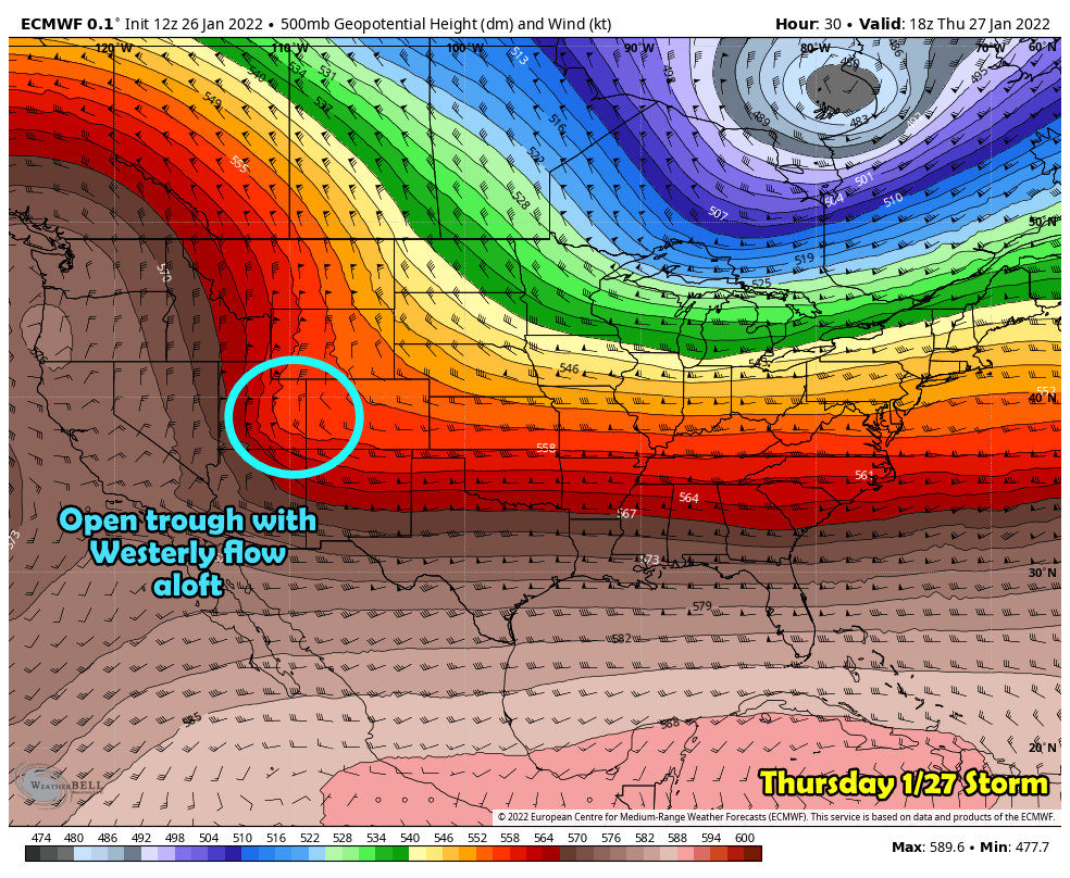 For Thursday’s storm a similar looking short wave sets up to the West though not as pronounced as the last. This would mean that snow amounts could be similar to the past storm but if this verifies they will most likely be a bit less. The wildcard here will still be if we see any snow-banding with this storm. Given the positioning and the setup with this storm I think it is possible again for some very specific areas to overperform their forecasts.
Here’s a look at yesterday’s snow band on the Eastern plains:
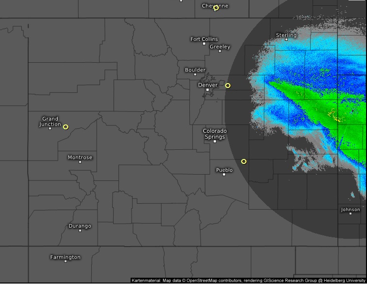
Here’s the caveat with these snow bands; models cannot tell us where they will set up, how strong they will be, what time they will set up or how long they will linger. We really only get an idea about any of this information as it starts to happen – so we can’t give any more heads up beyond that snow bands will be possible with a storm.
Snow bands will be possible with this storm… ;-P There’s your warning. No we don’t know if, when or where. That’s the rules of the game.
Snowfall/Impact Forecast
Palmer Divide/ Urban Corridor
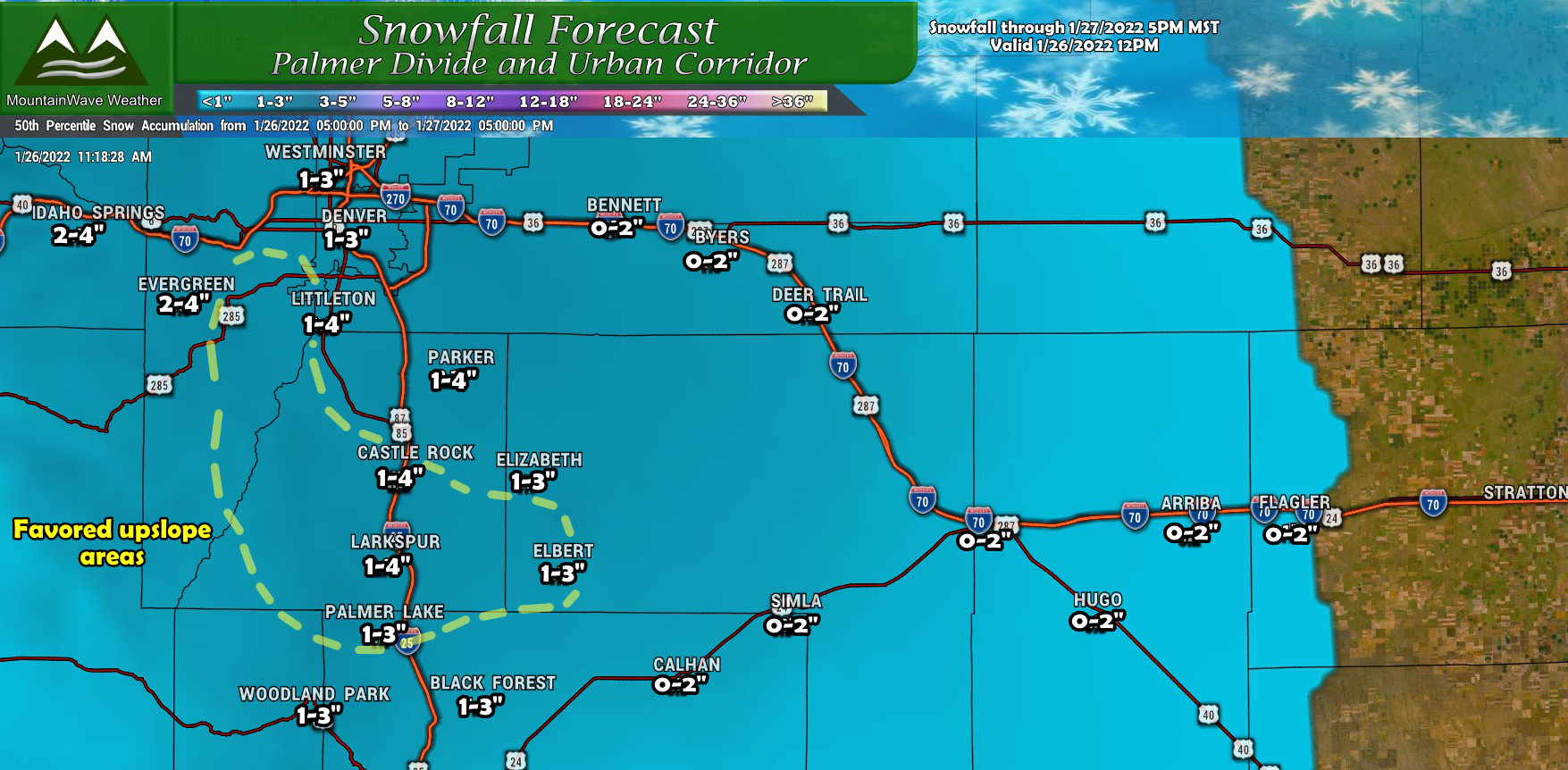
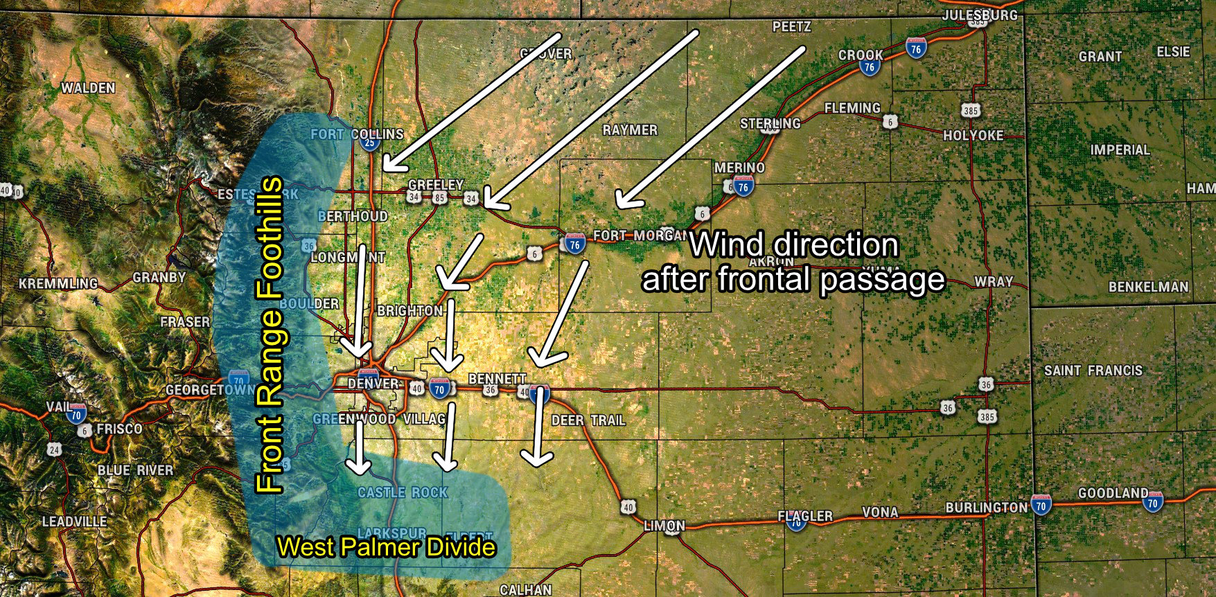
Fairly minor amounts overall again with this storm. You’ll notice the wider range in snowfall amounts predicted right along the Western parts of the Palmer Divide. This is because like the last storm, North-Northeasterly winds will favor those areas for additional upslope. This means a higher range is possible if that sets up properly and hangs around long enough. Models don’t agree on much with this storm but they do agree on that highlighted area being the “bullseye” for higher snowfall amounts (higher meaning more than the general 0-2″ or 1-3″ amounts.)
I’ll use this graphic again because it is applicable and illustrates a good point:
The wildcard with this forecast will be snowfall banding again, should that set up over the Palmer Divide and linger, forecasts will need to be adjusted upwards upon the storm’s arrival – very little advance notice.
Northern Colorado
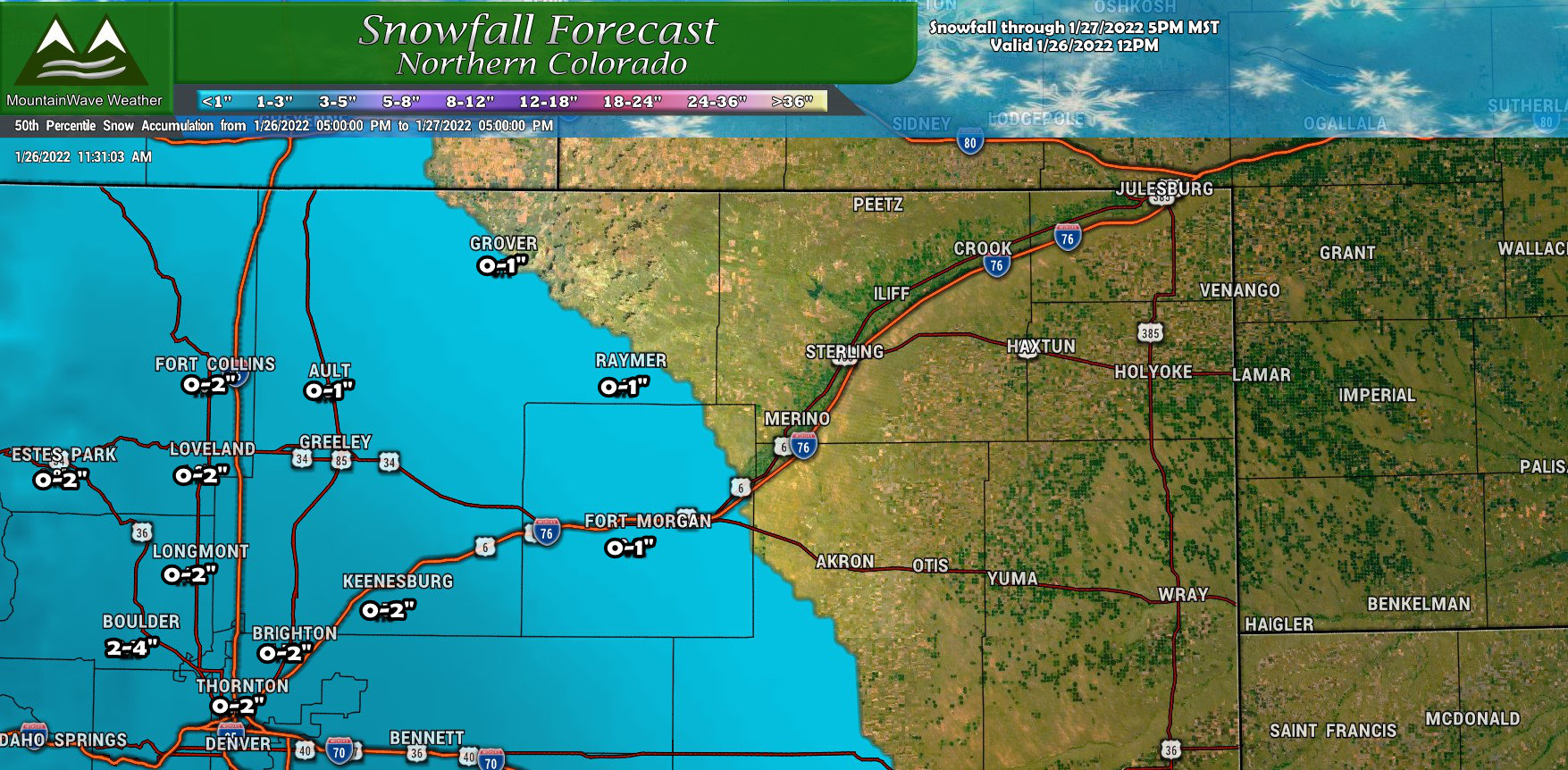
Northern Colorado won’t benefit much from this storm East of I-25 beyond some wind. Light snowfall amounts are possible as you get closer to the foothills but just like the last storm the areas in and around Boulder and the Foothills and Mountains West of Fort Collins are favored with better upslope. Still, models are not excited about high snowfall totals in those areas like they were for the past storm so I’ve bumped those all downwards just a bit.
Southern Colorado
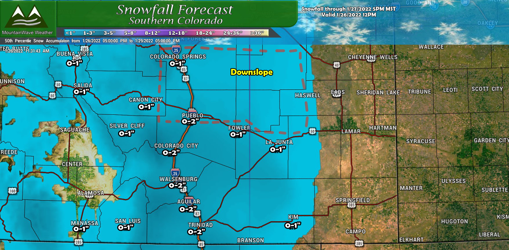
As usual these Northerly wind storms don’t tend to do much for the Southern part of Colorado. Most of these areas will see minimal snow so not much to write home about there. The Northerly winds will probably downslope on the other side of the Palmer Divide so areas just to the immediate South may end up picking up little to nothing besides some wind with this storm.
Impacts/Keep in Mind…
A few things to remember with this storm:
- Roads are already cold so snow/ice will accumulate quicker
- Expect slick road conditions and travel impacts especially if a heavier snow band sets up
- Give yourself plenty of time and space
This storm will likely impact the commute Thursday morning at some point. Be prepared!
Timing of heaviest snow along the Palmer divide is again that 6AM – 12PM timeframe… models agree especially on about 9AM – 1PM
Summary
As always, I’ll have more updates as needed. This storm won’t be a big snow maker for most of us, but with the cold roads and ground temperatures in place, snow accumulation and travel impacts are all in play here.
Not what I’d call a major storm, but enough to cause some headaches I’m sure! Stay tuned!
