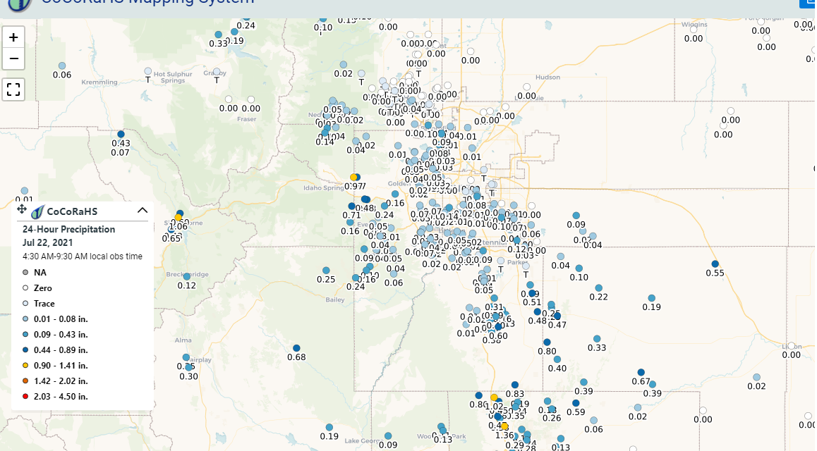
Were you one of the lucky ones that received beneficial rain yesterday? A series of thunderstorms fired up over some parts of the Palmer Divide yesterday afternoon and laid a lot of rain down… for some of us. Others received very little rain or none at all, so goes the monsoon in Colorado!
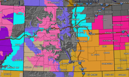
The 1 day observed precipitation map is attached below and gives you a good idea of who saw the best rain. Generally the areas East of Castle Rock, Eastern and Southeastern Douglas County and a good portion of Elbert County received the most. These storms fired up and did not move much, so the areas that were under the rain got drenched for quite awhile! If you were in or around Castle Rock, you probably didn’t see a whole lot of action yesterday unfortunately…
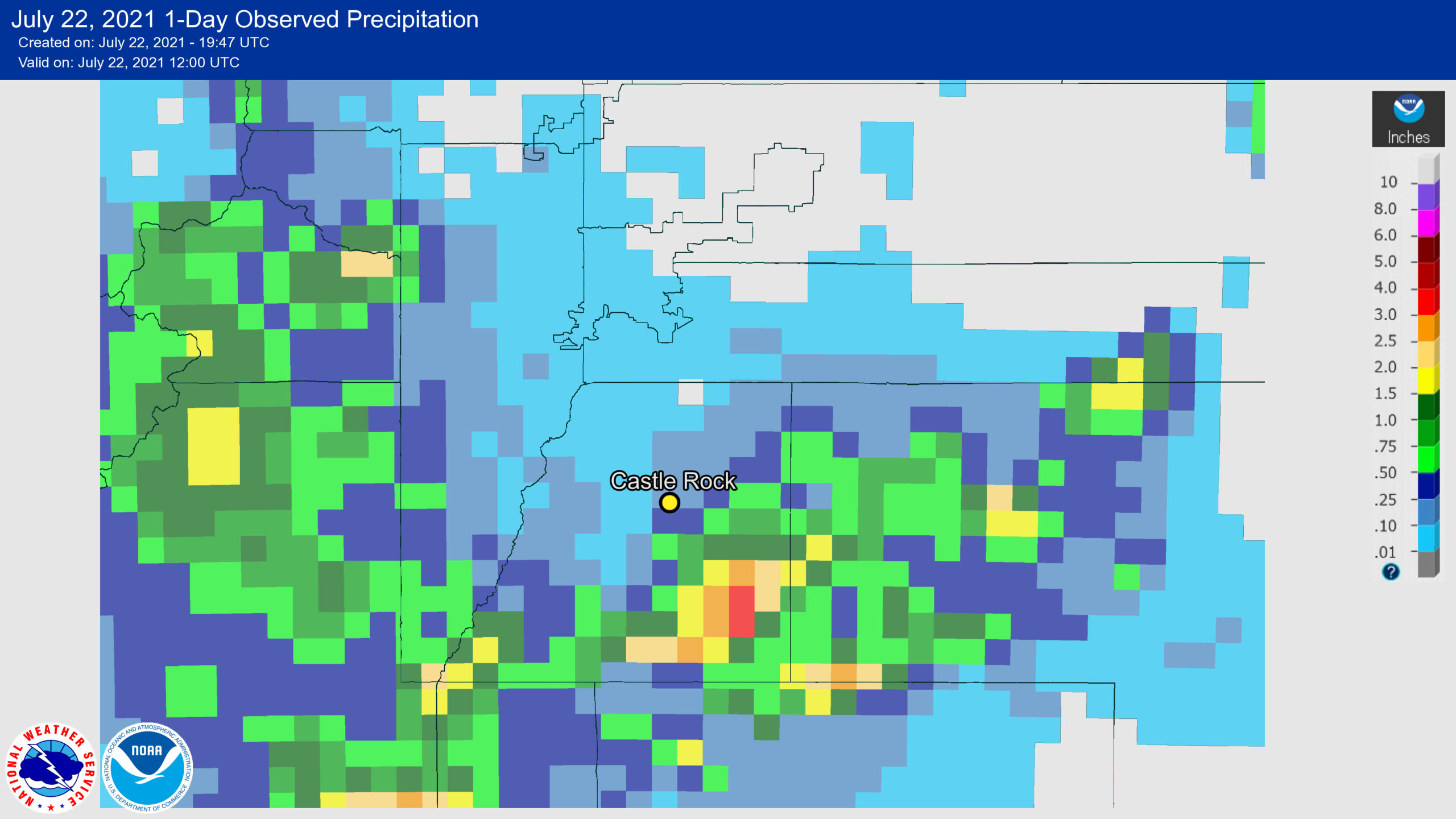
24 hour rainfall totals through 8AM 7/22/2021
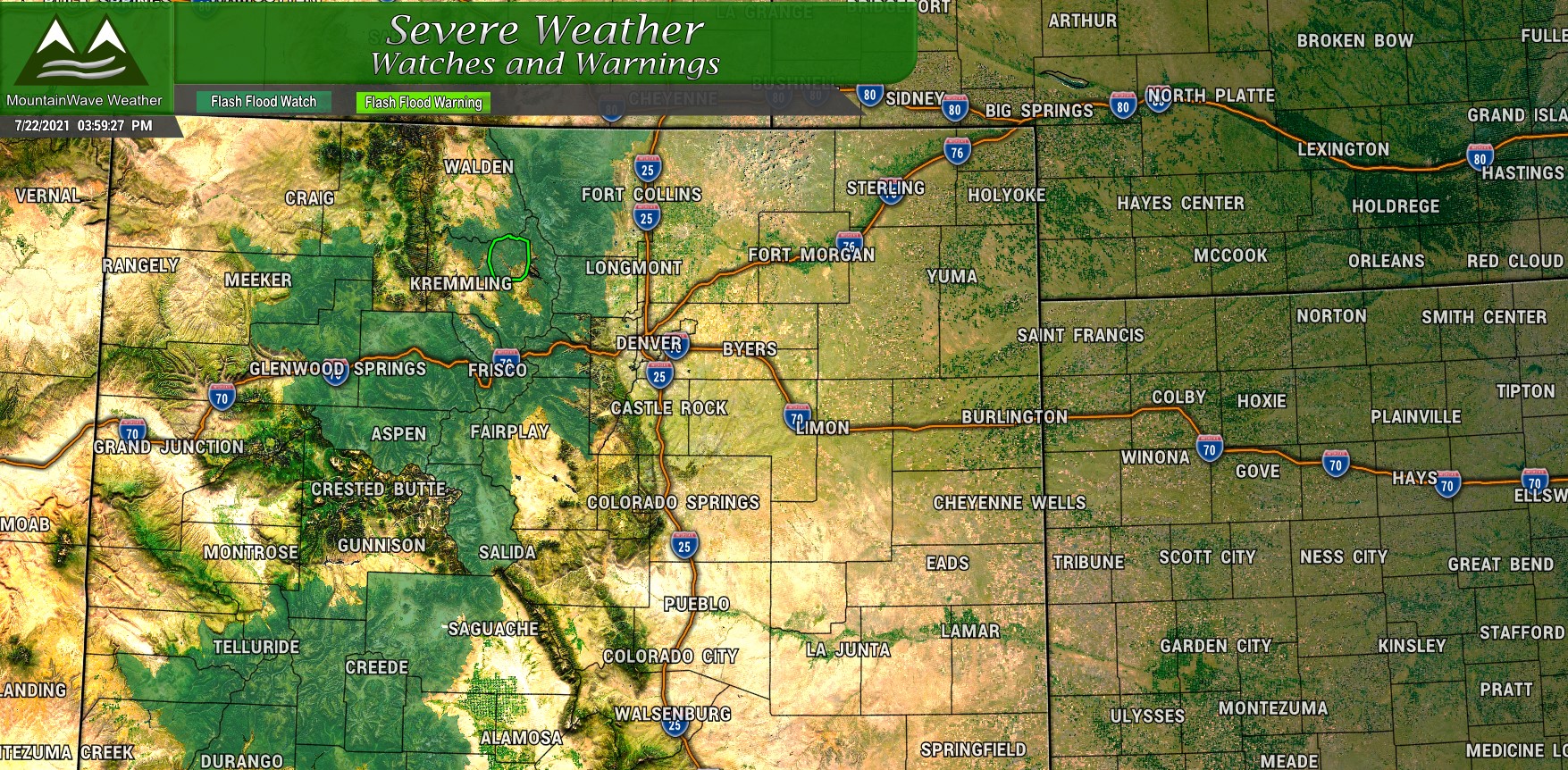
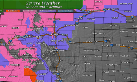
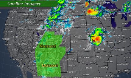
More rain looks likely for mainly the mountains and foothills locations on Thursday. As of this afternoon several flash flood watches have been issued and some flash flood warnings are effective for areas of heavy rain over burn scars.
Storm chances look meager on the plains, about in the 20-30% change range. Keep an eye on the forecast Friday and Saturday as thunderstorms with heavy rain look more likely again during that period.
