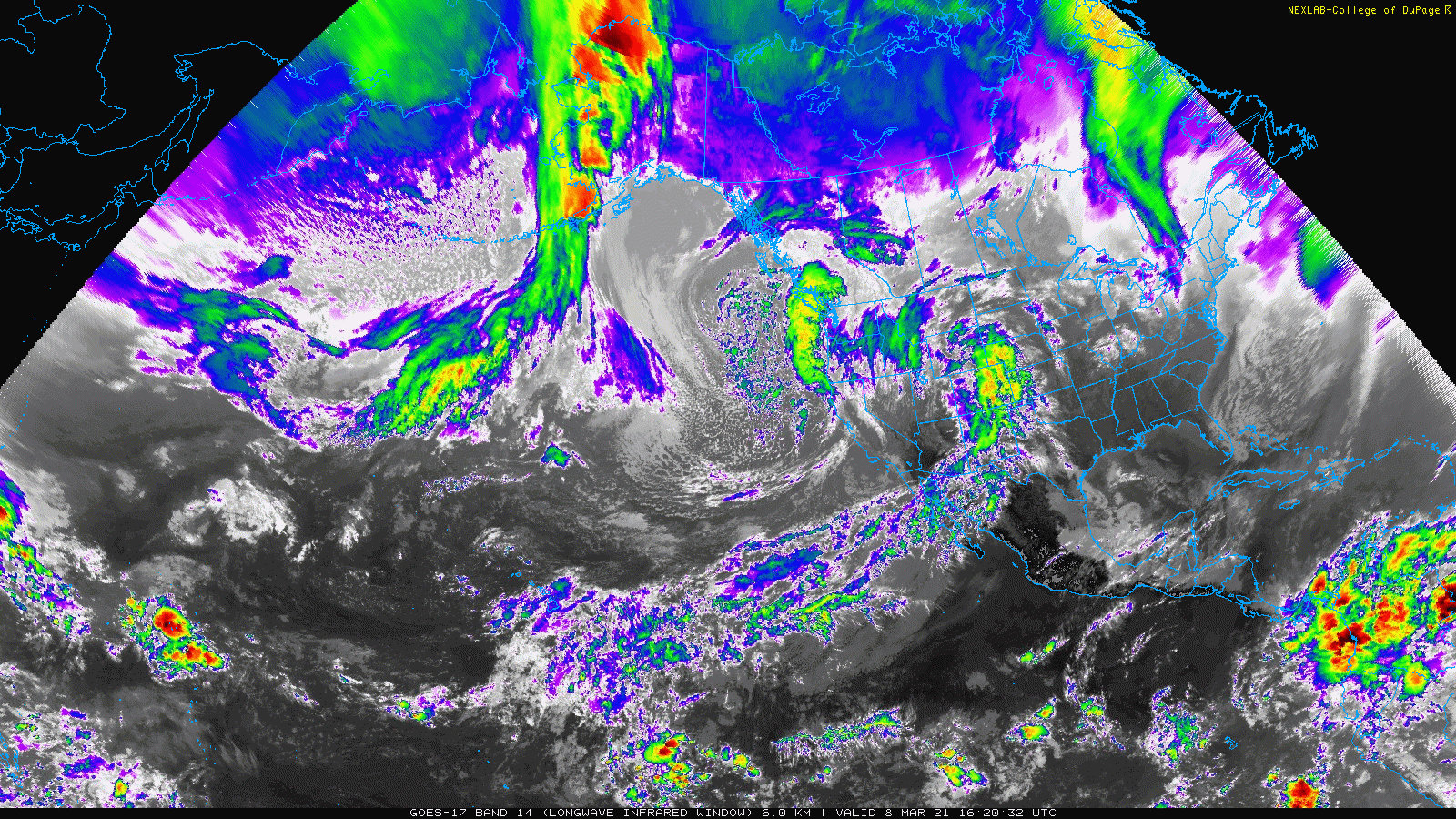
The surge of monsoon moisture that brought some parts of the state much needed rain is shifting away from Colorado. This is already evident this morning (Tuesday July 29, 2020) as we see a marked drop of dew-points across Colorado; a sure fire sign that a weather pattern shift is taking over the desert Southwest of the U.S.
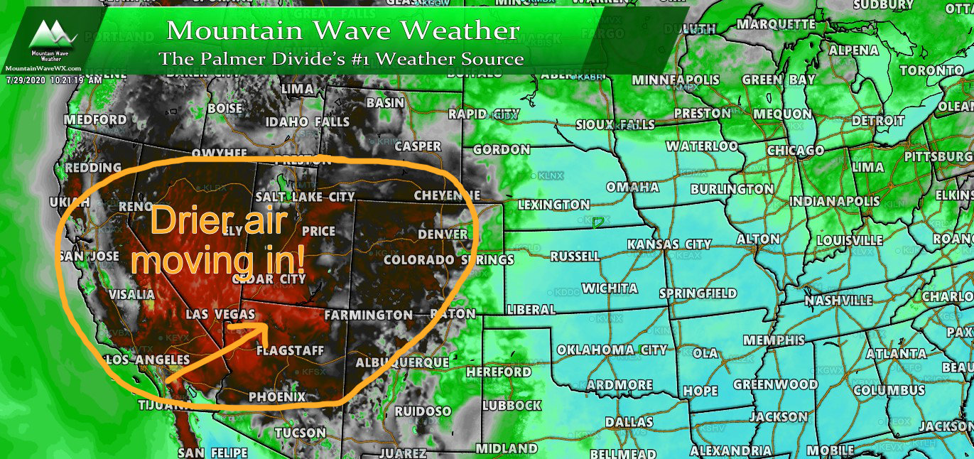
Drier air is moving in from the Southwest effectively shutting down the monsoonal flow we saw last week
Where Do We Go From Here?
The high pressure ride over Texas last week responsible for pushing moisture into the state has broken down and a new ridge will form to the Southwest over Arizona. This is not the place you want high pressure if you’re looking for more monsoon moisture to stream into the state. As the ridge builds it will turn the flow aloft over Colorado to a Northwesterly direction instead of the Southerly and Southwesterly direction we saw last week.
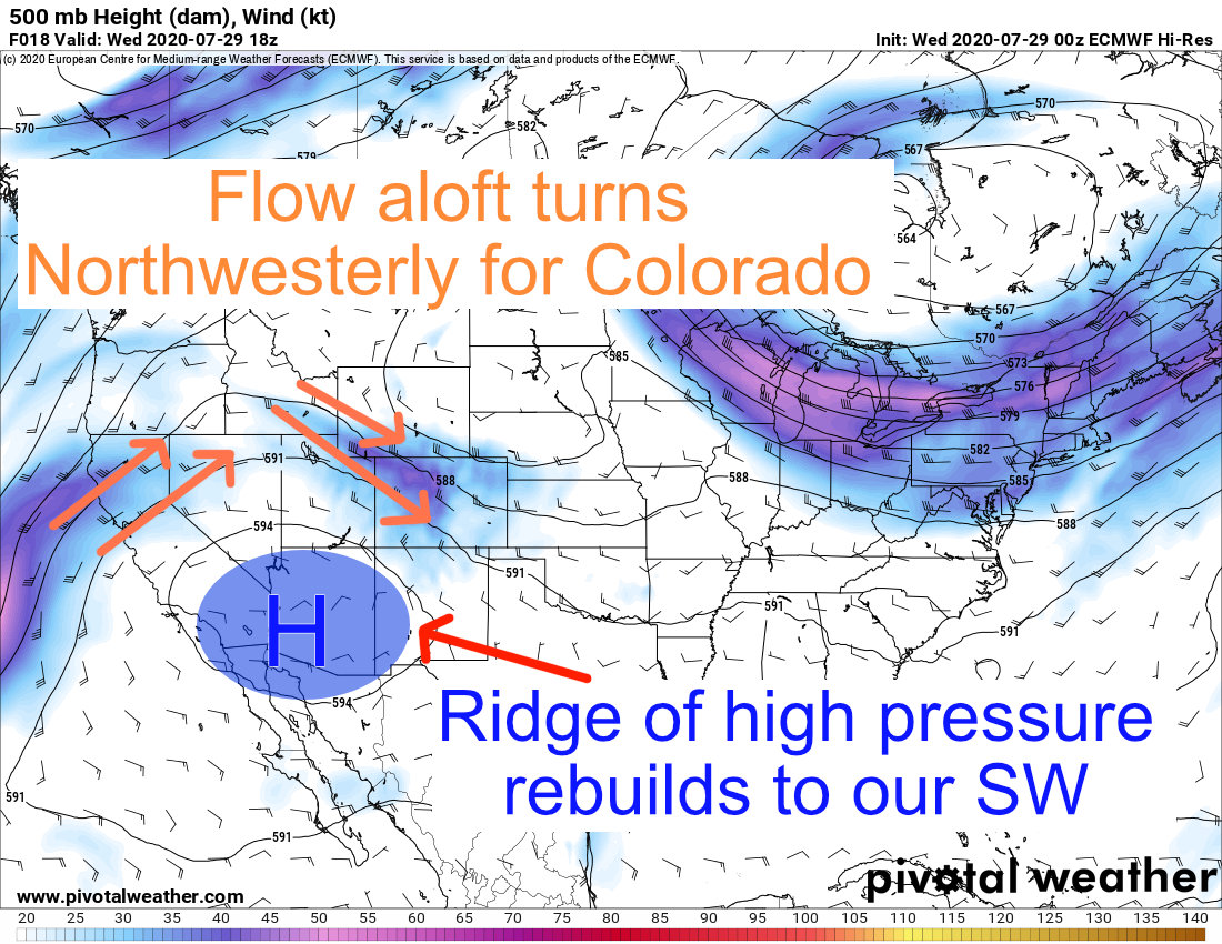
Models show a strong high pressure ridge through the week staying mainly anchored over Arizona
The ridge slides a bit East and West but predominantly stays over Arizona which means a few things for out weather in Colorado this week:
- The ridge stays Southwest of Colorado
- This means temperatures will heat up again, but won’t be record setting like we saw in mid-July
- Northwesterly flow aloft
- This is a dry feature that will allow desert air into the state through the week
- This air mass will be relatively dry meaning thunderstorms with rain will be hard to come by
- Thunderstorm chances aren’t 0% however, any residual moisture in the atmosphere could fire off highly isolated storms with mainly a lightning/wind threat
Come Back Monsoon!
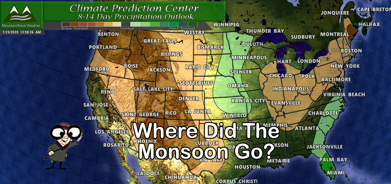
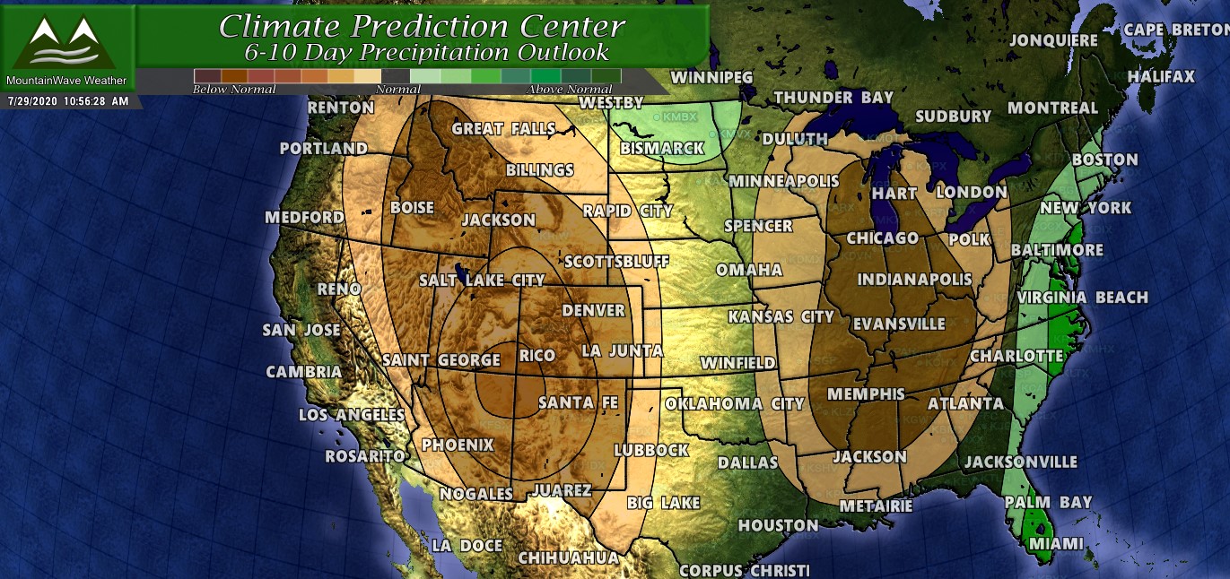
Here’s the part where I rain on the parade a bit (pun intended, but sadly not a lot of widespread rain in our future.) I’ve put together the 6-10 day and 8-14 day precipitation outlooks from the Climate Prediction Center. These aren’t useful for nailing down specific details but they are handy for spotting overall trends and patterns…
6-10 Day Precipitation Above or Below Average Probability Outlook
8-14 Day Precipitation Above or Below Average Probability Outlook
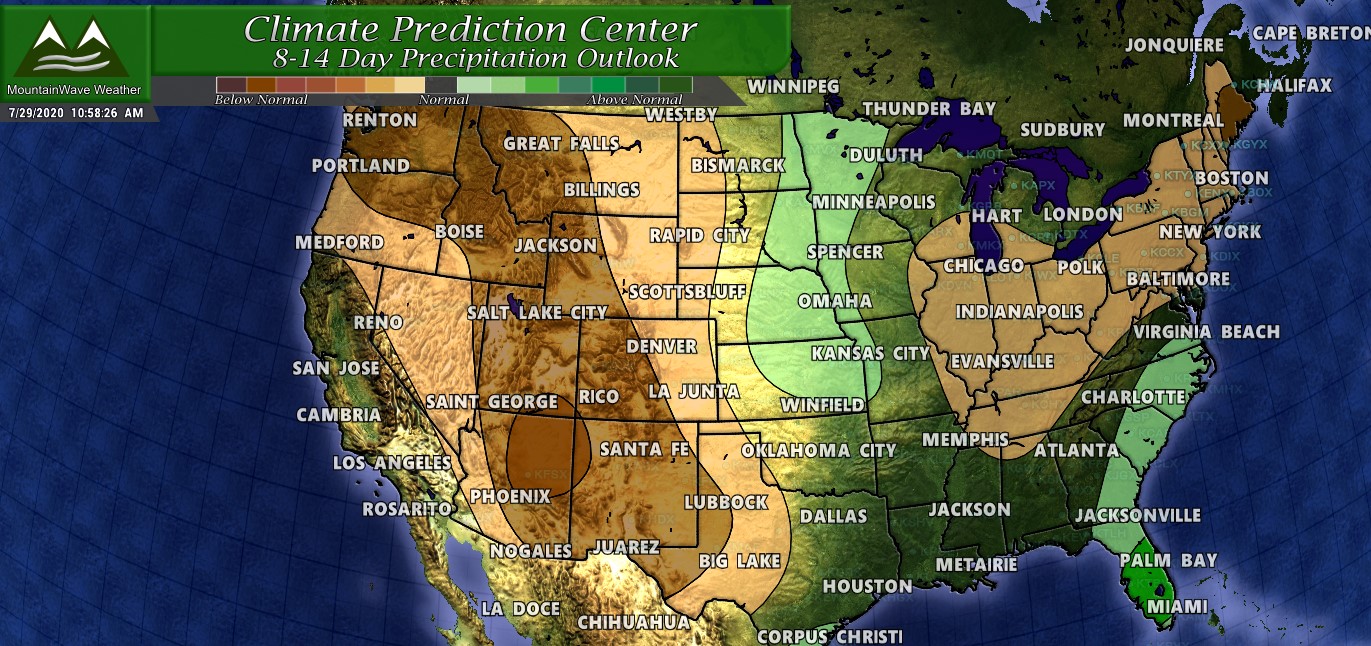
There’s no point in covering the two outlooks posted above separately because they essentially show the same picture. Over the next 2 weeks the chances of being drier than normal are better than 50% for large portions of Colorado. I think for the most part this is consistent with what I see in model data but there is one part of the state that could be the exception; the extreme Eastern part of the state near the Kansas and Nebraska borders may turn out to get a bit better moisture than predicted here. This is all based on what I am seeing in modeling data for the next 2 weeks… the Central and Western parts of Colorado due look quite dry and crispy on most models.
Here’s what the Euro thinks on total precipitation for the next 10 days in Colorado:
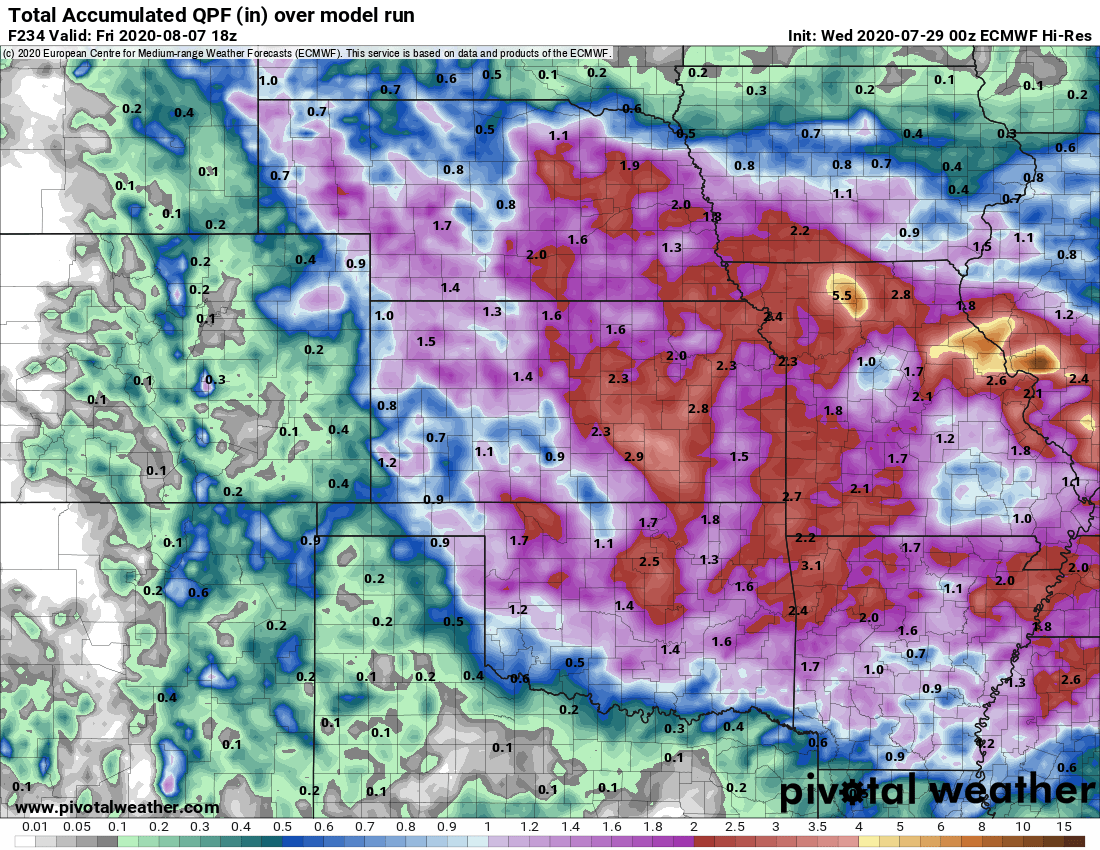
You’ll notice it has pretty abysmal amounts of rain for anyone West of the border areas in Colorado. Some areas may get lucky and get a hit or miss rain shower but widespread chances of rain like we saw this past 5-7 days will be pretty much gone looking forward the next 10 or so days.
Wrapping It Up!
Long story short, the monsoon is done with us for now. I’ll be putting together some more information on whether we see it again this year or not… and as always if you’re a MountainWave Weather Site Supporter you can check out the monthly 30 day outlook to get a good idea of what’s coming down the pipe as well!
The main pattern looks to be shifting back to a warmer and drier trend at least for the near future!
