Almost a year later from March 2019’s “Bomb Cyclone” and Colorado finds itself under a new slew of Blizzard Warnings. The data on this storm system has been coming in fast and furious and models are holding steady on a lot of things now with only a few differences. Overall we have moved to medium-high forecast confidence in a lot of areas. A lot of folks have told us about the differences in forecast between TV stations, or NWS, or even ours. That’s the way it is sometimes folks, we do the best we can with what we have and our knowledge and experience and if you’ve followed us for awhile you know we have a pretty decent track record.
Winter Weather Highlights
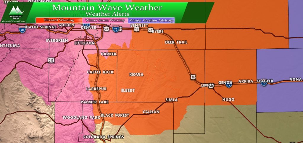
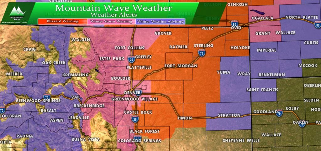
An afternoon full of very busy winter weather highlights on the maps. I’ve posted both the Palmer Divide Region as well as Northern/Central Colorado to give you an idea of how big an impact this storm will have.
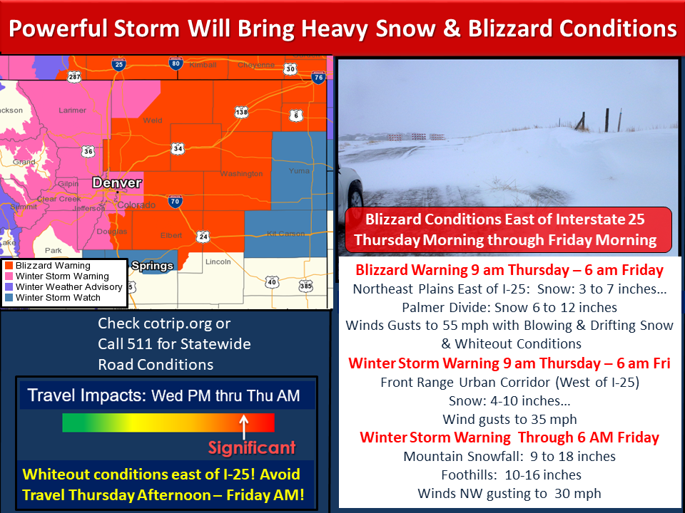
Here’s a rundown of the warnings/advisories
Blizzard Warning
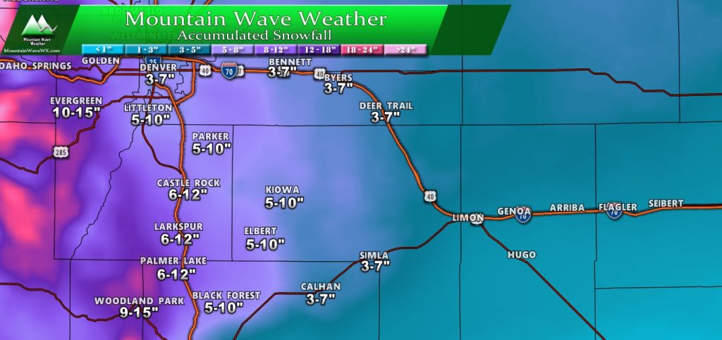
- Palmer Divide snowfall between 6-12 inches for most locations. Some locales may see higher totals (12+”)
- Northeastern Plains 3-7″
- All areas in warning: winds between 45-55mph will be likely
- Heavy snow rates (1-3″ per hour) strong winds and blowing snow will make travel conditions extremely dangerous.
- Travel is not recommended during this warning
Winter Storm Warning
- Denver metro area between 4-8″ of snow with locally higher amounts especially near the foothills
- Foothill locations could see 6-12″ with locally higher amounts
- Heavy snow (1-3″ per hour rates)
- Travel is not recommended and could be dangerous
There are also some winter weather advisories for travel issues related to wind and snow highlighted in purple.
Expected Snowfall
Palmer Divide Region/ South Denver
The Palmer Divide region has been one area of emphasis on a lot of the models. I think the higher snow totals will be along the I-25 corridor and into the foothills of Douglas County. Elbert County should see decreasing snow amounts from a line from between halfway between Kiowa and Limon. I do think it’s possible some of the western parts of Elbert county could see a foot.
Make no mistake though… even if snow ends up a bit less in these areas the strong winds will still make for blizzard conditions and travel will be dangerous.
Colorado
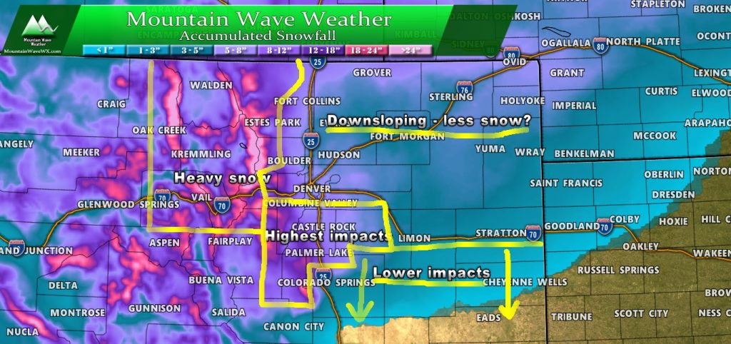
I’ve left the snowfall gradient on and highlighted a few features on the Colorado map above. Highest impacts look to occur along the Palmer Divide and front range foothills. Lesser impacts South of the Palmer Divide and Northeastern Colorado, due to downsloping in both cases.
Storm Discussion (Impacts/Timing/Hazards/Trends)
Timing
- Thursday – early
- Precipitation is expected to start as rain or a mix
- The biggest uncertainty in models is when rain switches to snow. Earlier means higher snow totals and quickly deteriorating road conditions, later means travel and impacts will occur a bit later
- If you have plans to be out and about Thursday morning be very aware that when it starts snowing heavily conditions may rapidly deteriorate
- Thursday – late morning/afternoon/evening
- Blizzard Warning goes into effect at 9AM
- Most models show a change to snow between 9AM-12PM
- High winds will also begin during this time so expect conditions to change quickly
- Some models have snowfall rages of up to 3″ per hour into the late morning/ early afternoon hours — that is very heavy snowfall if this verifies
- Thursday – overnight
- Snow intensity decreases into the overnight hours
- Some lingering snow showers possible into early Friday morning
Impacts/Hazards
- Rain switching to snow in the morning
- Heavy snowfall and wind may overcome wet roads quickly
- High winds up to 55mph will cause extensive blowing and drifting snow with poor visibility
- Power outages will be possible, make sure you are prepared for this especially in rural areas
Summary
Here’s the current graphic from the NWS for a good summary.
Their forecast is pretty well in line with ours so I won’t beat a dead horse.
Speaking of which (I’m so sorry for the bad joke, I can’t help it… please know that it is meant with love)
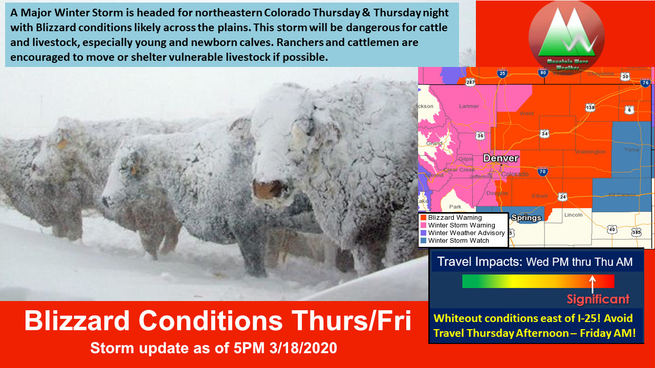
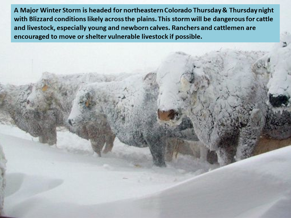
If you have ag interests in Douglas and Elbert counties; this storm will present dangerous conditions to livestock especially younger animals. Please make sure livestock is in place and sheltered by tonight. Things will change very quickly in the morning and if you wait until then it may be difficult.
Hopefully everyone is already hunkered down and has what they need. I may do a live-stream around 10PM tonight so if you’re still up feel free to join me and ask any questions you have!

