January was a fairly active month for snow and we have continued that trend into February so far. While a lot of these "storm" systems haven't been much to write home about, the steady inflow of little bits of moisture has helped the area recover slightly from drought conditions. That being said, we still need a substantial amount of moisture into Spring to make any real dent in our drought conditions.
Will we see that type of wet spring? The jury is still out on that one, but La Nina springs are sometimes unkind to us in terms of delivering abundant amounts of mositure.
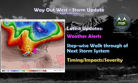
More on that later, let's turn our focus to what's going on this week.
Something Brewing to our Southwest?
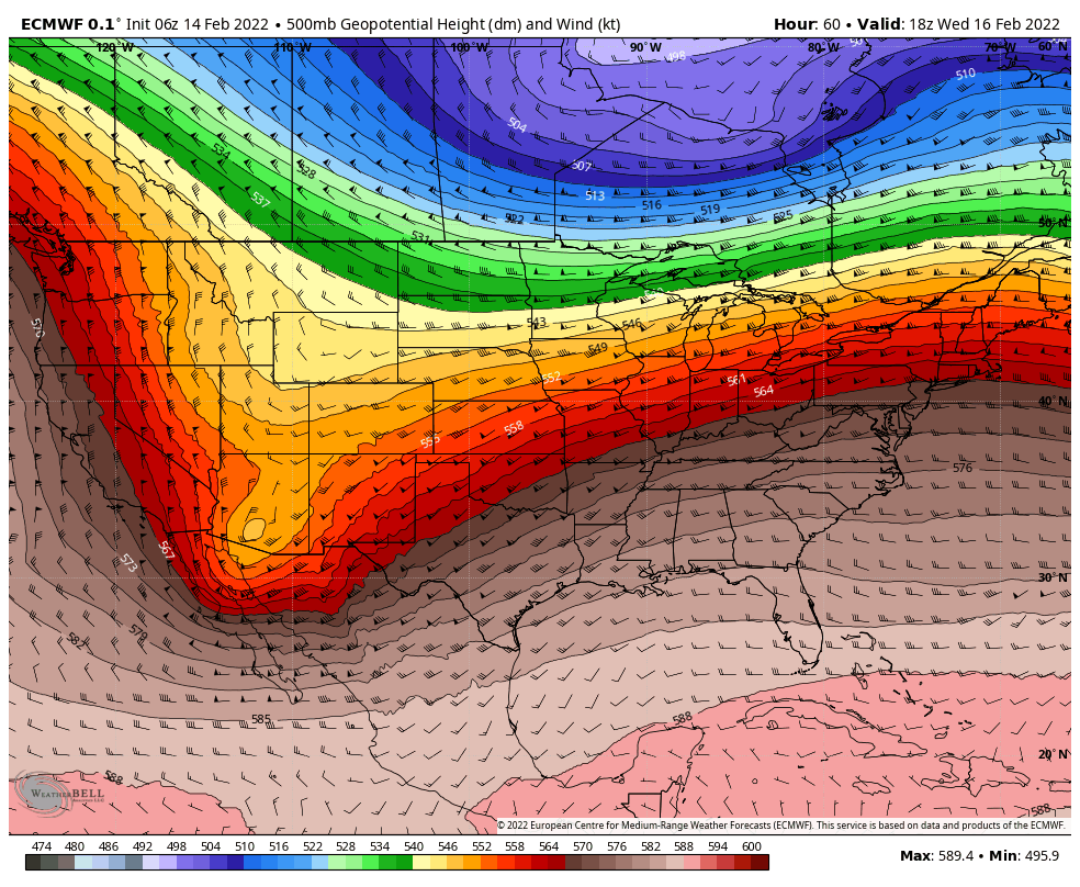
Models show good agreement on a piece of energy breaking off of the main part of the jet stream and diving South across the desert Southwest through the middle of the week. As it moves across Arizona, New Mexico and eventually Colorado it gets stretched out a bit and weakening. The kicker here is look at where the GFS has it ending up...
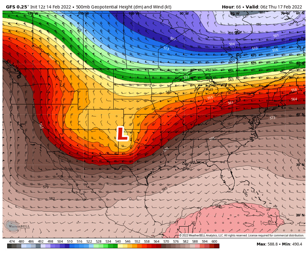 This is a favorable position for what we look for in larger snow storms, but before you get excited... there's a couple of points to take note of here:
- Models show the storm weakening as it moves across the Panhandle region
- Models also show the main energy moving a bit too far South
- The storm is currently projected to move through the area fairly quickly, this will minimize the time the storm hangs over the area and produces snow.
As with all storms like this, these details can drastically changed base on how fast the storm moves, what track it takes and a few other variables.
What do the Models Say?
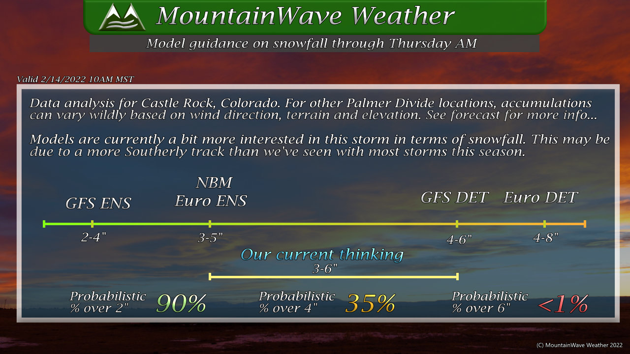
I've compiled a graphic based on model data this morning as to what models are thinking in terms of snowfall for Castle Rock and surrounding areas. Here's a quick breakdown:
- GFS Ensemble: 2-4"
- Euro Ensemble and National Blend of Models: 3-5"
- GFS Deterministic: 4-6"
- Euro Deterministic: 4-8"
The tricky part here is the models are still wildly swinging between higher snowfall amounts and lower snowfall amounts with each run, this means they have low confidence on the track, intensity and overall snowfall associated with this storm.
What this means simply is the forecast as it is right now is low confidence, maybe low-medium at best. You should expect this to be a fairly fluid forecast with considerable changes until we get a better handle on how this storm will set up and where it will move.
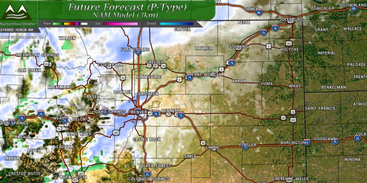
Preliminary Snowfall Forecast - Palmer Divide
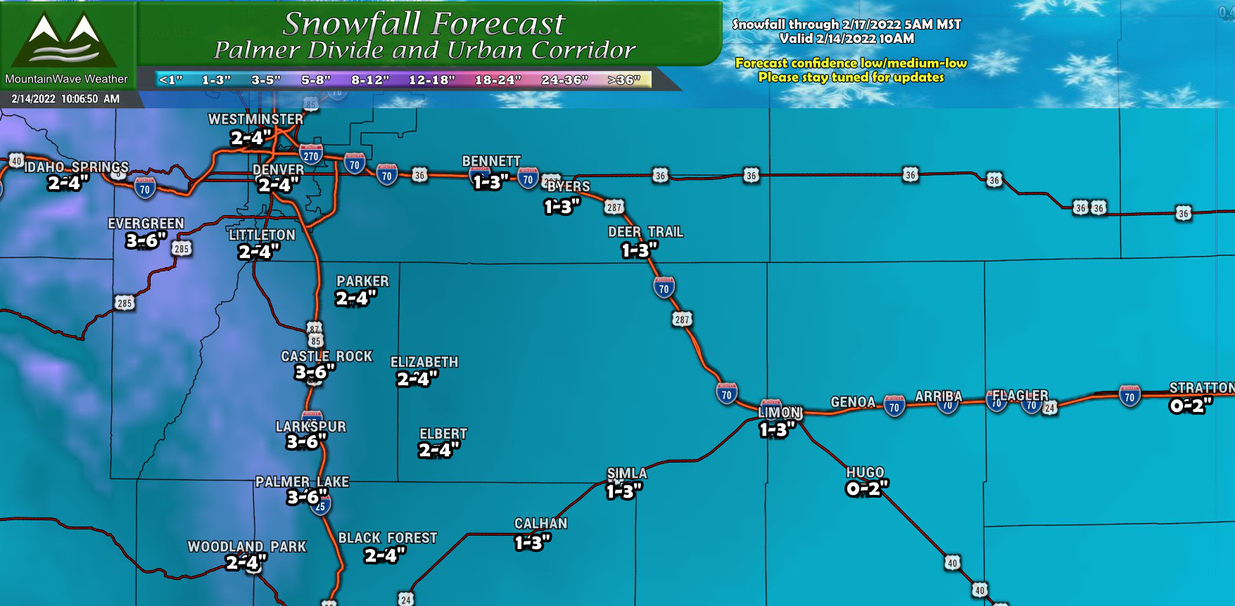
This is where I see snowfall as of right now, I'd like to point out that things are still swinging pretty wildly with this particular storm so make sure to keep up to date with posts as I release them. There is at least a decent chance these snowfall amounts could bump upward or downwards as we get more data in... for now just use them as a reference.
Upslope favored areas are again highlighted for the highest snowfall amounts - this includes Castle Rock, Larkspur, Palmer Lake, Monument and points further West. With upslope like this those areas West of I-25 are more generally more favored so that's something to keep an eye on.
As you move further East, snowfall amounts will drop off a bit... if these seems similar to the past couple of storm setups, you would not be wrong for seeing the similarities.
Let's Talk About Timing
Another aspect of this forecast that is still up in the air, initially we saw this as a late Tuesday/ early Wednesday/ clear out by Wednesday night type of storm. This morning's data sees the storm arriving later on Wednesday so that would put late Wednesday morning, all of Wednesday afternoon, evening and overnight into play.
I don't have good details on exactly when the snow gets here and when it becomes intense just yet... but for now
Wednesday looks like the day to watch for snow/travel impacts
Summary
I wish I had better details for this storm at this point in the forecast, but the fact is that with the models seeing a lot of "bounce" and a few other big question marks to still be answered; the data you see with this post is the latest and best we have.
This forecast will be very fluid, so make sure to keep up on the latest details. If I had to wager a guess I'd say we are looking at the potential for at least a "medium" sized storm midweek, but my confidence in any gauge of a small or big storm will remain low until better data comes in.
Stay tuned!
