Setup (SPC Outlook)
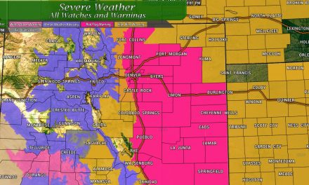
Here’s the current Storm Prediction Center Day 2 – categorical outlook for Friday. As you can see, it’s mainly the Northeastern portion of Colorado under the slight risk area, but the marginal area extends all the way back along the front range and the Palmer Divide. This why even though the risk for severe storms will be low in our neck of the woods, it won’t be zero. Anything that forms in the green has a small chance of becoming severe – meaning large hail and gusty winds with a small tornado threat as well. Storms in the yellow area will have a slightly better chance of becoming severe due to better moisture and wind shear… the tornado threat is slightly higher in that area as well, but low overall – generally around 2% in a 25 mile radius.
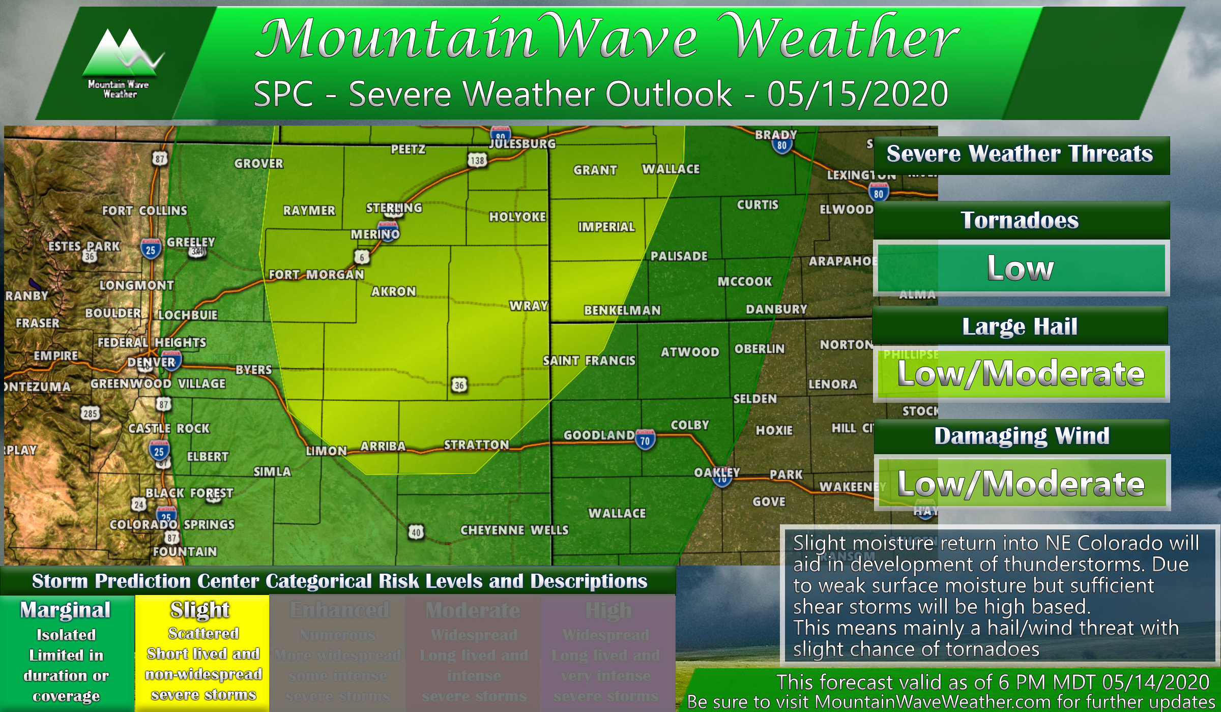
Remember what these thunderstorm threat colors mean!

Locations/Timing
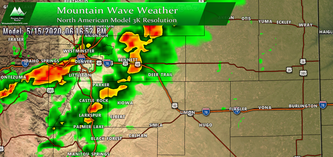
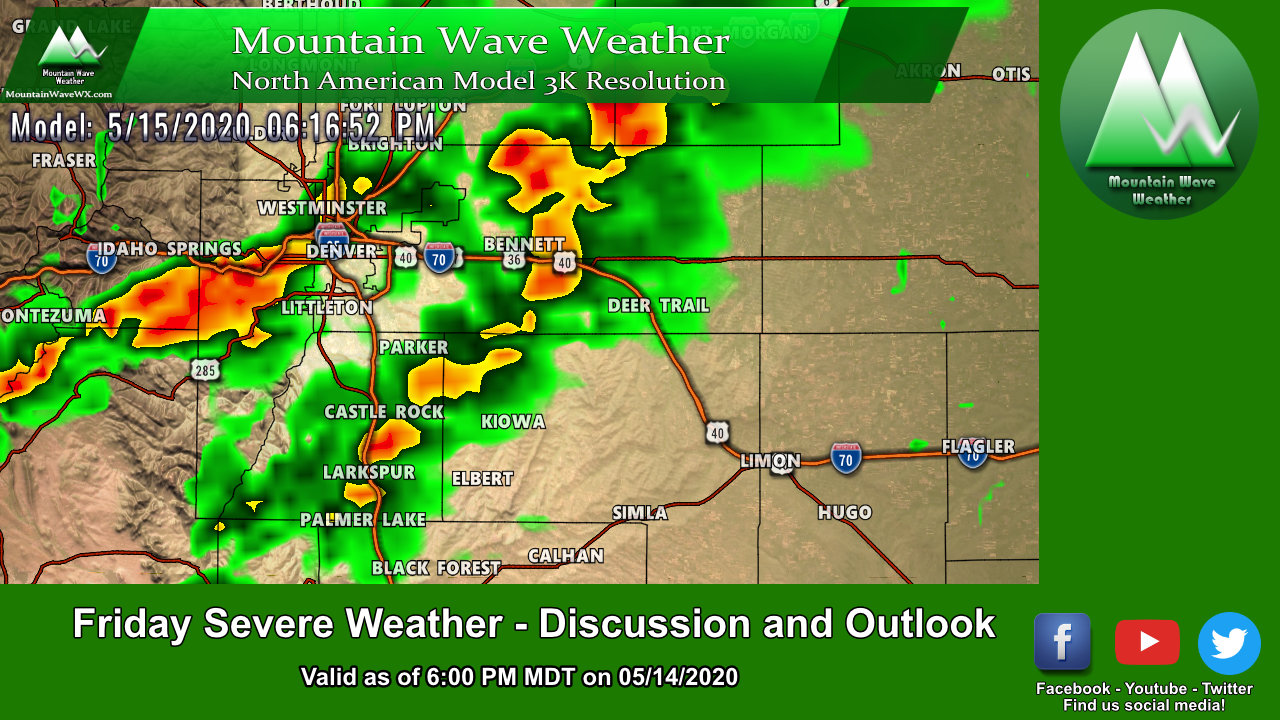
Nam3K model snapshot around 6PM tomorrow (05/15/2020)
- Thunderstorms will begin to build along the foothills after 12PM… we don’t expect severe storms along the foothills initially, but stronger storms could initialize in some areas
- Expect thunderstorm activity between 2PM-7PM along the Palmer Divide, most storms won’t be severe but there is a chance a couple could reach severe levels
- Eastern sections of the Palmer Divide and out onto the plains will see thunderstorm activity later in the evening and into the overnight hours
As with any forecast, expect these times to shift slightly with new data on Friday morning. Be sure to check back here for any updates, we’ll keep you ahead of it!
Primary Threats
The threats should be pretty uniform across the outlook area, due to high temperature/dewpoint spreads forecast by most models we would expect storms to be elevated, especially the further West you go. This means:
- Primary threats with these storms will be large, damaging hail
- Elevated severe storms can also cause strong outflow, meaning gusty winds could cause damage out of stronger storms
- A tornado threat exists (low at this time) mainly East of I-25 and North of I-70 (see the yellow slight threat area on the SPC map above) – any tornadoes that form should be relatively weak (landspout tornadoes) and short lived
- Due to terrain and dynamics we can’t rule out a weak tornado along the Palmer Divide – but the probability is very low (generally less than 2% in a 25 mile radius of a point)
What to Watch For
Here’s a few things we will watch for and discuss in a Friday morning update if needed:
- Does moisture stretch further West? If so we’d expect the Slight risk area expanded Westwards towards the I-25 corridor
- Temperature/Dewpoint spreads – the further apart these are the more likely storms will be elevated and more of a hail/wind threat
- Cap – this will help determine thunderstorm initialization… if the cap breaks early we could see a linear set of thunderstorms (this diminishes the tornado threat but can enhance the hail/wind threat)
Lots of fun stuff to keep an eye on over the next 24 hours… hopefully many areas see some beneficial rain out of these storms tomorrow. The long range pattern still looks dry and many places are already starting to get crispy!
Make sure to check back here for a Friday morning update if necessary!

Trackbacks/Pingbacks