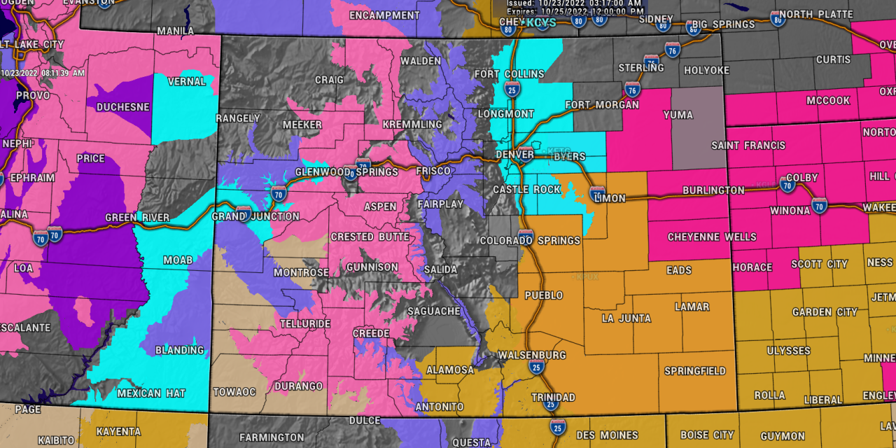
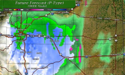
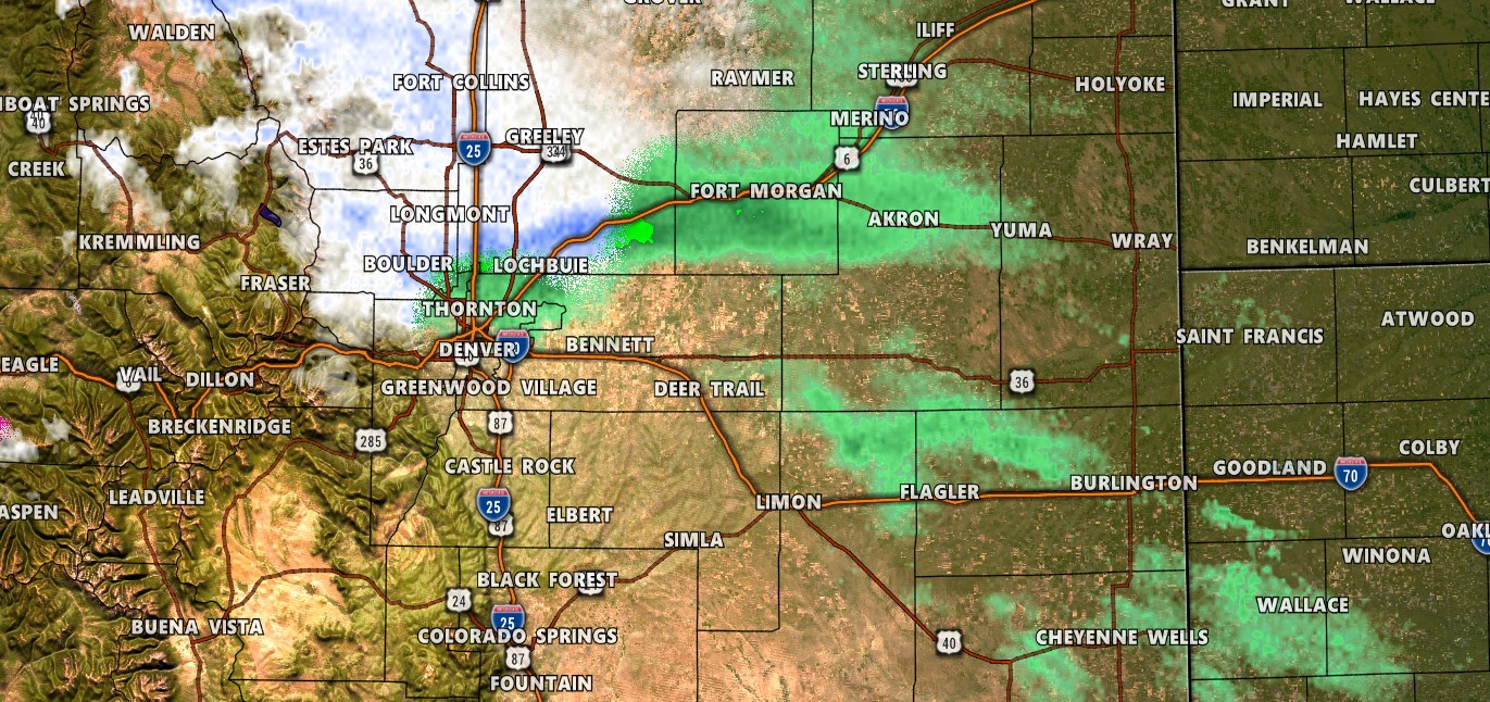
Quite an active weather day on tap for much of Colorado, but what type of weather you see will largely depend on where you are. Regardless, there’s a whole truckload of weather alerts up for the state on Sunday – let’s get to those then we will get to storm impacts.
Weather Alerts
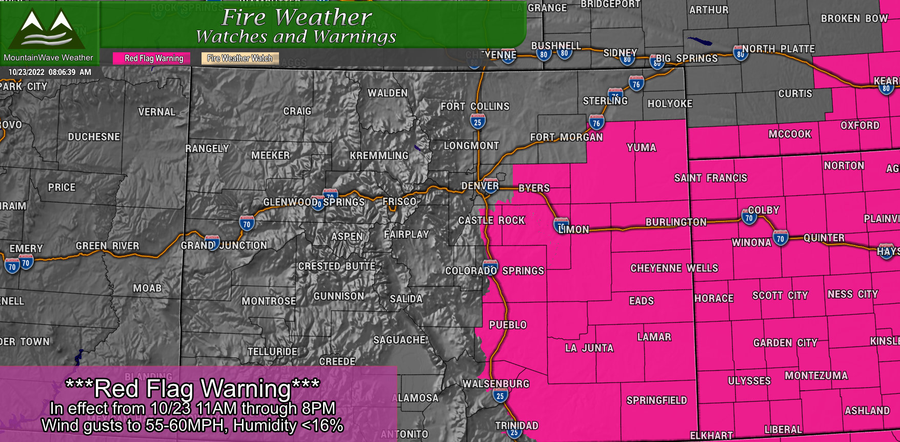
Red Flag Warning
…REMAINS IN EFFECT FROM 11 AM THIS MORNING TO
7 PM MDT THIS EVENING FOR WIND AND LOW RELATIVE HUMIDITY FOR
PORTIONS OF EAST CENTRAL AND NORTHEASTERN COLORADO
* Timing…11 AM Sunday morning until 7 PM MDT Sunday evening.
* Winds…West 30 to 40 mph with gusts up to 60 mph.
* Relative Humidity…As low as 15 percent.
* Impacts…There is high potential for rapid fire spread and extreme fire behavior.
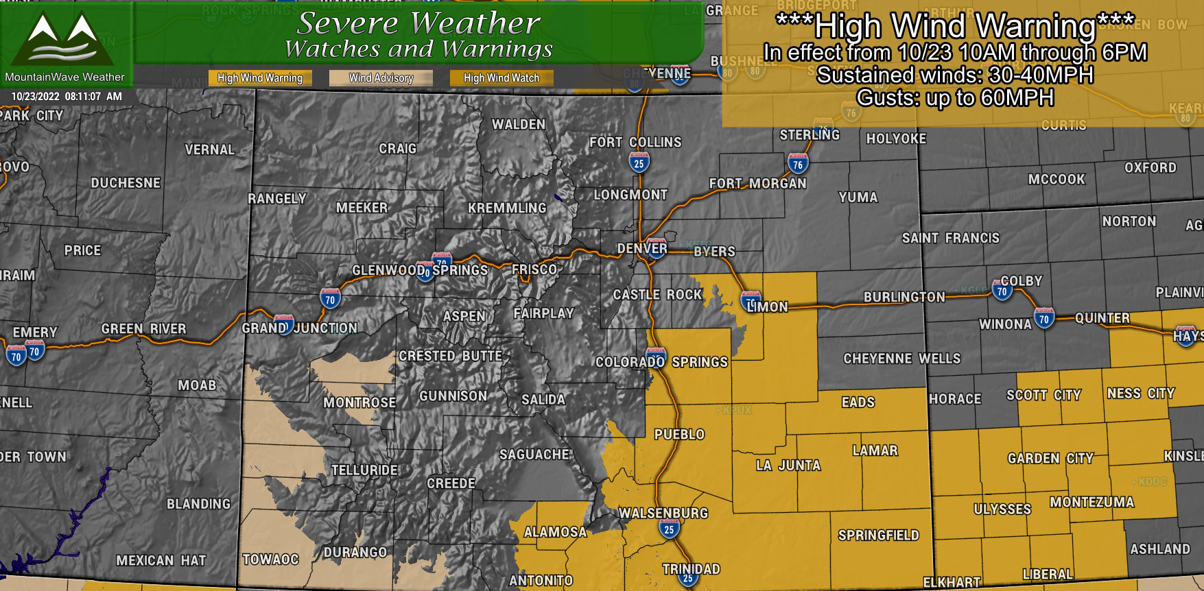
High Wind Warning
…IN EFFECT FROM 10 AM THIS MORNING TO 4 PM MDT
THIS AFTERNOON…
* WHAT…Southwest winds 30 to 40 mph with gusts up to 60 mph expected.
* WHERE…Elbert County Below 6,000 feet in elevation, Limon, Southern Sangre de Cristo Mountains, the Wet Mountains, and Pueblo, Huerfano and western Las Animas, Crowley, Otero, Eastern Las Animas, Bent, Prowers, Baca and El Paso County.
* WHEN…From 10 AM this morning to 6 PM MDT this afternoon.
* IMPACTS…Strong winds will likely lead to rapid fire growth of any new fire. Blowing dust will reduce visibility to less than a quarter mile in places.
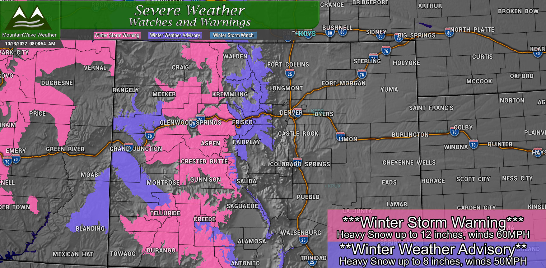
…REMAINS IN EFFECT UNTIL 6 AM MDT MONDAY
* WHAT…Heavy snow above 8500 feet. Total snow accumulations of 6
to 12 inches with locally higher amounts. Winds gusting as high
as 60 mph.
* WHERE…Grand and Battlement Mesas, Gore and Elk Mountains/Central Mountain Valleys, West Elk and Sawatch Mountains, Northwest San Juan Mountains, Southwest San Juan Mountains, Elkhead and Park Mountains and Flat Tops counties
* WHEN…Until 6 AM MDT Monday.
* IMPACTS…Travel could be very difficult. Widespread blowing snow could significantly reduce visibility.
Winter Weather Advisory
…REMAINS IN EFFECT UNTIL 6 AM MDT MONDAY…
* WHAT…Snow ongoing. Total snow accumulations between 2 and 8
inches. Winds gusting as high as 50 mph.
* WHERE…Rocky Mountain National Park and the Medicine Bow Range, and The Mountains of Summit County, the Mosquito Range, and the Indian Peaks. Western Mosquito Range Above 11000 Feet, Western Chaffee County Between 9000 and 11000 Feet, Upper Rio Grande Valley and Eastern San Juan Mountains Below 10000 Feet, and the Sangre de Cristo Mountains Above 11000 feet.
* WHEN…Until 6 AM MDT Monday.
* IMPACTS…Plan on slippery road conditions.
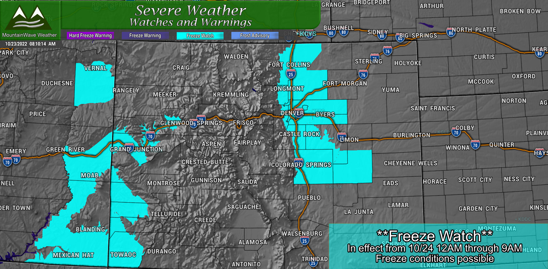
Freeze Watch
…REMAINS IN EFFECT FROM LATE TONIGHT THROUGH MONDAY
MORNING…
* WHAT…Sub-freezing temperatures as low as 27 possible.
* WHERE…Fort Collins, Boulder and the western suburbs of Denver, Denver, Castle Rock, Greeley, and Byers.
* WHEN…From late tonight through Monday morning.
* IMPACTS…Frost and freeze conditions could kill crops, other
sensitive vegetation and possibly damage unprotected outdoor
plumbing.
Phew!
Sunday, What to Expect
- Mountains
- Storm is in full force
- Expect heavy snow and strong winds all day and into Monday
- Travel not recommended in Winter Storm Warning areas
- Difficult travel likely in Winter Weather Advisory areas
- Plains
- High winds are likely
- Blowing dust and sporadic power outages will be possible – along with scattered tree damage
- Lightweight and high profile vehicles may experience travel difficulties, especially South and East of Denver
- Scattered light rain showers are possible late in the day and into early Monday morning
Monday, What to Expect
- Mountains
- Storm will being to move out later in the morning
- Icy roads and slick spots will remain
- Winds will die down later in the day
- Plains
- Winds relax
- Storm moves out by late morning
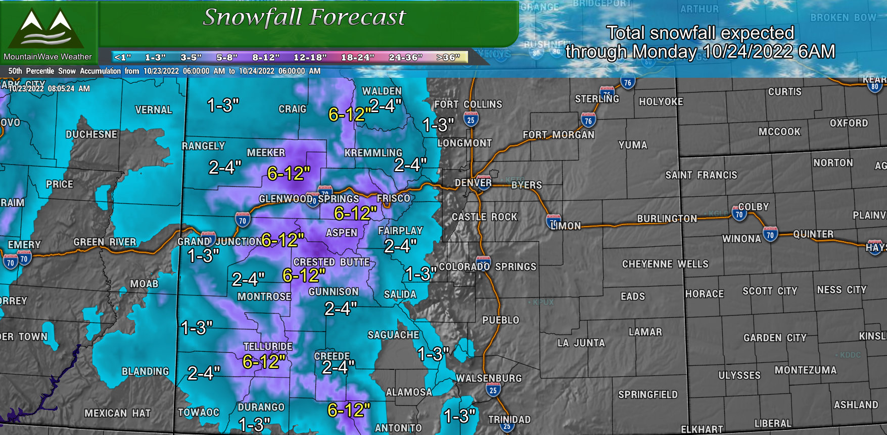
Updated Look at Snowfall
Only minor adjustments to the snowfall forecast, mainly tweaking amounts in a few areas. Overall, the message is still the same; the mountains
will get the bulk of the snow from this storm system with very little moisture making it across the divide and onto the plains. The purple areas (6-12″ of snow possible) will see the worst of the travel conditions throughout the day on Sunday. Many mountain areas were already reporting snow as of this morning.
We’ll Keep an Eye on Things
Forecasting part of this storm is pretty much finished so we will just be communicating any alerts or any changes through this afternoon.
Long story short, don’t expect much moisture on the Eastern side of the state outside of a stray shower here and there… some select *lucky* areas at higher elevations may see a dusting of snow by Monday morning – but it doesn’t look widespread.

