A Quick Lesson on Drought
A lot of people often ask what exactly drought is, how it is measured and how it is determined and on what timeframes. The answer to this question is a bit complicated as many variables go into determining if any one specific area is in drought or out of drought conditions. I’ll try to break it down in case you’ve ever wondered.
Rainfall or snowfall alone cannot be used to determine drought status, this is why you’ll often hear me say a quick couple of days worth of rain won’t break us out of a drought – though many folks do seem to believe a week or two of wet weather is enough, this is inherently false.
Here’s what the U.S. Drought Monitor uses to classify drought:
Palmer Drought Severity Index
The longest tool used in monitoring and classifying drought – the Palmer Drought Severity Index is calculated using a combination of temperature and precipitation data along with variables such as the crop moisture index and soul moisture data. It is best used to classify drought status for a location or region on longer time scales and is slower to move areas in or out of drought. The PDSI takes into account such things as;
- Have temperatures been warmer or cooler over a long period of time – this can help determine whether evaporation takes place more quickly or more slowly
- Has precipitation been above or below normal – this determines if precipitation has been occuring in a region and affects the next two variables
- Is there enough moisture in the soil for crops – healthier crops with higher moisture supply allow for evapotranspiration which returns moisture back into the air as fuel for showers and thunderstorms
- How wet or dry is the soil – as above, wetter soil allows moisture return into the atmosphere but also takes longer to warm up.
(In Colorado we love wet springs because it often means hotter temperatures are delayed until all of the moisture is “baked” out of the soil – as dryer conditions establish later in the summer we often see hotter temperatures.)
Climate Prediction Center Soil Model
This model run by the Climate Prediction Center takes observed precipitation and temperature and calculates soil moisture, evaporation and runoff
United States Geological Survey Weekly Streamflow Percentiles
This index gives us an idea how streamflow are doing – are they above or below normal? A lot of factors can go into this such as was snowpack above or below normal or if thunderstorms are occurring regularly to replenish rivers and streams.
Standard Precipitation Index
This parameter focuses solely on precipitation over a period of time vs probability of precipitation over various timeframes. This tool is often used to classify a drought’s beginning and end.
As you can see, drought is more complicated than “did we get a couple of big snow storms or has it rained a lot in the past few weeks.” This is the biggest misconception about drought I see in the public – it takes a substantial amount of time to get into drought and an equally substantial time to get out of it.
Now that we have the science-y stuff out of the way – let’s take a look at where Colorado is as of this week.
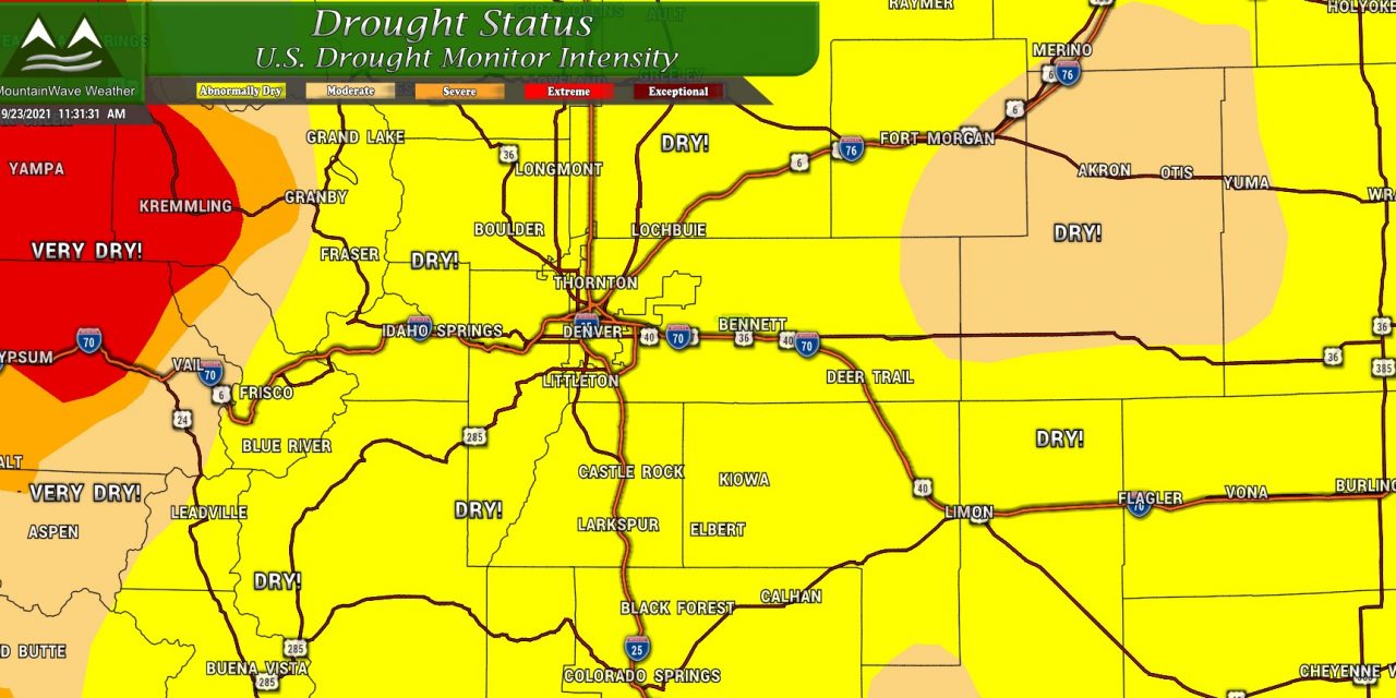
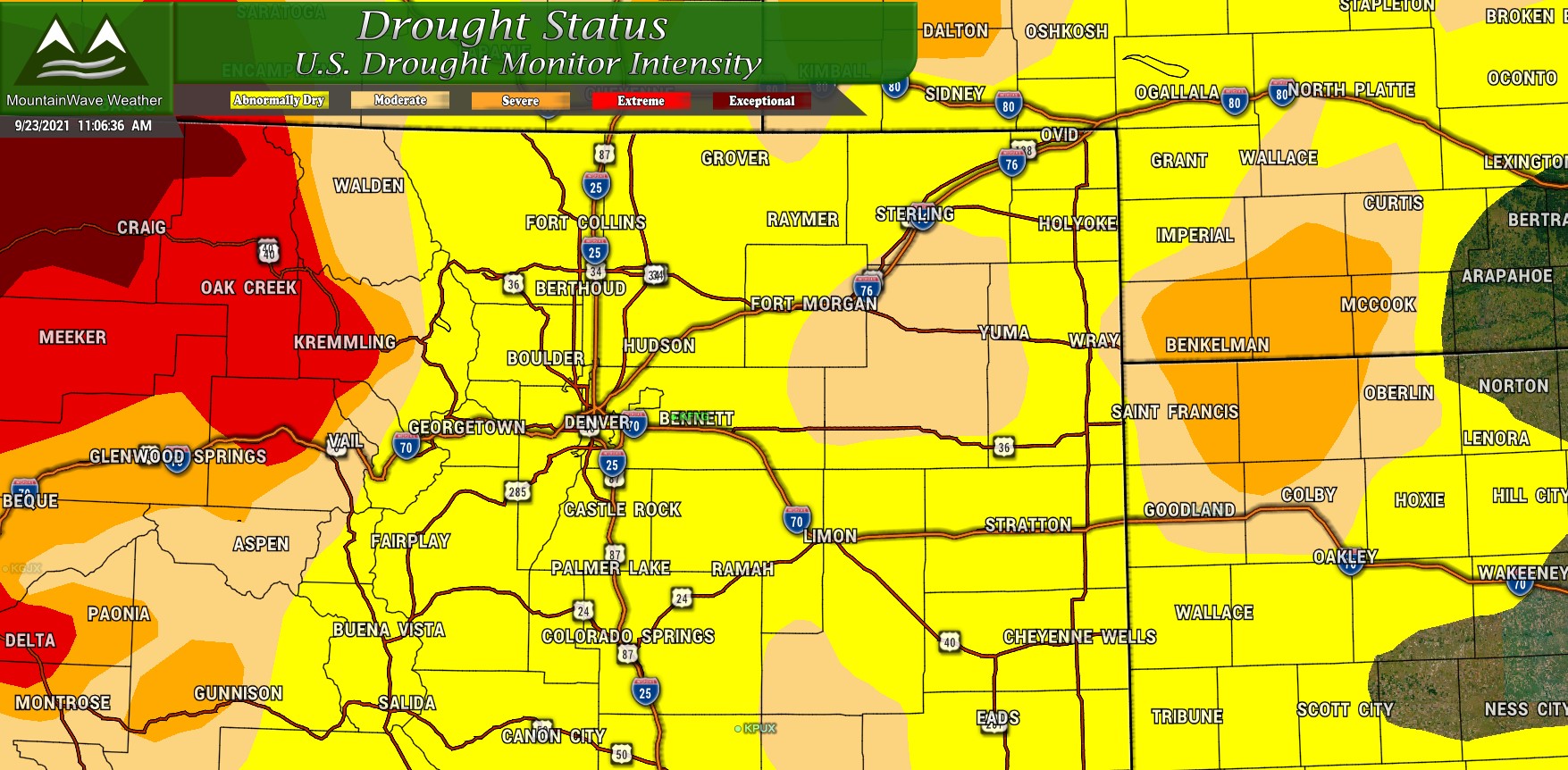
Colorado Drought Status
Here’s the latest drought status update for Colorado as of this week on 9/23/2021 (this data is updated weekly)
The biggest changes we’ve seen in the past few weeks is the re-introduction of drought status for much of Eastern Colorado. Much of the front range and plains is solidly back in the “abnormally dry” category with a few areas showing moderate drought conditions. We can chalk a lot of this up to the very warm conditions we had nearly all of August and for much of September combined with lower than average precipitation, a fairly disappointing monsoon and strong winds.
Summary: we are beginning to see the return to drought status for much of the state and I believe we will see the extension of more serious drought conditions in the near future. Remember a lot of variables used to calculate drought can lag by several weeks, so it’s possible a lot of locations are in more substantial drought status than their official classification shown here. We will keep a close eye on drought status over the coming weeks and pass along information as needed.
Colorado Drought Outlook (Fall 2021)
There’s a lot of good news/bad news when I look ahead at what we can expect in the near to medium term future when looking at what could become of our drought status.
The good news; the final part of September is expected to have a somewhat decent chance of above average precipitation.
The bad news: September is on average one of our driest months. This means we may not even actually see a whole lot of precipitation to end out September in the grand scheme of things.
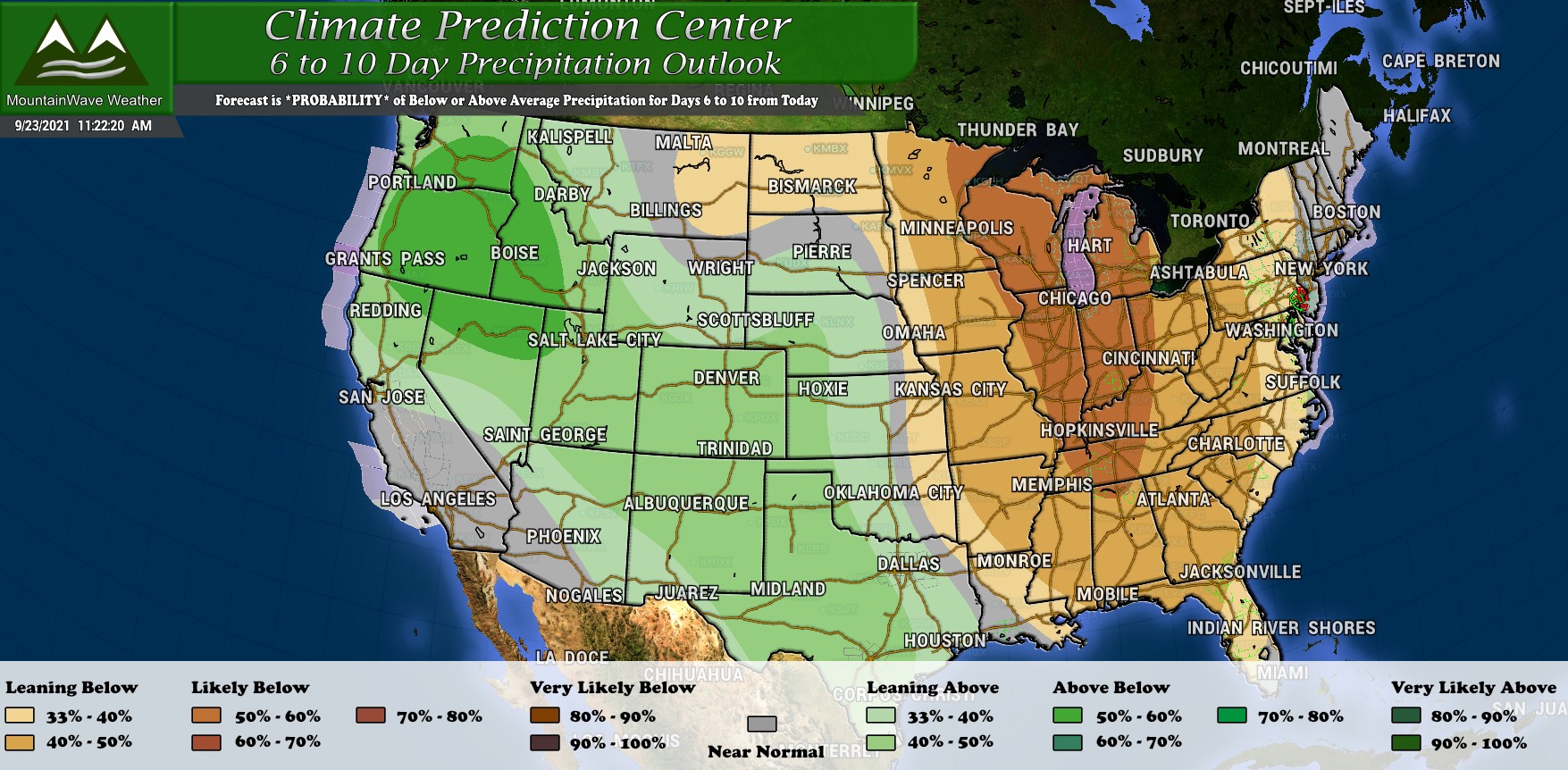
We will have to keep an eye out for any storm systems or weather pattern changes, but honestly I’m not super excited about a major weather pattern shift or even a random storm system or two changing the status qou for us anytime soon. If you asked me what the next 2 weeks would feature I’d say: overall fairly dry and warmer than average. A storm system may cool things off here and there and perhaps even bring some lucky areas a bit of rain. I don’t see an overall cooler or wetter pattern anywhere in our near future though.
Here’s the CPC’s thoughts on our drought status going from now through about the end of November:
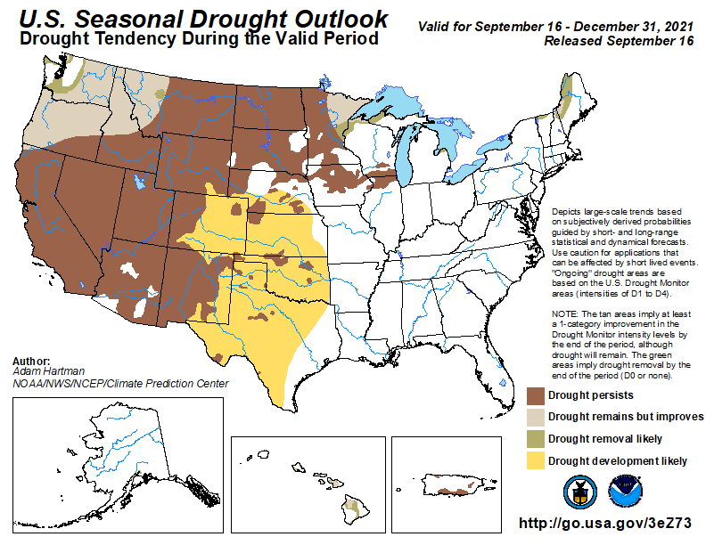
Summary: As I mentioned above, it is looking likely that Northeastern Colorado, the Front Range and Palmer Divide of Colorado extend their drought status throughout this fall. Anyone with vested interests in ranching, agriculture or any related industries would do well to begin preparing for these conditions as we move into fall and winter.
But What About Winter?
I’m working on trying to scope out what our winter may have in store for us. It’s a bit early on for details about that yet, but will have a post up once I’ve run through all my tools/data and have a forecast together. Stay tuned!


That’s a scary picture! Here’s hoping the lord will step and give us rain here and the western states,