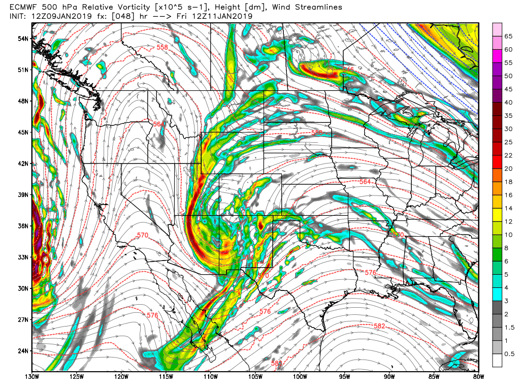
Euro Model: 500mb upper air + vorticity
Our weather pattern will see a bit of a wobble to end the week out… we say wobble because the overall longer term will be warm and dry. However, just because we are stuck in a longer term warm/dry pattern doesn’t mean we won’t see any snow or storm systems at all, it simply means it will be hard to get excited about any of them.
The later part of this week will be no exception; the EURO model above is picking up on a trough developing to our Southwest by Thursday and moving into the region late on Friday. Given the positioning and energy shown with this storm, snowfall is looking more and more likely, but again we can’t get too excited about it with the data we are seeing just yet.
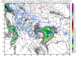
Euro Model: mean level sea pressure and precip type
The EURO MLSP (pressure) and precip outlook shows that storm staying far enough away so that we don’t see a lot of impact from it. Notice on Friday morning how it has a bit of precipitation over the front range and Palmer Divide, but not a whole lot in the way of intensity. This storm falls apart a bit as it moves through Southern Colorado and then reorganizes substantially as it moves East. If this is giving you a sense of deja vu from the last storm, you’d be right.
The other issue with this storm may be the temperatures…
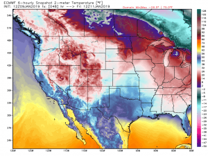
Euro Model: 5AM Friday 1/11/2019 temperatures
This snapshot of the temperatures from 5AM saturday shows air temps along the front range generally in the upper 20’s to low 30’s (obviously there are variations with microclimate and elevation) but temperatures like that are marginal for snow sticking to the ground… especially with how warm we have been for the past week.
What to Plan For
I’m not showing snow totals right now because this far out and with the model disagreement, I don’t think they’re very accurate. Here’s what we are becoming more confident on though;
- Timing
- Possible late Thursday into early Friday
- Maybe some impact through the day Friday
- Impact
- Impacts look minor with the data we are seeing right now
- Colder temperatures look likely
- Wind may be a factor, we’ll keep an eye on this
- Snow accumulation looks light at this time, we will keep an eye on this as well.
So nothing to get too excited about yet, just be aware that we are watching some sort of storm coming together around the late Thursday to early Friday timeframe.
We will keep an eye on it and be sure to pass along any updates, stay tuned!
