Do We Have a Storm?
Lot’s of model analysis in this post as that is where we are at in the forecast process for this weekend’s storm. While we are optimistic that this storm may finally bring a bit of snow to the front range for the end of the week, there’s still a lot of moving variables that could drastically change that snowfall forecast. We will continue to monitor those shifts through the next few days and post updates as needed.
Storm Analysis
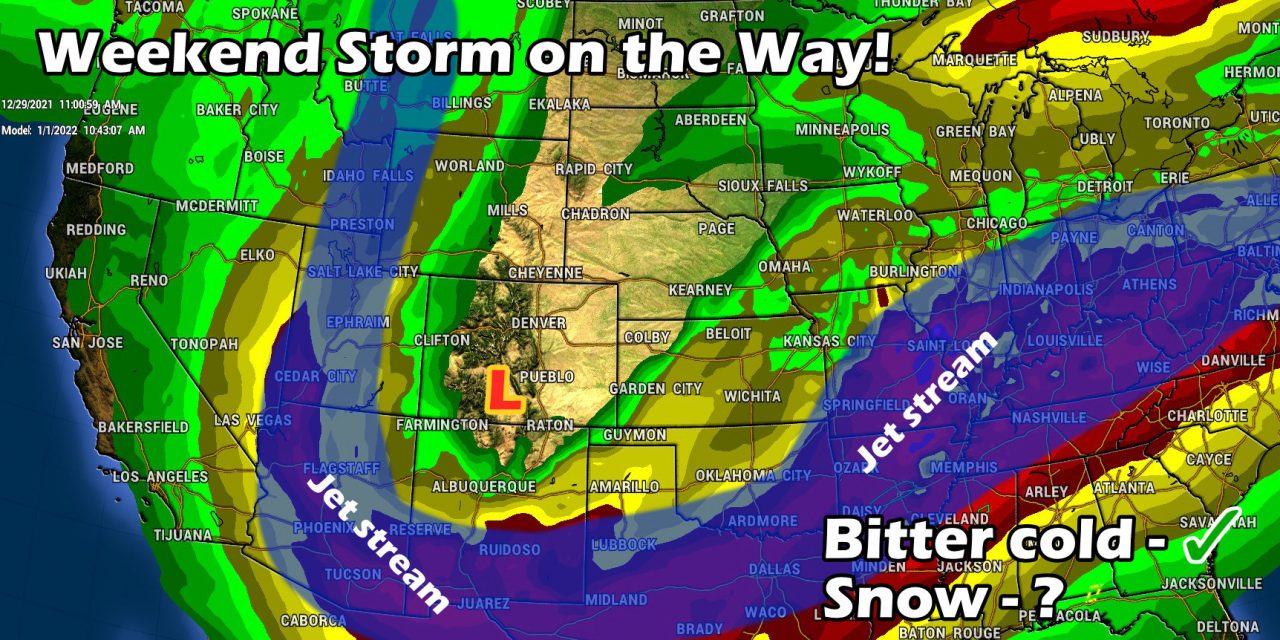
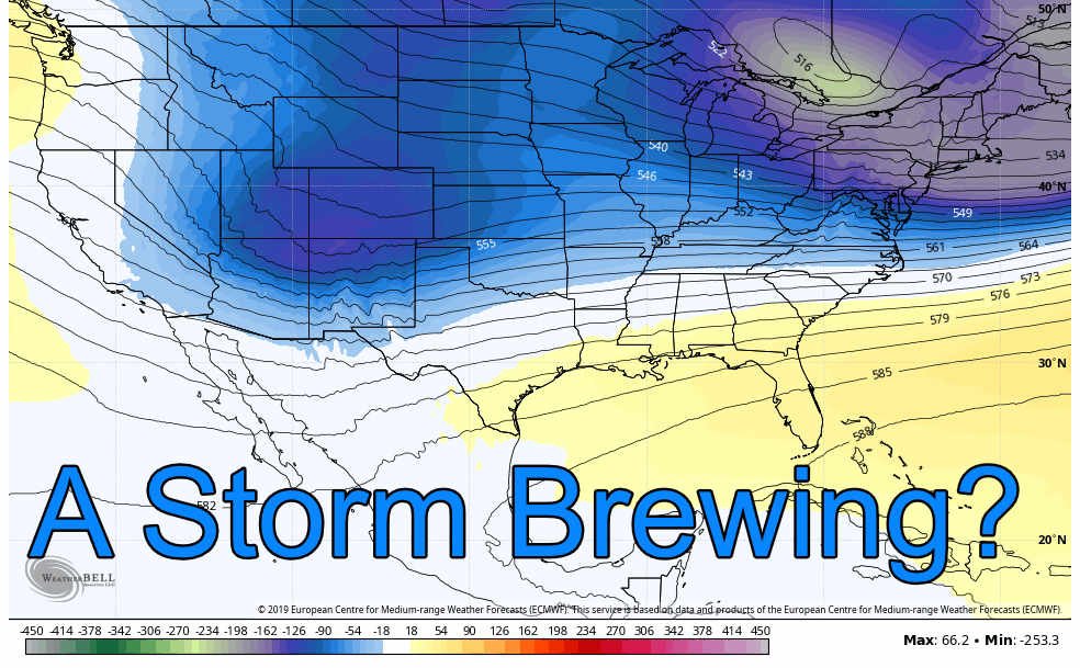
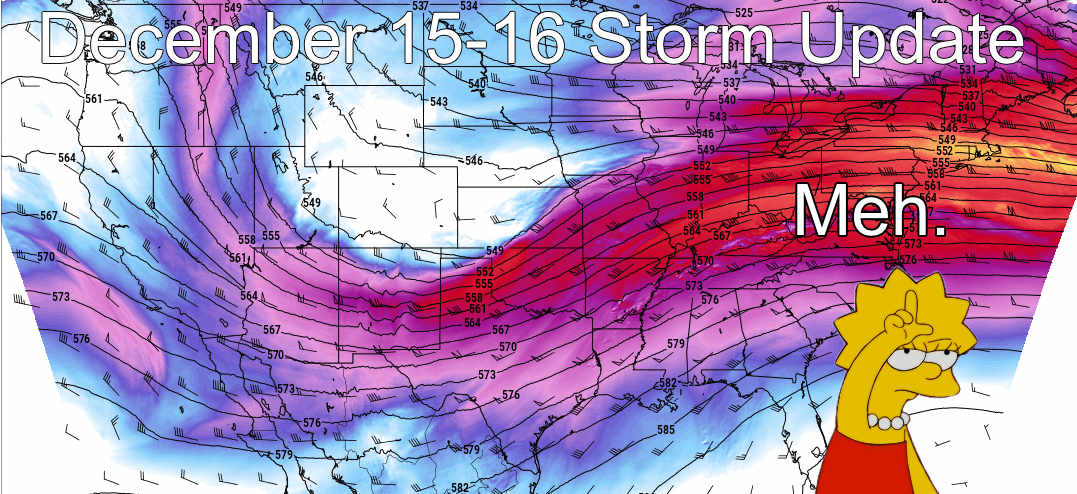
Models show a decent sized upper level trough approaching the area late Friday and into Saturday. If models verify on this, it would be the first decent sized trough to swing far enough South to bring snow to the front range this year so far. This means we have higher confidence on the bitter cold temperatures that we will likely see for the weekend and gives us a bit more confidence that we will see snow along the front range – but exact totals are still very much out of focus for now.
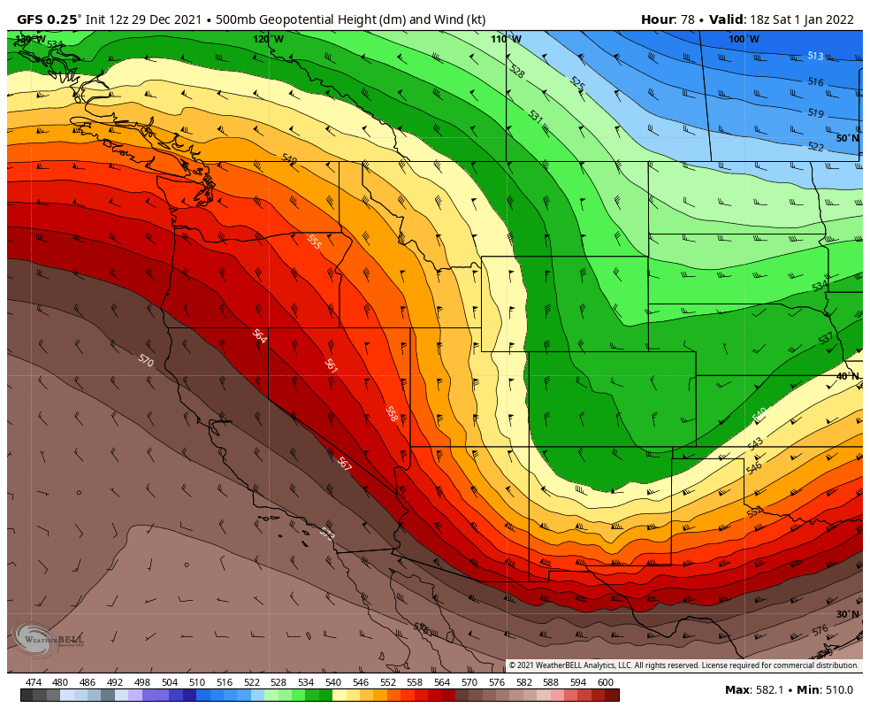
Here’s the trough positioning for Saturday morning per the GFS:
The GFS brings the low across Eastern Colorado early in the day on Saturday. The positioning is further South than many storms we’ve seen this year which is a good sign for possible snowfall, even though there is still time for the storm track to wobble and shift. Like many storms we’ve seen this year, the track will determine ultimately what we do or do not see. If this track shifts Northward at all, we would be looking again at more wind and less snow.
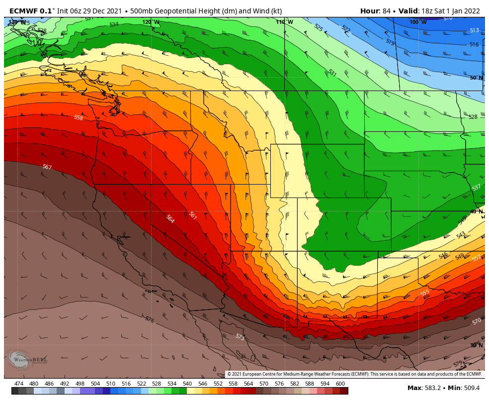
and the Euro’s thoughts:
Decent agreement on the storm track with the GFS, it does bring the low through a bit later so that would be one thing to keep an eye on in terms of timing. Just like the GFS above, we would watch this storm track with the Euro on each run to see if the storm track trends further North or South. Northward would mean less snow and more wind while a Southerly track could mean more snow.
Arctic Blast on the Way!
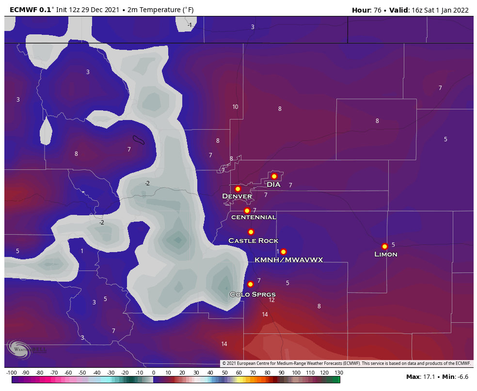
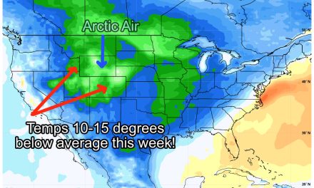
There is higher confidence overall in the forecast that we see colder temperatures late Friday and into Saturday. Models still disagree exactly how cold it will get, but suffice to say it will be much colder than what we’ve experienced so far this fall and winter.
The Euro below shows forecast temperatures around 9AM on Saturday.
Models do also suggest that this cold air doesn’t ‘linger very long with many showing us back in the 30’s and 40’s by Sunday, so that’s something to be happy about if you’re a warmer weather lover!
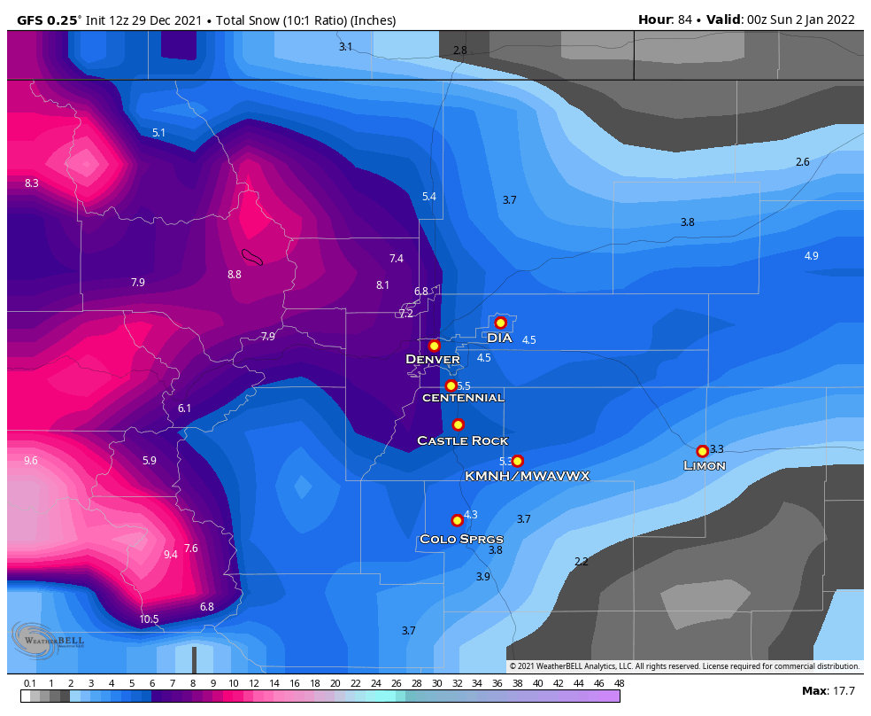
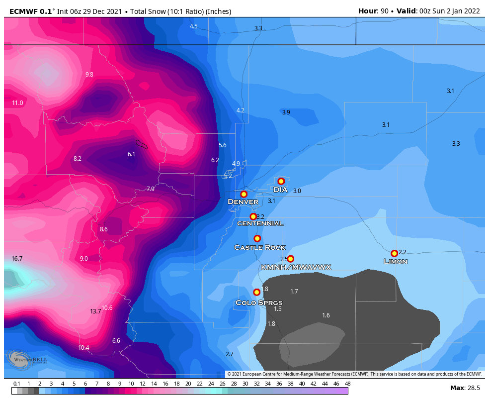
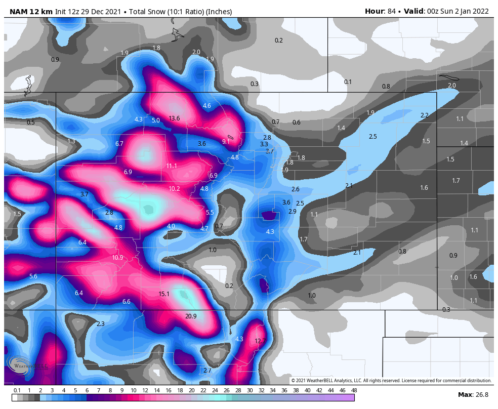
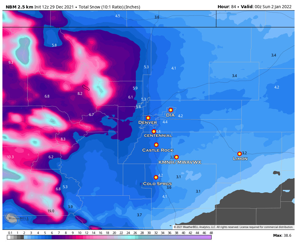
What Do the Models Say? (Snowfall)
Friendly reminder, models are not a forecast so don’t take any of these as such! A forecast is built upon model data, experience and knowledge of local topography, climatology and tendencies.
GFS
Euro
NAM (not completely in range yet!)
National Blend of Models
Summary From Today’s Data (valid 11AM 12-29-2021)
Timing for Snowfall
This will most likely change a bit, but for keep an eye on Friday PM – Saturday PM for snowfall with the data we see today.
Timing for Arctic Temperatures
Friday daytime highs look to be in the upper 30’s to low 40’s for most areas. The cold settles in by Friday evening with very cold temperatures likely Friday night and into Saturday morning.
Possible Impacts
The cold temperatures could overcome the roads and cause snow/ice/slush accumulation.
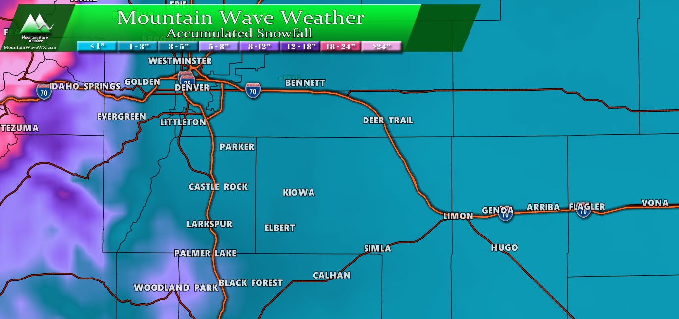
Expect some travel impacts across the front range and Palmer Divide if the forecast stays on track for cold temps and accumulating snow.
As always, this forecast is fluid and there is still a couple of days for things to shift. I’ll pass along any updates as we get new data in… for now just be prepared for cold and possible snow late Friday and into Saturday.

