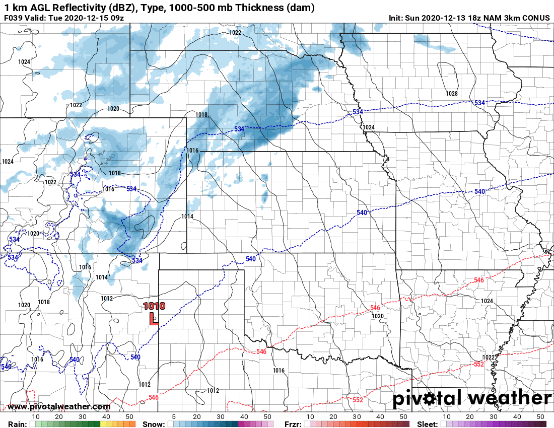
A significant storm is on track to affect Colorado's eastern plains, front range and Palmer Divide regions late Monday into Tuesday. If you've followed along with us the past 5 or so days you recall how we have continuously mentioned that this would be a storm worth keeping an eye on... here it is. There's a lot of data in and a decent amount of information to cover so let's get started!
As with every forecast, we expect to make additional tweaks to timing, snowfall amounts and impacts based on further data. Keep a close eye on the forecast through the day Sunday and Monday.
Watches/Warnings/Advisories
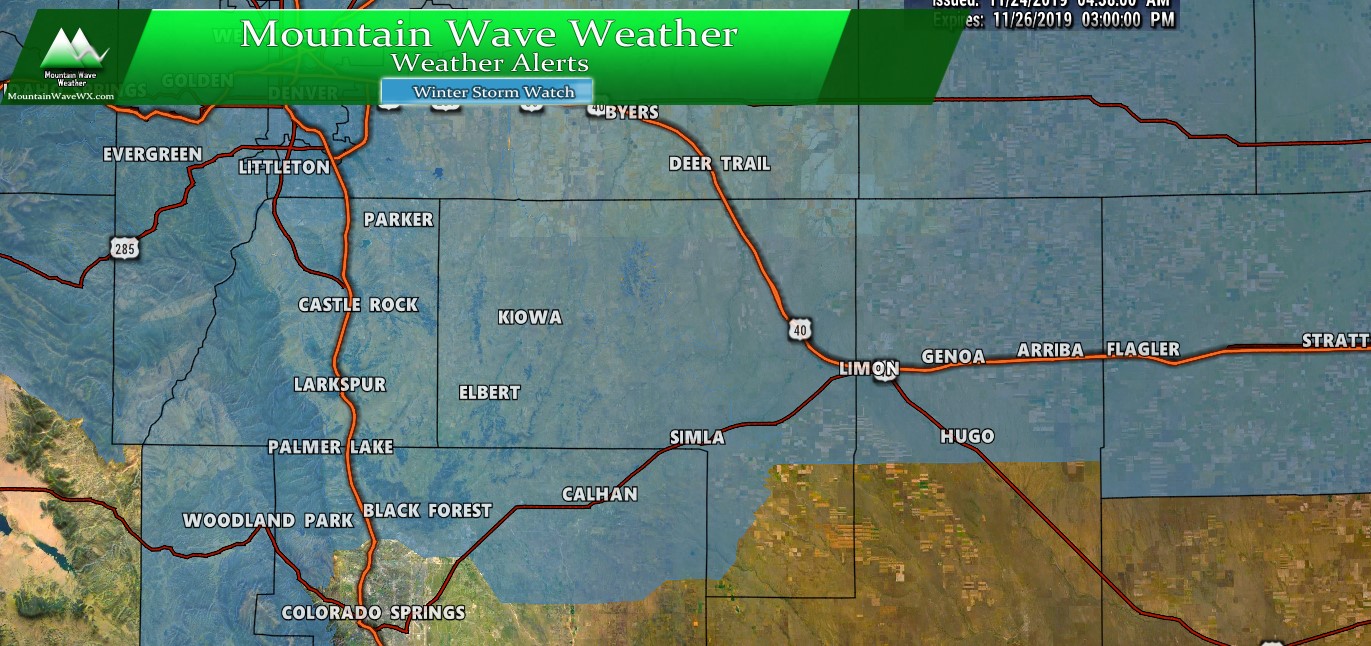
Winter weather highlights for Palmer Divide/ South Denver region as of 8AM 11/24/2019
***Winter Storm Watch***
...WINTER STORM WATCH IN EFFECT FROM MONDAY EVENING THROUGH
TUESDAY AFTERNOON...

* WHAT...Heavy snow possible. Total snow accumulations of 6 to 14
  inches possible. Winds could gust as high as 35 mph.

* WHERE...Northeastern Colorado including the Denver metro area.

* WHEN...Snow will spread from northwest to southeast Monday
  evening. The snow may be heavy from late evening into Tuesday
  morning. Conditions will improve Tuesday afternoon.

* IMPACTS...Travel could be very difficult to impossible,
  especially during the day Tuesday. Blizzard conditions are not
  expected, but drifting snow may slow clearing of roads on
  Tuesday.
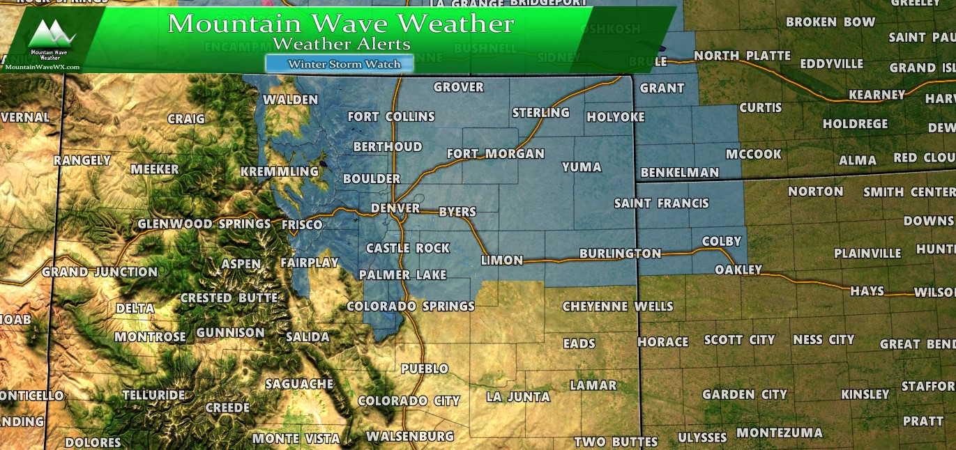
View of Winter Weather Highlights as of 8AM 11/24/2019 for Colorado, Western Kansas and Western Nebraska.
Remember: A Winter Storm Watch is issued when medium or better confidence of a high impact weather event is possible. A watch means the public should begin making preparations in advance of the storm. During a Winter Storm Watch the public is encouraged to monitor the latest forecasts for updates on this situation. Consider alternatives to traveling later Monday night and during the day Tuesday.
Full watch/warning details are available here.
Forecast/Hazards/Timelines/Impacts (The Need to Know Planning Stuff!)
Impacts
Snowfall/Travel Impacts
- Denver metro and areas North and East - expecting potential high impact event
- Areas South of Denver/ Palmer Divide - expecting a medium to high impact potential
- Heavy snow will be likely late Monday and into Tuesday
- Winds will be strong enough that localized Blizzard conditions will be possible
- Airport delays and cancellations will be likely late Monday and early Tuesday - check with your airline!
- School cancellations and delays will be possible Tuesday - check with your school district!
Timing
- Monday
- Current modeling suggest snowfall begins during the evening hours on Monday
- Still some uncertainty as to whether the Monday evening commute is impacted or not... stay tuned on that.
- Later evening into overnight Monday, snow will become heavy across many areas
- Travel is not recommended overnight Monday into Tuesday morning
- Tuesday
- Heavy snow is possible Tuesday morning
- Expect high to severe impacts to Tuesday morning commute
- Snow looks to taper off towards Tuesday afternoon/evening hours
- Wednesday
- Storm exits the area
- Still expect lingering impacts depending on how long storm sticks around on Tuesday and how much snow accumulates
Please note: there is growing confidence of a high to severe impact with this storm. We will continue to monitor weather data and models this afternoon.
Snowfall - Preliminary Forecast
These are the preliminary snowfall amounts we are going with at this time. Again, due to the fluid nature of any storm system, this forecast may change several times over the next 24 hours. Please continue to check back on our site or Facebook for any forecast changes.
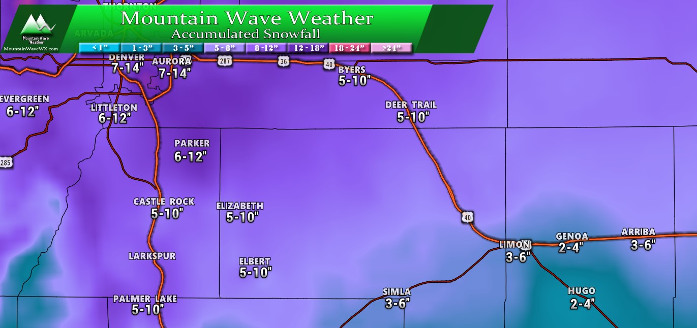
Palmer Divide Region - Expected snowfall through Tuesday (11/26) evening
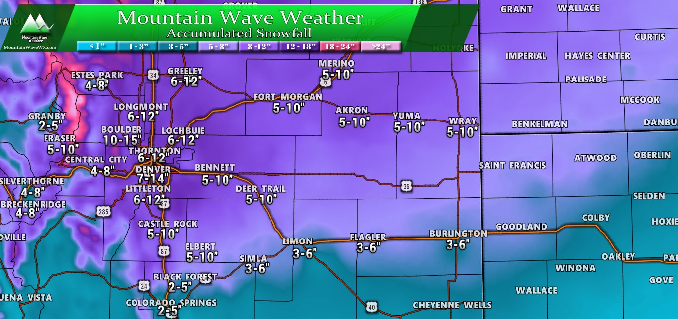
NE and Central Colorado - Expected snowfall through Tuesday (11/26) evening
Summary

Travel will likely not be recommended late Monday and a good chunk of Tuesday. If you do have to go out, please make sure to have these items in your car. This information can save your life!
Looks like we may have a decent sized storm on our hands. As with any storm of this nature, there's always a chance it could shift last minute and fall apart, but the models have been unusually consistent their agreement so we can't ignore that fact. Any forecast is an evolution though so continue to stay tuned for updates through the day Sunday.
We will be sure to pass anything along that warrants it.

Trackbacks/Pingbacks