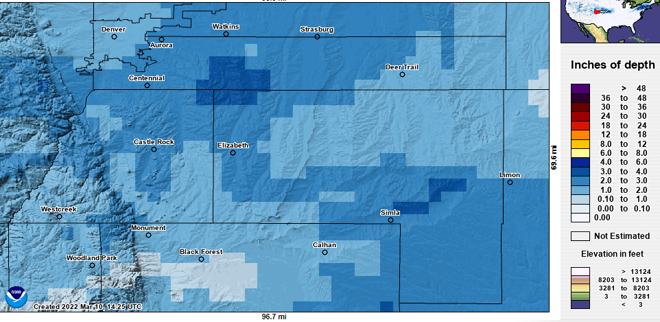
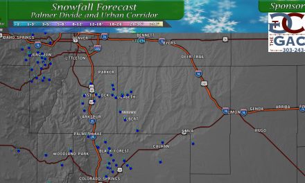
Last night’s storm is moving out throughout the day today with dryer and warmer weather expected for the weekend. Here’s a quick look at how snow totals ended up and how the forecast verified.
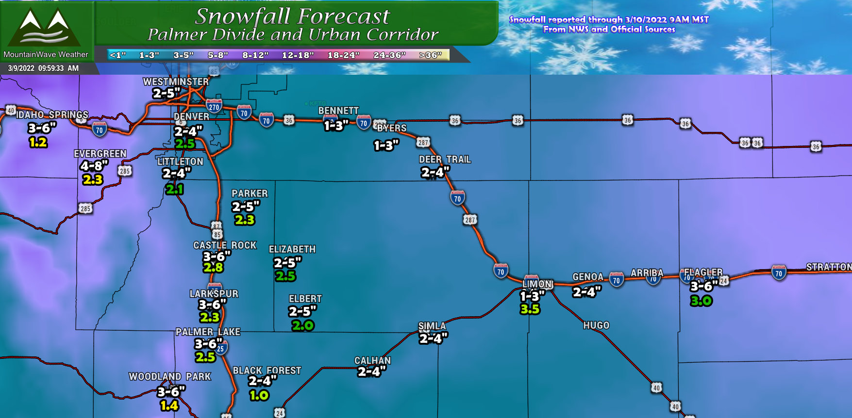
Not a spot on forecast but most areas were pretty close to the snowfall amounts I forecast – this storm was more of an underperformer for many areas rather than an overperformer. This was communicated pretty well though as we made sure folks knew there was lots of uncertainty around the snowfall aspect of this forecast. This is the case whenever you are relying more on the jet stream and banded lift for your snow rather than an upslope type storm.
The rule of thumb for these types of storms is most areas end up on the lower range of the forecast or underperform with a few isolated geographic areas overperforming. In this storm’s case, nearly all areas did not realize anywhere near the top of their range for snow potential.
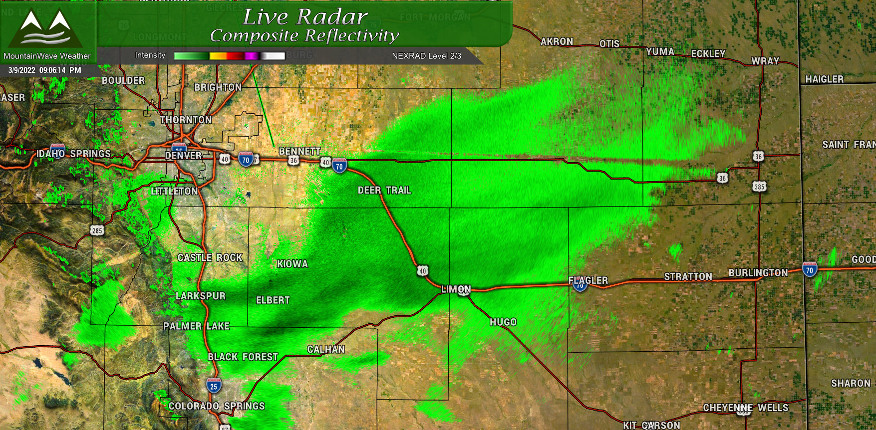
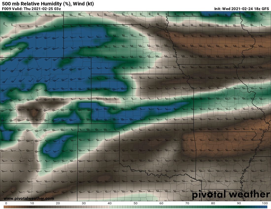
A look at the radar last night around 9PM showed the heaviest snow bands had moved South and Eastwards. Areas outside of this heavier pocket of snow saw snow taper off quicker than expected – with little lift left the rest of the night, only scattered/light snow showers remained overnight making for less snow accumulation. Even the areas under the snow band didn’t amount to much though as it weakened and moved off to the East pretty quickly.
