This Week – More Warm and Dry Weather
We won’t spend a whole lot of time talking about this week because it will mainly be more of the same – warm and dry days followed by cool crisp nights. It is fall in Colorado after all!
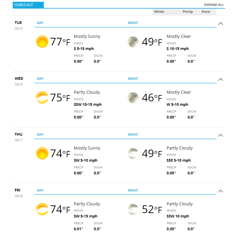
Expect temperatures in the mid to upper 70’s along the Palmer Divide during the day and lows in the upper 40’s to low 50’s.
As you can see, we don’t expect any freezing weather conditions this week.
Next Week – Keeping an Eye on Interesting Changes
While we will see a bit of a cooldown as we move into the weekend the bigger change will come to start next week into the middle of the week.
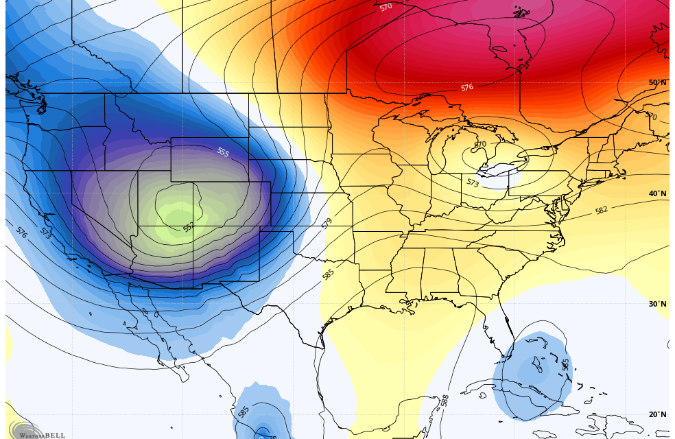
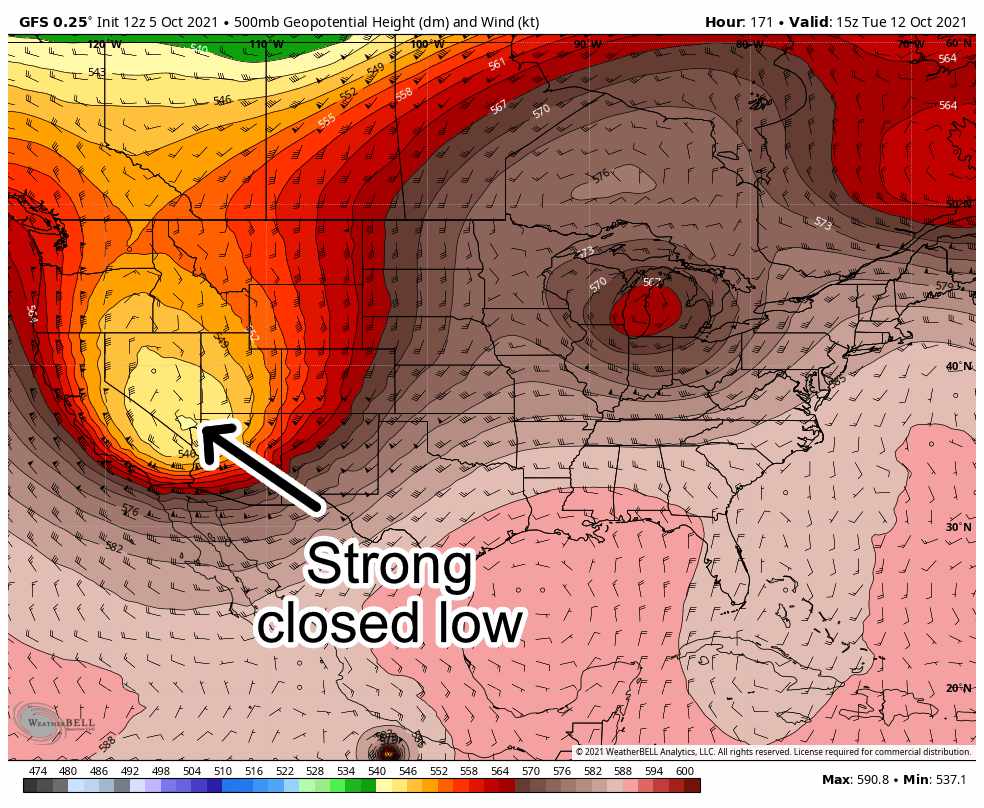
A strong area of low pressure will cut off to our West on late Sunday and into Monday. As it moves Eastwards on Tuesday, this is when we could see a potential impact with this storm system.
What does this mean for Colorado?
- Mountains will very likely see shots of snow into next week
- Colder air will move down from Canada
- Some areas East of the Continental Divide COULD POSSIBLY see some snowfall accumulation next week – we won’t know details about this for several more days
Here’s a quick reminder of a few things about a forecast for any type of storm system or pattern changes:
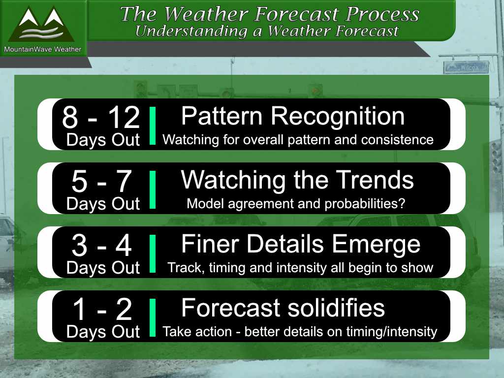
With this storm we are currently in the 7-8 day timeframe so I want to make a couple of points because people seem to forget these things:
- At this time we cannot predict who sees snow or how much with any decent degree of accuracy
- We will not know yet when this storm system gets here, what track it takes or how intense precipitation will be
- Even specific temperature forecasts are still subject to significant change at this point
The reason I bring this up again is a lot of folks are asking me things like; “when will the snow start?” “How much snow will fall at my house?” “When’s this massive October snowstorm getting here?”
Anyone giving you snowfall totals or locations at this point in the forecast timetable is either incompetent, trying to generate clicks or revenue or has some ulterior motive.
Summary
Here’s the long story short on this storm system. It will impact us in some way next week at some point between late Sunday and Wednesday. We don’t yet know who sees snow and to what degree.
This is nothing to get too worked up about as of yet – this storm system and forecast is still in the “wait and see” phase.
We will keep a close eye on it and provide updates throughout the week as needed. Expect there to be significant changes to the forecast for the next several days – we will do our best to filter out that “noise”

