Monday – Severe Weather Threat
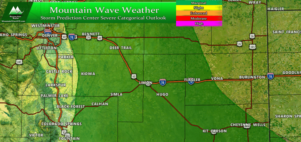
The marginal risk for severe weather is mainly East of the I-25 corridor with main threat being hail and wind. Can’t rule out a widely scattered brief tornado though!
A marginal risk for severe weather exists for a corridor extending from East of Denver and the Douglas County Line out into Elbert County, Eastern El Paso County and towards Eastern Colorado. Thunderstorms are expected to form after 2PM today and anything forming in or around these areas could be strong or become severe.
Primary Threats
- Large hail
- Strong winds
- A slight tornado risk exists (see graphic below)
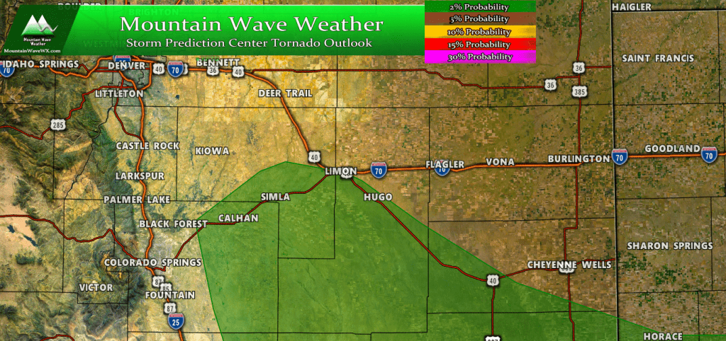
Just because you’re not in the exact threat area is not reason to let your guard down. Anywhere along the Palmer Divide could see a spin up or two where storms form on Monday. Keep your eyes up!
The tornado risk today is small (about 2% probability) and mainly covers the area in Southeastern Elbert County and Eastern El Paso count extending towards Southeastern Colorado. Shear, instability and lift enhanced by terrain means tornado formation will be possible in this area. We are not expecting widespread tornadoes along the Palmer Divide or in Colorado today though.
Tuesday – Thursday – Cold with Rain and Snow Chances
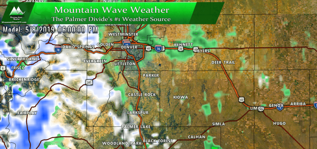
A complex and rather slow moving storm system will begin to affect the region on Tuesday and looks to last through Thursday. As with a most of our storm systems this time of year; the whole gambit is possible. Everything from severe weather to moderate rain to accumulating snow is a potential outcome from this storm.
This storm system features a nice double whammy of cold air moving in from the North and moisture moving in from the South. As many of you know, where exactly these features set up will mean all the difference between rain vs. snow and how much moisture we see in general. The good news is, models have consistently favored the Palmer Divide region with a healthy dose of terrain induced upslope meaning we would see a healthy dose of moisture.
That being said, the big question still remains around the snow. Will we see any and how much (if any) will accumulate. Here’s a couple of model thougts:
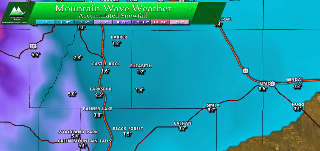
WPC outlook like the last storm shows pretty low accumulation amounts overall. Generally in the 1-3 inch range for most areas along the Palmer Divide with slightly heavier amounts to the West in the higher elevations of the foothills.
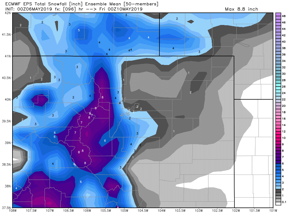
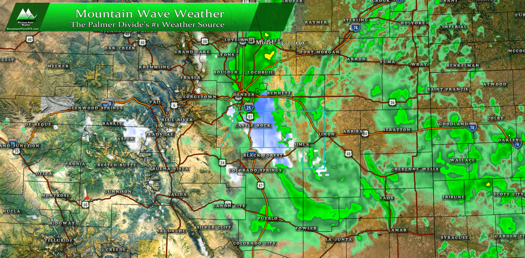
The EURO is a bit more bullish on snow, considering it’s accuracy when it has slightly higher amounts it’s definitely something to take note of. We will be watching this model closely over the next 24-48 hours to see if there are any up or downtrends on snow accumulation.
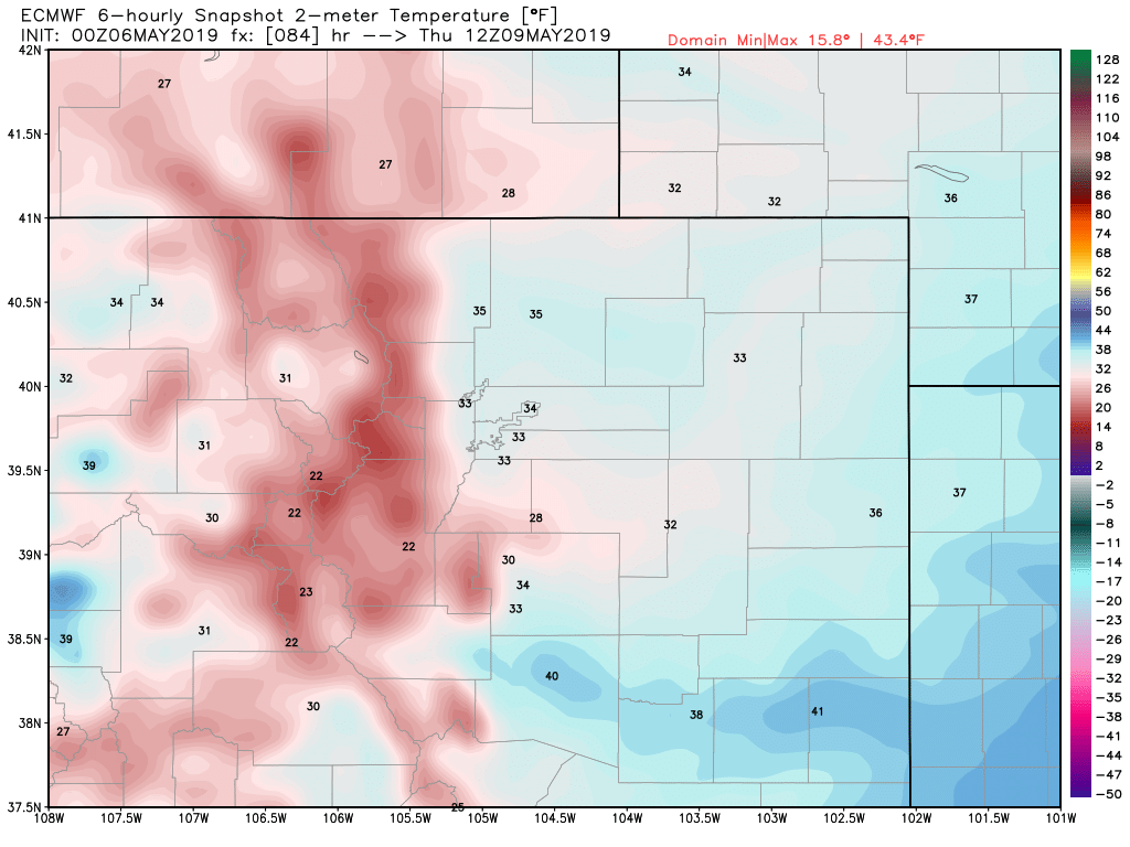
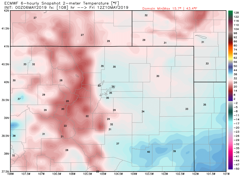
The biggest story with this storm may not be the snow, but the temperatures!
Keep in mind, the images above come from the Euro; it’s a low resolution model so doesn’t take into consideration small local microclimates and terrain. It is possible some areas could end up colder than shown above.
Summary
All in all, a very active weather week ahead… but as we all like to say- we need the moisture. Doing some of the data in April; it actually ended up drier than average along most areas of the Palmer Divide. We will need to continue getting periodic wet storms to keep things from getting too crispy! The good news is there is a pretty pronounced wet pattern for the next several weeks and possibly even extending well into summer.
We’ll keep an eye on the storms this afternoon and the bigger colder one later this week and be sure to pass along any updates!


