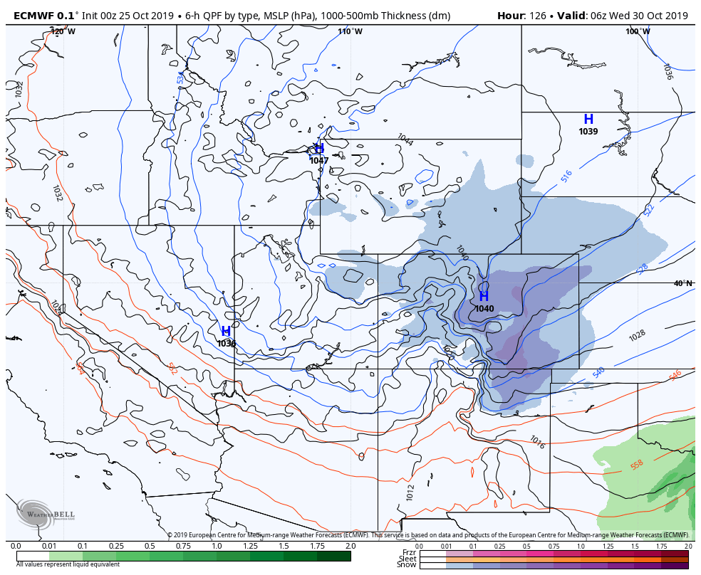
There is no doubt the storm moving in this afternoon is a powerful one, there are two areas identified as higher impact areas that will see significant precipitation and even significant snowfall accumulations. The bad news is that models are coming into agreement (and as we suspected) that the Palmer Divide doesn't look likely to be in one of those high impact areas.
Here's the latest updates as of noon today:
Weather Watches/Warnings/Advisories
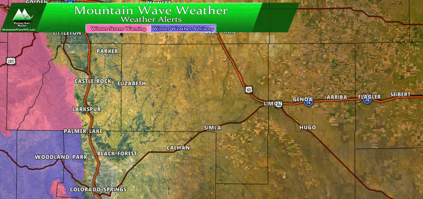
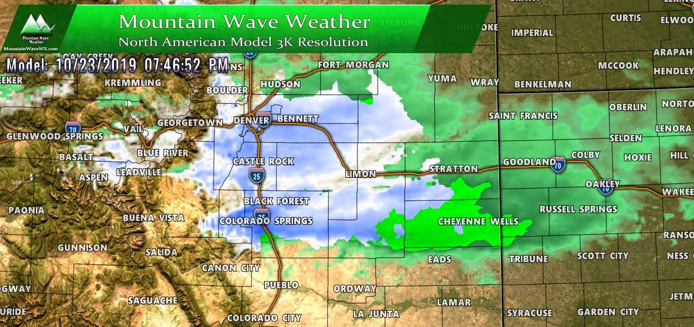
The only Palmer Divide areas in winter weather highlights today are extreme Western Douglas County and areas in the Western foothills West of I-25 and West of Colorado Springs.
The only winter weather highlights issued around the Palmer Divide region are shown above. Winter Storm Warning areas may see over a foot of snow, while Winter Weather Advisory areas will see a slushy/snow mix that may cause travel difficulties. With the data we are seeing and the latest NWS forecast discussion, we have no reason these warnings/advisories will be expanded to other areas along the Palmer Divide at this time. We will continue to watch that for changes though...
Expected Snowfall (through Tuesday 12PM)
*These are our forecast numbers and may not always match the NWS official forecast numbers*
- Castle Rock and surrounding areas
- 0-3 inches
- Parker, Lone Tree, Highlands Ranch areas
- 0-3 inches
- Elbert, Elizabeth, Kiowa
- 0-3 inches (will be watching higher elevation areas for slightly higher totals)
- Larkspur, Monument,Black Forest, Palmer Lake,
- 1-4 inches
- Woodland Park, W. Colorado Springs Foothills
- 5-10 inches (especially higher elevation foothills areas West of Colorado Springs)
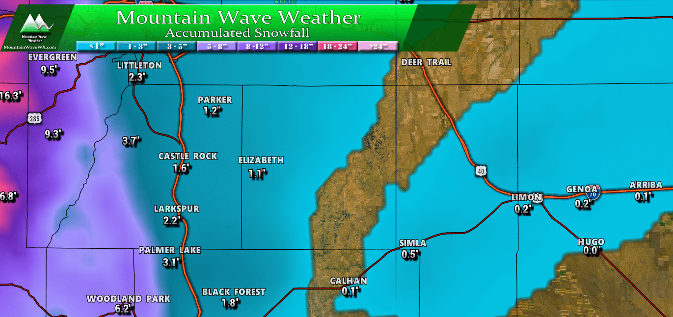
Expected snow accumulation totals through Tuesday 12PM - have been decreased slightly across the board for areas outside the foothills. Foothills and mountain locations; no changes made to expected snowfall from yesterday.
Timing
- Precipitation will likely as we move late into the afternoon and evening hours
- Any snow that falls earlier Monday may not accumulate much
- Highest chance for accumulating snowfall for the Palmer Divide looks to be the time-frame around 6PM Monday evening to Midnight.
- Snow may be heavy at times under convective snowfall bands Monday night
Potential Impacts
- Models have backed off for the potential for heavy snowfall bands, but they are still there.
- Will be watching the Monday evening and Tuesday morning commute closely for potential travel impacts
- Roads parked under convective snow or snowfall bands could see slushy and slick conditions
Summary
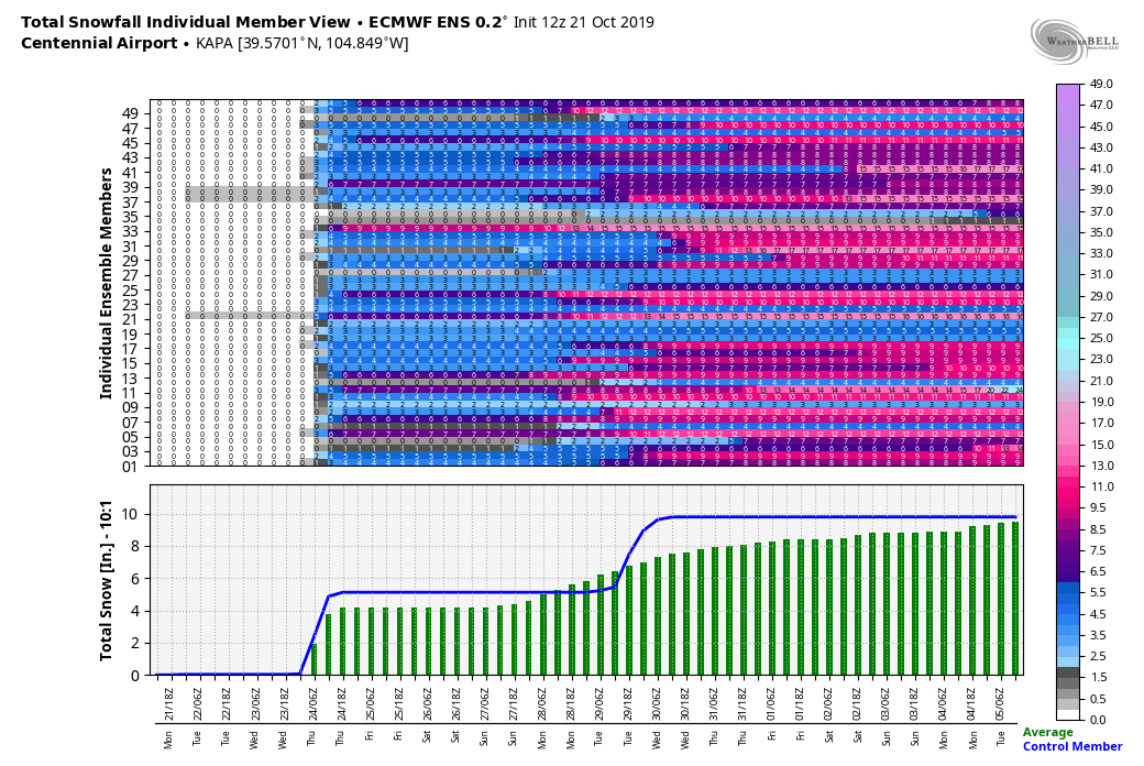
As with all these spring storms, they don't look too impressive on paper but still are worth watching closely. The major wildcard here is the temperatures, a shift of a couple degrees colder can drastically change how much snow we expect to see. Any shift to warmer temperatures means less than expected snow.
Another thing that doesn't impress me too much is the wind profiles with this storm, especially at the surface.
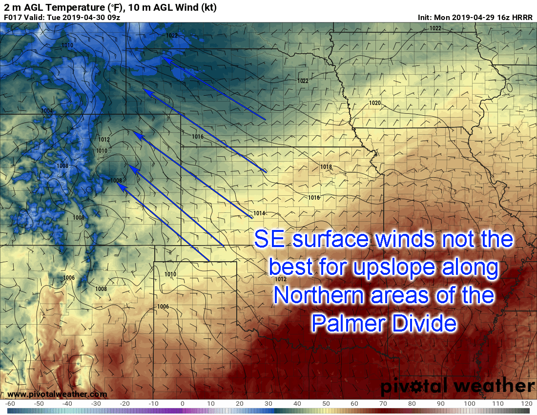
In a situation like this we see Southeasterly winds bringing moisture around the storm system and transporting it into Colorado. As the air moves up the Southern part of the Palmer Divide it create upslope conditions, but on the other side it can create downslope. This doesn't help with efficient snowfall and in some cases it can actually dry out the atmosphere as the air rushes down the other side.
In a scenario like this I'd expect heavier snow along the foothills and mountains. I'd especially watch the areas directly west of Colorado Springs, Denver and Boulder. If you're travelling to the mountains or foothills tonight into Tuesday morning, that's where you'll see the highest travel impact.
We will keep watching for any changes, as you all know by know these spring storms can often throw a curve ball at the last minute!
