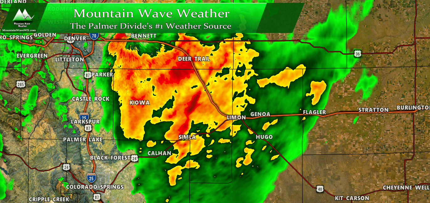
This storm is going to surprise a lot of folks… a powerful spring storm system is moving through Colorado and the central and southern plains. Colorado will see ample amounts of moisture and for some areas that may mean decent snow accumulation, while the SE corner will see heavy rain and potentially severe storms.
^^ My video update at 2PM on May 20, 2019 ^^
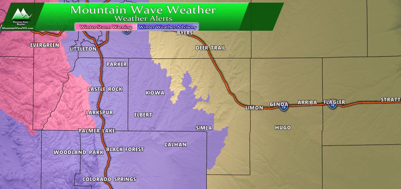
Weather Watches/Warnings/Advisories
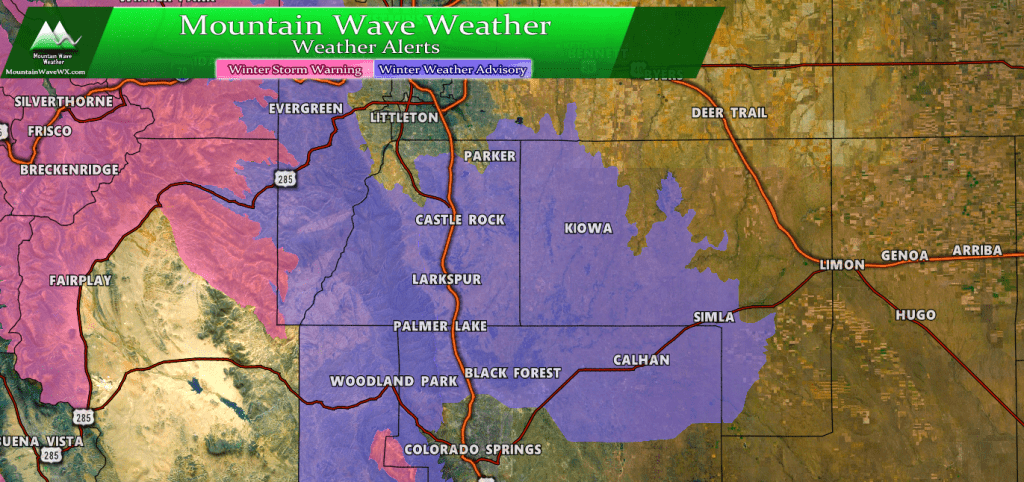
Here’s the latest winter weather highlights as of 3PM on May 20, 2019
Winter Weather Advisory – Palmer Divide Region
URGENT - WINTER WEATHER MESSAGE
National Weather Service Denver CO
1221 PM MDT Mon May 20 2019

...STRONG LATE SEASON SPRING STORM TO AFFECT COLORADO...

.A strong storm system will move into Colorado today and continue
to affect the area through Tuesday night. This system will bring
heavy, wet snow to elevations above 6000 feet, impacting travel
with snow covered and slushy roads.

COZ041-210400-
/O.EXB.KBOU.WW.Y.0025.190521T0000Z-190521T1800Z/
Castle Rock-
Including the cities of Castle Rock, Elbert, Fondis, Kiowa,
and Larkspur
1221 PM MDT Mon May 20 2019

...WINTER WEATHER ADVISORY IN EFFECT FROM 6 PM THIS EVENING TO
NOON MDT TUESDAY...

* WHAT...Wet snow expected. Total snow accumulations of 5 to 10
  inches expected, with the heaviest amounts above 7000 feet.

* WHERE...Castle Rock.

* WHEN...From 6 PM this evening to noon MDT Tuesday.

* ADDITIONAL DETAILS...Travel could be very difficult. The
  hazardous conditions could impact the morning or evening
  commute.

PRECAUTIONARY/PREPAREDNESS ACTIONS...

A Winter Weather Advisory for snow means periods of snow will
cause primarily travel difficulties. Expect snow covered roads
and limited visibilities, and use caution while driving.
Winter Storm Warning
COZ031-033-034-210400-
/O.CON.KBOU.WS.W.0012.000000T0000Z-190522T0600Z/
Rabbit Ears Pass-
Rocky Mountain National Park and the Medicine Bow Range-
The Mountains of Summit County, the Mosquito Range, and the
Indian Peaks-
Including the cities of East Slopes Park and Northern Gore
Ranges, Gore Pass, Rabbit Ears Pass, Cameron Pass,
Laramie and Medicine Bow Mountains, Rabbit Ears Range,
Rocky Mountain National Park, Willow Creek Pass, Berthoud Pass,
Breckenridge, East Slopes Mosquito Range,
East Slopes Southern Gore Range, Eisenhower Tunnel, Indian Peaks,
Kenosha Mountains, Mount Evans, Williams Fork Mountains,
and Winter Park
1221 PM MDT Mon May 20 2019

...WINTER STORM WARNING REMAINS IN EFFECT UNTIL MIDNIGHT MDT
TUESDAY NIGHT...

* WHAT...Heavy snow expected. Total snow accumulations of 8 to
  18 inches expected. Winds gusting as high as 35 mph.

* WHERE...Rabbit Ears Pass, Rocky Mountain National Park and the
  Medicine Bow Range and The Mountains of Summit County, the
  Mosquito Range, and the Indian Peaks.

* WHEN...From noon Monday to midnight MDT Tuesday night.

* ADDITIONAL DETAILS...Travel will be hazardous with snow
  covered roads. Secondary roads may see more difficult travel
  conditions due to more significant accumulation of heavy, wet
  snow.

PRECAUTIONARY/PREPAREDNESS ACTIONS...

A Winter Storm Warning for snow means severe winter weather
conditions will make travel very hazardous or impossible. If you
must travel, keep an extra flashlight, food and water in your
vehicle in case of an emergency.
Updated Forecast
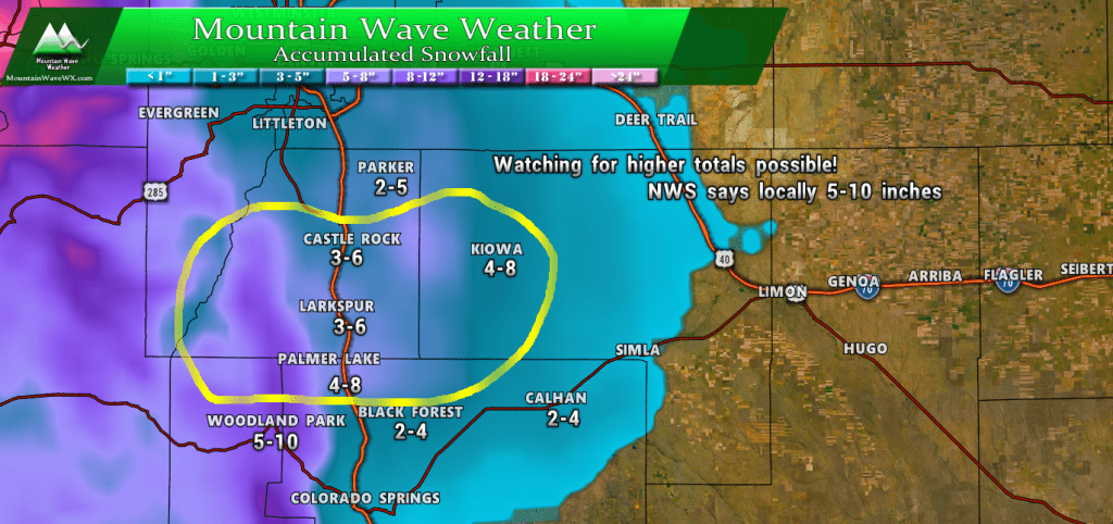
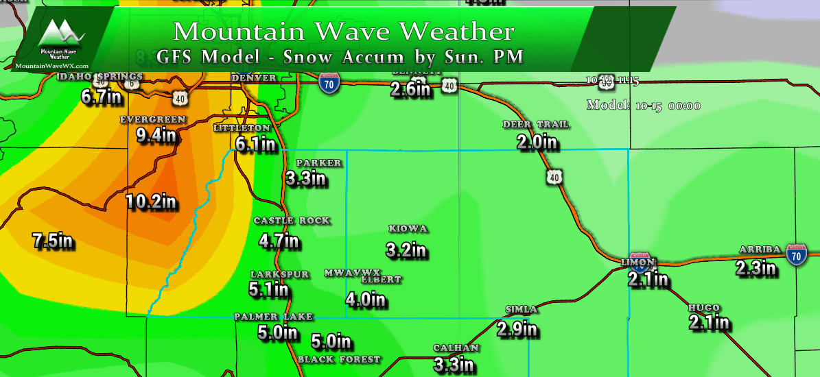
If you saw my video this afternoon (it’s posted above) you know that I’m not 100% sold on what the models are saying. Since this storm is a bit of a different animal I’ve kept snowfall totals somewhere in between ultra conservative and what the models are saying. As I mentioned; this is a fluid forecast and it’s very likely these numbers will change in the next few hours. Stay tuned for updates!
Expected Snowfall (through Thursday 6PM)
*These are our forecast numbers and may not always match the NWS official forecast numbers*
- Castle Rock and surrounding areas
- 3-6 inches
- Parker, Lone Tree, Highlands Ranch areas
- 2-5 inches
- Elbert, Elizabeth, Kiowa
- 4-8 inches
- Larkspur, Monument,Black Forest, Palmer Lake,
- 3-6 or 4-8 inches — Depends largely on elevation!
- Woodland Park, W. Colorado Springs Foothills
- 5-10 inches (especially higher elevation foothills areas West of Colorado Springs)
Timing
- Monday PM: snow showers had begun in most areas along the Palmer Divide. We expect accumulation during the day to be light
- Monday Night: Heavier snow showers will establish overnight and into early Tuesday morning
- Tuesday AM: Snow showers will continue through the rush hour, most accumulation will be confined to areas above 6,500-7,000 feet
- Tuesday PM: will be watching for continued wet and unsettled weather throughout the day. Most areas will see rain rather than snow Tuesday afternoon.
Potential Impacts
- We expect minor to moderate travel impacts along the Palmer Divide; roads may become slick and slushy, especially in areas above 6,500 feet
- Freezing temperatures will be possible; sensitive vegetation should be covered Monday and possibly Tuesday night. We will keep an eye on this!
As I said in my video and discussion above, the models are jumping all over snow totals but I’m not sold just yet. Models often struggle with snow accumulation this time of year due to temperatures and sun angle (melting) which is why I generally lean conservative on snowfall this time of year.
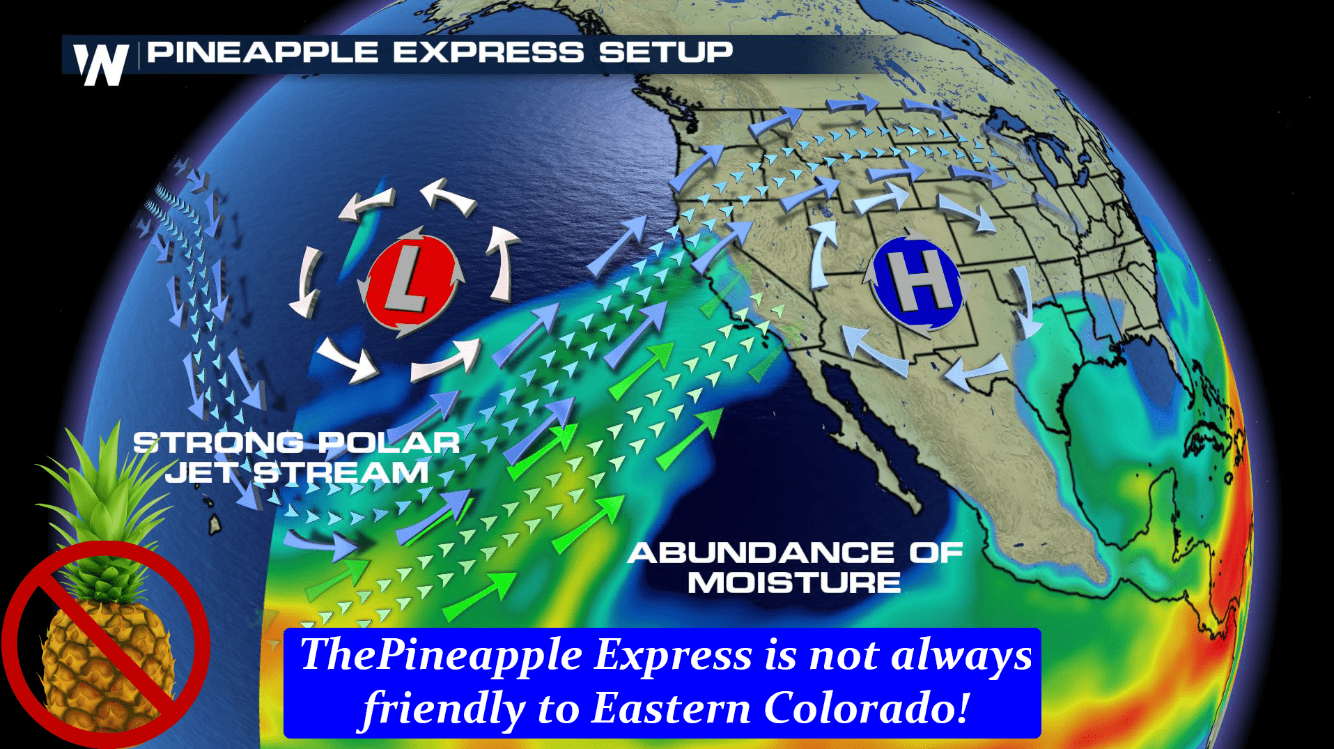
That being said, we can’t ignore that this storm is highly unusually in its setup and mechanics for this time of year. With that, the forecast is still very much fluid and will change a few more times over the next 24 hours. Stay tuned and I’ll be sure to pass along updates!

