Another strong spring storm is moving into the area starting late in the day Sunday and will bring cool, wet and unsettled conditions to the front range over the next several days. Here's the latest details and look at what the rest of the week holds!
Weather Watches/Warnings/Advisories
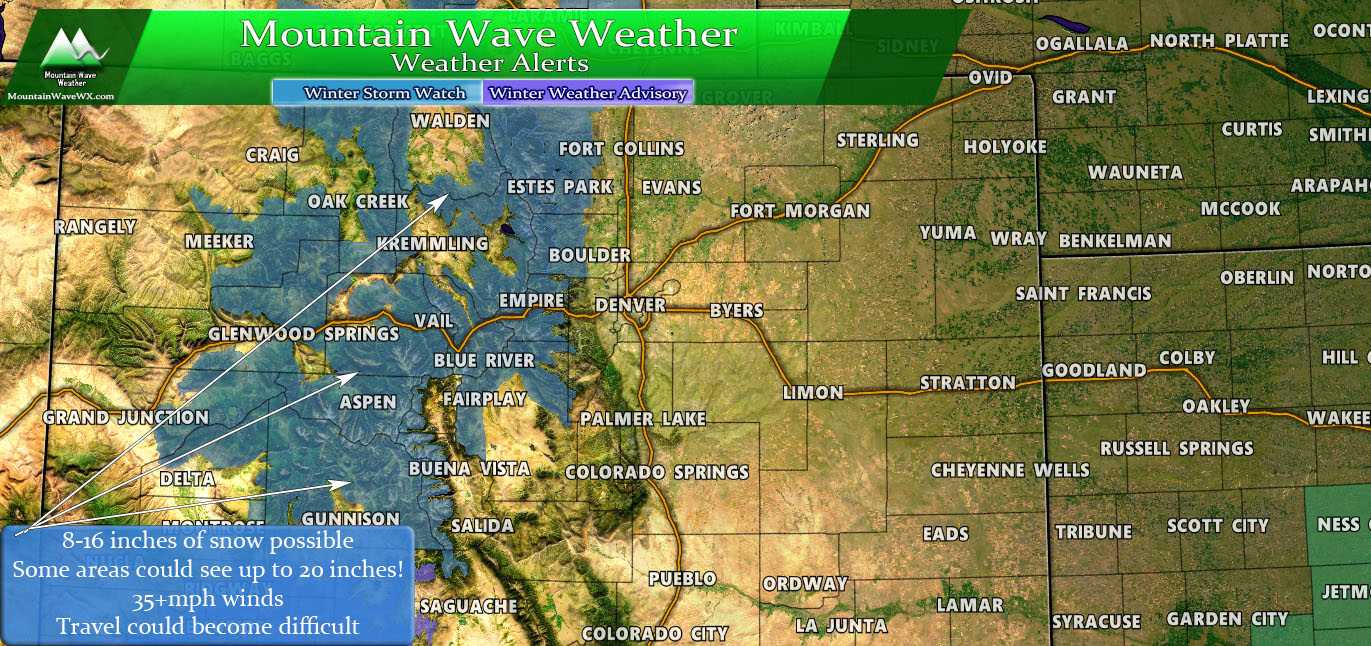
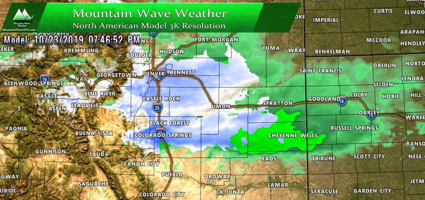
The mountains will be under again in the latest storm; many areas will see between 8-16 inches of snow with some higher peaks seeing upwards of 20 inches. Moderately strong winds are possible in the high country and that with the combination of falling snow could make travel dangerous.
Here's some detailed information, if you have travel plans in the high country later Monday through Tuesday you'll want to pay special attention to the hazards and timing:
...WINTER STORM WATCH REMAINS IN EFFECT FROM MONDAY AFTERNOON
THROUGH TUESDAY AFTERNOON...

* WHAT...Heavy snow possible. Total snow accumulations of 8 to
  16 inches possible with up to 20 inches in some mountain
  areas. Winds could gust as high as 35 mph.

* WHERE...Rabbit Ears Pass, Rocky Mountain National Park and the
  Medicine Bow Range, The Mountains of Summit County, the
  Mosquito Range, and the Indian Peaks and The Northern Front
  Range Foothills.

* WHEN...From Monday afternoon through Tuesday afternoon.

* ADDITIONAL DETAILS...Travel will be hazardous with snow covered
  and slushy roads. Secondary roads may see more difficult travel
  conditions due to more significant accumulations of heavy, wet
  snow.
Closer to Home… Our Palmer Divide Forecast
Snow is back in the forecast... this should come as no surprise folks! Colorado is no stranger to snow all the way through late May... and if you've been paying attention we've been entrenched in a particularly cool and unsettled pattern for quite awhile now.
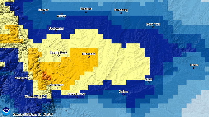
Expected Snowfall (through Thursday 6PM)
*These are our forecast numbers and may not always match the NWS official forecast numbers*
- Castle Rock and surrounding areas
- 0-2 inches
- Parker, Lone Tree, Highlands Ranch areas
- 0-2 inches
- Elbert, Elizabeth, Kiowa
- 0-3 inches
- Larkspur, Monument,Black Forest, Palmer Lake,
- 0-3 inches — Black Forest totals may be lesser in lower elevations
- Woodland Park, W. Colorado Springs Foothills
- 0-3 inches (especially higher elevation foothills areas West of Colorado Springs)
While areas along the Palmer Divide may see snow, not much is expected to accumulate on more than grassy or dirt surfaces. Ground temperatures are warm and temperatures will be marginal at best for snowfall sticking. Most areas will see very little to no accumulation.
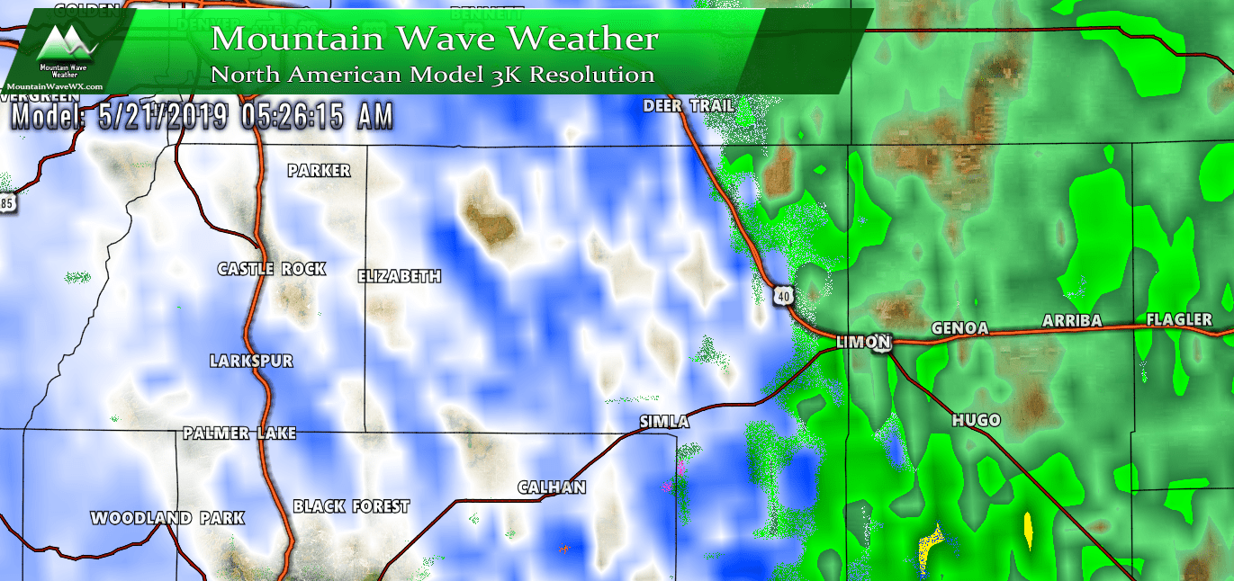
If models verify on this; expect bands of heavy wet snow across the Palmer Divide. Keep in mind though, due to warm temperatures and ground; snow accumulations won't be impressive...
Timing
- Sunday PM- showers and thunderstorms will be possible. Precipitation will mainly be rain
- Monday late morning/early afternoon - spotty showers in the earlier morning hours will give way to stronger showers and thunderstorms by late morning to early afternoon. Precipitation will mainly be rain at this point.
- Monday afternoon/evening - heavier showers and thunderstorms likely, rain may transition to snow along the Palmer Divide sometime between 5-9PM depending on temperatures.
- Monday overnight - Snow showers will continue overnight, some snow may be heavy at times but only minor accumulation expected
- Tuesday Morning - Snow and rain showers continue depending on your elevation. Should see precipitation taper off by early Tuesday afternoon
- Tuesday afternoon/evening - continued unsettled conditions but precipitation should be lighter. Spotty rain and snow showers could be possible into Tuesday afternoon and evening
Potential Impacts
- We expect minor travel impacts along the Palmer Divide; roads will remain mostly wet with spotty slush
- Freezing temperatures will be possible; sensitive vegetation should be covered Sunday, Monday and possibly Tuesday night. We will keep an eye on this!
Synopsis
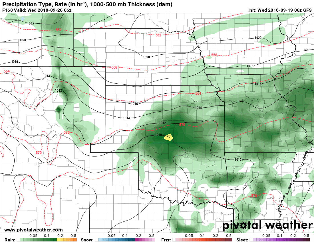
Fascinating storm system we have shaping up here. I posted a video below of the Nam3K model we've been looking at throughout this post with precipitation type and 500mb contours turned on. You can see the low pressure trough establish and swing through California, Arizona and into Utah.
The trough weakens a bit as it crosses the mountains (as they often do thanks to the terrain) but pay special attention what happens as it regenerates on the plains of Colorado. If this looks familiar it should! We've seen this a couple of times this year... remember the blizzard we had in March and the weaker snow storm we had in April?
People love to call this a "bomb cyclone" these days and while I'm not in love with that term (hype, hype, hype!) I'll use it since it's familiar to most people.
This rapid intensification will mean a few things weather-wise depending on where you live.
- Colorado Mountains
- Heavy snow as the low transitions across the higher terrain. Expect mountain areas to pick up ample amounts of snow with strong winds possible Monday Afternoon - Tuesday Afternoon
- Colorado Front Range
- Temperatures will be too warm to see a "blizzard" type event out of this. That being said, there's a lot of energy and a ton of moisture. Expect moderate to heavy rain and some snow accumulation in the higher terrain. Strong winds will also be possible in some areas.
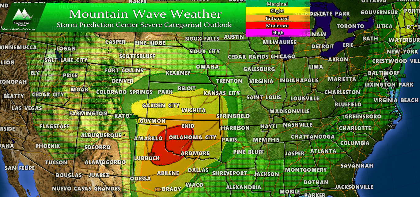
- Further East (ahead of the low on the plains)
- Classic severe weather setup here. Energy and instability ahead of the low will means some areas in the central and southern plains will be primed for significant severe weather.
- If you have friends or family in Oklahoma, Texas or Kansas... make sure they are following their local weather sources. Significant tornado threats exist with this storm in the plains.
Summary
I'll have some more posts up here and there over the next few days. The weather pattern looks to remain active for at least the next couple of weeks.
I may have a livestream up regarding some of this late Sunday night so stay tuned for that if you stay up!

Thanks!!!
Thanks John. Your forecasts help us sort out the weather from the drama! One comment on the Palmeer Divide page your sponsor panel on the right overlaps some significant info and we cannot seem to move it etc to see the numbers behind it.