If you’ve followed my site for awhile you know I present the weather very “level-headed” and don’t like to hype things. If there’s a serious event headed our way I’ll let everyone know! That’s why the information below is so important.
Large Storm Looks Likely… For Someone!
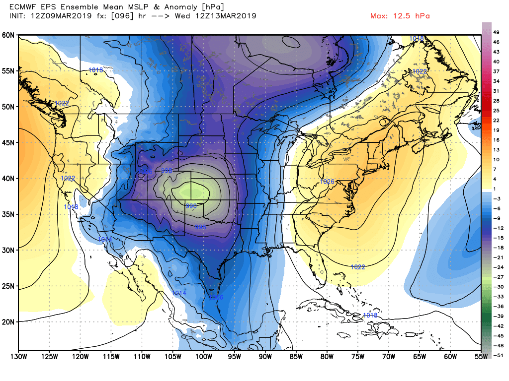
Euro mean level surface pressure anomaly snapshot 5AM Wednesday 3/13/2019
2 of our longer range, higher resolution models have been moving slowly closer to agreement on the setup for a significant storm next week. The GFS and Euro were originally far apart as of yesterday (GFS showing a non-event for this storm and Euro very bullish.) The movement has been towards a higher impact storm across both models, so that increases our confidence in this event.
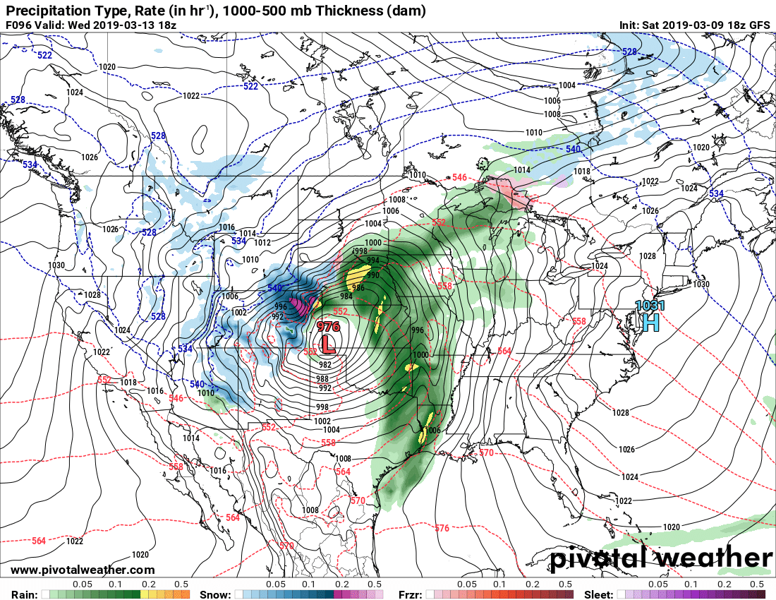
GFS precip type and rate snapshot for Wednesday 11AM 3/13/2019
So, a large storm looks very likely. The questions we still have are pertaining to timing, storm track and intensity along with speed. There’s a few variables at play here we just don’t have the answers to just yet.
- Storm track
- Further North or South can mean different snowfall amounts in different locations
- We’ve seen some big misses when the storm track wobbles at the last minute, so that’s something to keep an eye on
- Timing
- Trying to pinpoint when the worst of this storm will hit is elusive right now. This is to be expected as we are still quite aways out. Suffice to say the impact window is sometime between Tuesday and Thursday at this time.
- Speed
- For big snow out of this, we need the storm to stall for a decent amount of time. Too quick and the heaviest stuff will slide to the East, leaving us with little precip and mainly a lot of wind. This something we will have to keep an eye on.
- Wild Card!
- See all those thunderstorms on the GFS image above? Severe weather is likely in front of this storm along the warm sector. If those storms get too big or hang out too close to Colorado, they could rob this storm system of moisture for our upslope. We’ve seen this happen before and it will be something to keep a very close eye on.
What to do Ahead of this Storm
We can’t get too excited about this just yet because it could fall apart. That being said, we can’t ignore when models agree on a POTENTIALLY HIGH IMPACT STORM. It’s one of those things where it’s better to be prepared in case something does happen than unprepared and caught with a major storm.
Here’s what to keep an eye on the next couple of days:
- Pay very close attention to the forecasts! We will keep you updated on what the storm is doing and what models and guidance are saying
- National Weather Service is a great resource!
- If you feel like you want to get prepared for this storm; get your errands and shopping done early on Sunday. I imagine the news stations will start to pick up on this and stores will be crowded later on Sunday and especially Monday and Tuesday.
**Understand that there is still possibility this storm does nothing… but there is equal the possibility it is a high impact event. That’s why I’m stressing folks begin to get prepared for this!
