The picture on this storm is becoming a bit clearer as we get more data in. This will be another tricky forecast (I’ll discuss why a bit further down the page) but basically most areas along the front range won’t see a whole ton of snow out of this. Some very specific areas will have the chance to bust high on the snowfall forecast again, that combined with quick bursts of snow and some wind means travel conditions will likely be tricky for the commute Wednesday night.
Here’s the latest updates as of 1PM today:
NWS Weather Alerts (Updated as of 1PM 2/5/2019)
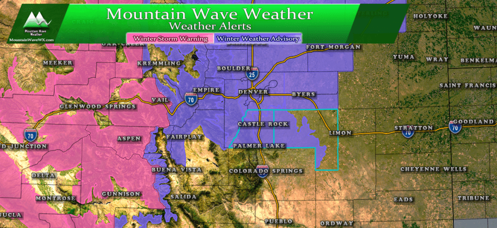
Winter Storm Warnings for the mountains are up for hazardous travel conditions due to heavy snow, strong winds and snow accumulation. For the front range of Colorado, a Winter Weather Advisory is in effect for primarily travel difficulties.
Winter Weather Advisory (12PM Wednesday– 5AM Thursday)
Cities/Areas Included
Including the cities of Estes Park, Glendevey, Nederland,
Red Feather Lakes, Bailey, Central City, Evergreen, Georgetown,
Idaho Springs, Westcreek, Fort Collins, Hereford, Loveland, Nunn,
Arvada, Boulder, Golden, Lakewood, Longmont, Aurora, Brighton,
City of Denver, Denver International Airport, Highlands Ranch,
Littleton, Parker, Castle Rock, Elbert, Fondis, Kiowa, Larkspur,
Briggsdale, Grover, Pawnee Buttes, Raymer, Stoneham, Eaton,
Fort Lupton, Greeley, Roggen, Brush, Fort Morgan, Goodrich,
Wiggins, Bennett, Byers,
Hazards
Plan on slippery road conditions. The hazardous conditions will impact the evening commute. The cold
wind chills as low as 25 below zero could cause frostbite on  exposed skin in as little as 30 minutes.
A Winter Weather Advisory for snow means periods of snow will
cause primarily travel difficulties. Expect snow covered roads
and limited visibilities, and use caution while driving.
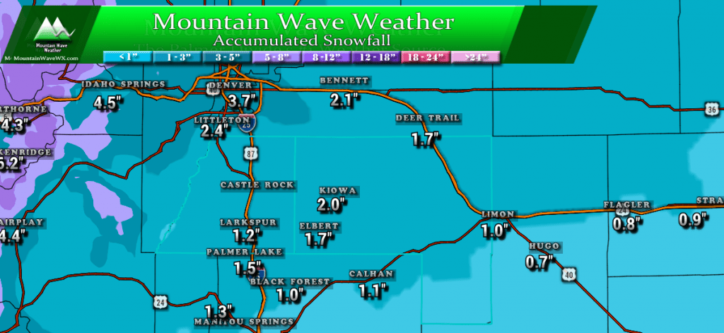
Expected Snowfall (through Wednesday 5AM)
*These are our forecast numbers and may not always match the NWS official forecast numbers*
- Castle Rock and surrounding areas
- 1-4 inches
- Parker, Lone Tree, Highlands Ranch areas
- 2-5 inches
- Elbert, Elizabeth, Kiowa
- 1-4 inches
- Larkspur, Monument
- 1-4 inches
- Woodland Park, Palmer Lake, W. Colorado Springs Foothills
- 1-4 inches
Timing
- Snowfall may spread onto the front range late Wednesday morning
- Heavier snow showers are most likely between 12PM and 6PM on Wednesday
- Snow showers should diminish and be out of the area by 9PM or so
- **Largest chance of a travel impact will be 12PM-8PM on Wednesday**
WPC most likely snowfall for this storm, it’s pretty in line with our forecast.
Impacts
- Likely travel impacts will be slick roads with some accumulating snow on road surfaces
- Wednesday evening looking likely to be impacted
- Models as of this afternoon still favor areas around and North of Denver for more of an impact with less of an impact along the Palmer Divide.
- Stay tuned in case the storm position changes and thus the impact area
Storm Synopsis
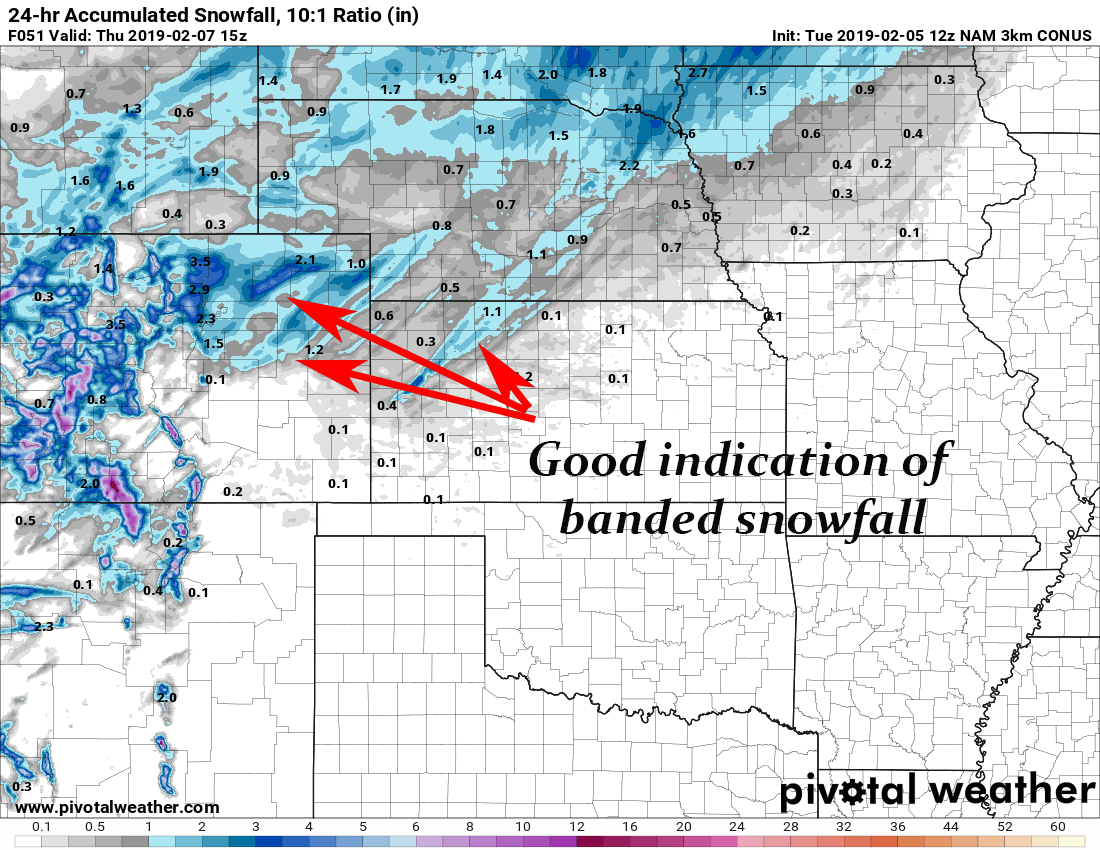
The turd in the punch bowl (excuse the expression) for this storm is thrown in when we look at the snowfall models coming out this afternoon.
Remember these…?
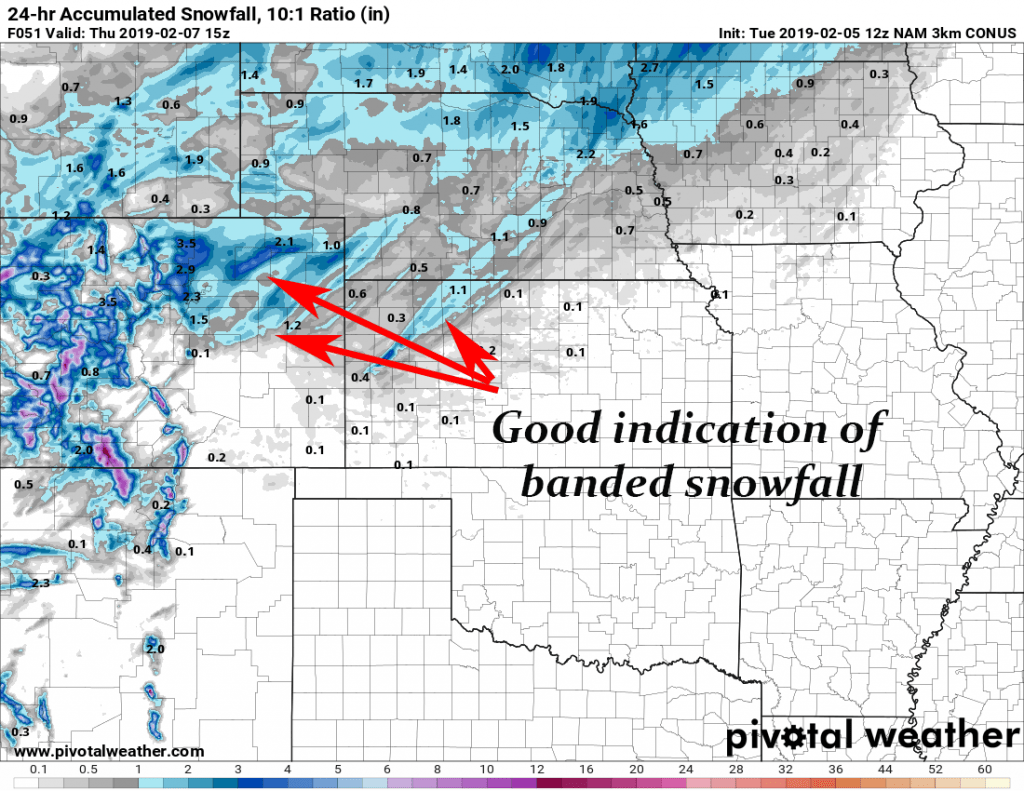
They’re back! Given the storm setup aloft and the fact that we can see banded snowfall on the models means some areas will not fall within their forecast snow range.
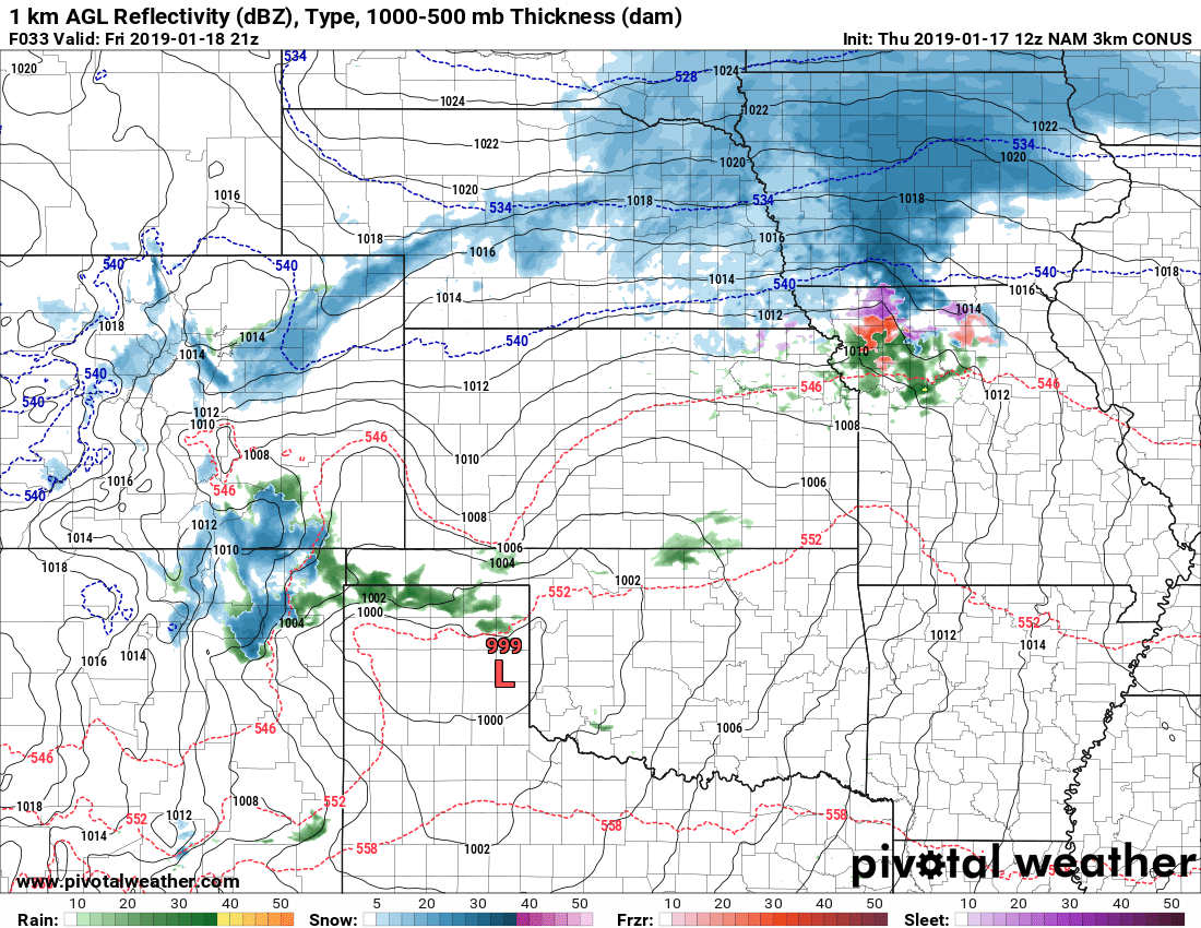
We can see pretty clearly on some of the higher resolution models that there will be bands of heavier snowfall along with this storm. Given the strong flow aloft out of the West and Northwest, this is something I’d expect even if the models didn’t pick up on it.
Here’s the big thing to remember about snowfall bands:
- We can’t forecast where they set up exactly
- We can’t forecast exactly when they set up (only a range)
- We can’t forecast how intense they get
- We can’t forecast how long they stick around
All we can tell you based on this information is that some areas will see higher snowfall amounts than what is forecast.
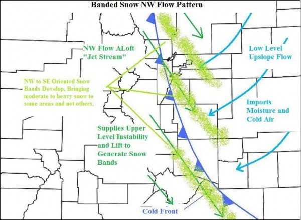
Banded snowfall setup; ours will be similar with this storm but snow bands will be more oriented SW to NE. (Credit: http://www.skyviewweather.com)
For what it’s worth models tend to be keeping the heavier snowfall bands in and around Denver and points to the North. That doesn’t necessarily mean a thing, just figured I’d point it out!
Summary
All in all, this storm will be like the past couple we’ve seen. With the jet overhead to enhance lift in very specific areas and moisture and up slope establishing with a cold front moving in; I’d expect this storm will be mainly just a headache for most folks.
Those that do get lucky enough to stick under those snow bands for awhile will graduate this storm beyond a headache to a pain in the rear.
We’ll be keeping an eye on this storm as we get more data into the evening. Probably expect at least one more post or two up late tonight and perhaps tomorrow morning if things start to change.
Stay tuned!
