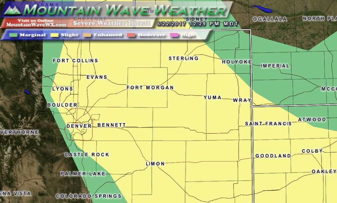
Palmer Divide Specific Severe Weather Discussion
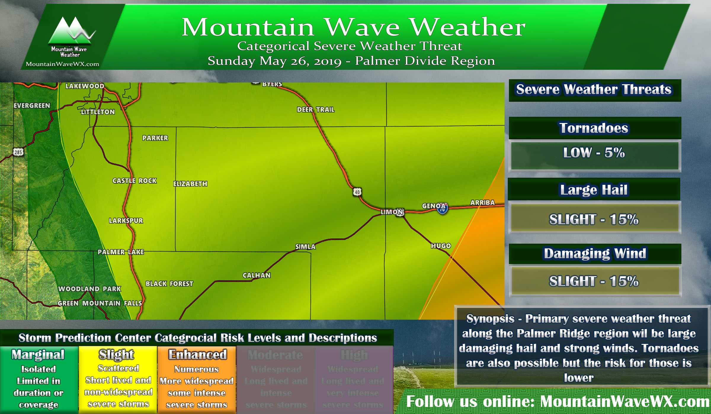
For the Palmer Divide region we don't expect widespread severe weather this afternoon but any thunderstorms that develop will have the potential to become strong or severe. A slight risk exists for the Palmer Divide East of Interstate 25 with the primary threat being large damaging hail and strong winds. There is also a small potential for tornadoes with some of these severe storms but the main risk for those is further Southeast of our area.
Remember, a slight risk means severe storms will be widely scattered, so most folks won't see an impact but if you find yourself under a storm... keep an eye as it could quickly grow strong or severe.
Timing
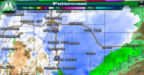
- Storms are expected to fire around 12-2PM
- Severe weather may be possible after 1PM
Preparedness Actions
- As hail and wind are the primary threats so take actions to protect property
- Move things that you don't want hail damaged into a building or under a structure
- Be sure to secure any lightweight objects that could blow around in high winds
- Keep a close eye on local weather sources for weather watches and warnings and have access to that information easily in the afternoon

Please Note: NWS has requested that Storm Spotter Activation may be required after 1PM today.
If you are a NOAA/NWS Certified SkyWarn Weather Spotter in Douglas or Elbert County, please be prepared to report severe weather with intensity, description and location this afternoon.
Southeastern Colorado Specific Severe Weather Discussion
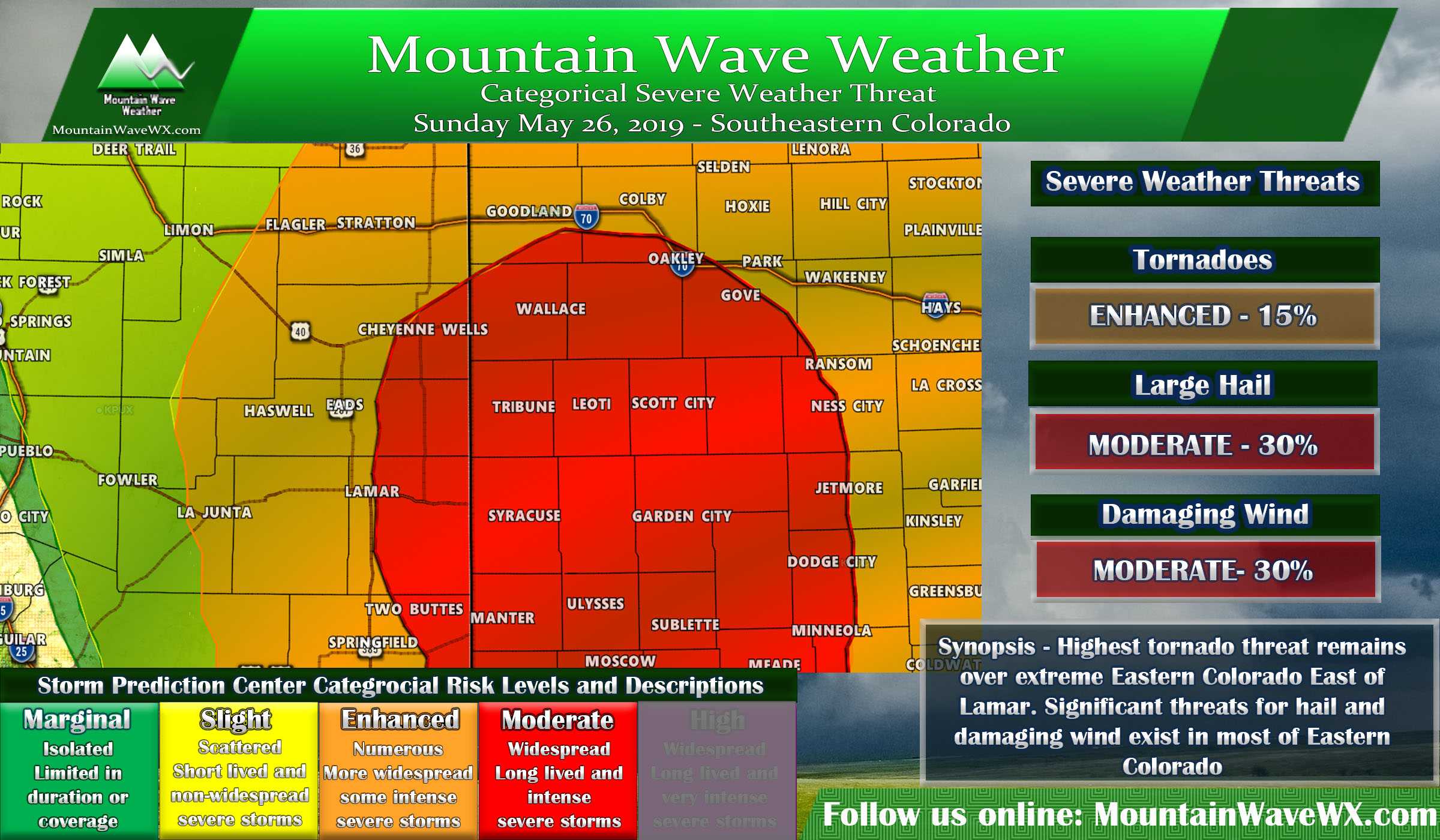
The main threat for severe weather exists over extreme Southeastern Colorado today. In these locations a significant hail and wind threat exists along with a substantial threat for tornadoes. If you live in or around these areas please take proper precautions and make preparations this morning. Don't wait until storms fire this afternoon, things will begin to move very quickly!
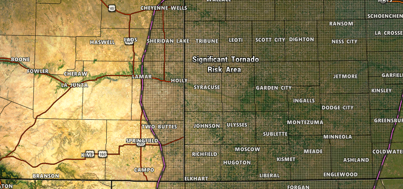
Of most concerns are the areas outlined in the hatch above. This product is for Significant Tornado risk areas. If you live in areas from roughly east of Eads, south into Lamar and just East of Springfield you need to be especially aware this afternoon.
Summary - My Thoughts
We will have to keep a close eye on this setup. Models don't show a whole lot going on along the Palmer Divide and I-25 corridor today, but given the atmosphere is relatively primed today for severe weather in the area we still need to take that into consideration.
So today's message is that most of us won't see severe weather (it won't be particularly widespread along the Palmer Divide) but there is a decent change some of us will. Primary things to watch out for will be hail and wind but give our terrain around here, you know that tornadoes will be a slight possibility with any severe storms.
I'll be away from the computer this afternoon but will try to pass along any updates as needed.
Stay safe out there and keep your eyes to the sky!
