The week ahead looks to feature more classic Colorado Spring weather for many areas of the state and the Palmer Divide will be no exception. As the week starts off relatively quiet, our fire concerns will begin to creep back in again, but a lot of folks will enjoy the warm temperatures. The bad news is that the wind will be back, especially on Tuesday as a weak storm system pushes through. The roller coaster ride continues up and down as we keep our eyes on a larger and more powerful storm system that looks to impact Colorado around Friday. Here’s the week outlook:
Weather Alerts
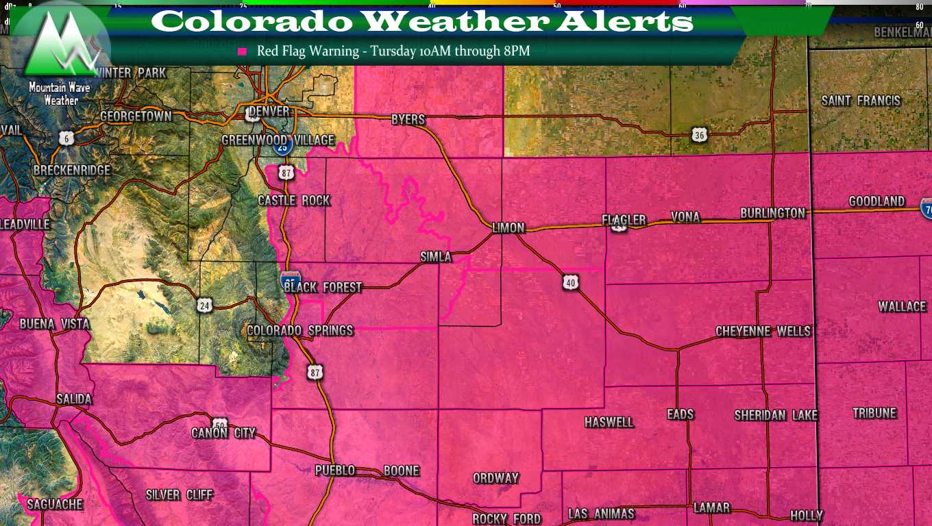
A Red Flag Warning will be in effect for most of Eastern and Southeastern Colorado for Tuesday from 10AM through 8PM for high winds, warm temperatures, low humidity and critical fire danger.
You can see details for the Red Flag Warning updated on our Warnings and Alerts Page
We will update through the week if any additional weather alerts are issued, stay tuned!
Forecast ( First Half of the Week)
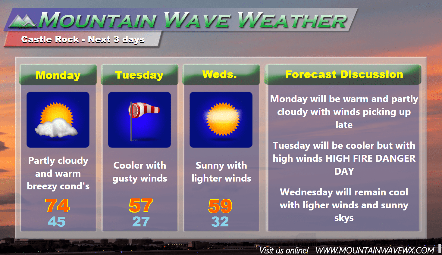
AS you can see from the forecast, the first half of the week looks relatively unremarkable in terms of day-to-day weather. Tuesday’s main concern will be the return to high fire danger but little to no precipitation is expected the first half of the week. Tuesday may see some sprinkles with a weak storm moving by but it mainly looks like a mountain event.
Forecast ( Second Half of the Week)
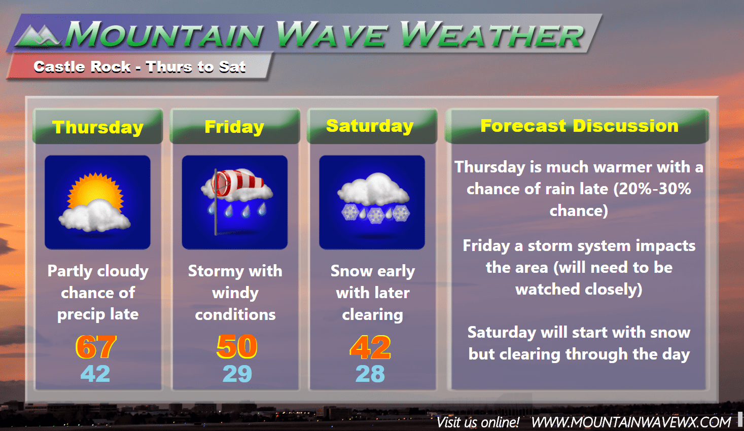
The second half of the week looks a bit more unsettled, the storm on Friday into Saturday will have to be watched. Some models have it setting up very similar to the last storm that brought blizzard conditions to the Northeast corner of the state, but setting up a few hundred miles further South. That would mean a higher impact event for the Colorado front range. Nothing to get too excited about just yet, but we will be keeping a watchful eye on it.
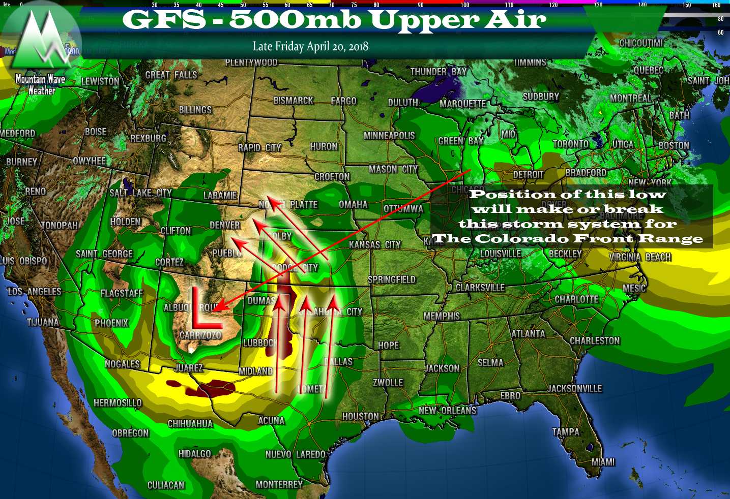
Late Week Storm System (Quick Note)
The interesting bit of this storm is that it looks relatively powerful on our models (at least the few we can see with right now) and the positioning has been consistently further South than the last storm. The big questions here will be;
- Does it stay as strong as we get closer?
- Models will need to be consistent with the strength of the storm system
- Does the positioning end up “just right”?
- Any wobble to the storm track is the difference between getting “hammered” or nothing at all!
- Will it bring blizzard conditions to the Front Range this time?
- Lots of variables here; is the system too warm? Do severe storms out East rob it of moisture?
As you can see, we have a lot more questions than answers at this time. Keep in mind, we’re not getting too excited about this storm system just yet, but we’ll watch the models and forecasts over the next few days to see if this thing comes together and how. It is possible it can’t tap into enough cold air and all we see is rain and thunderstorms. Stay tuned for details throughout the week!

Are we really going to have 50mph winds like the weather ppl keep saying?
It looks likely, many of the models show sustained winds in the 25-25mph range with gusts up to 45-50mph. I imagine some wind prone areas will get gusts well into the 50’s, it’s all part of a quick storm system that is moving too far to our North to bring us much impact besides wind and a bit cooler air.
Thank you! Just trying to prepare here in the Meadows!