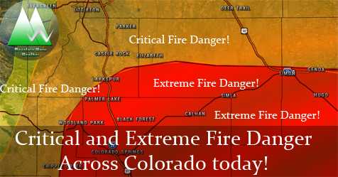
There’s a lot going on weather-wise across Colorado today and many areas have weather warnings and alerts up. Without too much blather and further ado; here’s the latest!
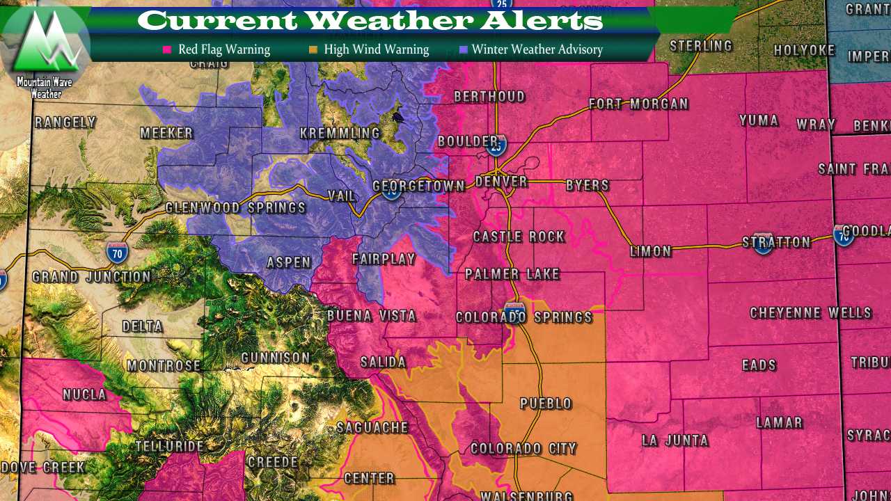
Current Weather Alerts as of Thursday morning
Current Weather Alerts and Details
Red Flag Warning — Thursday from 10AM through Thursday 9PM
Areas included:
South Park and the Southern Foothills across the Palmer Divide and
Denver metro area and most of Northeastern and Eastern Colorado
Severity:
Severe
Conditions will be favorable for new fire starts and
rapid fire growth. Extreme fire behavior is possible.
Details:
Open burning is highly discouraged if not prohibited on Red Flag
days. Use extreme caution with anything that may produce a spark.

A Red Flag Warning means that critical fire weather conditions
are either occurring now....or will shortly. A combination of
strong winds...low relative humidity...and warm temperatures can
contribute to extreme fire behavior.
High Wind Warning — Thursday from 12PM through Thursday 9PM
Areas included:
Colorado Springs, Peterson AFB, Pueblo, Branson,
and Kim
Severity:
Severe
Expect areas of blowing dust, along with strong cross
  winds on north south oriented roadways on Thursday, and on
  east to west oriented roads on Friday. This will cause hazards
  to high profile or light weight vehicles.
Details:
A High Wind Warning means a hazardous high wind event is expected
or occurring. Sustained wind speeds of at least 40 mph or gusts
of 58 mph or more can lead to property damage.
Winter Weather Advisory — Thursday from 6PM through Friday 9PM
Areas included:
East Slopes Park and Northern Gore
Ranges, Gore Pass, Rabbit Ears Pass, Cameron Pass,
Laramie and Medicine Bow Mountains, Rabbit Ears Range,
Rocky Mountain National Park, Willow Creek Pass, Berthoud Pass,
Breckenridge, East Slopes Mosquito Range,
East Slopes Southern Gore Range, Eisenhower Tunnel, Indian Peaks,
Kenosha Mountains, Mount Evans, Williams Fork Mountains,
and Winter Park
Severity:
Moderate
Plan on slippery road conditions. In addition, areas of poor visibility are likely. Winds gusting
as high as 50 mph will cause areas of blowing and drifting snow.
Details:
A Winter Weather Advisory for snow and blowing snow means periods
of snow and blowing snow will cause primarily travel
difficulties. Expect snow covered roads and limited visibilities,
and use caution while driving.
As always, you can see Castle Rock specific weather warnings here!
Summary
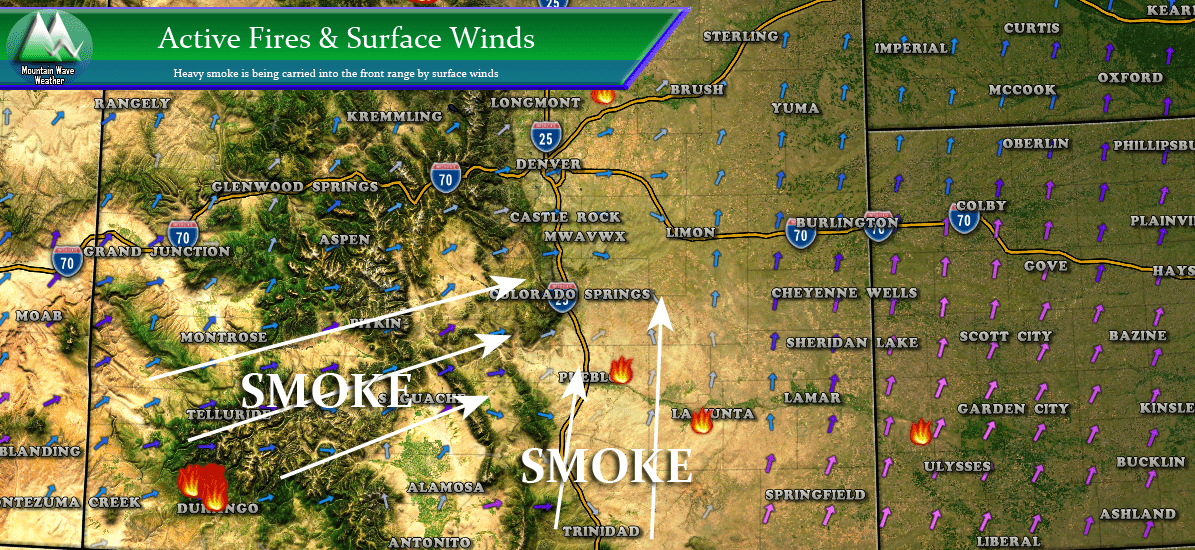
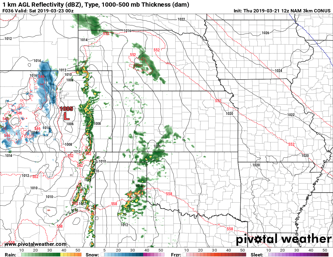
All in all it will be a very busy day for weather watchers and meteorologists across Colorado. Strong winds and low humidity will mean nearly all of Eastern Colorado will be under the gun for extreme fire conditions. Meanwhile a strong storm system to the North of Colorado will usher in moisture to the mountains, that combined with strong winds will mean tricky travel conditions late Thursday and most of the day Friday.
This storm system will impact Denver and the Palmer Divide to some degree on Friday, not seeing a ton of moisture with it but winds will continue to be strong on Friday coupled with a cold front that will drastically drop temperatures.
Look for an update on that storm system later today!

