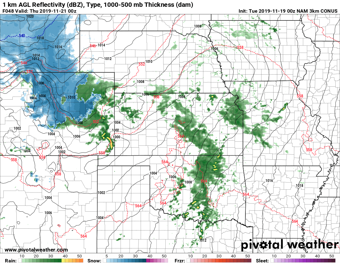
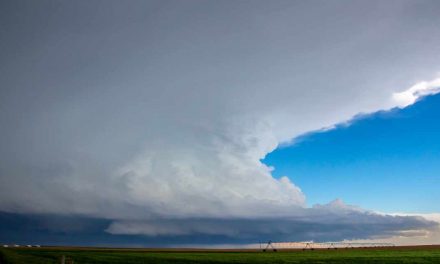
A storm system is lining up to move across Colorado for the middle and late part of this week; it’s one of a series of storms that will kick off a relatively unsettled weather pattern for the next 7-10+ days. We can see series of storm systems on the models into the Thanksgiving Holiday, so that’s something we will have to keep an eye on in terms of if/how it may impact travel. For now though, here’s the details on this week’s storm.
Watches/Warnings/Advisories
There are currently no weather highlights for the front range or Palmer Divide.
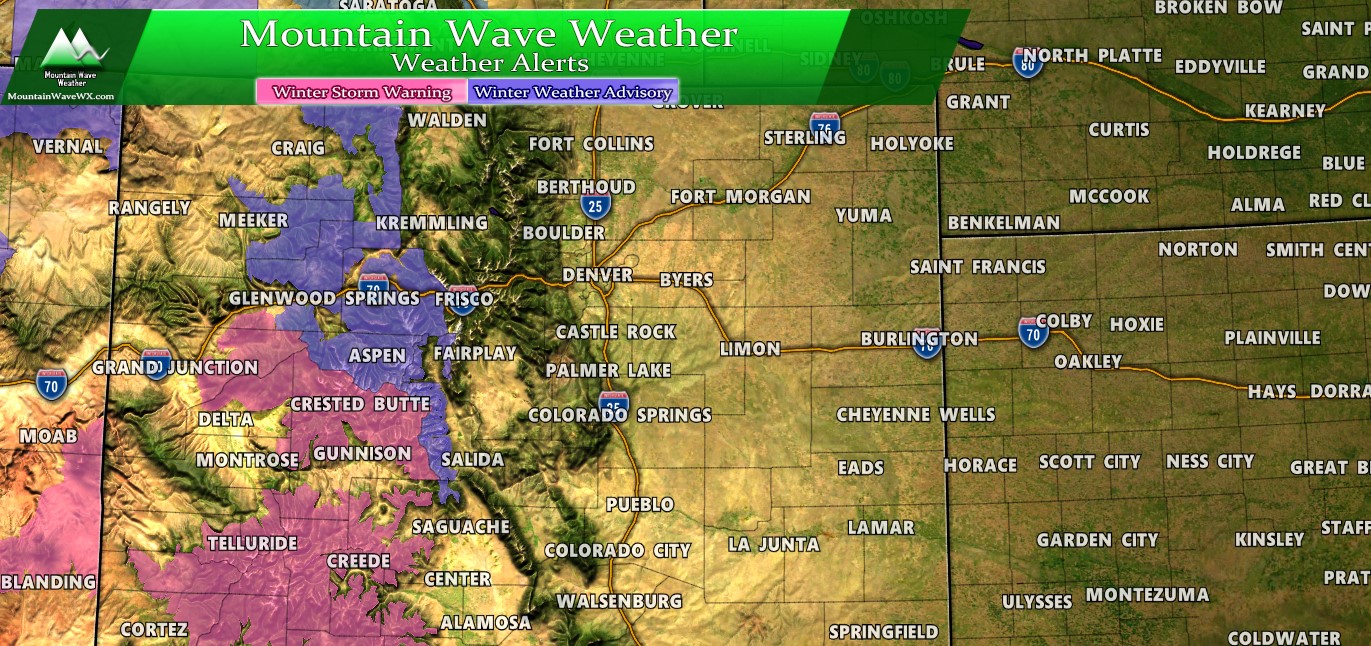
Winter weather highlights for Colorado as of 6AM 11/19/2019
The only winter weather highlights associated with this storm is a Winter Weather Advisory for the Northern and Central mountains well west of Denver and a Winter Storm Warning for areas in Southwest Colorado. The areas in the warning will see the heaviest snow and higher impacts from this storm.
At this time, not sure we will see any highlights along the front range with this storm system.
Forecast/Hazards/Timelines/Impacts (The Need to Know Planning Stuff!)
Impacts
Snowfall/Travel Impacts
- Low impacts are expected overall during this storm event
- Some roads may collect a bit of snow or slush causing moderate impacts, but those areas will be spotty
Timing
- Wednesday
- Precipitation starts initially as rain on Wednesday
- Precipitation looks to kick off late morning/early afternoon
- Thursday
- Snow showers will establish early Thursday morning
- Showers continue on and off through the day Thursday with cold temperatures remaining
- Snow continues late Thursday into Friday
- Friday
- Spotty snow showers continue through late morning Friday
- Clearing by afternoon
- Temperatures remain cold
This is a longer duration storm, but snowfall intensities won’t be too great with this storm. Expect cold and unsettled weather from late Wednesday through late Friday.
Snowfall
Snowfall accumulation totals below are through Friday afternoon. Keep that in mind, this is a longer duration event with lighter snowfall intensity so if you wake up Thursday morning and don’t see a ton of snow that doesn’t mean the storm is a bust. These amounts are through late Friday, but if you’re looking for heavy snow amounts out of this storm in general you’ll probably be disappointed (unless you’re in Southwest Colorado anyways.)

Palmer Divide snowfall through Friday afternoon
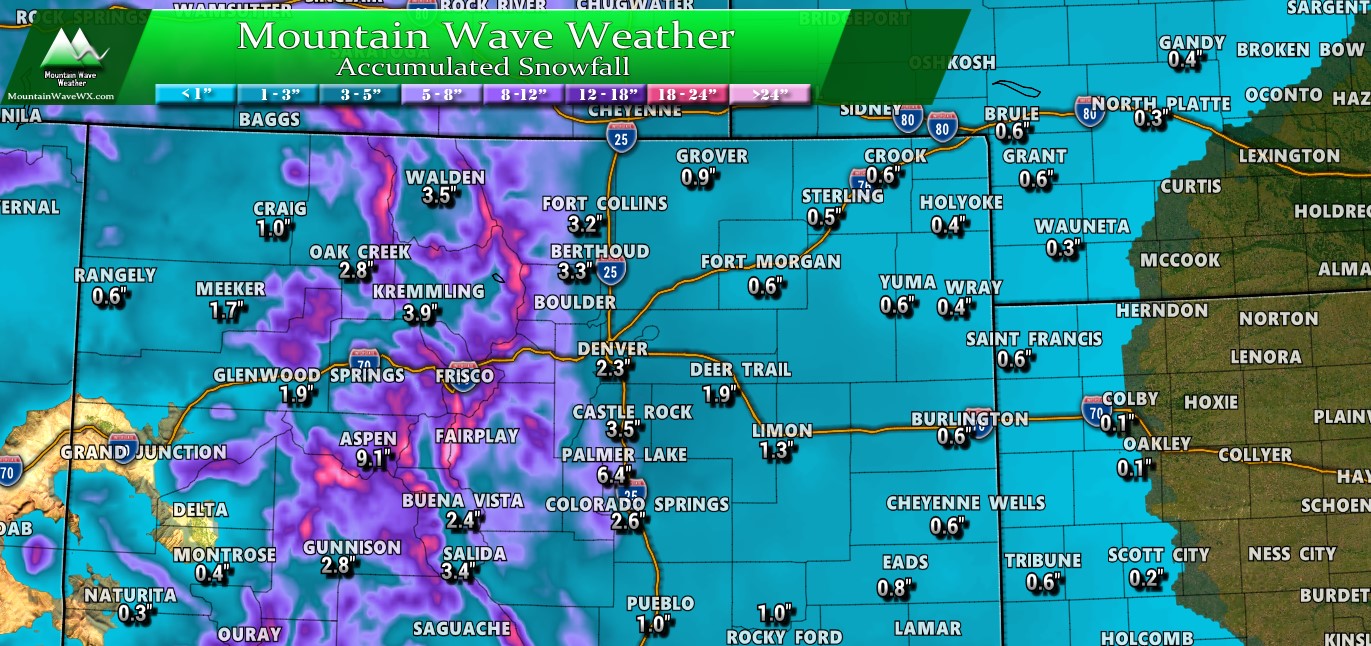
Colorado snowfall through Friday afternoon
Summary
Overall, not looking like much to write home about for this storm. More of a headache than anything, snowfall amounts will be light and travel impacts look light to moderate as well. Heaviest snow looks to stay in Southwest Colorado, which is good news because that area is still seeing the worst of our drought currently. The more moisture they can get the better!
Stay tuned, we will be sure to pass along any updates as needed!

I think your forecasts have been spot-on!
Thank you! 🙂