In our previous article we talked about the life-cycle of a thunderstorm and some of the ingredients necessary for them to form. Today we take a look at the different types of thunderstorms that form and what types of threats they can being as we continue our spring series on thunderstorms and severe weather!
Single Cell Thunderstorm
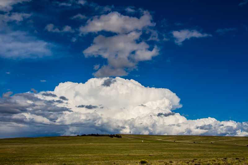
Photo: John Braddock (Mountain Wave Weather)
Single cell thunderstorms are a variety of what I call “garden variety” thunderstorm that pop up and die quickly. These are often seen along Colorado’s front range earlier in the day and may be isolated to small areas. These storms have a quick life, they often blow up and rain themselves out in an hour or less, but they may aid in the development of other storms later in the day.
Notable Features:
- Seen on days with lower moisture, this helps the storms stay isolated and further apart from each other.
- The lack of winds pushing them along in the atmosphere means they usually moves slowly
- Quick lifecycle; they may grow, mature and die in an hour or less
- These storms don’t often produce severe weather in most areas, they can however produce brief, weak severe weather events in Colorado (Why? More on this a bit later!)
Multi-Cell Thunderstorm
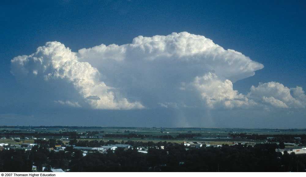
Credit: http://www.atmo.arizona.edu
Multicell thunderstorms are basically a line of thunderstorms building one after the other in a common area moving in a common direction. In most cases they don’t remain strong for very long and don’t always have severe weather. They can however cause severe weather, especially if building along a flanking line of a stronger or severe thunderstorm (more about this later…)
Notable Features:
- These types of systems are quite common in Colorado
- These storms can move slowly if a strong jet is absent to give them a push. Multicelluar storms can however move quickly if atmospheric conditions are favorable
- Can either have quick lifecycle if consisting of weaker “garden variety” storms or can have a longer liftecycle if one or many of these storms can sustain near or above severe limits
- These storms can produce severe weather, but the main severe threats consist of hail and strong winds. Weak and brief tornadoes may be possible but are rare.
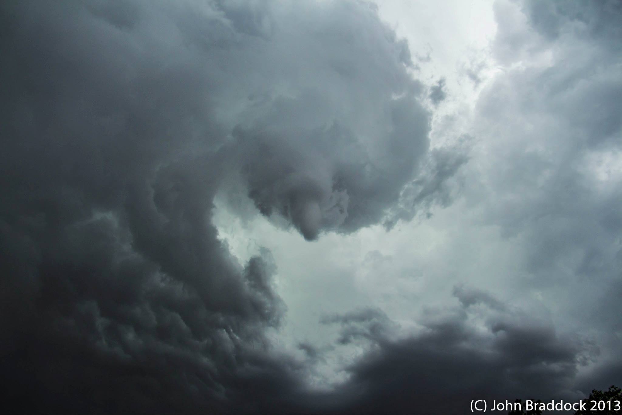
Supercell Thunderstorm
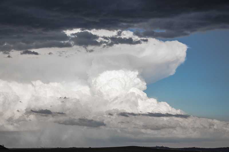
Photo: John Braddock (Mountain Wave Weather)
Supercell thunderstorms are strong, long lived, rotating storms that are often seen in the central United States in spring months. These storms can have a combination of hail, strong winds, heavy rain, and tornadoes. They are quite a thing to see and can be quite photogenic. There are actually different types of supercell thunderstorms that we will take a closer look in our next article, but for now… here are some of the notable features of a supercell thunderstorm.
Notable Features:
- These types of systems are common in Colorado mainly in the spring months. They are not often seen in the summer months due to the jet stream shifting away from Colorado
- Depending on the wind shear aloft, these storms can move quickly or slowly, but are often seen moving faster than normal thunderstorms
- Supercell storms can often last for several hours and cover a lot of ground. It is not uncommon to have these types of storms start in Colorado by early afternoon and be found raging along in Kansas that evening
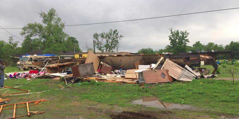
- Due to their strong nature, these storms often have flooding, strong winds, anywhere from small to larger hail and are often found to have the highest occurrence of tornadoes.
We will take a closer look at the different types of supercell thunderstorms in our next post. These storms are truly fascinating and as a storm chaser I get to see and interact with them quite a bit!
Supercell Favorites
No quiz for this post, instead I will share a few of my favorite supercell/severe thunderstorm pictures I have from storm chasing over the years…
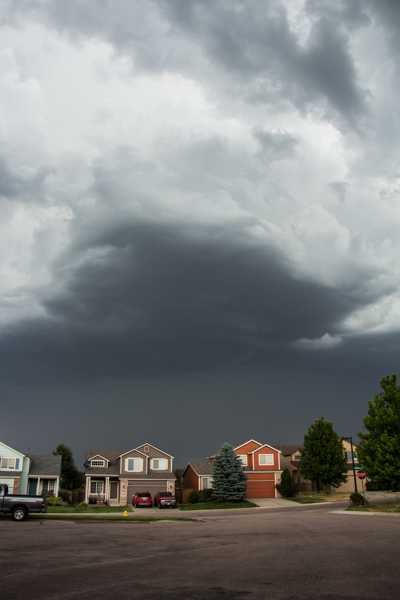
Supercell that was part of a multi-cluster line. Castle Rock, Colorado 2012. This storm was moving due West and had an intense area of rotation below it!
The above storm produced this great funnel cloud and occlusion over the Meadows in Castle Rock, June 2012.
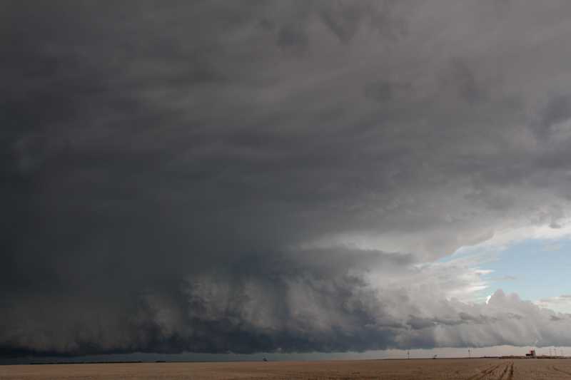
Strong supercell thunderstorm with flanking line along the updraft. Northeastern Colorado May 2016
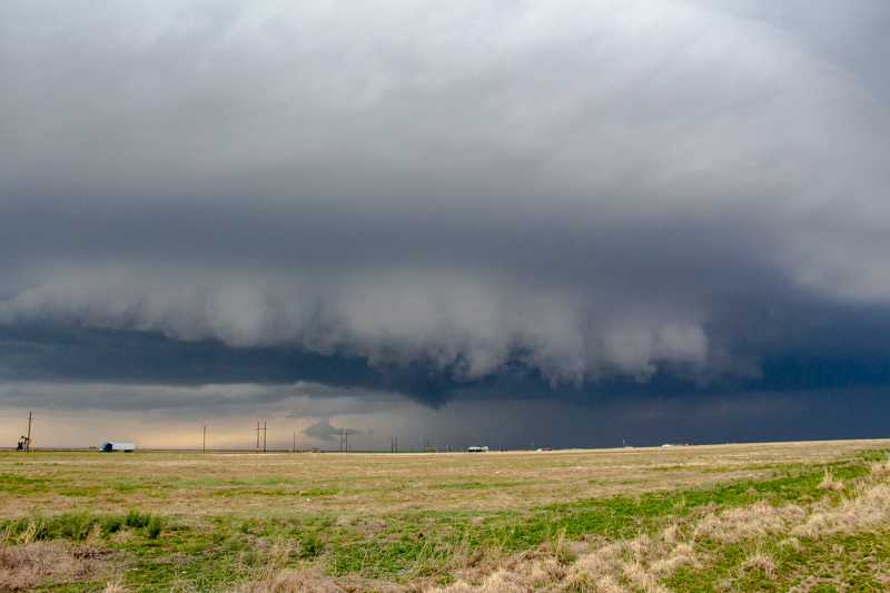
Strong supercell that eventually went on to produce a tornado in the Texas Panhandle. April 2016
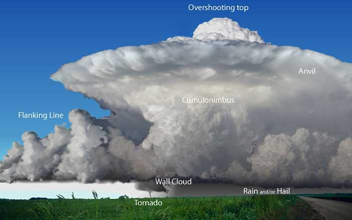
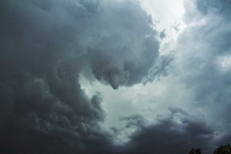
…of course the above picture was just the rotation and wall cloud. These large areas of rotation are called mesocyclones and can be very small or very large, sometimes spanning many miles.
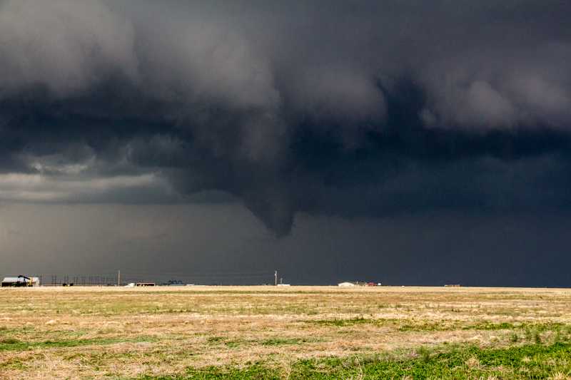
Funnel from the above storm. We didn’t see it touch down from our position but several reports later confirmed that it did indeed touch down! This storm was part of a 3 tornado day we captured in Texas in the spring of 2016!
Have a great weekend everyone, the weather in and around Castle Rock will be great!

