The traditional summer weather pattern has settled into Colorado this week, this means most days will feature warm to hot temperatures and chances for thunderstorms. It it monsoon season and while we see a bit of that pattern working its way back into our area by mid week… not everyone will see rain!
Here’s what we’re looking at for this week:
Smoke/Haze/Poor Air Quality
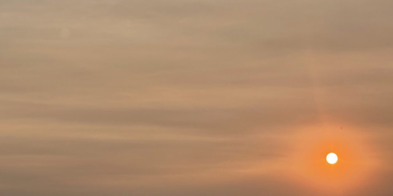
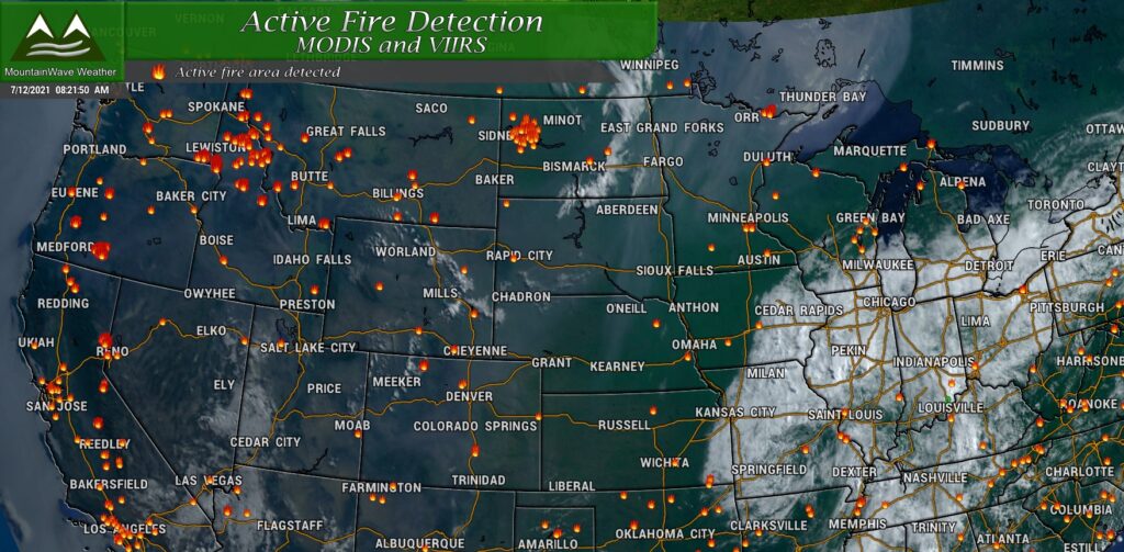
Fires continue to ravage the Western United States. Some of these areas are experiencing the hottest temperatures they’ve ever recorded and extreme to exceptional drought conditions and while we are mainly out of drought conditions in Eastern Colorado, we will be affected in one way or another. Due to the upper level winds a lot of the smoke from these fires will be moving into Colorado for the next few days. Expect air quality to remain very poor and be aware that your lungs may be burning here and there with how much smoke is in the air.
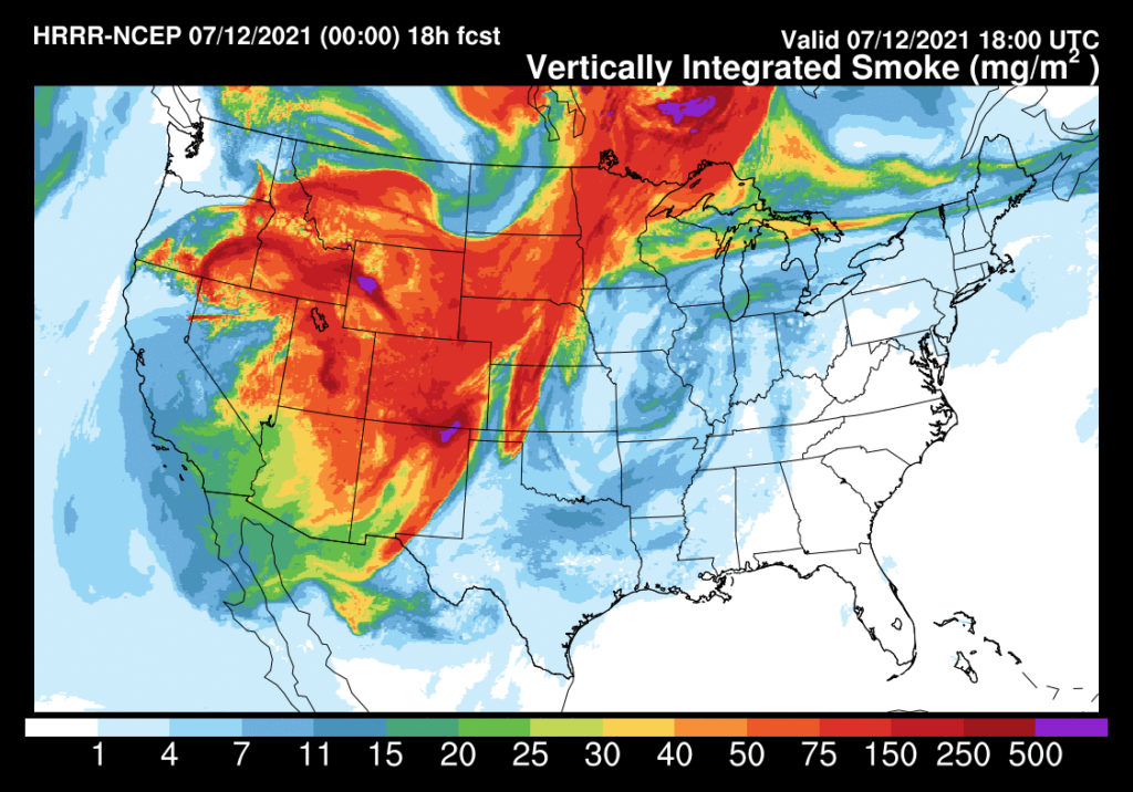
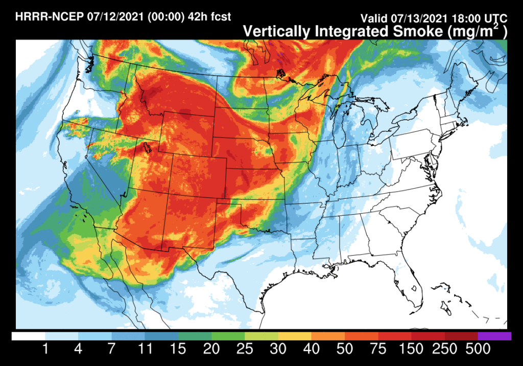
The HRRR model shown below is for Monday at noon and Tuesday at noon. It gives you a pretty decent idea of where our smoke is coming from and where it’s going to go. Unforuntately there won’t be a lot of relief from any of the smoke across nearly all of Colorado for the next couple of days.
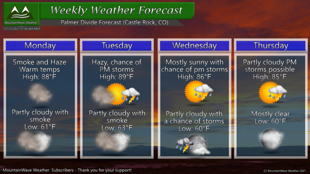
Forecast for the Week – Heat and Monsoon Storms Returning?
Chances for storms look to return this week in our weekly weather forecast. A ridge of high pressure to our West will break down just long enough for monsoon moisture to move upwards from the Southwest and into Colorado. This pattern looks fairly short-lived, but the good news is we will see some moisture out of it. The other story will be the warm temperatures… we see highs for Castle Rock right around 85-90 over the next few days… while these are hot I wouldn’t call them oppressively hot!
As with most monsoon-type thunderstorms; not everyone will see rain out of this as thunderstorms will be spotty in nature and won’t move a whole lot before dying off. Tuesday, Wednesday and Thursday will all have storm chances with Tuesday and especially Wednesday looking to have the best coverage. Your overall chance of seeing precipitation in any one area is around 40%-50% and as always keep an eye out if you have outdoor plans – lightning will be plentiful with these storms.
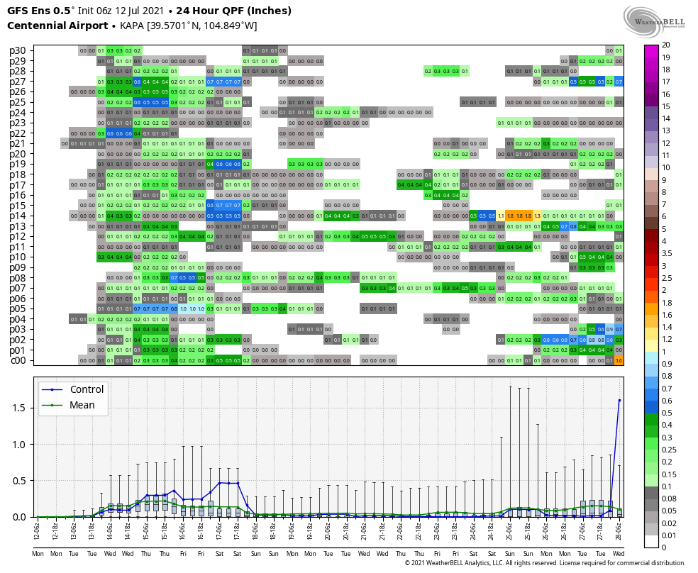
The GEFS above shows a uptick in possible chances at moisture in the next few days – the Euro is also on board but is overall less excited about some of the precipitation numbers and chances. One thing you’ll notice is that after this week our moisture chances drop again pretty significantly for a bit. Remember this is a model, not a forecast so it does get a bit fuzzier the further from today you go out. We can’t see decent details out past about 7-10 days but we can see a bigger picture view of what is looking likely.
If these verify, we don’t see a strong push of monsoon moisture establish for some time… not to say we don’t see any storms across the region. It just means if we do they will most likely be spotty in nature and more people will see dry conditions than wet.
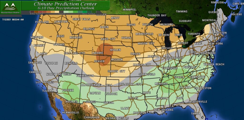
The Climate Prediction Center’s latest outlook agrees, showing the 6-10 day outlook (the period after this week) with a higher than normal chance of dry conditions.
So this is something we will keep an eye on.
Question: Is the Monsoon A Bust?
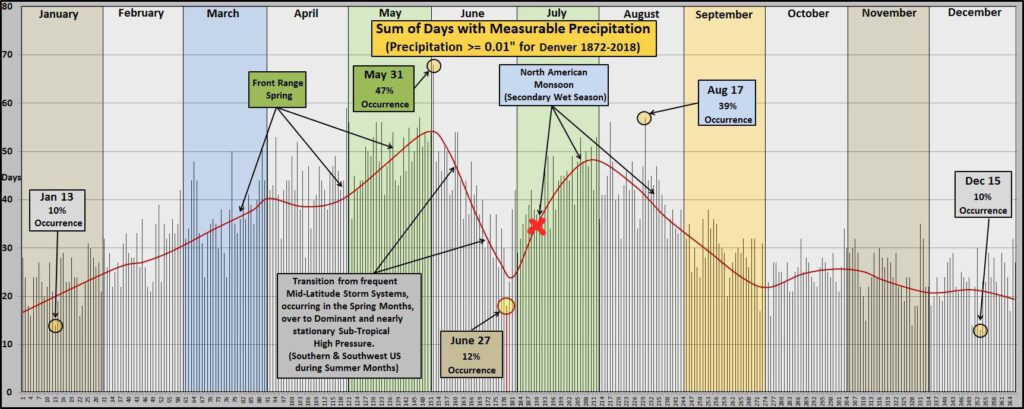
Absolutely not! We are not even in the peak of the monsoon season yet so the fact that we’ve started off dry doesn’t mean a whole lot at this point.
X marks the spot! This is roughly where we are in the monsoon season for Colorado. As you can tell, it’s very early… you can’t write off a monsoon season before it’s even really had a chance to get started. I think a lot of folks these days take a very short term, “the sky is falling” view on a lot of things. Weather takes patience and observation. By late August we will have a better idea on whether this year’s monsoon was a dud or a success. I’ll keep you updated either way!

