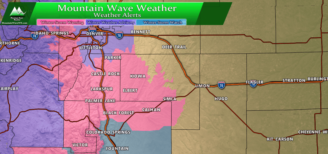
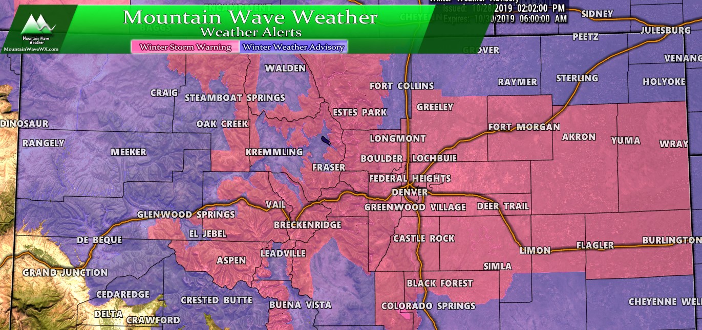
Busy day ahead from a weather standpoint. A lot of watches have been upgraded in one form or another, Denver is now included in a Winter Weather Advisory for travel conditions tonight and a Winter Storm Watch remains for the Colorado Springs area. The good news is, we are starting to get decent agreement between most of the models but a few are still holding out a bit in terms of who sees the heaviest snow. The good news is we have enough to get a good idea of where the trouble spots will be.
Here’s the rundown of the latest…
Watches/Warnings/Advisories
***Winter Storm Warning***
In effect 6PM Weds through 8 AM Thurs
The Southern Front Range Foothills-Castle Rock-
Including the cities of Bailey, Central City, Evergreen,
Georgetown, Idaho Springs, Westcreek, Castle Rock, Elbert,
Fondis, Kiowa, and Larkspur
354 AM MDT Wed Oct 23 2019

...WINTER STORM WARNING IN EFFECT FROM 6 PM THIS EVENING TO 8 AM
MDT THURSDAY...

* WHAT...Heavy snow expected. Total snow accumulations of 4 to 8
  inches with locally up to 12 inches in the southern Foothills.

* WHERE...The Southern Front Range Foothills and Castle Rock.

* WHEN...From 6 PM this evening to 8 AM MDT Thursday.

* IMPACTS...Travel could be very difficult. The hazardous
  conditions could develop during this evenings rush hour, and
  may linger into early Thursday morning.


PRECAUTIONARY/PREPAREDNESS ACTIONS...

If you must travel, keep an extra flashlight, food, and water in
your vehicle in case of an emergency.
***Winter Weather Advisory***
In effect 6PM Weds through 8 AM Thurs
Boulder and the western suburbs of Denver-Denver-
Including the cities of Arvada, Boulder, Golden, Lakewood,
Longmont, Aurora, Brighton, City of Denver,
Denver International Airport, Highlands Ranch, Littleton,
and Parker
354 AM MDT Wed Oct 23 2019

...WINTER WEATHER ADVISORY IN EFFECT FROM 6 PM THIS EVENING TO
8 AM MDT THURSDAY...

* WHAT...Snow expected. Total snow accumulations of 2 to 4
  inches.

* WHERE...Boulder and the western suburbs of Denver and Denver.

* WHEN...From 6 PM this evening to 8 AM MDT Thursday.

* IMPACTS...Plan on slippery road conditions. The hazardous
  conditions could impact the Thursday morning commute.

PRECAUTIONARY/PREPAREDNESS ACTIONS...

Slow down and use caution while traveling.
***Winter Storm Watch***
In effect 8PM Weds through 10 AM Thurs
Canon City Vicinity/Eastern Fremont County-
Colorado Springs Vicinity/Southern El Paso County/Rampart Range
Below 7400 Feet-Pueblo Vicinity/Pueblo County Below 6300 Feet-
358 AM MDT Wed Oct 23 2019

...WINTER STORM WATCH IN EFFECT FROM THIS EVENING THROUGH
THURSDAY MORNING...

* WHAT...Heavy snow possible. Total snow accumulations of 3 to 9
  inches possible, however these snowfall amounts are prone to
  change depending on where the heavier snow bands develop.

* WHERE...Southern El Paso, eastern Fremont, and Pueblo counties.

* WHEN...From this evening through Thursday morning.

* IMPACTS...Travel could be very difficult. The hazardous
  conditions could impact the morning commute.

* ADDITIONAL DETAILS...Rapidly deteriorating travel conditions
  will be possible across portions of the area tonight as heavy
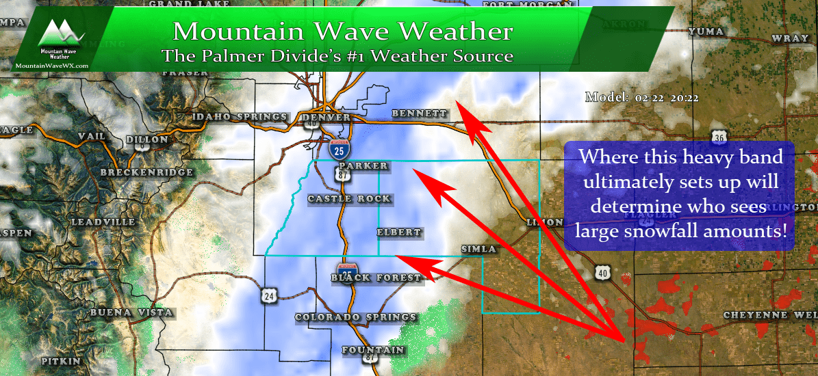
  snow bands develop. There is still some uncertainty on where
  these heavier snow bands will set up.
Forecast/Hazards/Timelines/Impacts (The Need to Know Planning Stuff!)
Impacts
Snowfall/Travel Impacts
- There will be likely impacts to Wednesday evening commute and possible impacts to Thursday morning commute. Heavy snow is expected after 6-8PM along the Palmer Divide. If you have travel plans, please ensure you’re off the roads or well on your way home no later than 8.
- The highest chance of travel impacts will be areas South of Denver along the Palmer Divide, in the foothills in western Douglas County and the foothills West of Denver.
- Roads are expected to become icy and snow packed in the heaviest areas of snow. Be prepared for difficult and even dangerous travel conditions in some areas.
Timing
- Wednesday
- Wednesday will start out calm with patchy fog in some areas
- Rain and rain/snow mix showers will be possible between 3-6PM
- Transition to snow between 5-8PM, this transition will occur quickly so be prepared for rapidly deteriorating conditions on the roads, especially South of Denver in the higher elevations.
- Thursday
- Snow showers will begin to taper off by Thursday morning from North to South between 5-8AM.
- Spotty snow showers may continue through mid morning for some areas along the Palmer Divide
- Snow should be completely ended by around noon on Thursday with improving travel and clearing conditions.
- Friday
- No snow is expected
Snowfall
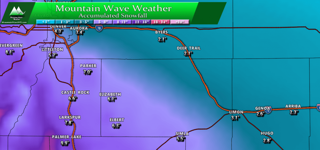
WPC product is uploaded below, this tends to over-do snow just a bit but I like these numbers +/- an inch or two as a range. You can see my forecast ranges below.
Our official forecast ranges are listed below:
- Castle Rock
- 4-8 inches
- Parker
- 4-8 inches
- Highlands Ranch
- 3-7 inches
- Elbert
- 4-8 inches
- Elizabeth
- 2-5 inches
- Kiowa
- 2-5 inches
- Centennial
- 1-4 inches
- Denver
- 1-4 inches
- Larkspur
- 5-10 inches
- Monument
- 5-10 inches
- Black Forest
- 4-8 inches
- Littleton (putting this on for a reason)
- 3-5 inches
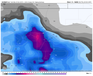
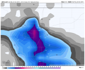
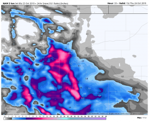
Model Output as of This Morning (for those interested)
Summary
A decent sized October storm on tap for tonight, I don’t think it will be the worst storm we’ve ever seen but areas South and West of Denver could see pretty decent travel difficulties in the overnight hours tonight. We are getting decent model agreement so we are fairly comfortable with our forecast right now, but some of the higher resolution models are getting less excited about this storm.
Again we can’t change a forecast based on one model run, but we will keep an eye on this trend to see if it continues. The higher resolution, shorter range models can give us an early hint if a storm is going to fall apart, we’re watching for that but as of right now there’s no reason to believe things will end up outside of our forecast ranges and impacts.
As always, this is an evolving forecast so stay tuned here for any changes!

