It’s been a quiet week here at Mountain Wave Weather, mainly because I needed a bit of a break after the blizzard and because the weather itself has been pretty quiet. Not only that, a large part of the week has been spent fighting off the pop up social media “meteorologists” picking up on every single model blip and forecasting the next “monster snowstorm.”
For the record, there is no scientific proof or data that we will see another massive snowstorm in the next 7-10 days let alone the season. If that changes we will let you know but right now anyone predicting such a storm is being irresponsible and inaccurate, so keep that in mind!
Unsettled Weather Expected over Next Week or So
Let’s get back to the fun stuff, just because there’s no “monster snowstorm” in our forecast doesn’t mean we don’t have a decent chance at wet weather for the next week or so.
Next Storm System – Friday Night/ Saturday Morning
Models have been picking up on this for a few days now, you probably haven’t heard a ton about it because it doesn’t look all that impressive. That being said, we will keep an eye on it because this time of year temperatures can play a big part of what we see out of any storm (in terms of snowfall) and this time of year models struggle with forecasting the temperature/precipitation type link very well.
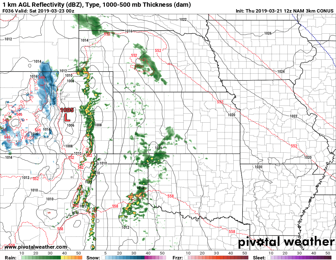
Nam3K Surface Map around 6PM Friday
The front end of the storm has pretty decent warm and instability so wouldn’t be surprised if we get the first organized thunderstorms of the year. The low isn’t especially well organized though and the track is not the same as our last storm so we don’t expect major impacts with this one as of right now.
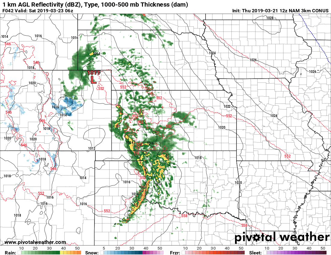
Nam3K around midnight Saturday morning
As the low moves through and cold air swings aroudn the back side of the storm system, we will see some decent upslope. A setup like this favors the Palmer Divide pretty well in terms of upslope, the big question will be how cold does it get and with that how much snow actually sticks and accumulates?
Fore brevity’s sake I won’t post images of every model but here’s a quick run down of what they’re thinking as of today:
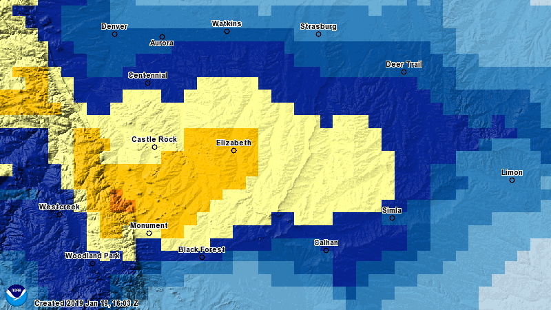
Euro – 3-5 inches, targets Palmer Divide from Castle Rock to Elizabeth (central Douglas County to central Elbert County)
Nam3K – 1-4 inches, targets primarily Palmer Divide locations East of Castle Rock
GFS – 0-3 inches, mainly South of Castle Rock and East of Castle Rock
So as you can see, there’s not great agreement on any of these. The more accurate Euro model is predicing higher snowfall amounts especially for the Palmer Divide, so we will see if it is picking up on something the others aren’t.
Weather Into Next Week
Here’s a few things that jump out at me or warrant keeping an eye on as we go into next week. Keep in mind, the further out we go into time the more likely the forecast can change…
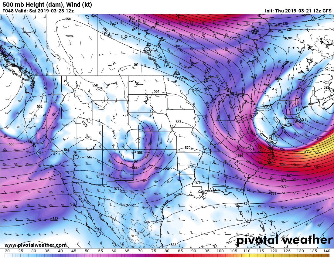
500mb Friday/Saturday storm
You’ll notice the setup looks similar to our “blizzard” storm that we had this week in terms of where this low sets up in Colorado. The big difference is that it is nowhere near as organized and doesn’t undergo any rapid intensification. Bomb Cyclone 2.0 this storm is not!
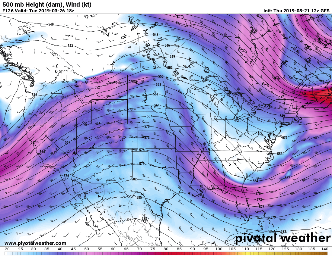
500mb noon on Tuesday
The week sees Colorado largely among “zonal” East/West flow. This generally means mountains continue to see snow as long as storms keep riding that track. For us East of the divide, this usually means we don’t have a good shot at any significant precipitation events. We do tend to see precipitation sneak over the divide on occasion with these setups but nothing large scale. I’d expect a decently nice week with a few shots of light precipitation here and there… wouldn’t be surprised to see some of the warmer days we’ve had in awhile in the middle of the week.

GFS 500mb next Friday March 29 timeframe
This is one that caught my interest a bit… a pretty strong low pressure system sets up over the plains late next week. This one I’ll be watching throughout the week next week, remember the GFS is horrible on accuracy this far out so while this looks intriguing it’s nothing to fret about at this point in time. Remember, a million little things have to go right for us to see another storm like last week and no model is going to get those details 7+ days out.
Wrapping it Up
Looks like a typical spring week in Colorado; decent chances to see thunderstorms, snow here and there and temperatures ranging in the daytime from the 40’s to possibly the 70’s. Buckle up folks, it’s springtime and it’s always a fun ride in Colorado!

Thanks! We like your forecast!!