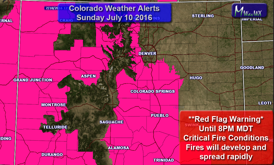
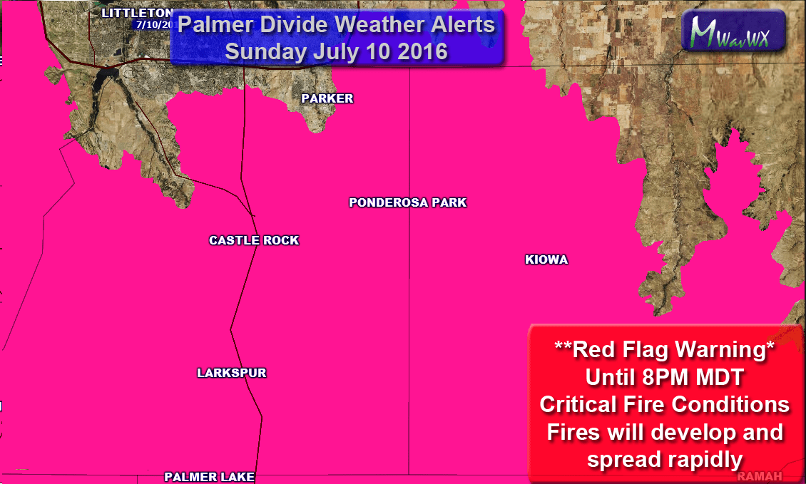
A Red Flag Warning has been issued today until 8:00PM Mountain time. A Red Flag Warning means critical fire conditions are imminent or occurring. As such, if you are doing any activities that require fire or anything that makes sparks, please be extra careful.
Current Red Flag Warning Areas
Warning Details
URGENT - FIRE WEATHER MESSAGE
NATIONAL WEATHER SERVICE DENVER/BOULDER CO
346 AM MDT SUN JUL 10 2016

...RED FLAG WARNING FOR LOWER ELEVATIONS OF NORTH CENTRAL
COLORADO...SOUTH PARK...THE FOOTHILLS AND PALMER DIVIDE FOR LATE
THIS MORNING THROUGH EARLY EVENING...

.AN INCREASING SOUTHWEST FLOW ALOFT WILL BRING WINDY CONDITIONS
TO THE MOUNTAINS AND MOUNTAIN VALLEYS WHERE GUSTS TO 40 MPH WILL
BE POSSIBLE THIS AFTERNOON AND EARLY EVENING. ALONG THE FRONT
RANGE...WIND GUSTS TO 35 MPH ARE EXPECTED. DUE TO THE HOT
TEMPERATURES...LOW RELATIVE HUMIDITIES...AND GUSTY SOUTHWEST
WINDS EXTREME FIRE BEHAVIOR WILL BE POSSIBLE.

COZ241-102215-
/O.EXA.KBOU.FW.W.0013.160710T1600Z-160711T0200Z/
ELBERT/CENTRAL AND EAST DOUGLAS COUNTIES ABOVE 6000 FEET-
346 AM MDT SUN JUL 10 2016

...RED FLAG WARNING IN EFFECT FROM 10 AM THIS MORNING TO 8 PM MDT
THIS EVENING FOR WIND AND LOW RELATIVE HUMIDITY FOR THE PALMER
DIVIDE...

THE NATIONAL WEATHER SERVICE IN DENVER HAS ISSUED A RED FLAG
WARNING FOR WIND AND LOW RELATIVE HUMIDITY...WHICH IS IN EFFECT
FROM 10 AM THIS MORNING TO 8 PM MDT THIS EVENING.

* AFFECTED AREA...FIRE WEATHER ZONE 241.

* TIMING...LATE THIS MORNING THROUGH EARLY EVENING. RED FLAG
  CONDITIONS WILL BE POSSIBLE AGAIN MONDAY.

* WINDS...SOUTHWEST 10 TO 20 MPH WITH GUSTS UP TO 30 MPH.

* RELATIVE HUMIDITY...9 TO 14 PERCENT.

* IMPACTS...RAPID FIRE GROWTH AND SPREAD WILL BE POSSIBLE. ANY
  OUTDOOR BURNING IS STRONGLY DISCOURAGED.

PRECAUTIONARY/PREPAREDNESS ACTIONS...

A RED FLAG WARNING MEANS THAT CRITICAL FIRE WEATHER CONDITIONS
ARE EITHER OCCURRING NOW....OR WILL SHORTLY. A COMBINATION OF
STRONG WINDS...LOW RELATIVE HUMIDITY...AND WARM TEMPERATURES CAN
CONTRIBUTE TO EXTREME FIRE BEHAVIOR.
Synopsis
The good news is that we had tons of rain this spring and a period of wet weather and a large amount of plant growth. The bad news is that we are now drying out very quickly and that plant grown is turning into fuel for fires. The overall weather pattern has been mainly wet up until the last couple weeks, but recently we have not only begun to dry out but with temperatures cranking up sharply it is drying vegetation out very quickly.
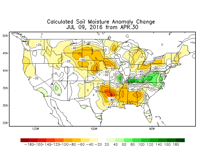
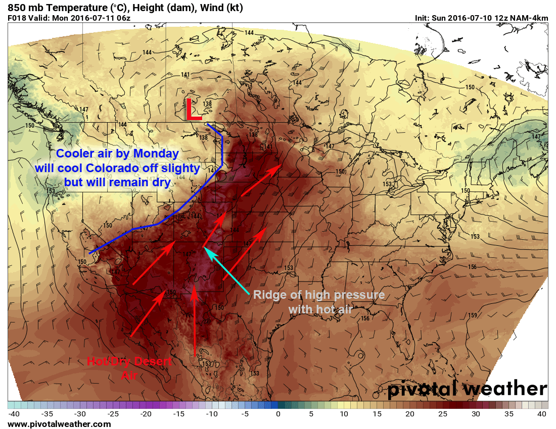
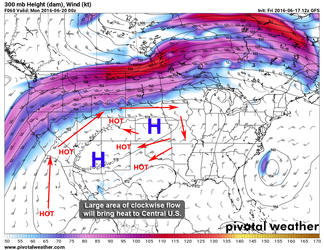
The latest soil moisture anomaly report shows how quickly our soils and vegetation is drying out in Colorado and to a bigger extent, the Northern plains. This is all due to a general shift in the weather pattern allowing a large ridge of high pressure to dominate the atmosphere in our area. Sure we’ve had some thunderstorms move through under this ridge, but we need surface storm systems (surface lows or fronts) to help spur those thunderstorms.
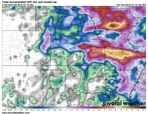
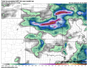
When looking at some of the models for the next 3-5 days we can see QPF or total quantitative precipitation. Basically this is how much precipitation is expected to fall over the next week…
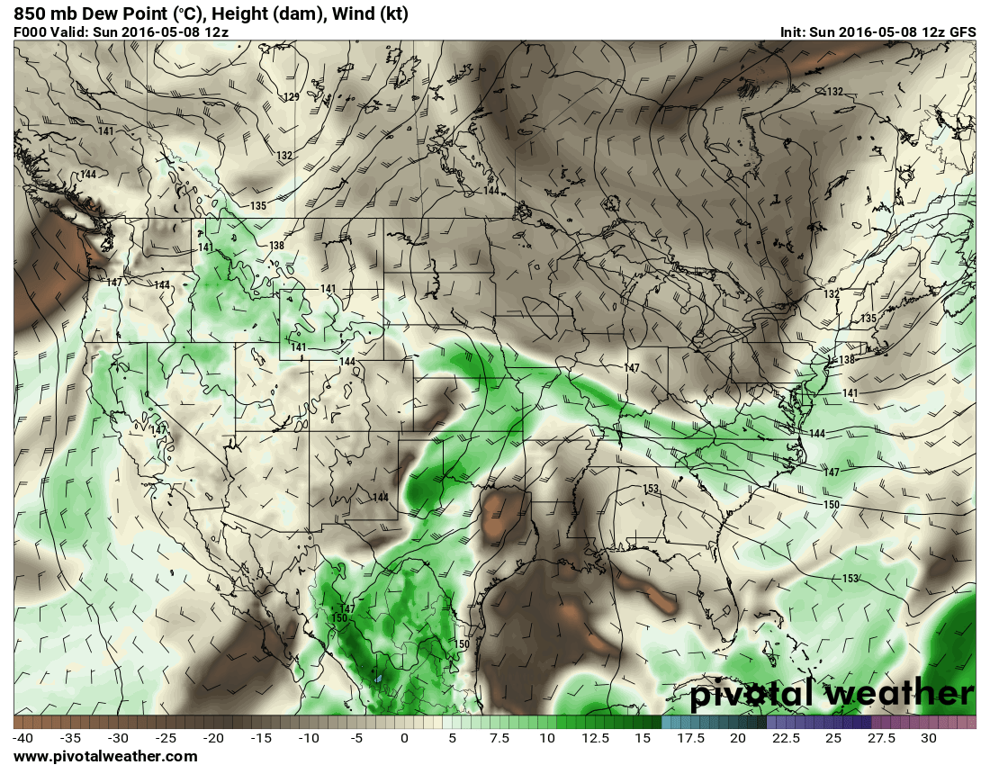
The GFS model allows us to look all the way out to Friday, this model is predicting little to now moisture for most locations along the front range. The one exception is out east on the plains of Colorado where pop up thunderstorms and enough moisture (due to higher dew points in general) may allow them to see more storms in the afternoon and evening hours.
Given how hot and dry it has become this is a pretty abysmal outlook for fire conditions this week. Moisture looks hard to come by for the entirety of this week.
When looking at weather models you can’t just look at one to get a clear picture so we’ll take a look at the NAM (North American Model) as a double check. This model only runs through about Wednesday at 6PM so it is only a good look at the next couple of days.
The NAM is a lot less bullish on moisture for most areas in Colorado. This model even shows the Eastern Plains getting much less moisture than the GFS, however the GFS has a lot of the moisture out East coming in later in the week. So for right now we can’t focus on that too much as that period is out of range with this model.
Summary
The long and short of it is that this week have fully entered our summer pattern. It’s going to be very warm and very dry in almost all areas in Colorado. The weather pattern this week will allow cooler air in by Monday but only slightly cooler. Temperatures will drop from the upper 90’s to the lower 90’s or upper 80’s through most of the week. Unfortunately the system that brings the slightly cooler air in will have little moisture to work with. While thunderstorm chances will be there, they will be quite low overall, any areas that see storms will be quite lucky.
For this week: stay cool and be mindful of heat and fire conditions. Happy Sunday!

