Since last Saturday’s wild weather that saw hail and even tornadoes in many areas along the front range of Colorado, this week has turned out relatively soggy but interesting overall in terms of weather. Each afternoon the past few days we have seen what I like to call “garden variety” thunderstorms, storms with rain, wind and even a bit of hail but generally remain below severe levels.
Short Break and Warm Up
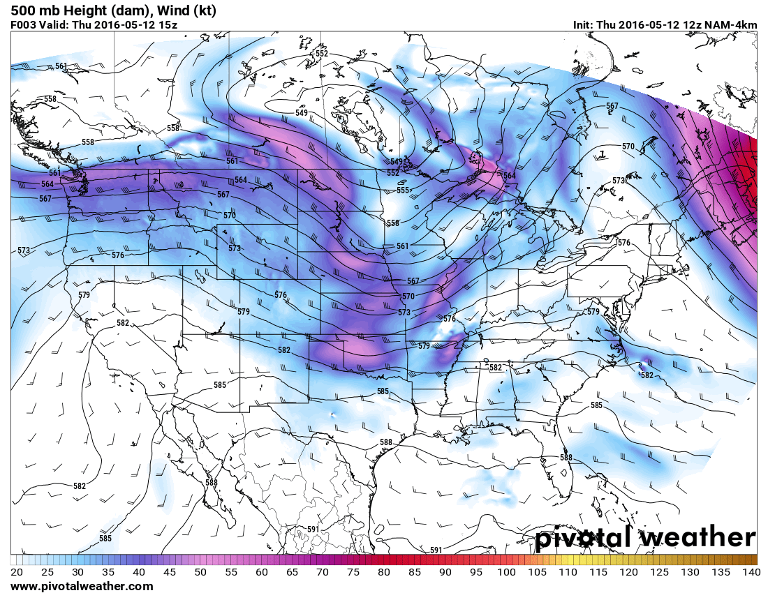
Colorado is on the Eastern side of an upper level ridge building to the West. The good news is this feature will give us a break from stormy and cooler weather, the bad news is it doesn’t stick around terribly long. This ridge will allow us to warm in the 70’s both Thursday and Friday. Friday afternoon and evening another cool front will move through making for cooler temperatures and a better chance of thunderstorms on Saturday. Once this system begins to move through, the extended forecast calls for another period of unsettled from the weekend into next week.
Some Interesting Weather Stats for Spring 2016 So Far
- Castle Rock has yet to reach its first 80 degree day (Denver as well has not hit 80 degrees yet this year)
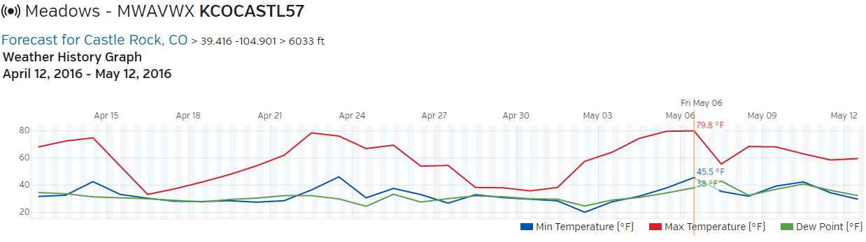
Data for the last month from the Mountain Wave Weather station in Castle Rock Colorado. You can visit our station and view real-time data here: https://www.wunderground.com/personal-weather-station/dashboard?ID=KCOCASTL57#history
The closest we have come in Castle Rock is 79.8 on Friday May 6, so close!
- Snowfall is well above average so far this year
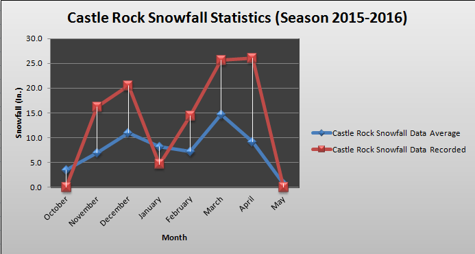
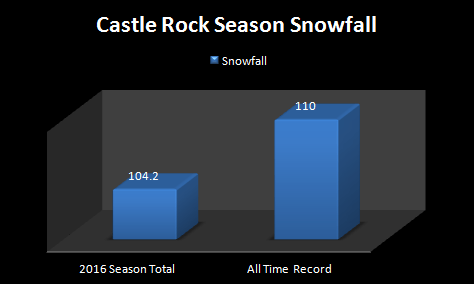
Castle Rock had near record snowfall this year, sadly (or not sadly for some folks) it doesn’t appear we will break this record
We’ve had well above average snowfall all along the front range. This is excellent news and will help to keep things green at least for the first part of the summer season. Things are a little less clear that we will maintain the wet pattern after about mid-June. The well above average precipitation is something we see quite often during an El Nino year in Colorado and speaking of El Nino…
- El Nino is on its way out!
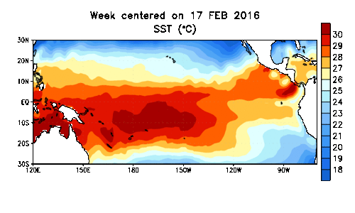
You can notice the cooler water beginning to form off the coast of South America. This is a strong signal that our El Nino pattern is weakening and should continue into summer. If this continues into fall and winter we could be looking at a La Nina event later this year and most models are indeed predicting that. We shall see what develops but a La Nina pattern can affect Colorado’s weather patterns as much as El Nino can, but at the end of the day no two La Ninas are alike!
Have a great Thursday and enjoy the warm weather!

