Storm Heading This Way! Snow for the Mountains, Question Marks for the Plains
At this point in the forecast of a winter storm, we start to see areas where we have higher confidence in the forecast and areas that are still low confidence. The mountains look like a pretty sure lock to pick up some decent amounts of snow with this storm... the plains are still uncertain. Any wobble or shift in the storm track can mean more or less snow for us East of the mountains. As many storms have shifted North on us this year, that will remain a concern with this storm.
For right now though, we do have some winter weather alerts for the mountains and parts of Western Colorado.
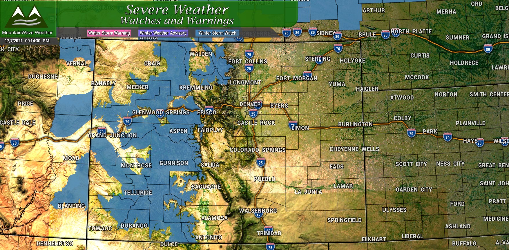
The Winter Storm Watch runs from 12/8/2021 5PM through 12/10/2021 5PM
Here are some of the things to watch for in the watch area:
- Some areas could receive between 12-24" of snow
- High winds with gusts up to 40mph
- Combination of snow and wind will cause for icy roads and poor visibility
- Travel may become very difficult in many areas and impossible in some select areas
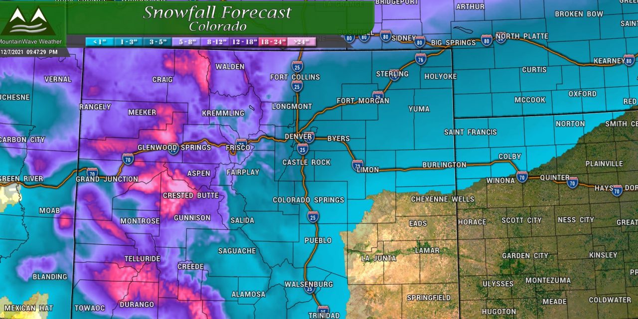
MountainWave Weather Preliminary Snowfall Forecast 12/8/2021 through 12/10/2021
Here's our first stab on snowfall amounts and thinking with this storm system. You'll be able to see pretty clearly which areas are favored at this point to receive the heavier snow (spoiler: it's the mountains.) As we still have a couple of days to go with this storm, expect the exact snowfall amounts to change somewhat over the next 24-48 hours as we get more model data in and we see if the storm shifts at all. As you know, any shift North or South with the storm track can have pretty drastic implications for who sees snow and how much.
Palmer Divide and Urban Corridor
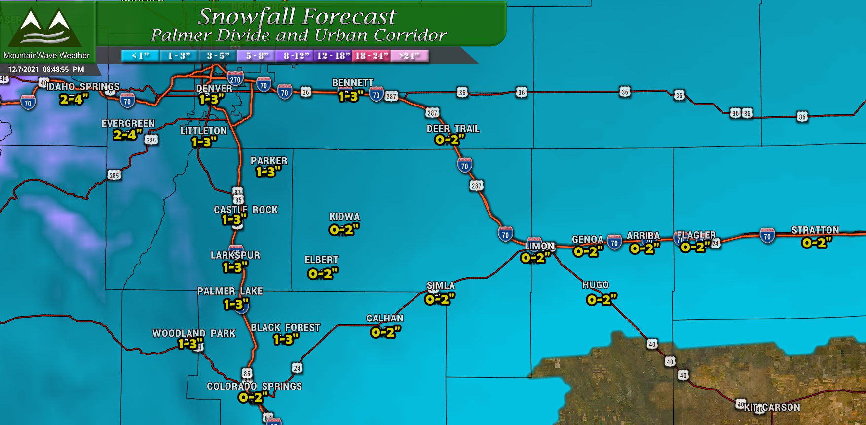
Palmer Divide total snowfall forecast through Saturday AM
Pretty standard here, most areas will end up in the 0-2" or 1-3" range. Areas towards the Western Foothills may tend to see slightly higher snowfall totals but not anticipating any major snow accumulation with the data coming in as of tonight. As always, we will keep tracking to see if that changes.
Northern Colorado
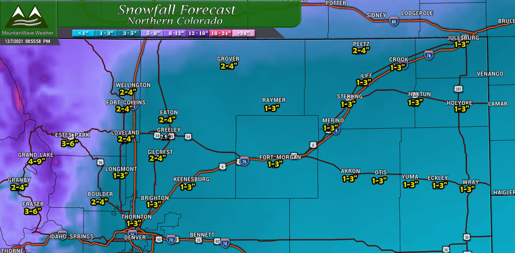
Northern Colorado total snowfall forecast through Saturday AM
You'll see the Northern bias with this storm in this map, notice areas North and Northwest of Denver will have a better chance of seeing a couple of inches out of this storm. There is also better chances of higher snow accumulation Northwards into Wyoming so keep that in mind if you have travel planned up that way. Much of Southern Wyoming is included in their own Winter Storm Watch so conditions may be tricky in those areas as the storm hits.
Southern Colorado
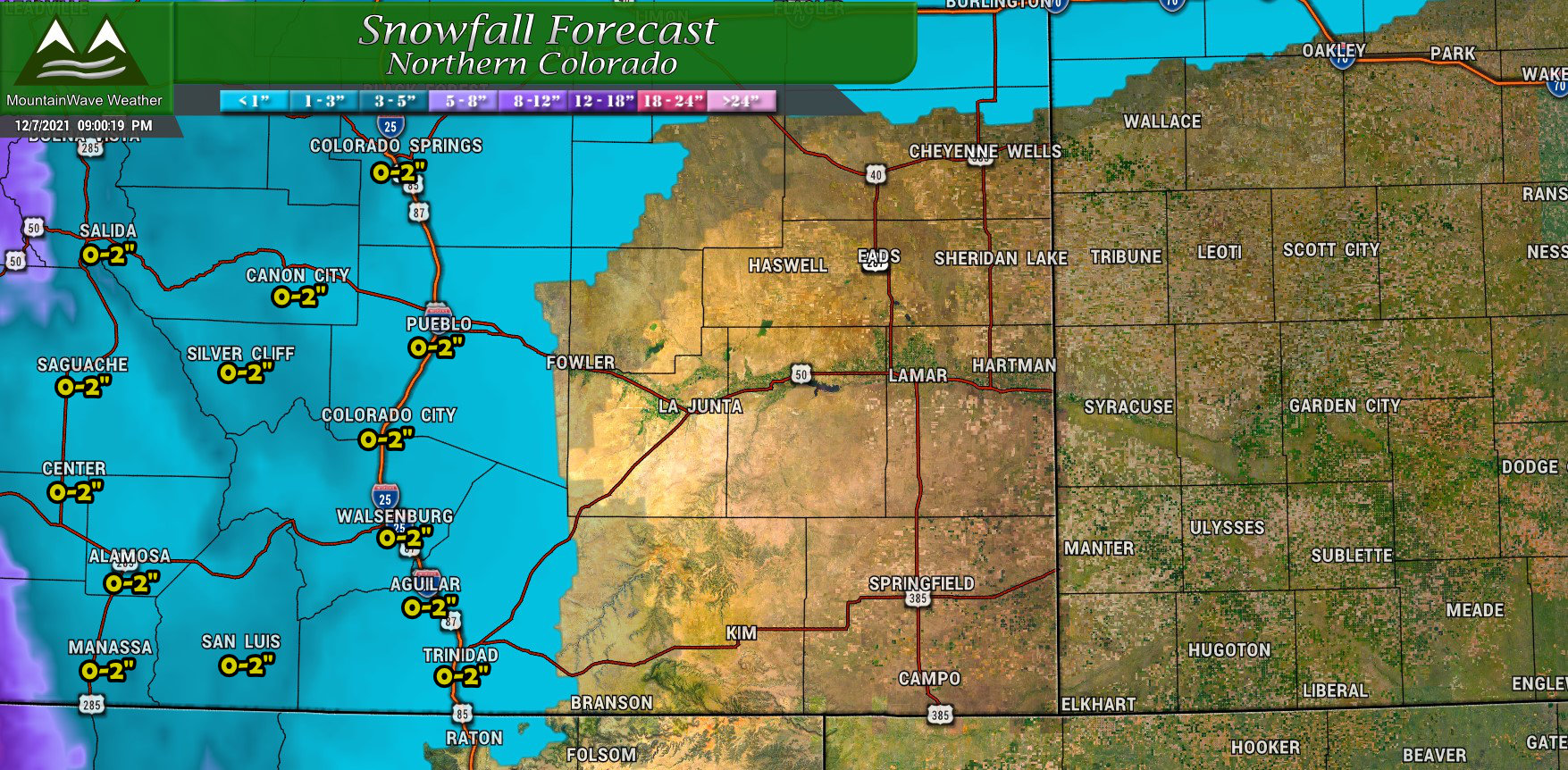
Southern Colorado total snowfall forecast through Saturday AM
Due to the positioning of this storm, you'll notice that much of South Central and Southeastern Colorado get left out with this storm system. We are expecting minimal snowfall amounts along the Southern I-25 corridor, really the winners of any part of Southern Colorado will be the Southwestern mountains. Everything East of the I-25 corridor will see little to no snowfall.
Northern/Central Mountains and Western Colorado
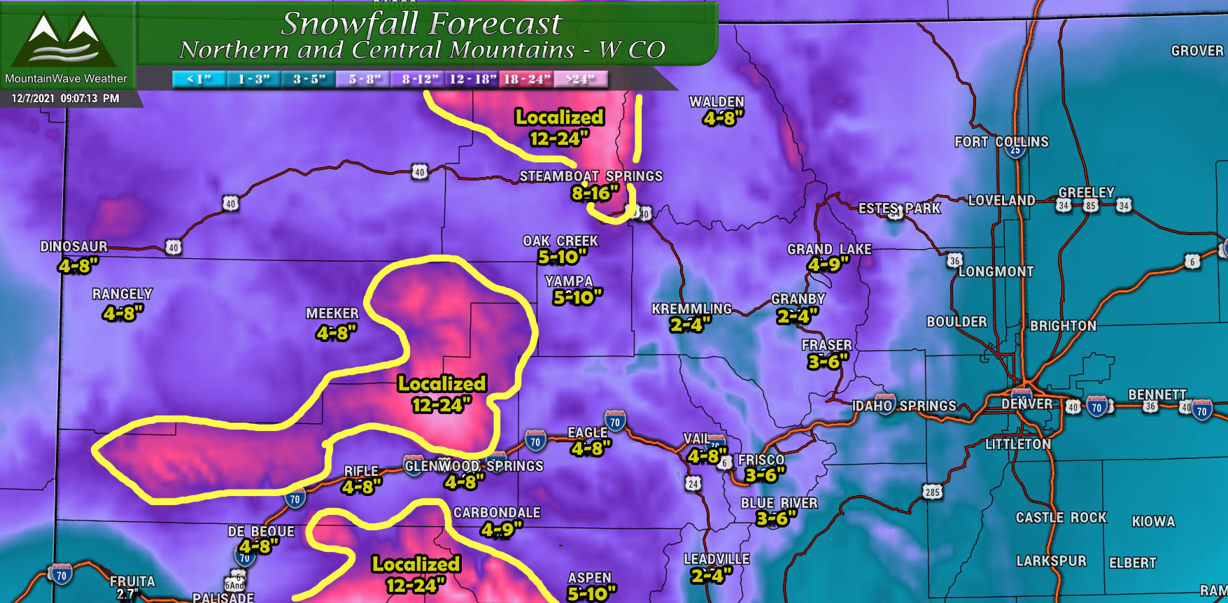
Northern and Central Mountains & Western Colorado total snowfall forecast through Saturday AM
The mountains are starved for moisture so far this year, the good news is they stand to benefit the most from this storm system. Many mountain areas will see several inches of snow, lots of ski areas should see 5-10" of snow. I've highlighted the areas above in yellow too that stand to see upwards of 2 feet of snow. If you have travel planned in or around any of those areas between Thursday night and Saturday morning, realize that roads may be closed or impassible with very dangerous driving conditions.
If you have any travel planned through the mountains between Thursday night and Saturday morning, pay close attention to the forecasts and warnings. It may get to a point where travel is best left to before or after this storm. If you must drive, make sure you have a winter survival kit in the car and ample supplies in case you are stranded somewhere.
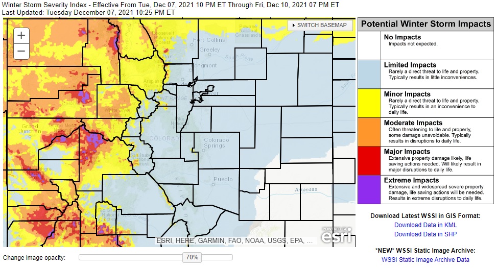
Winter Storm Severity Index
The product attached below helps identify areas that may have significant impacts from a winter storm due to snow, wind or treacherous travel conditions. The main heavy impacts from this storm will be felt mainly in the mountains, we don't expect severe impacts along the Front Range or Palmer Divide out of this storm.
Final Thoughts
We will have to watch this storm closely for effects East of the Continental Divide. Heavy snow and good accumulations are fairly high confidence for the mountain areas outlined above, but there are still a lot of question marks for areas East of the Divide. Should the storm shift Northwards (a concern with any storm this year as nearly all of them have done this at the last minute) we would see lower snowfall amounts for Denver and the Palmer Divide than what I've outlined above.
Long story short: I'm excited about the snow in the mountains as that looks pretty on track. I am not writing home about our snowfall chances East of the Continental Divide however, I don't see evidence as of now that it will be a significant storm and I'm more concerned that our snowfall chances bust low than bust high at this point.
As always, I'll keep you posted as we get more data in!
