Smoky Start to the Day!
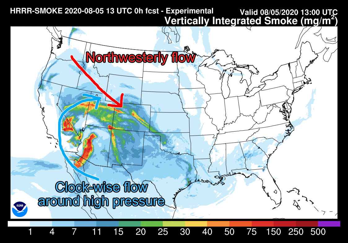
Many folks noticed the hazy, red sunrise we had this morning and we can thank the large amount of smoke streaming into the state from fires in Arizona, California and Mexico. This smoke is being picked up by a large high pressure system to our South (ironically this is the same high pressure system that has pretty much killed our monsoon season) and transporting it North. From there it is caught in mid and upper level winds streaming in from the Northwest into Colorado. You can see the Northwest flow pretty clearly in the HRRR Smoke Forecast graphic above, this flow is responsible for a lot of the hailer storms we've seen over the past few days.
Speaking of hail...
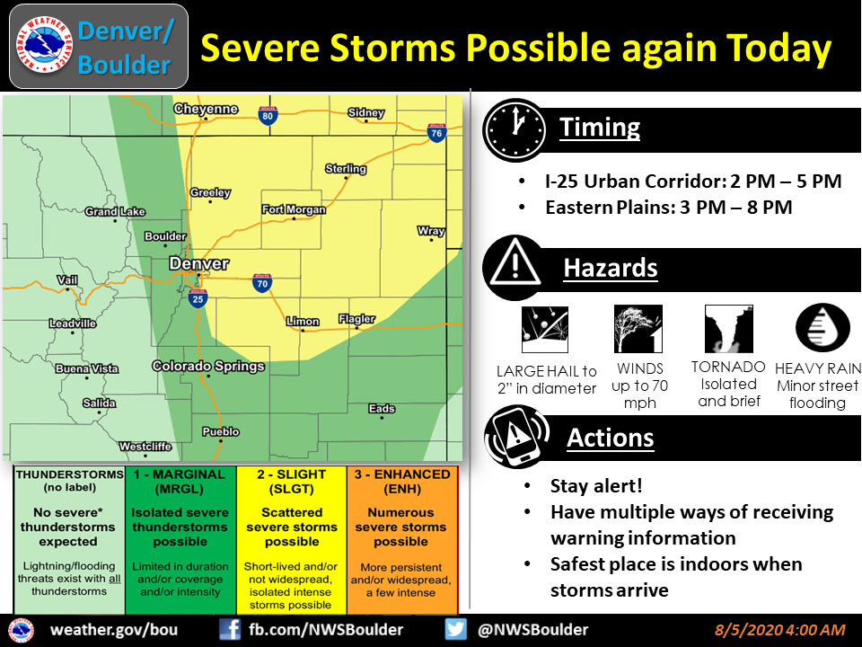
Severe Weather - Large Hail/ Tornadoes Possible
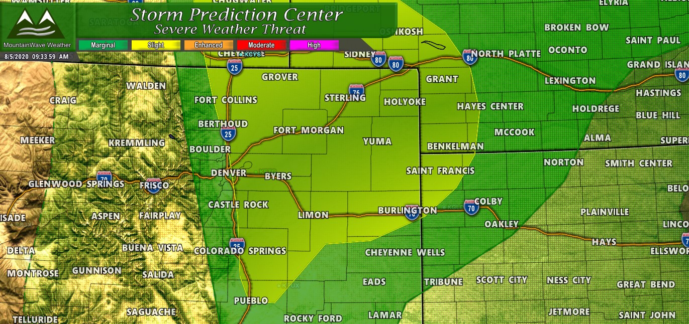
The Storm Prediction Center has the outlook today for areas in Colorado ranging from "Marginal" (green areas) to "Slight" yellow areas. Much of the Palmer Divide resides in the slight risk area today so while severe storms won't be widespread you'll be a sad panda if you find yourself under one of the stronger ones.
Remember, yellow means a 15% chance of seeing severe weather in your area... which means 85% chance you see no severe weather at all today. It really is a game of roulette, we will all just be playing the odds - a lot of us will be lucky but a few of us won't. If you're unlucky today it means big chunks of ice falling from the sky. May the odds ever be in your favor!
Primary Threat - Large Hail
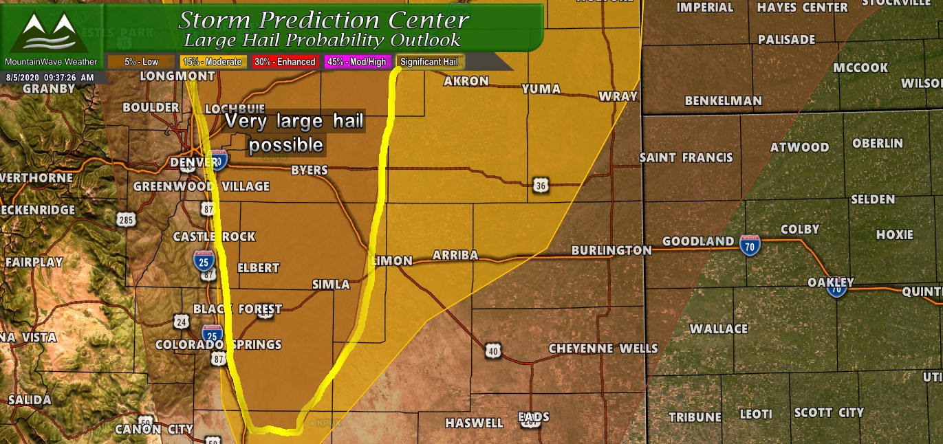
Like yesterday any spotty severe storms that form will have to the potential for large, destructive hail. The brown area above is a 5% low chance of seeing severe sized hail, the yellow area is 15% and the brown outlined area is a 15% chance with a high significant hail parameter. This means that storms in that area that do turn severe have the potential for large, destructive hail. For example yesterday, some areas in the significant hail area saw tennis ball sized hail... that should give you an idea of what we could be dealing with.
Lower Threat, but not 0% - Tornadoes
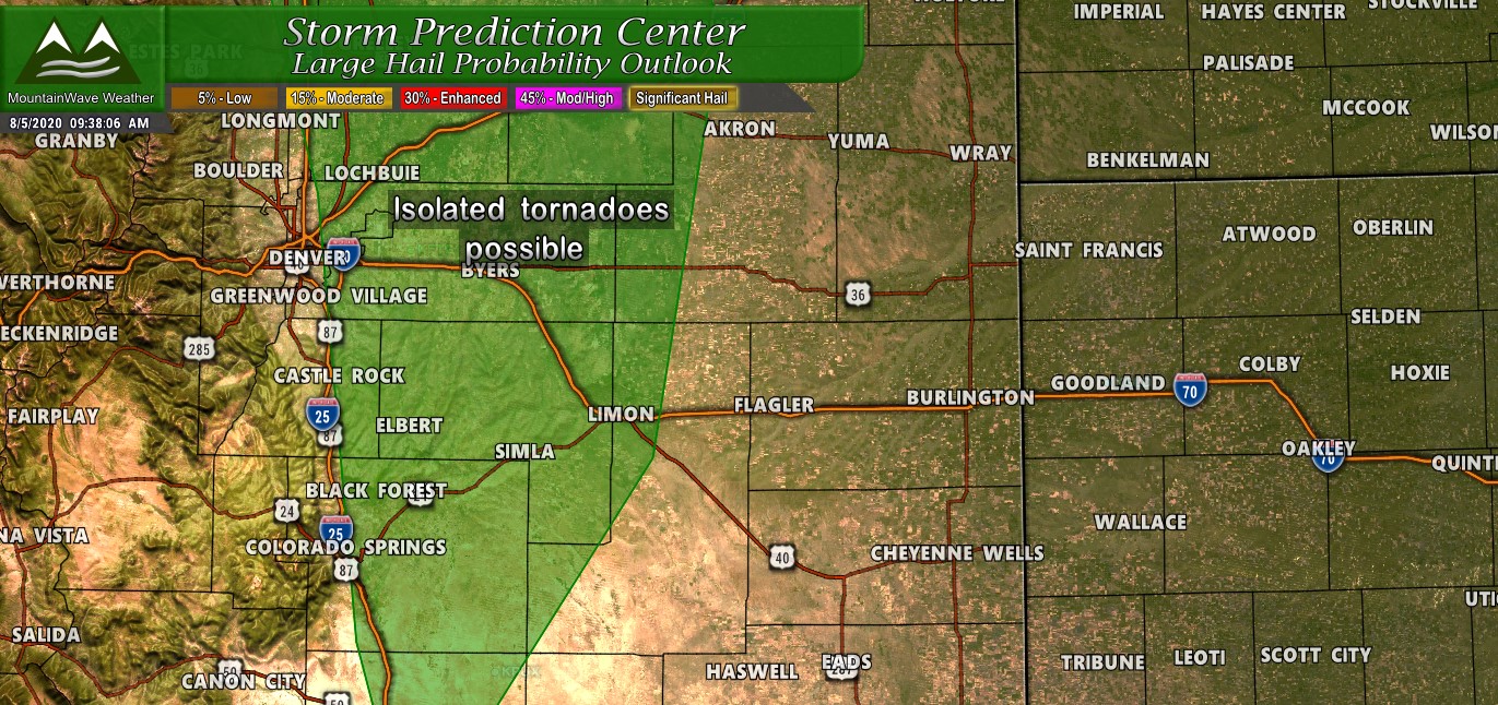
To be clear, the threat for tornadoes is VERY LOW today but there is a chance of a funnel cloud or short lived tornado (mainly landspout type tornadoes) especially early on in the storm cycle. As storms continue to strengthen and merge together the tornado threat will drop considerably. Just pointing this out in case you see on of these this afternoon.
Preparedness Actions/ Timing
- Even though most of us won't see hail today, it's best to prepare like you will. Move cars in the garage and have gardens covered up
- For those in Elbert county with farming/ag interests, make sure you have preparations completed by afternoon
- Expect storms to fire around 1-2PM
- Storms expected to move across the urban corridor and plains through 8PM or so.
I've overlaid the HRRR over the SPC risk areas below. Highlighted as "watch these areas closely" are the regions models are most consistent about seeing stronger storms. Those areas include East of Denver, Northern Colorado East of I-25, the Northeastern Plains and areas out towards Limon and Burlington.
The Palmer Divide region is a bit more of a question mark... models have shown storms on some runs but none on others. This means they are less confident about the atmosphere in our area so while we can't breathe a sigh of relief yet hopefully we will dodge the bullet again today. I love severe weather but I can do without tennis ball sized chunks of hail dropping on my house...
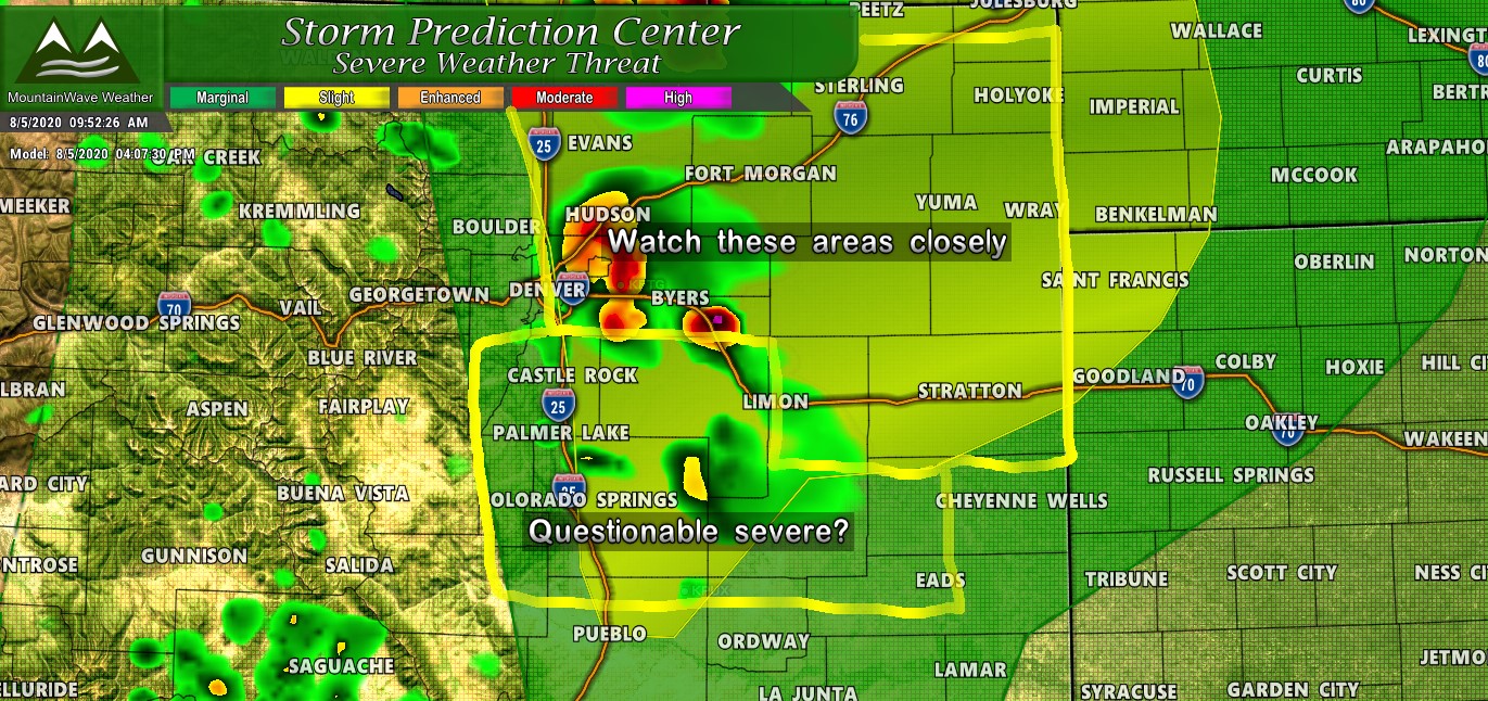
Elbert county is borderline in the models... this area could fall under the "watch closely" categorization as well.
Summary
This will be a rapidly evolving situation today so be sure to keep an eye on your favorite weather sources for updates. Of course we will have updates on our Facebook page, but you can also check Castle Rock Weather Conditions along with Castle Rock Weather Alerts on our new web pages!
