Quick Look
Quick look at information regarding timing, impacts and severity for folks who just want the quick information about this storm
Timing
- Expect precipitation to begin mainly as rain on Tuesday morning
- Models currently have the transition to snowfall occurring in the early to mid morning hours on Tuesday
- Snow showers continue on and off through the day on Tuesday
- Tuesday night features the potential for heavier snowfall, especially over the Palmer Divide
- Snow continues overnight Tuesday until Wednesday morning, models have it wrapping up by Wednesday morning
Hazards
- Freezing conditions possible as rain transitions to snow on Tuesday
- Snowfall could become moderate in intensity Tuesday evening and late Tuesday night
Travel Impacts
- Expect the possibility of snow-packed and icy roads Tuesday evening and Wednesday morning
- Biggest impact could come during Tuesday evening rush hour and Wednesday morning rush hour
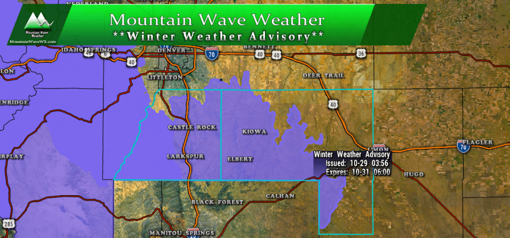
A Winter Weather Advisory is in effect from Tuesday 12PM through Wednesday 6AM for travel impacts due to snow
Halloween
Snow should mainly be done by Halloween night but cold temperatures will still remain. If you have friends and family heading out for trick-or-treating dress warm and be prepared for the potential of snow and ice on the roads and sidewalks!
Synopsis
A more detailed look at the weather and mechanics with this storm system
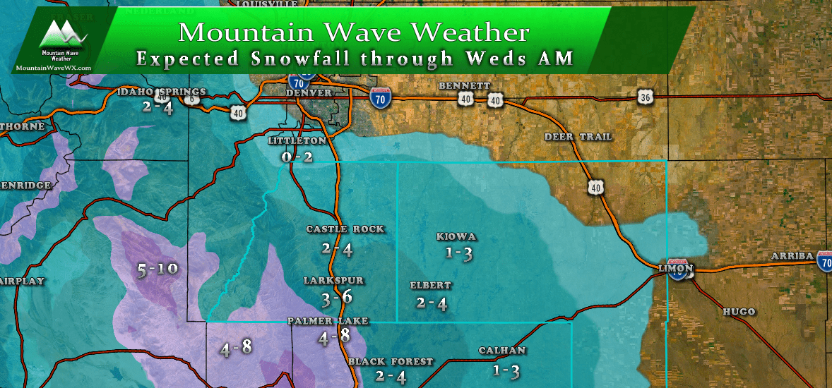
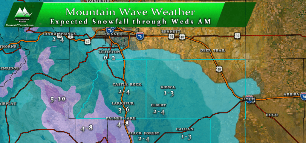
Snowfall is expected mainly across the higher elevations (Palmer Divide) south of Denver and in the foothills and mountains. The elevation you live at will make a huge difference eon how much snow you see accumulate and how far North or South of Denver you are will make a difference too.
There are some intriguing characteristics to this storm system but it has some similarities to the last one we saw. You may have noticed my snowfall forecast above doesn’t exactly match what you may have seen on some of the TV newscasts. There’s a few reasons for that which I’ll get into below.
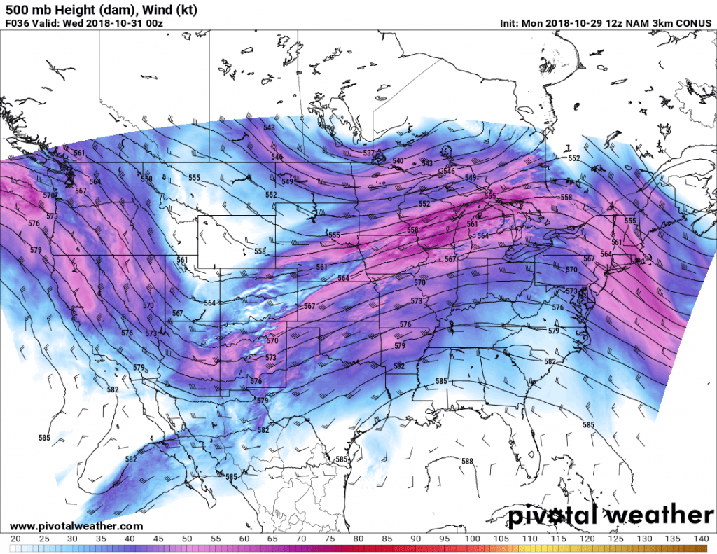
The main energy of this storm looks to extend further South than the last, but it still involves an upper level trough sliding in from the North just like the last storm. This will allow the cooler air to move in and provide some of the lift energy to kick off the snowfall.
We can see that pretty clearly as the snow begins to ramp up Tuesday evening… but you’ll notice the jet stream stays over Colorado during this time with Southwesterly flow aloft in the mid and upper levels of the atmosphere.
Very similar looking to our last storm… and we know that largely the last storm was a “banded” or “jet-induced” snowfall event. This means that some areas saw very good amounts of snow (Fort Collins and Loveland ended up between 6-10 inches) while us along the Palmer Divide ended up in the 1-3 inch range.
I recently read an interesting article about banded snowfall over on SkyView Weather and they had a great image illustrating this:
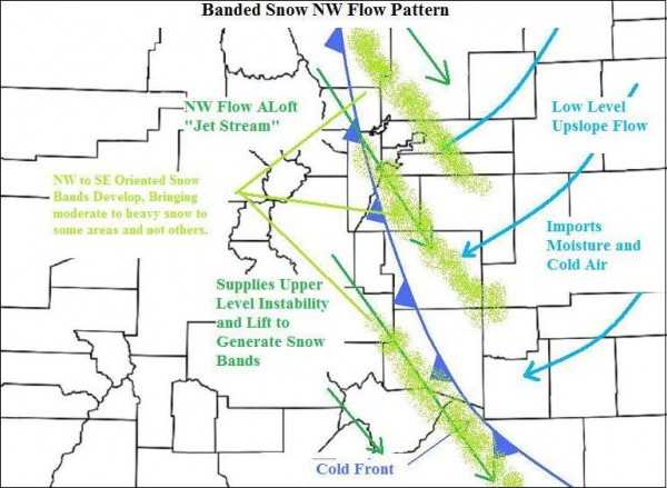
Great illustration, would love to have an actual article explaining the mechanics behind this type of storm on another day!
All in all, this storm screams “snow bands” to me just like the last so while it is similar to our last storm in that respect, we have to keep an eye on it because the main energy sets up to the South this time instead of the North. This means we could see higher snow totals (bust high) if the snowfall bands set up in just the right spot over the Palmer Divide.
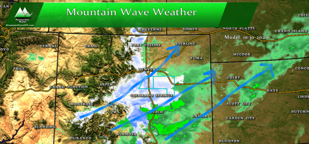
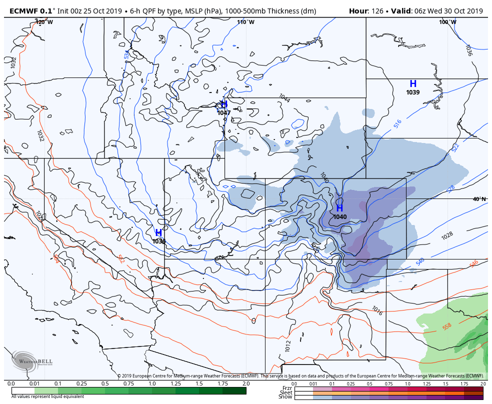
If we look at one of the models for Tuesday evening you can see some evidence of snowfall banding enhanced by the jet stream as it moves across the state. It shows a pretty strong signal for upslope across the Palmer Divide and heavier rain across the Southeastern portion of the state… very interesting.
There are some things to keep in mind:
- Models are good at showing the presence of snowfall bands but they are not good at predicting exactly where they will set up
- This storm is not a slow mover, the best lift will be along the cold front when it first moves through and as the jet transitions across the state. Quick moving storms don’t tend to produce a ton of snow, but jet induced lift can product very intense snowfall accumulation in very isolated spots
- A surface low setting up in Southeastern Colorado could aid in upslope and instability across the Palmer Divide and front range foothill
Lots of intriguing things going on with this storm, but given the warm temperatures at the ground level, the quickness of this storm and the spottiness of snowfall bands… I’ve aired on the lower snowfall amounts. Please keep in mind, this could change if we start to see drastic uptick in the models and data Monday night.
The SREF ensembles show a mean of 2.78 inches at Centennial and about 4 at Monument… I expect Castle Rock would end up somewhere in that range (2-4 looks most likely at this time.)
For now, we’ll keep an eye on it and pass along any interesting updates through the day Monday and early Tuesday!

