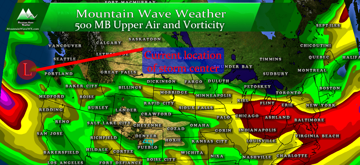
If you have weekend plans in the mountains or outdoors along the front range, you’ll want to follow the forecast closely over the next few days. A strong winter storm system is set to move into the great basin area of the United States and track towards the East into Colorado. Just like many storms, the ultimate track will make all the difference as to who sees snow and how much.
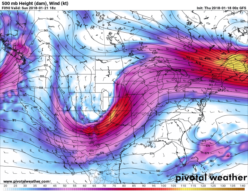
The GFS is in agreement with many models that the trough will eject over Southern Colorado. This isn’t something we’ve seen from a storm system so far this year, hence why we think this might be a bit bigger snowmaker than we’ve seen this year. Models are still all over the place with the exact track and positioning with the trough; as you know in Colorado where this ends up makes all the difference!
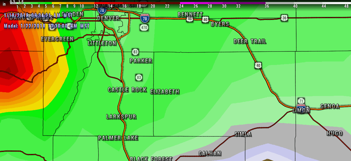
Preliminary Palmer Divide Snowfall Forecast
We are on the very edge of what we can see with our shorter range models, so we are taking an average between all the models we can see and some of the ensembles. Keep in mind, it is still very early in the evolution of this storm meaning; THESE SNOWFALL FORECAST AMOUNTS WILL CHANGE OVER THE NEXT FEW DAYS. Whether upwards with snow or downwards remains to be seen!
As of right now, models are really honing in on that 3-4 inch range for the Castle Rock area, so as of now I like the lower ends of these ranges until I see different in the data.
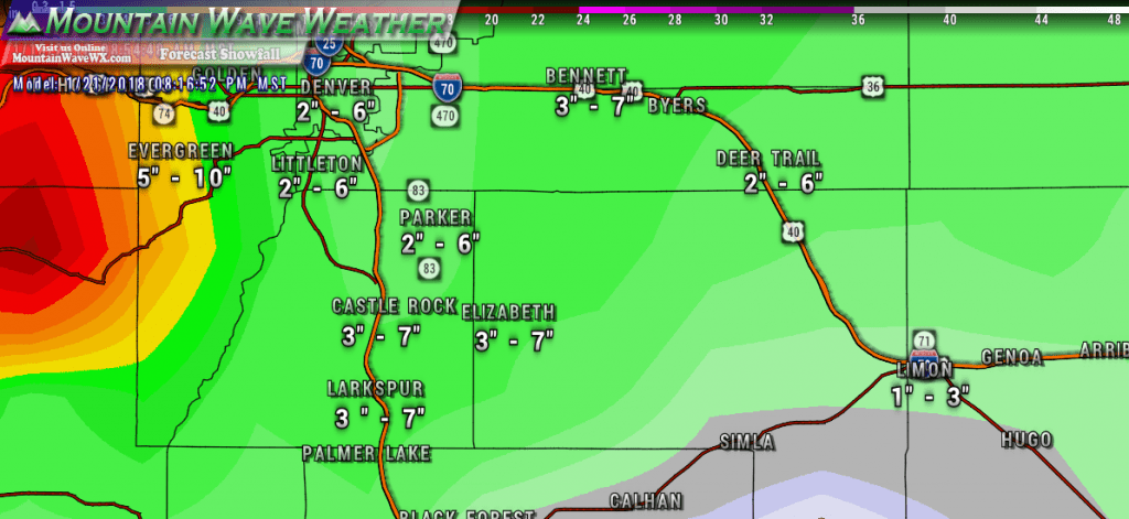
Preliminary expected snowfall ranges for this weekend’s storm along the Palmer Divide region. These amounts will change between now and Sunday!
What To Look Out for Over The Next Several Days
From a forecast standpoint, the models will bounce up and down on the snow over the next few days. Given how this year has gone, I would not be surprised to see these totals drop as we move closer to the weekend, however the POTENTIAL is there for them to actually go up. This storm is a bit of a different beast than what we’ve seen so far this year.
- If you are traveling to the mountains, keep an eye on later in the day Saturday and most of the day Sunday. I would expect significant travel impacts to develop.
- As of right now, moderate travel impacts will be most likely along the Palmer Divide late Saturday into early Sunday.
- Outdoor plans and activities along the Palmer Divide region may be impacted especially on Sunday. If the storm speeds up expect possible impacts later in the day on Saturday (think evening and overnight hours)
- This is not a “rush to the store and buy all the milk and bread” type storm, no matter what TV and social media tells you! Even on the high end, most areas are not expected to see more than 5-7 inches of snow.
- Don’t believe the hype, it’s been a quiet weather year so I suspect some TV stations and a lot of social media groups will attempt to hype this storm and get their ratings up. We will maintain a more level-headed approach and tell you what we are seeing with the latest data.
Stay tuned here or to whatever your favorite (RELIABLE) weather source is for updates to the forecast over the next few days.

