A powerful storm system and associated cold front is slated to begin affecting Colorado starting as early as Friday. If you’ve been following our Facebook page, it should be no surprise to you that Friday will be active as we’ve been discussing it for a couple of days now…
Severe Weather Threat
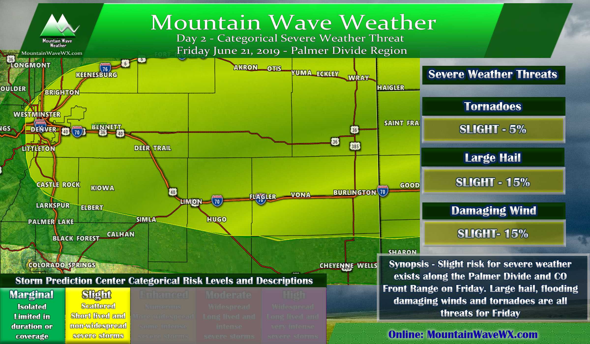
SPC Day 2 (Friday) Severe Weather Outlook
The graphic above illustrates the Severe Weather Threat is defined tonight by the SPC for Friday June 21, 2019. Keep in mind, the Day 1 outlook will update a few times in the morning tomorrow so stay tuned as we anticipate a shift in the coverage for some of these severe areas.
Here’s the need to know details if you have plans tomorrow:
Threats
- Large hail in excess of 1 inch in diameter
- Heavy rain and localized flooding will be possible
- Strong winds ahead of and under collapsing storms could cause damage
- Large amounts of cloud to ground lightning… lightning can strike 15-20 miles away from the storm so keep that in mind.
Timing
Per current modeling storms will begin building in the late morning hours. Expect thunderstorms to begin affecting areas in and around the Palmer Divide after 12PM with strong to severe storms forming a bit later in the afternoon.
Preparedness Actions
- Large hail could cause damage to vehicles, buildings and plants. Take necessary precautions.
- Flooding could cause localized travel issues
- Lightning can be extremely dangerous, move inside as soon as you hear thunder
Continue to monitor weather alerts from local and reliable weather resources.
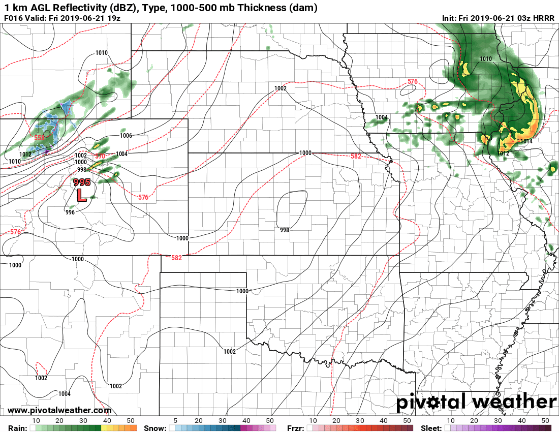
HRRR model has consistently shown the Palmer Divide as a bullseye area tomorrow. This model can’t predict exact locations of storms or their effects; so when you see this don’t assume the storms will show up exactly where they do on the model.
A Quick Note About Severe Weather Outlooks and Forecasts
There seems to be a lot of confusion about the SPC outlook graphics like the one posted above.
I’ll use tomorrow’s threat as an example and try to explain it a bit better. A slight risk for hail and wind with a probability of 15% means you could pick any point within that risk area and there is a 15% probability that anywhere in that radius could see large hail and damaging wind.
So if you live in Castle Rock, there is a 15% chance your area or any area within 25 miles of that point could see a severe storm with these effects. As you can see that’s not a particularly strong probability… but it’s not 0% either.
So the likelihood (85% chance) is that most of us won’t see severe weather tomorrow. So why do we make a big deal about it? Preparedness! Unfortunately we cannot predict exactly when or where these severe thunderstorms will form and hit… but we know the environment will be favorable for a few storms to grow severe tomorrow anywhere in the yellow shaded area. That’s why we preach being prepared. If you find yourself in the path of the storm, it could cause damage and injury if you are not prepared.
I’ll probably be making a video to discuss this in the near future so stay tuned for that.
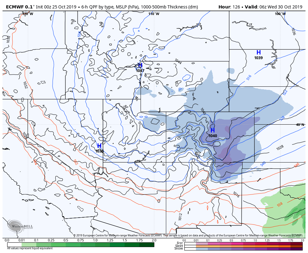
Another Quick Note: Snow in Summertime!

Many areas above 9,500 to 10,000 feet in elevation will see decent snow accumulation over the next 48 hours. Keep this in mind if you’re planning on camping or driving up in that area. It will be cold and wet and travel over some mountain passes may be slightly impacted.
I’ll have another post up late Friday talking about the weekend, the active pattern will continue followed by a big shift next week. Phew… lots to cover, stay tuned!

